Dr Joy Burgess, Lecturer in Landscape studies and Postdoctoral Research Associate at the University of Liverpool’s School of Architecture, is leading a new project, Playful Geographies, co-funded by a research grant from the Henry Moore Foundation and an AHRC IAA DOT competition award.
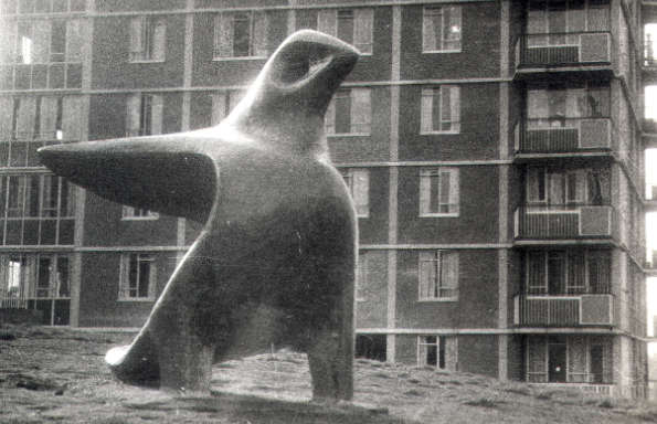
The project explores the collaborative work of landscape architect Mary Mitchell (1923-1988) and sculptor John Bridgeman (1916-2004), who designed a series of innovative, playable landscapes across post-war Birmingham. Working as the first landscape architect in Birmingham City Architect’s Department at a pivotal moment in the city’s post-war redevelopment, Mitchell played a significant role in shaping public landscapes and children’s play environments. However, much of this work has remained obscured and has yet to be fully recognised within histories of landscape architecture and public art.
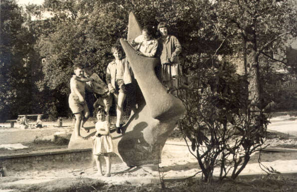
Playful Geographies builds on Dr Burgess’s AHRC-funded PhD research and subsequent research into the Mitchell-Bridgeman collaboration, which has begun to uncover the significance of their work. The project is structured around two key strands. The first is a city-wide mapping exercise that will identify and document all known collaborative sites across Birmingham. Using QGIS-based mapping alongside archival research, the project will visualise the scale and distribution of Mitchell and Bridgeman’s work for the first time. The project also demonstrates the extent of Mitchell’s contribution to the built environment and offers an important historical corrective to existing narratives in which women’s roles have been overlooked. The second strand focuses on the development of a narrative map designed for use with schools and community groups. This resource will translate the research into an accessible and engaging format, enabling local communities to connect to Birmingham’s lost post-war play landscapes and their cultural heritage.
Alongside these outputs, a digital version of the map will be made available online and incorporated into the Women of the Welfare Landscape Historypin collection. This will enable local communities to contribute photographs, personal archives and memories of the sites. By combining spatial analysis with creative interpretation, Playful Geographies not only documents an important but under-recognised body of work but also creates new ways for communities to engage with their local heritage and uncovers the impact of women on the built environment.
Click here to visit the Landscape || Gender || Environment research cluster