
Jump to Charts and buoys; Local Knowledge; My trips.
Also info on Rhyl; Crossing East Hoyle Bank; Meols access; Thurstaston access.
This section is about the tidal river Dee that is located on the border of England and North Wales.
I live overlooking the Dee estuary and I have made occasional visits to the Dee in my workboat (based in Liverpool 1989-2024) including trips up to Connah's Quay, Queensferry and Chester and several overnight stops. I have also sailed and motored in smaller boats, launching at West Kirby, Thurstaston, Meols and Heswall as well as going from Chester up the river Dee to beyond Farndon.
Here I collect what I know about the Dee estuary. I should be grateful to receive any relevant information from anyone who can correct, add to, or improve anything contained in this guide. (email: cmi@liv.ac.uk)
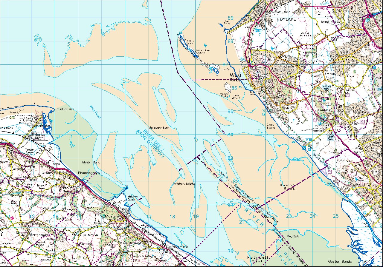
The Dee in a nutshell: there are three buoyed channels in from Liverpool Bay (i) the Welsh Channel close to Point of Ayr (ii) the Mid Hoyle Channel and (iii) Hilbre Swash passing close to Hilbre Island.
The upper Dee is canalised and is accessible only around HW. In principle boats can reach Chester. Above Connah's Quay there are bridges with air draught of 4.5, 4.0 and 3.8 metres at HW Springs. There is a bore on the flood at some spring tides.
The Dee estuary is littered with sandbanks and only a small area of sea remains at LW. Currents can be strong.
Commercial traffic comes to Mostyn Dock (using the buoyed and dredged channel). Mostyn is not a dock as such but a quay protected by a wall. It has no facilities for leisure boats. The only cargo carried above Mostyn is by a specialist boat (the AFON DYFRDWY with small draught and small air draught: 1.5m draught with 4.3m air draught) which brings Airbus wings from Broughton to Mostyn where they are offloaded for shipping to France. (She follows the buoyed channel marked by West Bar and Dee no. 1 to 10). As of 2020, this trade is suspended since Airbus is no longer making the A380.
High water is 17 minutes before Liverpool at Rhyl, 14 minutes before at Mostyn, 10 minutes before at Hilbre. Connah's Quay is 10 minutes after Liverpool and Chester 68 minutes after.
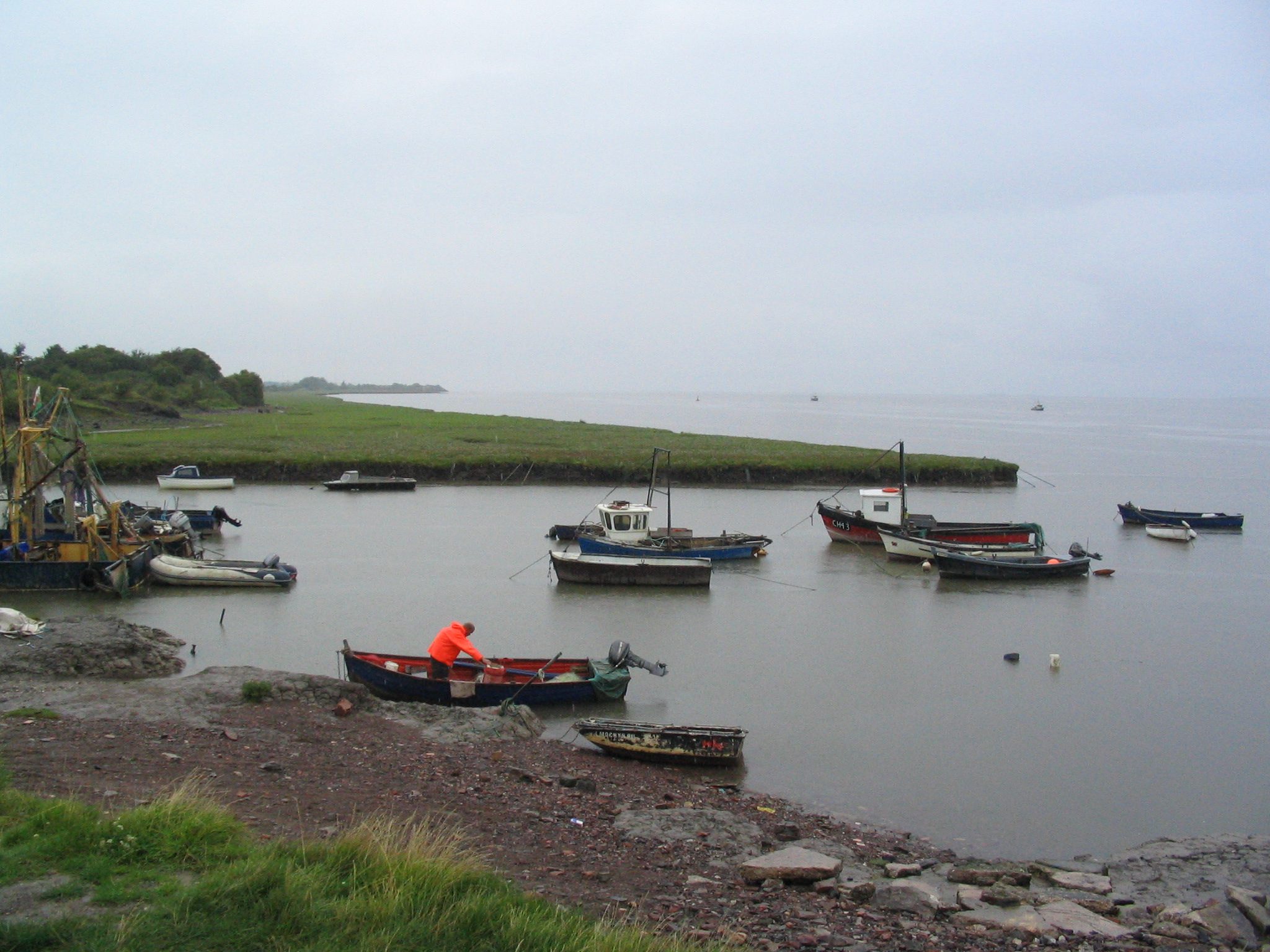
There are boat moorings (mainly summer only) off West Kirby and off Thurstaston. View. There are muddy gutters which provide shelter and some quays providing alongside berths, the best being at Connah's Quay. The Deeside wakeboard and waterski club is based at Connah's Quay. There are active yacht clubs at West Kirby and at Thurstaston. There is a boatyard at Lower Heswall, accessible up the gutter from Thurstaston at HW.
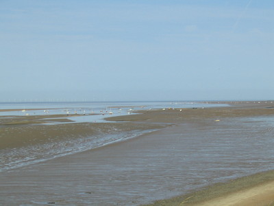
My favourite cruising destination is the SE corner of the West Hoyle Bank at LW. A big area of clean sand appears and it is a sheltered spot to dry out or go ashore by tender. A large colony of seals can be watched from here.
For orientation here are sketch maps of the middle and upper Dee (from Dee Conservancy):

Tidal information in the Dee from the Admiralty but expressed as
height in metres above/below OD datum - approx 0.2m below mean tide level.
| Location | MHWS | MHWN | MLWN | MLWS |
| Liverpool | 4.47 | 2.57 | -1.73 | -3.83 |
| Hilbre I | 4.07 | 2.27 | -1.63 | -3.63 |
| Mostyn | 4.00 | 2.20 | ? | ? |
| Connahs Quay | 3.95 | 2.25 | -0.75 | -0.75 |
| Chester | 4.6 | 2.6 | 0.6 | 0.6 |
The Dee Conservancy gives details of the state of the Dee estuary
with quite a lot of detail about the upper section to Wilcox Point
(including photographs).
The buoys (West Bar and Dee no. 1 to 10) are maintained by the Dee
Conservancy Harbour Master (tel 01244 371428; e-mail:
harbourmaster@deeconservancy.org).
See their
website for Notices to Mariners, etc..
Be aware that the channel changes frequently.
See also pdf file: Marine Safety - Dee Conservancy.
Above Wilcox Point the authority is Chester City Council. It is possible in theory for shallow draught boats to cross over Chester weir on a very big spring tide. See more info about the weir and boating on the upper dee. A canal branch gives access from the tidal Dee to the canal system - though it was little used and was totally blocked from 2016-2018.
See also 2006 guide to Dee Navigation from NABO.
For a survey (with 4 photographs including one of the Heswall boatyard) of the state of the coastline around the Dee Estuary see pdf file: coastline survey of Dee Estuary [web access no longer available]
See also DEFRA survey and 2013 survey of Dee Estuary
A detailed report on Hilbre Island in 2003, see pdf file here
The Hydrographic Office publish a chart "Approaches to the Dee" 1953 (previous edition 11-5-2006; new edition April 2012; newer edition December 2015). This had depth information in the estuary mainly from a 1987 survey of the outer part but this is now updated. The inner part is from a 1983 aerial survey - this information is mostly out of date. There is a discontinuity where these surveys fail to match.
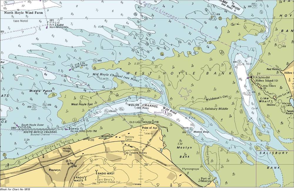
The "Great Ormes Head to Liverpool" chart 1978 (later editions 14-5-2009 and December 2015) actually shows additional information somewhat further into the estuary.
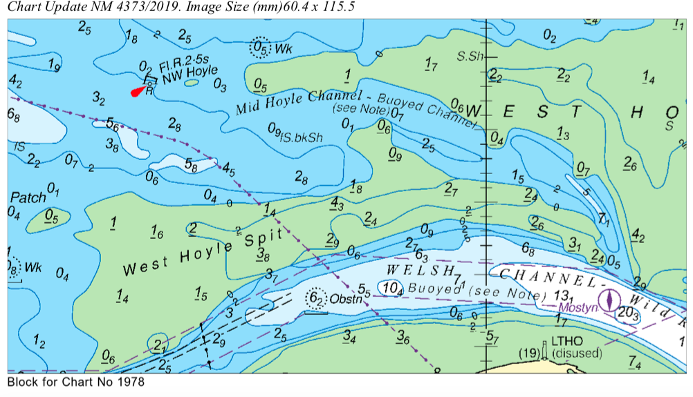
Recent surveys of the channel into Mostyn Docks 3893/2004, the mid Hoyle channel 6000/2010, then again mid Hoyle 4373/2019 and the Hilbre Swash channel 2628/2011 were made available as pdf files in notices to mariners. For the current info see here and enter chart number 1953 then click "add" then "view selection". Also Mostyn info.
An updated chart of the entry to the Dee (nm1466/2012) to chart 1978: apart from the dotted section in the lower right corner, this seems close to the actual 2012 situation. Note that the 2015 revised chart is again different and seems to fit well with my 2015/6 observations. It also does not cover the inner estuary. It is now (2017) less accurate - missing some significant changes to channels.
For a visual comparison of these Hydrographic Office charts of different dates see here .
An up-to-date chart (zoomable) is available free from Navionics. This has the option
to enable "Sonar Charts" which includes community input: this shows more
information about the depths in the upper Dee -- but since the source
appears to be solely input from me [
2013 trip] -- I consider that the treatment of my input is
unreliable except on my actual boat track.
In summary: I recommend to use the Navionics product as a way to
view the latest Hydrographic Charts for free (but avoid the Sonar Chart
option).
Note that C-Map has a similar online chart
offering. This has the extra useful feature that clicking (selecting -
right-click) gives lat and long.
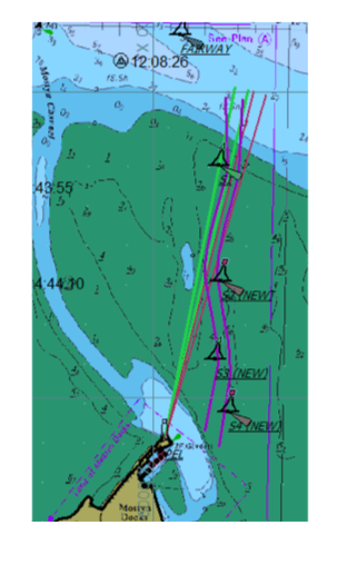
Buoyed channels into the Dee are the dredged South Hoyle channel (SH Outer,.. SH7 buoys); the Mid-Hoyle Channel (Hoyle, Mid-Hoyle, East Hoyle Spit and Dee buoys) and the Hilbre Swash Channel (HE1, HE2, HE3, HE4 buoys). The dredged channel into Mostyn is marked by M1,...M10 buoys [since 2018 a second and preferred channel (Salisbury S1,..S4 buoys) has opened up image]. The channel up the Dee follows HE4, D1,....D10 or (from the west) M1 or MF, West Bar, D1,...D10. See data on some buoy positions . These buoy positions have remained the same for many years and (see local knowledge below) D9, D10 are no longer in the optimum position: but a spherical yellow buoy is sometimes used to mark the channel (see Notices to Mariners or contact harbourmaster@deeconservancy.org for updated info). Also Dee2 seems (2016) to no longer mark the optimum route but is replaced by D1A. Note that (Aug 2017) Dee2 (now a port-hand buoy) has been moved to 53° 20.00'N, 3° 11.6'W to mark better the channel. Also Dee3 is now a starboard-hand buoy (at 53° 19.26'N, 3° 11.98'W as before). Dee1A is no longer close to the deepest channel.
Buoy positions in the outer Dee from a March 2010 (and later) survey by me.
Note that the South Hoyle and Mostyn dredged channels are a "narrow channel" and small boats must give way to ships constrained by their draught.
Ordnance Survey give the LW mark (for average tides) on their land maps. This is taken from aerial surveys. Earlier maps quote the date of survey (mainly 1970). Current maps show the same LW position as 1970 for much of the Dee estuary and no longer give the date of survey. This LW information is thus over 40 years out of date and is useless.
Note that the navigable channel in the Dee estuary used to be close to the Wirral shore and Neston, Parkgate, Burton and Shotwick were ports. See early charts (these are quite high resolution files).
The 1948 Admiralty Pilot gives information on wharves and quays giving maximum draught possible for access at HW Springs: Sluice House Gut and Colliery Wharf (near Talacre with 14 ft); Mostyn tidal basin (12 ft) and quay (19 ft); Connah's Quay and Steelworks wharf (12.5 ft); Queensferry wharf (10 ft); Saltney (9 ft) and Chester wharf (100-150 ton vessels reach it). At that date, the two bridges up-river from Connah's Quay both opened and the other bridges (below the rail bridge at Chester) were not yet built.
For a guide from a yachtsman see Dee Pilotage Notes by John Hughes.[link dead: see instead here]
West Hoyle Bank rendez-vous and trip there and to Hilbre here.
For information on racing marks laid by yacht clubs see West Kirby S C and Dee Sailing Club [also Dee SC guidance].
Satellite view and view of West Kirby/Caldy/Thurstaston area.
For places to visit at HW (Connah's Quay, Flint, Llanerch y Mor,
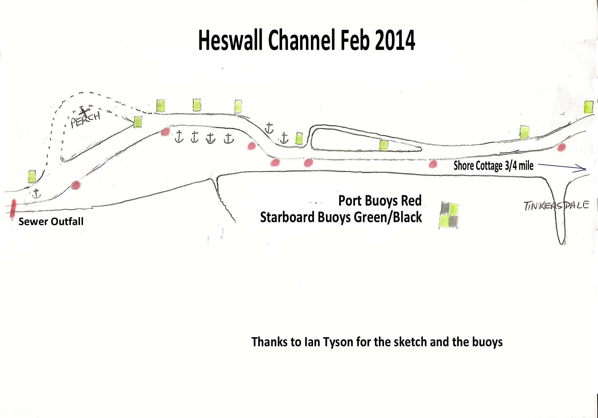
Thurstaston causeway and Heswall), sketch maps are available - see
chartlets from Dee Sailing
Club circa 2008. See also
channel up to Heswall in Feb 2014[link broken] and
channel here .
Note that the HO chart does not show the optimum route into
the moorings at Thurstaston. What it shows is a very out-of-date situation.
For the correct approach, as of 2019, use my track
(with depths) which is available at Thurstaston access or from
teamSurv [link dead].
At one time many small ports were in use: Talacre, Mostyn, Llanerch-y-Mor, Bagillt, Greenfield, Flint, Connah's Quay, Queensferry, Sandycroft. For aerial views of these "ports" as they were around 2006, see here[link broken] or ports here.
The colliery at Point of Ayr had a channel (Sluice House Gut) which
allowed ships of up to 10ft draught to come alongside. The Gut was kept
deep by impounding water at HW and then flushing it out nearer LW. The
1960 West of England Pilot states that this Gut has 14 ft depth at HWS.
The Point of Ayr Colliery owned 4 steamships [Clwyd(sank 1917 after
collision), Point of
Ayr (ex-Solway Firth),
Talacre and Tanlan
(ex-Elwy)] which carried coal to North Wales, Ireland and the Isle of Man. By 1959
this fleet had been scrapped and coal was carried by rail until the
colliery closed in 1996. So, presumably, Sluice House Gut was allowed
to silt up after the late 1950s.
[See also Talacre model]
The John Summers steel works at Shotton owned a fleet of ships which were used to ferry steel from their own wharf at Shotton to Liverpool, where they were transferred to sea-faring ships.
Another record of historic Dee-side quays.
Historic images of ships in the Dee Estuary: Chester, Connah's Quay, Flint, Parkgate, Bagillt, Mostyn.
See here for History of the port of Mostyn.
More history: the 1840 Pilot to the Dee and 1870 Pilot to the Dee give insights into shipping trade at those dates.
In 1855 a shipyard at Sandycroft (above Queensferry on the Dee) launched (sideways) a large iron clipper ship ROYAL CHARTER of length 306ft and beam 41ft, although it did subsequently ground off Fflint on the way out of the Dee. She eventually sank with great loss of life in a storm in 1859.
A summary of wrecks in the Dee estuary and its approaches
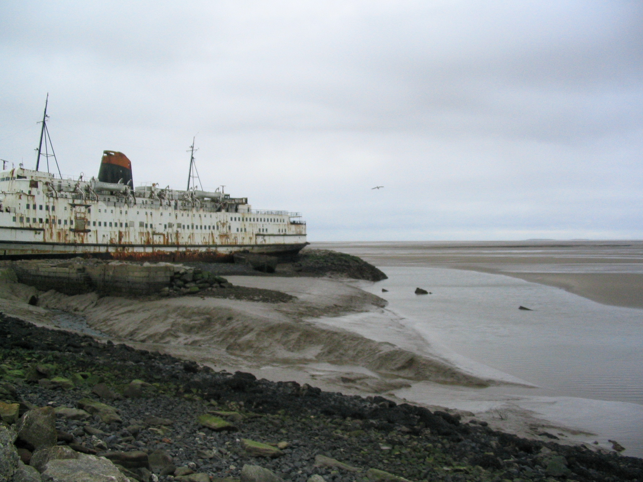
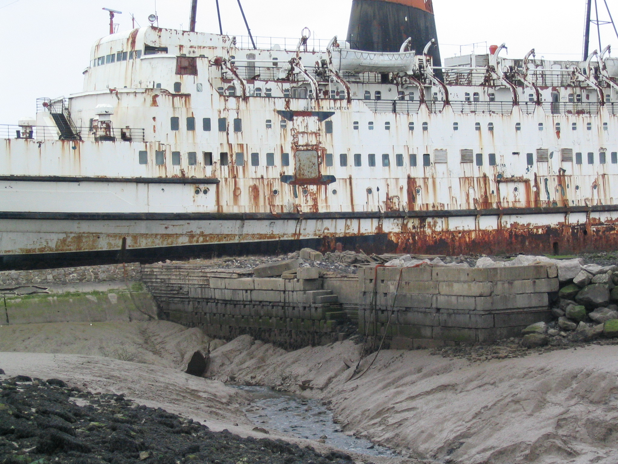
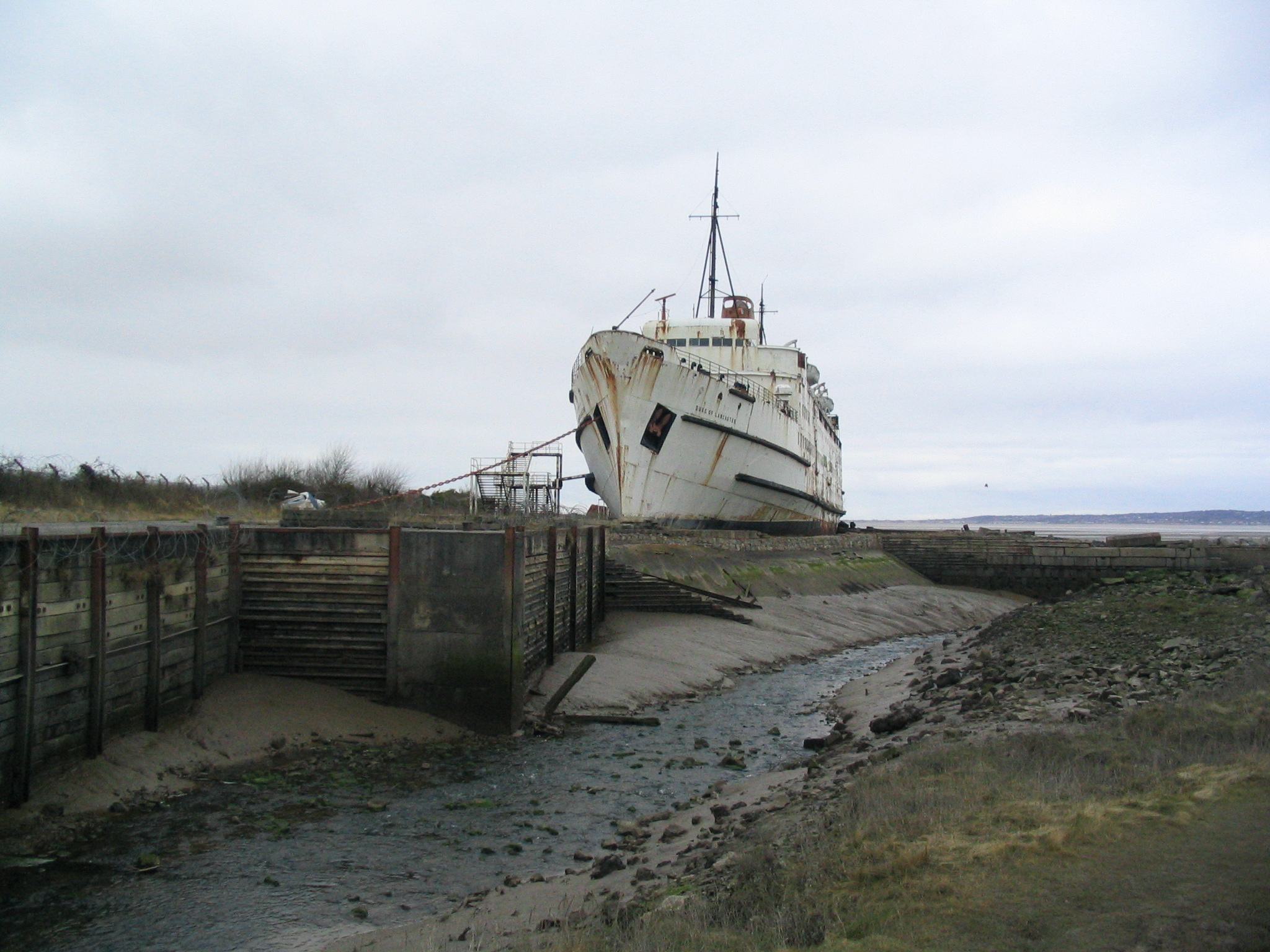
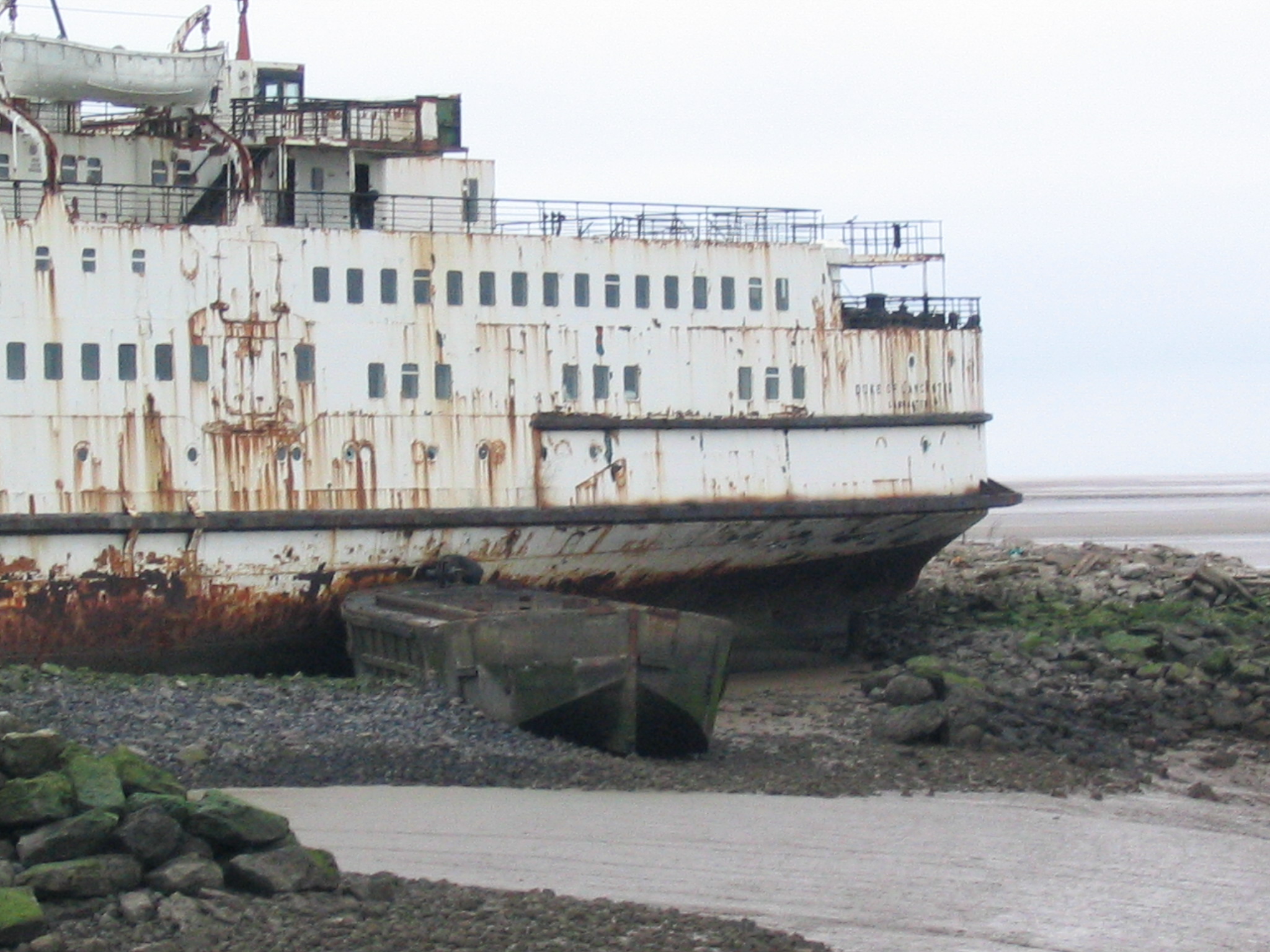
The "port" at Llanerch y Mor (next to the rusting hulk of the ferry Duke of Lancaster) has quays which are accessible near HW - but the uneven seabed contains rusty metal pieces and there is barbed wire alongside part of the inner quay. It would be possible to stop briefly on the outer quay near HW but, as of Feb 2015, the quay area is encircled by barbed wire, so access from the quay to Aberkhan (nearby textile shop complex which has a tea room) is not available. See photos of the entrance, the outer quay, the inner quay and the barge.
For more on the Welsh coast between Fflint and Bagillt: see coast path here.
More images of Greenfield Dock, click Dock here
Image of Bagillt Dee Banks Gutter at HW in 2010 (kept open by water coming down Milwr Tunnel).
Image of Bagillt Station Gutter (no longer used).
Image of Fflint Industrial Quay in 2010 at HW.
Images of the "pier" and "ramp" at West Kirby and the "causeway" at Thurstaston.
For information on bird watching in the Dee Estuary with a clickable map.
Dee area marine conservation information.
The Dee bore - info here
For some pictures and navigational information from my recent (2008, 2010, 2011/2/3, 2014, 2015, 2016, 2017, 2018, 2019, 2020, 2021, 2022) trips into the Dee, see 2008 , 2010 , 2011/2/3/5, 2013 trip to Connah's Quay, 2014 trip to Chester, July 2015 trip to Thurstaston, April 2016, May 2016 near LW, July 2016, Sept 2016, April, June, July, August and September 2017, May 2018 including Chester and Mostyn, Sept 2018, July, August, September 2019 inc Thurstaston, May, July 2020, June, September 2021, April 2022, June 2023.
Note 2017, 2018 and 2019 reports contain some waypoints that I find useful.
A record of the depth and track of most of my voyages since 2013 is available from teamSurv .[defunct]
Images of the NESTOS (for more details see my book Wrecks of Liverpool Bay: details ).
Satellite photos of the AFON DYFRDWY loading dock at both ends of its voyages (at Broughton and Mostyn).
Hilbre Island webcam [not working].
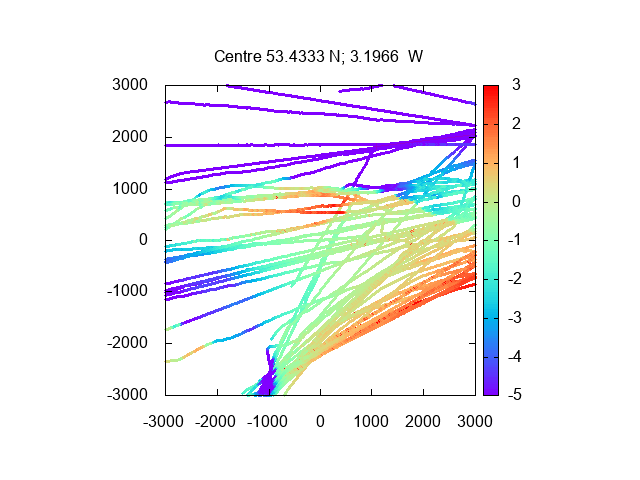
When coming to/from the Mersey via the Rock Channel and Hilbre Swash, it is
possible to cut across the East Hoyle Bank (East Hoyle Spit) at most
states of the tide. On a straight line between Meols buoy(Pipeline) and
HE2, the chart shows (2014) that the bank dries at most 1 metre above
chart datum, but further west it dries up to 2 metres. In July 2014,
near spring LW, I could see the end of East Hoyle Spit dry (so about 2m
above CD) and that the dry section overlapped the direct line from HE2
to Pipeline. See also 2019
observation of a drying height of East Hoyle Bank more like 3m. A
better route would be to cross the bank further SE of this line: for
instance heading from HE2 to my waypoint
ROCK . Then least depth would correspond to about 1m above CD with
the shallowest point being the northeast edge of the bank (so at
half-tide with depth 5.2m above CD, there would be plenty of depth - as
I found on earlier trips). See also 2016 info and my tracks and
depths (in metres): Crossing E Hoyle
Bank/Spit (Hilbre Swash to west and East Hoyle Spit to North (dries
more than 2m)). From this survey, I set up a waypoint 53° 26.290N,
3° 10.180W to show the shallowest crossing point.
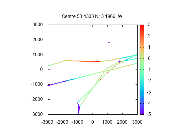
In Sept 2018, I tested
this crossing with success: see depths here
above CD and tracks (+ at middle right is the waypoint; He3 is at
bottom left). Also tested July
2019, 2020 and 2021.
In March 2019 at very low water (0.1m at Liverpool), I
observed this area on foot - and there was a large area between the shore and the
outer East Hoyle Spit which was still covered. So the short cut discussed
above does not dry.
Rhyl information: drying harbour accessible HW +/- 2.5 hours with 4
ft under a workboat keel (seabed in outer harbour about 4m above CD) . The
(opening) footbridge is now operational and limits access to the inner
part of the harbour which has a pontoon for loading/unloading to the
north-west of the harbour (it dries to an uneven bottom and needs a code
for shore access).
Further in, the road bridge is passable with moderate air draft to
give access to a further inner sheltered drying area. The rail bridge is
further upstream and is lower and no powered craft should pass under it.
Before the footbridge, there is a pontoon in mid-channel which is
used by the fishing charter boats. There is also a pontoon on the north
wall which has access ashore (code needed to return).
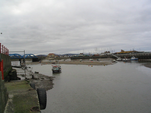
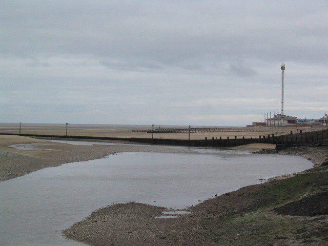
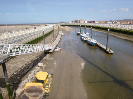
Images of Rhyl harbour (2008) near LW image 1 and image 2. Map of Rhyl harbour
Image of pontoons in outer Rhyl harbour on 3 May 2016 near LW during sand removal operations.
Note that harbour improvement works are not yet completed at Rhyl (info), for instance the air draught gauge is still to be provided. The harbour master is on channel 14 or call 01825 708 400 for information and for opening the bridge. There are three vertical lights ashore which show red when the bridge is closed (with an additional amber meaning the harbour is open to vessels with small enough air draught), and green when open.
Navigation information from
Rhyl YC[link broken] also
PBO article here[link defunct].
2014 Marlin trip to Rhyl
2018 Marlin trip to Rhyl
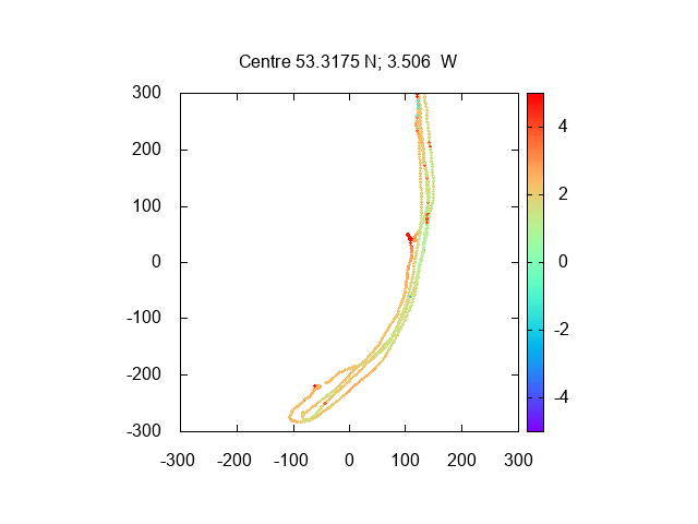
See depths here (above CD) and tracks in the harbour itself from my two visits above (isolated red spots on track are sonar glitches)..