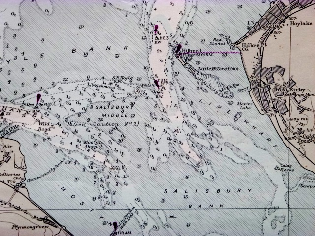
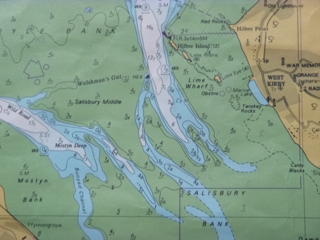
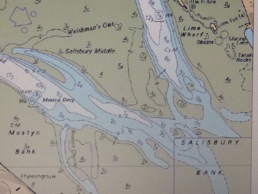
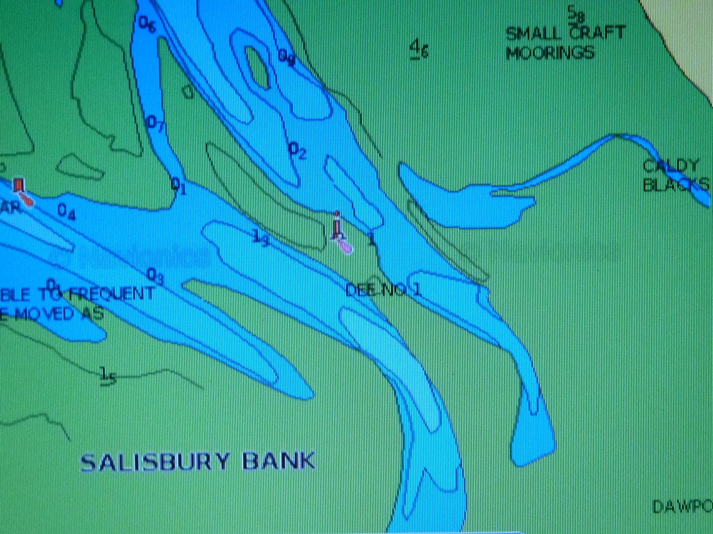
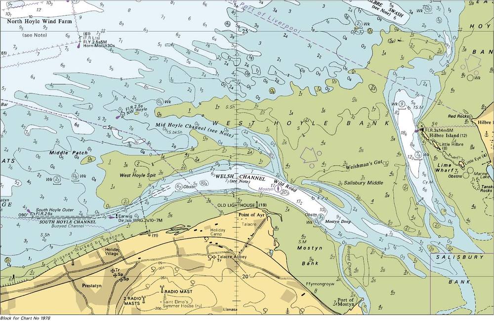
Dee Charts (Hydrographic Office) showing changes. The area shown is near Dee1 buoy - where the channel coming in southwards from Hilbre Swash meets that coming in southeasterly from near Point of Ayr.
Pre-metric (depths in fathoms) from 1974 (survey date may be older)
Pre 2012 chart (survey dated 1986 to 1997)
2012 chart
2015 chart