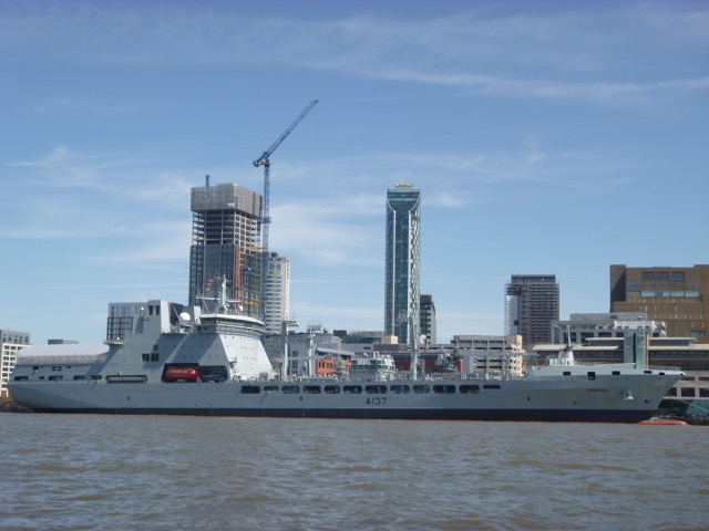
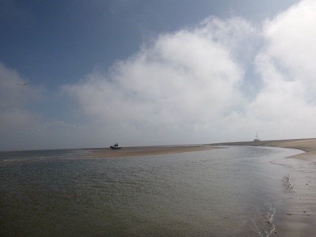
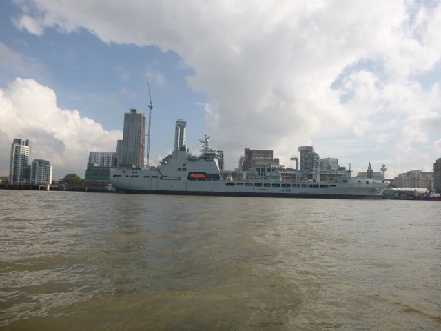
Warship A137 (Royal Fleet Auxilliary Tiderace - that has been refitted at Cammell Lairds) alongside at Cruise Terminal
Jump to: May
Jump to: June (wrecks N of Hoyle Bank)
Jump to: July
Jump to: Oct.
Wednesday 20 May. High pressure. Leave Liverpool Marina at 12:15 (HW 10:42 8.5m; LW 17:27 1.8m; HW 23:04 8.5m). Calm and sunny. Though onshore breeze built up.
Proceed past New Brighton (at 12:40) and through Rock Gut [this is charted as lying north of the Rock Channel and bisecting Brazil Bank]. I found the seabed can rise as much as 1.5m above CD - similar to what I observed previously - 1.3m.
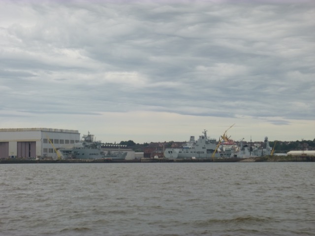
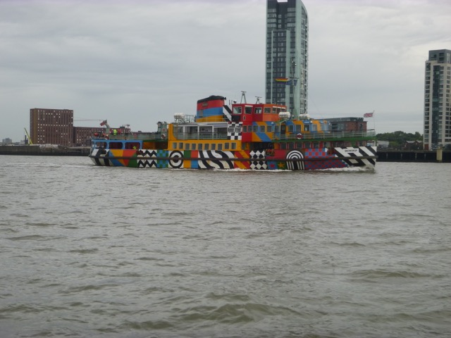
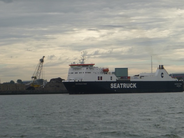
Shipping seen in Mersey:
Warship A137 (Royal Fleet Auxilliary Tiderace - that has been
refitted at Cammell Lairds) alongside at Cruise Terminal
Passing New Brighton, the beach was already well populated - social
distanced, hopefully:
After surveying the Rock Gut,
I decided to survey a wreck site (Early SS).
Wreckage was reported here in 1919 and the location is listed by MDHB.
I found some underwater ridges - possibly wreckage, but also, possibly,
sand waves.
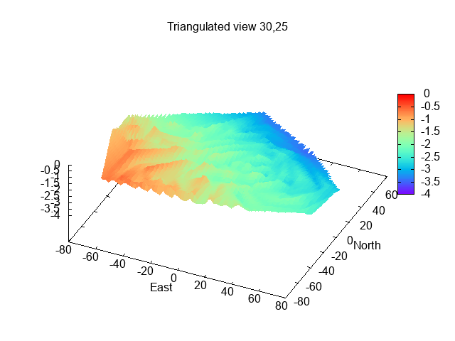
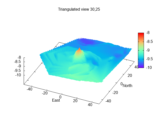
Seabed survey (as depth below CD):
I then headed for my waypoint for crossing the East
Hoyle Spit and then on to the He3 buoy.
Crossing the East Hoyle Spit had shallowest seabed at 0.5m above CD.
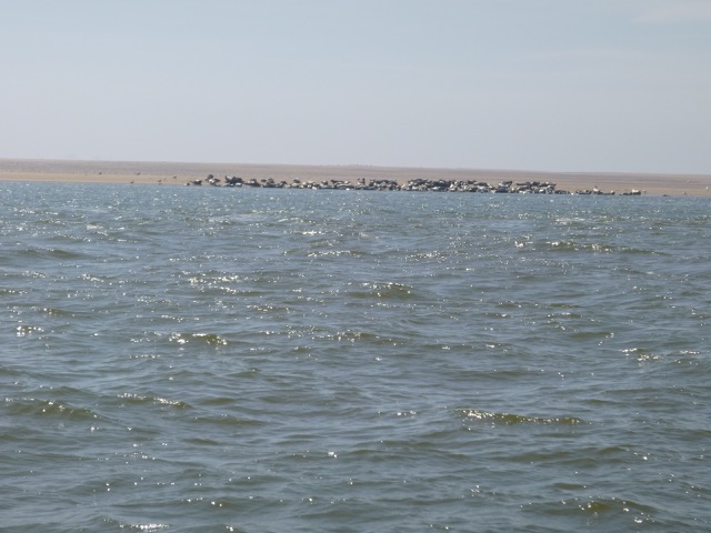
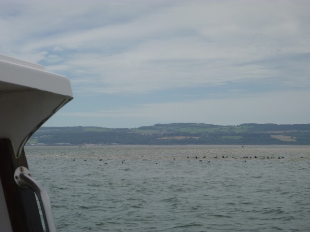
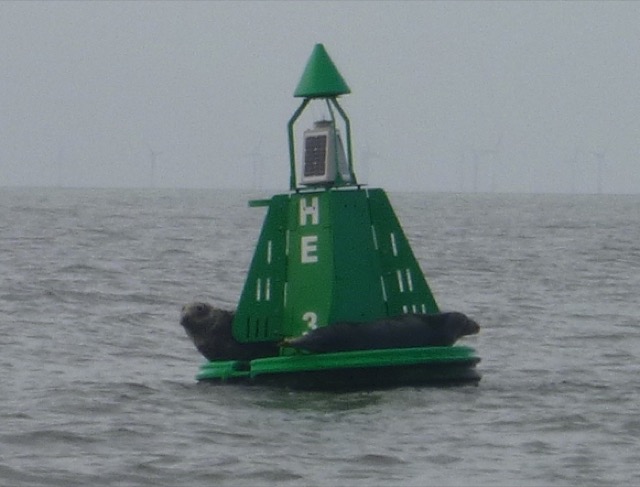
I rounded the end of Hilbre Island at 2:50 with adverse current. The
seals were lying on the SE tip of the Hoyle Bank - which was partly
dry at that time. There was a bilge-keel yacht dry on the bank already.
Seals on the Hoyle bank:
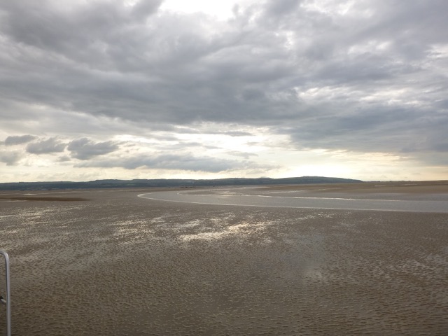
I wanted to be able to get back to Liverpool Marina by first lock (tidal height 6.5m), so surveyed the area just south of the SE point of the Hoyle bank - looking for a suitable spot. There was a flat area and I ran aground there at 3:15. Position 53°22.098N, 3°14.181W, quite near positions used in recent years.
After the tide ebbed further, I went
overboard to check my anode, stern gear and hull.
At this location, the seabed depth was about 2.2m above CD, using
Liverpool tidegauge data. So just above LW level [1.8m] on that day.
I also took a walk around - taking care not to disturb the seals.
There was a drainage channel right next to the Hoyle Bank - which was
knee deep to cross.
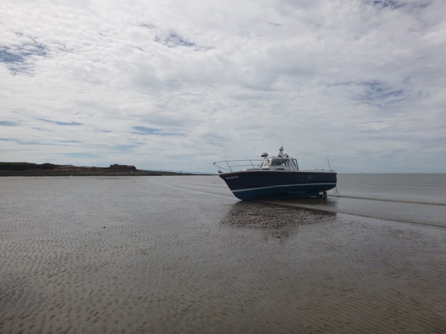
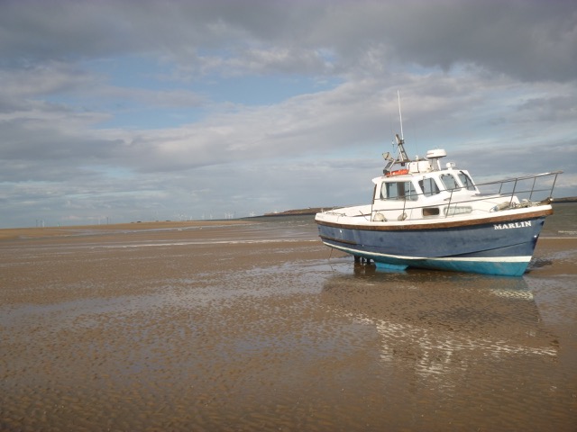
There was a strong sea breeze - so sunny but not very warm. The sea was sheltered behind the Hoyle bank, so Marlin took the ground gently.
Marlin aground (looking into Dee Estuary, drainage channel in
foreground, Hoyle Bank on right):
I was afloat again by 6:55 and returned via Hilbre, He3, my waypoint Corner, the Rock Channel, into the Mersey. The direct route from there to Corner crossed the North Bank at 8:20pm with least depth of 1.4m under my keel. I followed my waypoints Corner - Chip - Perch and found the seabed dries by no more than 0.5m at CD.
Reach Liverpool Marina by 9:00. There were 2 other boats waiting to enter, which had been out fishing.
Trip out 17.0nm, back 14.4nm.
Tuesday 2 June. High pressure. Leave Liverpool Marina at 9:40 (HW 8:44 8.6m; LW 15:42 1.7m; HW 21:21 8.7m). Calm and sunny.
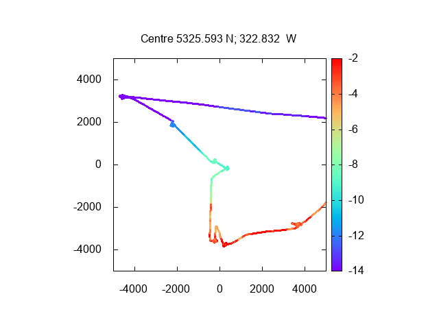
Out through Rock Channel (10:15) to North of Hoyle Bank to explore wrecks that have appeared on chart from Clinton Marine Survey in 2019.
Survey using sonar (downscan and sidescan) and position - to analyse later using tide-gauge results to correct for tidal height and reduce depths to Chart Datum (CD). Depths and distances in metres from waypoint (which is charted position). If parts of the wreckage were not covered by my track - they may not show correctly on the plots which interpolate the measured data. Wreck numbers are for my book-keeping. The word "wreck" is an assumption - these might be obstructions of some other source. More about these wrecks.
Wreck 1 (53° 24.077N, 3° 19.540W; reported 2019 as length
19m, width 5.5m, least depth 3.2m):
Wreck Boiler (53° 23.567N, 3°
22.606W, previously dived by me):
Wreck 2 (53° 23.669N, 3° 23.071W; reported 2019 as length
18.2m, width 5.2m, least depth 2.9m):
Wreck 3 (53° 25.485N, 3° 22.515W; reported 2019 as length
14.8m, width 6.4m, least depth 8.1m):
Wreck 4 (53° 25.697N, 3° 23.069W; reported 2019 as length
11.2m, width 4.4m, least depth 8.1m):
Wreck 5 (53° 26.593N, 3° 24.832W; reported 2019 as length
14.5m, width 5.3m, least depth 11.4m):
Wreck 6 (53° 27.322N, 3° 26.973W; reported 2019 as length
12.3m, width 4.3m, least depth 14.5m):
If anyone dives these wrecks and can report to me what they find, I would appreciate it.
Overview of my track around these wrecks:
Note other wrecks in this area are Ceylon (53° 23.754N, 3° 26.609W); see survey here by me in 2019 since Clinton Marine reported a wreck 65m N of this - and it (along with the Ceylon) is currently charted.
Then a little fishing - one foul-hooked tiddler only. Head back via Rock Channel to marina. Lock in 7:30.
50.5 nm run
Thursday 30 July. Overcast with thin cloud, Wind S. Leave Liverpool Marina at 9:37 (HW 7:54 8.0m; LW 14:48 2.5m; HW 20:35 8.0m).
Proceed past New Brighton (at 10:05) and through Rock Gut [this is charted as lying north of the Rock Channel and bisecting Brazil Bank]. I found the seabed can rise as much as 1.5m above CD - similar to what I observed previously - 1.3m.
Shipping seen in Mersey:
Royal Fleet Auxilliary Vessels being refitted at Cammell Lairds
Dazzle Ferry (Snowdrop)
SeaTruck Pace.
After surveying the Rock Gut, proceed across North Bank, East Hoyle
Spit, to HE3 (at 11.18). Then pass end of Hilbre to HE4, where the seals
were awash on the Hoyle Bank:
I was near He4 at 11.45, (HW+4hrs) and it would be a while before I
could dry out nearby, while still being able to refloat in time to
return to the Marina by 6.45pm. I surveyed the area, the wind was S force 3 which made the
south side of the Hoyle Bank (my usual drying out spot; which had 1.2m
under my keel at that time) a bit choppy.
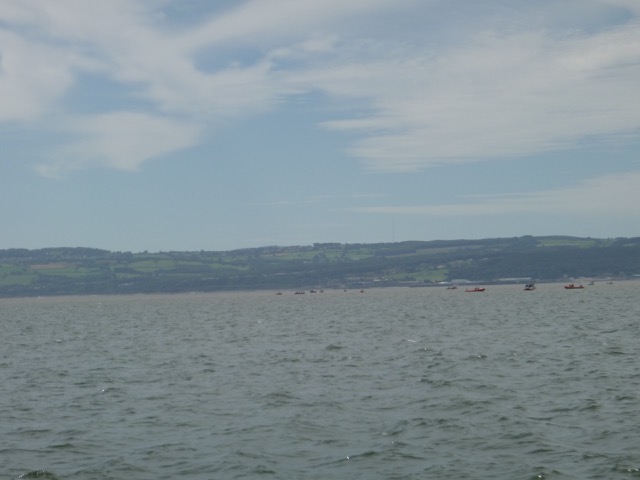
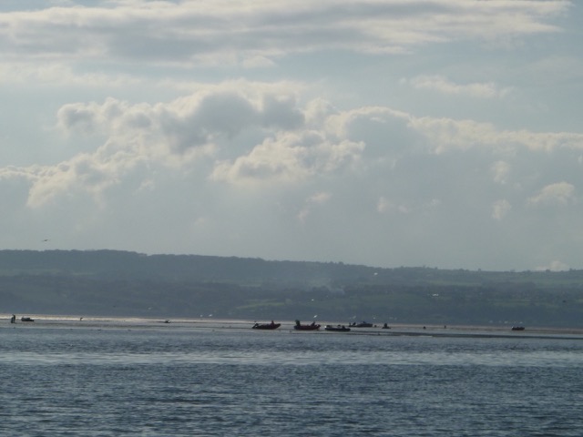
To compound the disadvantage, there were 12 small boats nearby -
presumably cocklers waiting for the tide to fall so they could land on
Salisbury Bank nearby.
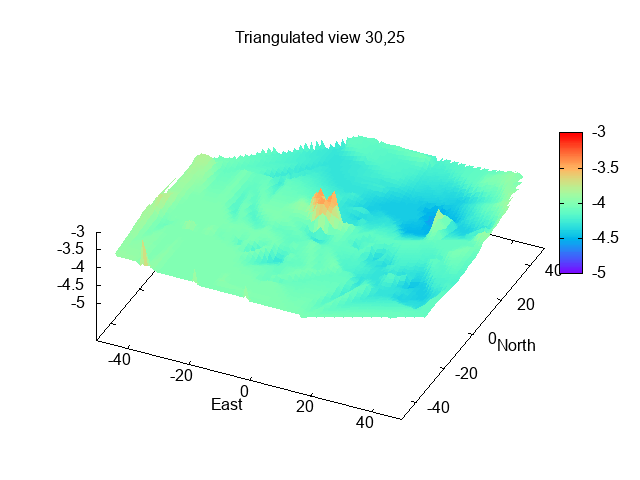
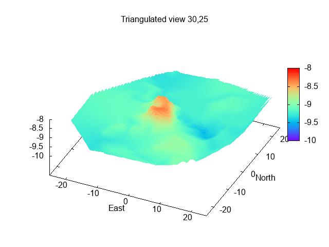
Survey (2019-20) of seabed just S of SE tip of Hoyle Bank (depth above/below CD in metres), distance in metres [file missing]
With southerly wind, the beach NE of Hilbre is a good choice - it is firm sand and would be sheltered. It is connected to the mainland, so I would get some visitors on foot, but is usually quite peaceful.
I anchored off at 12.24 and then drove ashore at 1.00pm at 53°22.178N, 3°13.433W. With an offshore wind, the sea was calm. In this area, it is important to avoid the wreck of the Thomas, now charted as drying 2.3m (thanks to my report to the Hydrographic Office). The wreck was not visible - since LW was 2.5m - but was "lurking, ready to trap the unwary".
I was able to go overboard and remove some slime and weed from the hull, as well as "rehome" some barnacles from the propellor. It was a fairly quiet spot - two girls came to bathe nearby - and the beach shelves so gently that they only got out to waist height after a long walk.
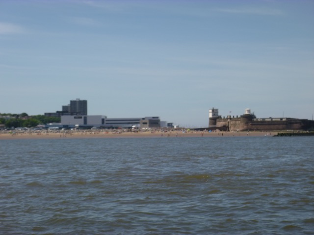
The (charted) remains of the Hilbre Swash beacon (built to line up
with another on Little Eye) with Hoylake and West Kirby beyond, from my
drying position:
![]()
Hilbre Island and Marlin aground
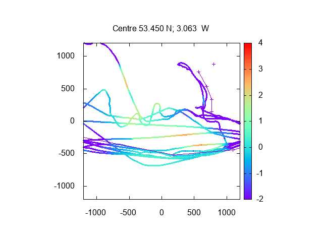
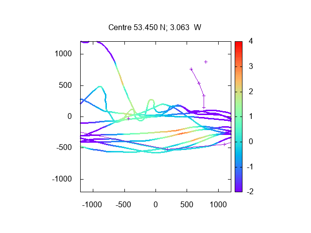
I refloated at 4.00 and remained anchored until 4.30 when I set off back to Liverpool. I was very calm. Again I crossed the East Hoyle Spit (5.00) and North Bank (at 5.55, least depth 4.3m under my keel) heading to my waypoint ROCK. I then surveyed the Rock Gut again. This Gut is shallower than the Rock Channel (1.5m above CD, rather than at CD) but is more direct and seems to have a stronger current - so may be preferable to use around half-tide for shallow-draught vessels. Note that one must keep well clear of the (not-buoyed) southern end of the training wall.
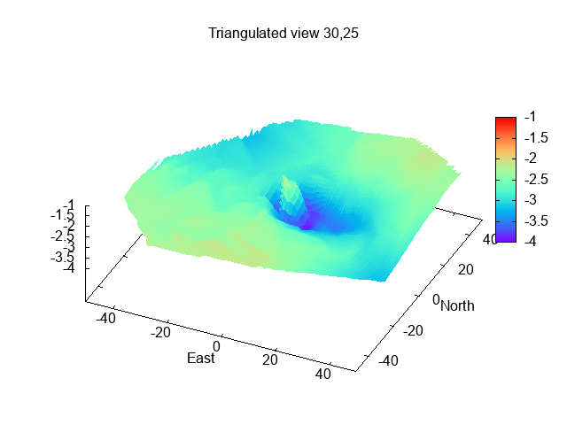
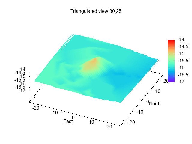
Survey (from 2019-20) of Rock Gut (east-west at centre); Rock
Channel (at south with lines joining waypoints), also training wall
marked at upper right. Depth above/below CD in metres, distances in metres.
I reached Liverpool Marina at 6.22 and entered the lock at 6.40. After waiting for some boats, there were 9 of us in the lock, the most unusual being a (retired) displacement steel lifeboat [Solent Class ON 1010, 48-007, some 50ft long, weighing 30 tons, built 1970], which had come in from the Clyde. I was on my berth at 7.10.
Trip out 15.5nm, return 13.5nm, all at slow speed [6 knots through the water].
Wednesday 14 October. High pressure at last. Leave Liverpool Marina at 11:10 (HW 9:54 8.7m; LW 16:35 2.1m; HW 22:12 9.1m). I was the only vessel in lock. Fairly calm (NE force 3) and mostly sunny but with some swell from the north.
Liverpool waterfront
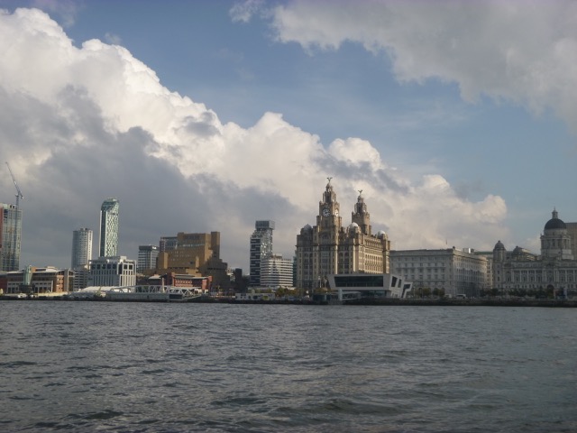
RFA Tideforce on the Cruise Liner terminal
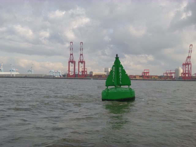
It doesn't take long to get to Brazil:
Proceed past New Brighton (at 11:35) and through Rock Gut [this is charted as lying north of the Rock Channel and bisecting Brazil Bank]. I found the seabed can rise as much as 1.5m above CD - similar to what I observed previously - 1.3m.
Depths in the Rock Channel and Rock Gut from my 2020 trips (depths
in metres over CD)
Head across north Wirral coast to Hilbre Swash (He3 buoy)
A double bed (for seals):
Then round Hilbre Island and across to buoy He4. The SE corner of the Hoyle Bank was not yet dry - so the seals were not yet in position (13:00). I intended, since it was before half-tide, to explore the Welshman's Gut. This [_not_ my stomach] used to run along the south side of the Hoyle Bank and provide a sheltered route going east or west. I remember that there was a buoy (S. E. Hoyle) marking the route when I first visited the area (1980s). I headed across (towards Mostyn) to see if there was a passage at that time. I eventually had less than a metre below my keel and, not wanting to get stuck there with a long wait to refloat, I turned around. After some surveying, I found a nice flat sheltered area to dry out and, duly, anchored. There was some current but only tiny waves.
During this time, more and more small vessels came to Salisbury Bank
(nearby) and then, as the tide fell, started collecting cockles
(eventually over a dozen boats).
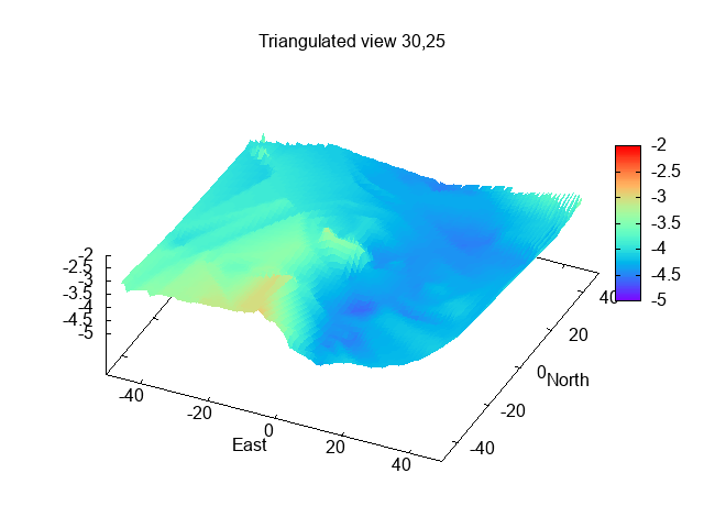
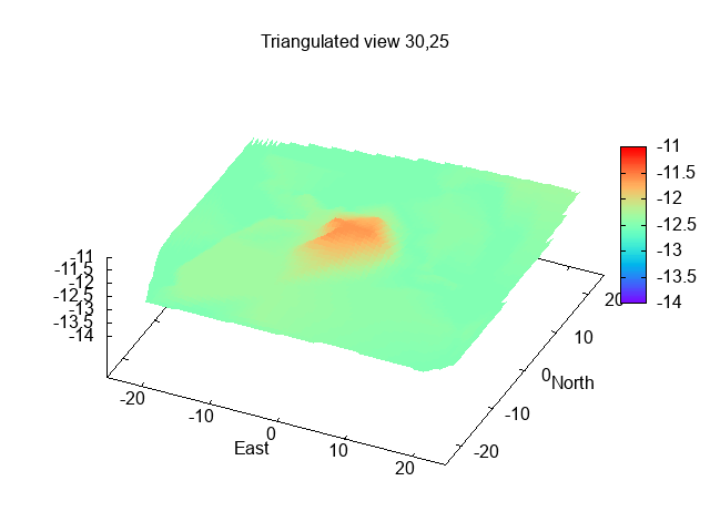
Depths (in metres over CD) near the edge of Hoyle Bank (Welshman's
Gut) - distances in metres, + are my anchoring waypoints:
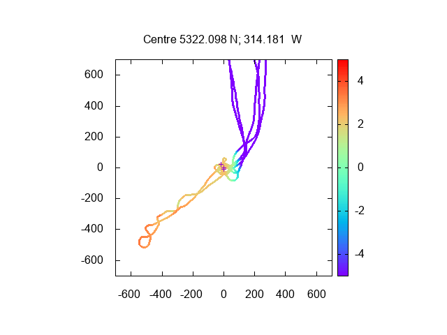
By 2:15, I was aground (at 53°22.093N, 3°14.178W) and the location was dry by 3:00. The location was firm sand and I expected, as usual, to dry out with Marlin tilted at 20°. Instead, Marlin settled nearly upright into a small lake (presumably scour from the current while anchored). This was good (easier to move around onboard) and bad (harder to reach under the side to change the anode).
Marlin aground with the SE corner of the Hoyle Bank
(where seals haul out), Hilbre Island and Burbo Windfarm beyond.
At low water, I could see that I was on a flat area of firm sand,
separated from the Hoyle Bank by a narrow drainage channel that runs
close to the Bank. View to west (towards Mostyn and along the start of
Welshman's Gut):
I refloated gently and was under way by 6:10. The sun set at 6:15.
While waiting off Liverpool marina, I was startled by a loud bang. This turned out to be from a nearby fireworks display - which had some rockets that burst at height.
I reached Liverpool Marina at 8.00 and entered the lock at 8.12 with just one other boat.
Trip 29.2nm, mostly at slow speed [6 knots through the water].
If higher resolution versions of the above images are wanted, please contact me. All information given in good faith, but please do not rely on it.
Back to index here