
Jump to: January(to Hale head)
Jump to: February(to Fidlers Ferry)
Jump to: April(to Warrington)
Jump to: June(to Eastham)
Jump to: July(to Eastham, Hale)
Jump to: August(to Eastham, Mount Manisty)
Jump to: September(to Hale, Runcorn)
Jump to: October(to Stanlow, Runcorn, Hale)
Jump to: November(to Eastham, Widnes)
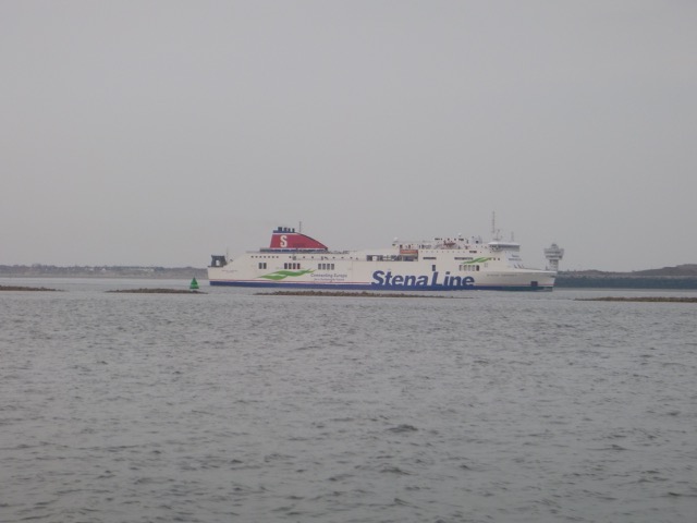
Thursday 21 February (Liverpool HW 12.20 10.2m). Wind slight then SW 2-3; sunny.
Enter river from marina at 10:37.
Calm weather. Sunny. Quite warm. Not at all like February.
This was one of the biggest tides of the year - so appropriate for
exploring the upper reaches of the Mersey.
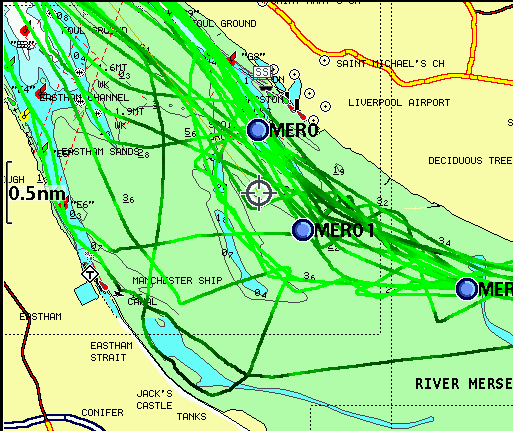
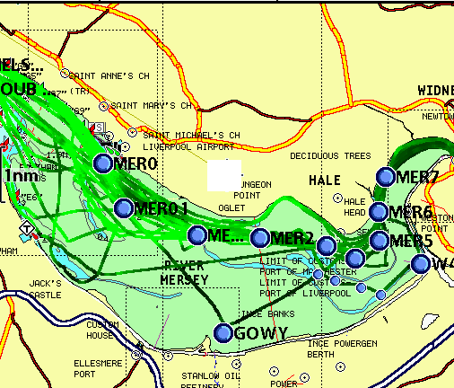
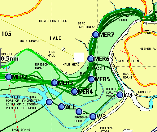
Head up Garston Channel. Leave Garston channel at G11 (SHM) and head
for waypoints MER0,...MER7. (see
here for navigation info, some history and more photos).
Actually since it was a very big tide, and while it was still making, I
could go just about anywhere - so I also used evidence from the surface
ripples to try to find the deepest part of the channel.
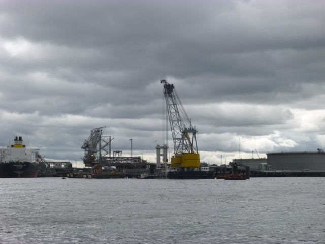
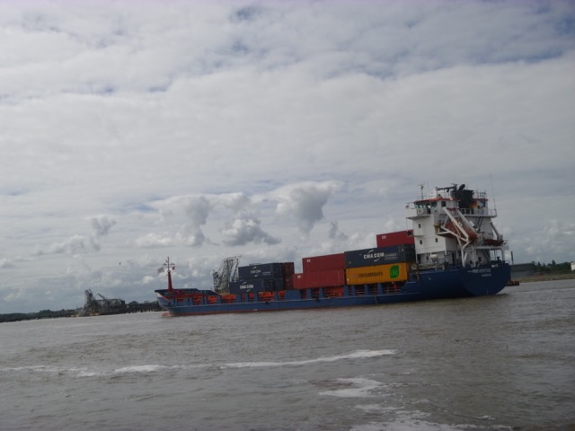
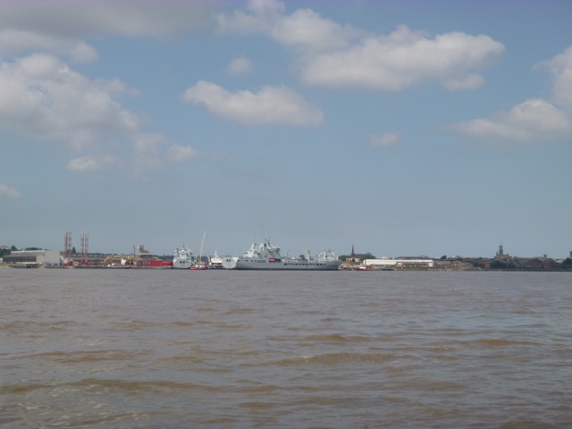
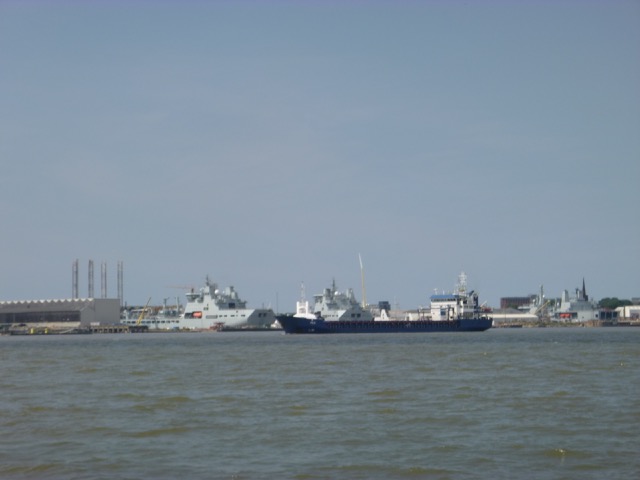
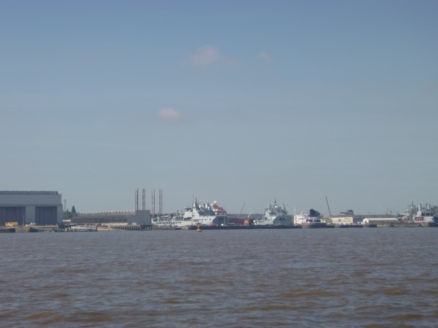
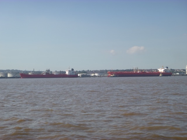
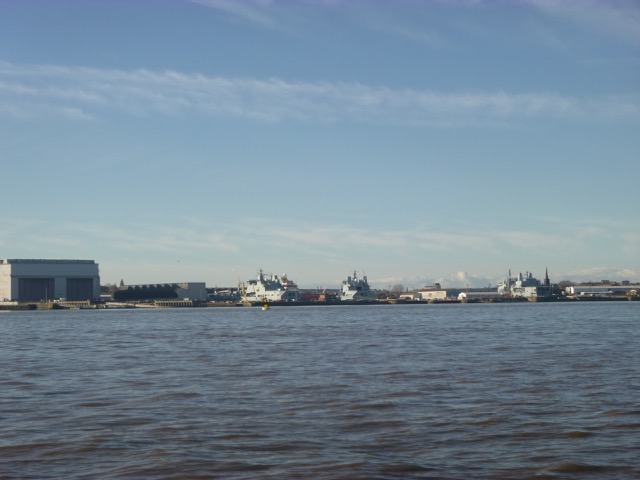
Floating crane [Lara 1, ex Mersey Mammoth] working at Tranmere Oil Terminal
Cammell Lairds shipyard.

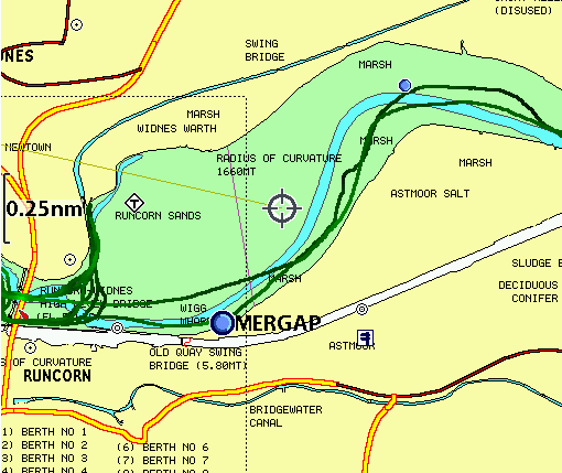
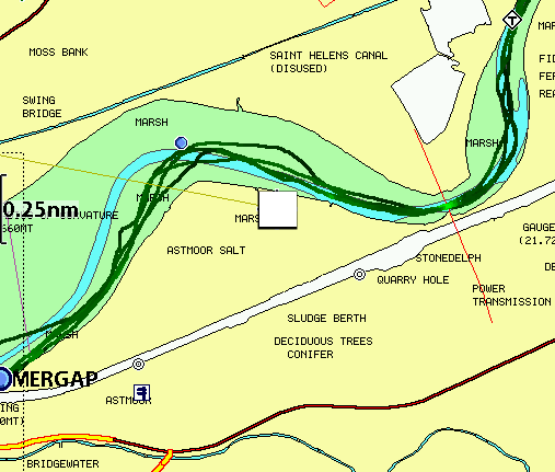
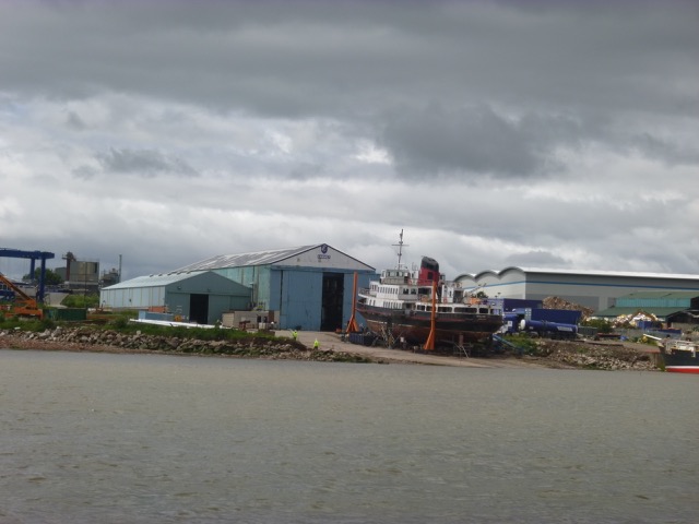
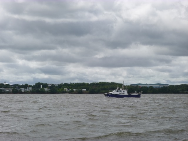
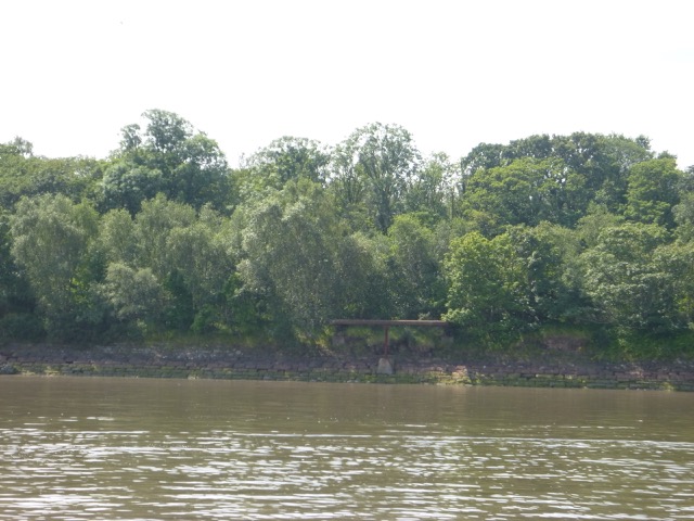
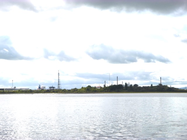
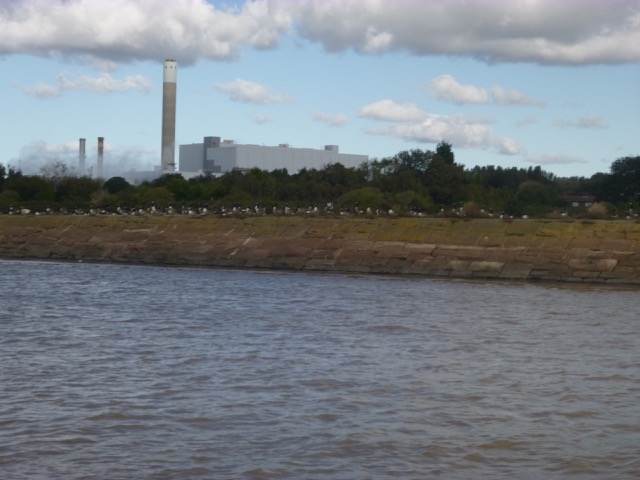
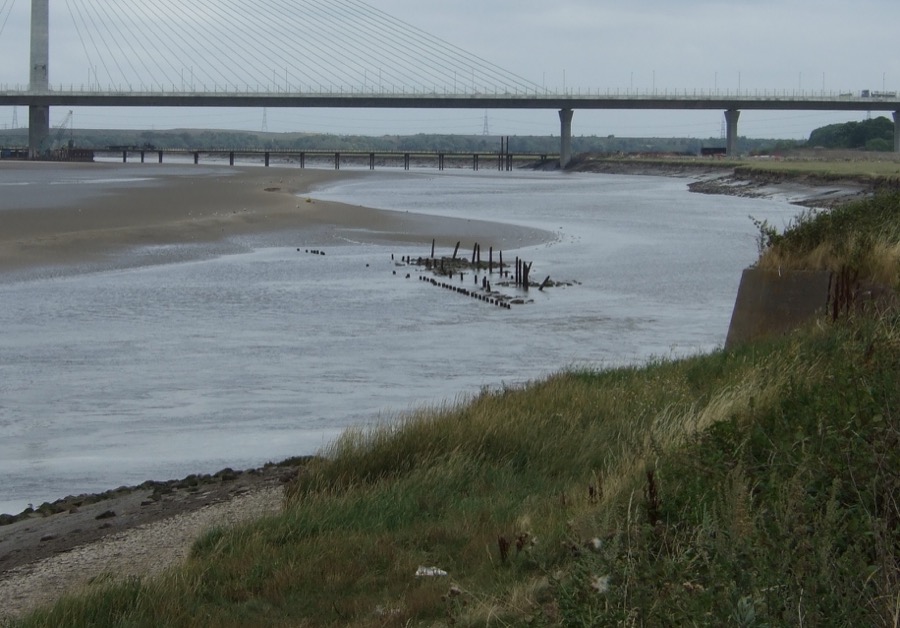
Cross south of Hale Head at 11.35pm and proceed along north bank up to the Runcorn bridges. Go through south arch (of three) of the railway bridge at 11.55. I met a yacht coming down the river just as I approached the bridges. Also a fast SURVEY motorboat (White Osprey) passed me going up river.
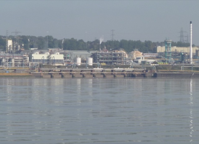
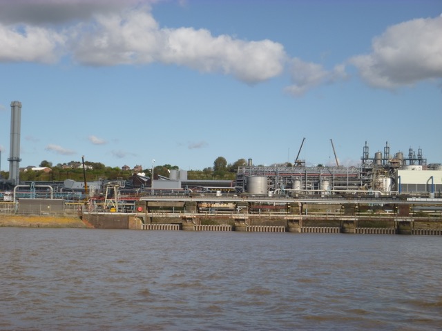
Runcorn chemical works

Foot Bridge on the walkway along the north shore at Widnes.

The Rail Bridge and (arched) Road Bridge, looking towards Widnes.

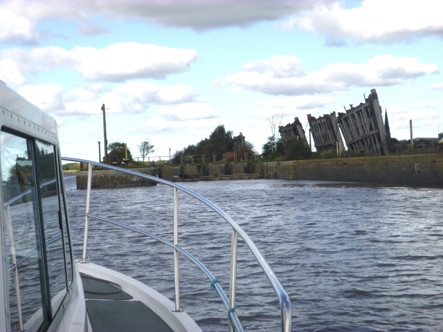
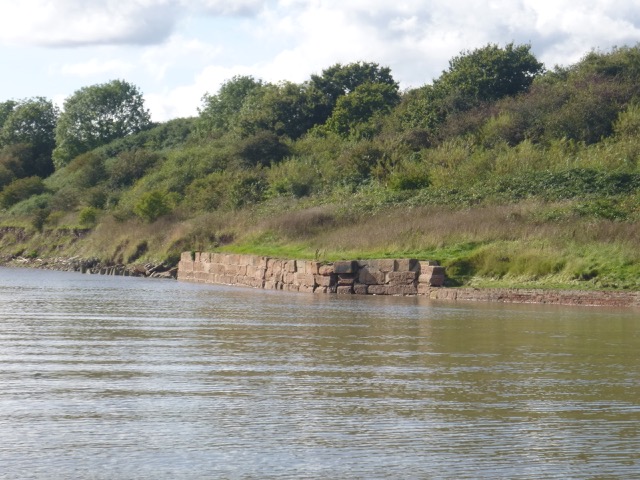
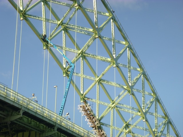
The road bridge is currently being repaired and has workmen on the arch. Follow south bank passing (abandoned) lock into Ship Canal, then head NE keeping close inshore - and avoiding the ruined quay which is an obstacle here (though most probably not when the tide was so high). There was a yellow buoy in place - most probably to mark this obstruction. I had set up a waypoint to avoid it - based on a Google Earth image at low water.
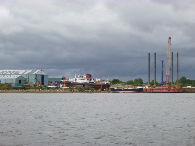
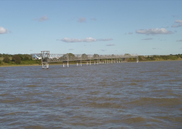
I had been restricted by the trestle bridge (low head room) that was in place 2013-2018 while the Gateway Bridge was built. So my last trip was in 2013. The trestle bridge is finally no more - so I could head on up. Some of the photos taken during construction of the Gateway Bridge helped to give an idea of the location of the deepest channel. I chose to keep fairly close to the Runcorn bank - as on previous trips. I crossed under the bridge using the gap south of the southern large support tower (see LW image).
There were a pair of yellow buoys on the NE side of the Gateway Bridge - possibly to mark the channel (or maybe left-over mooring buoys). I passed under this bridge at 12:05 with current still strongly up-river. I decided to head on up to Fidlers Ferry - calculating that I would have enough time to get back to Liverpool marina by last lock-in (at 2:39pm), if I pushed my speed through the water up from 7 knots (displacement speed) to more like 10 knots to counter the current which would still be flowing up-river until around 1:20pm.
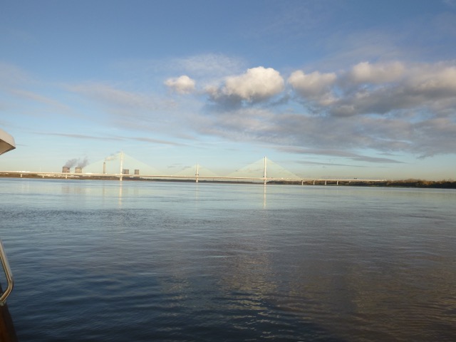
Gateway Bridge with yellow buoy in foreground; Fidlers ferry power
station to right.

Gateway Bridge

All 3 bridges lined up (looking up river).

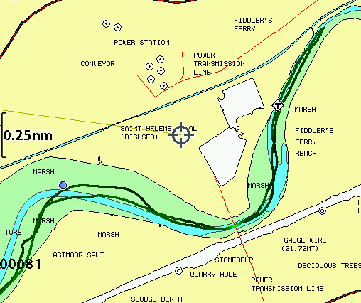
I passed the pylon crossing and then arrived at Fidlers Ferry at
12:25 (so about 2 hours from Liverpool marina at 7 knots through the
water). I had as little as 2 metres under my keel (depth 0.7m) once
or twice on the way up - but deeper water is available - I just did not chose to
creep up slowly checking depths.
The tide level was high and was lapping against the launching area
at Fidlers Ferry. I
heard a funny buzzing sound - and popped outside the cabin to see if
some engine malfunction was the cause - then I saw a small drone close
by. A group of people were standing on the bank - presumably piloting
the drone.
Image from the drone (from FFSC): Marlin passing Fidler's Ferry Sailing Club
heading out:

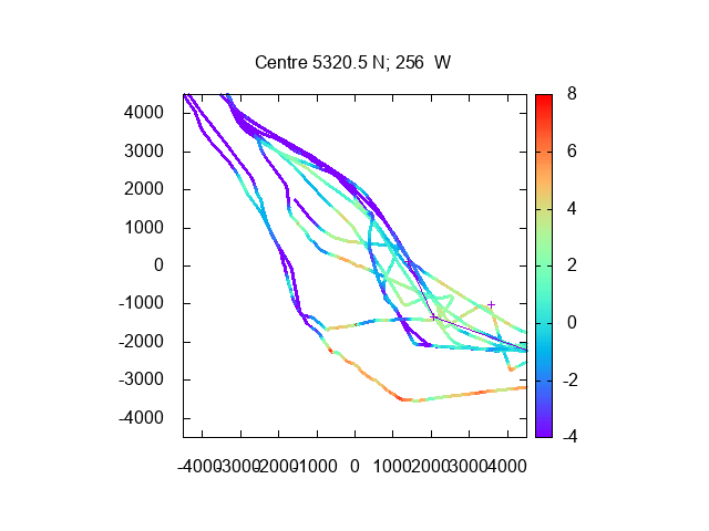
Depths (in metres under keel, not tidally corrected) from Runcorn Gap (at
left) to Fidlers Ferry (at top right).

Same information on HO charts (darker is shallower):
Fidlers Ferry Sailing Club

Fidlers Ferry Lock

So at 12:29, I had turned around and was ready to head back down river. With 2-3 knots of adverse current, I decide to up the revs - doing 10-11 knots through the water. I was under the Gateway Bridge at 12:50 and under the older bridges (rail and road) at 12:57. It was very calm. By 1:14pm, I was passing Hale Head and I was in good time since the current was slack by now and it usually takes me about an hour from Hale Head to the marina.
Spike Island (West Bank Boat Club) (lock into Sankey Canal)

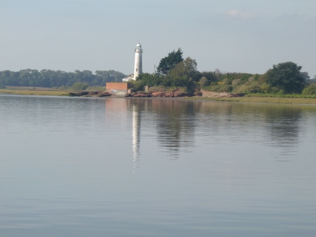
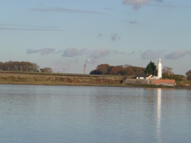
Hale Head Lighthouse (disused)

Flying a kite - Otterspool Promenade.

At 1:45 I was off Garston and the outgoing current was now 2-3 knots.
I noticed a new vessel (or part of a vessel) on Cammell Laird's slip in
front of the southern "shed" - presumably placed there after the Red
Kestrel IOW Ferry was "floated off" a few days ago.
I entered the marina lock at 2:12, along with White Osprey.
Thursday 18 April (Liverpool HW 11.10 9.5m; LW 18:13 0.6m)[Gladstone Dock Tide Gauge actual values: HW 11:02 9.46m; LW 18:08 0.66m]. This is an above-average spring tide - an exceptional or equinoctial spring. Wind ESE 3-4; watery sun, visibility about 1 mile.
Enter river from marina at 9:47 after a slight delay from workmen checking repair work to lock. Only one other boat left in that lock. Head up Garston Channel. Leave Garston channel at G11 (SHM) and head for waypoints MER0,...MER7. (see here for navigation info, some history and more photos).
With the strong tidal current (3 knots mostly), I made good progress at only 7 knots through the water (my efficient displacement speed). Off the airport I was overtaken by a survey Cat speeding up to survey the area around the new Gateway bridge.

By 11:06 I reached the Runcorn Bridges and passed under the southern arch and then followed the south shore - keeping inshore of the ruined quay which is an obstacle here (though most probably not when the tide was so high). I then passed under the Gateway Bridge and around Hempstones Point to Fidlers Ferry. Even though I had the data from my trip earlier that year, I still failed to find the deepest channel in places - but the tide was deep enough that I always had a metre or more under my keel.
Liverpool Bay Falcon from Fidlers Ferry Sailing Club:

I reached Fidlers ferry at 11:33 with a strong upriver current (3-4 knots). As well as the Falcon dinghy, there were some small motor boats and ribs out on the river. From now on, I was in territory that I had not explored since 2013. Since I was not planning to make it back to Liverpool Marina in time for the last lock on that tide at 13:25, I could afford to explore further up the river.
As on my 2013 trip, I again found it difficult to locate the deepest channel in the turn to port into Penketh Reach [in 2013 I ran aground, this time I kept 0.9m under my keel here on the way up].
At 11:41 I passed the entrance to Sankey Brook and the tide was rushing up the brook. This brook was, initially, the route taken by flats to reach the Sankey Navigation at Sankey Bridges. The brook proved hard to negotiate - so the Navigation was extended to Fidlers Ferry with a lock directly into the Mersey.
Entrance to Sankey Brook:

Then it was "run the bridges" time:
Forrest Way Bridge (a garbage truck stopped to look at me as I passed
under it on my way back)[there are plans to build a bypass bridge alongside this in a
year or two]:

There were several branches and logs floating in the river near Forrest way Bridge.
Pipe Bridge (also has footpath):

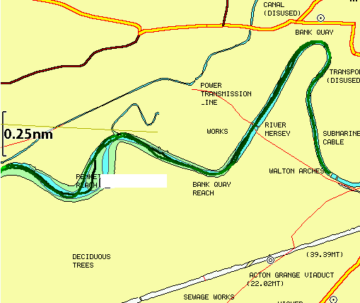
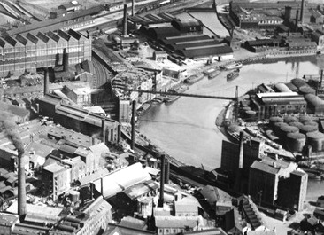
Image of Bank Quay in 1928 with barges moored, also showing earlier transporter bridge (built 1905, sited near where the pipe bridge is now, demolished 1960s). A second transporter bridge was built in 1915 and, though disused, still stands:
Transporter Bridge; and suspended "car":
![]()
![]()
I reached the Transporter Bridge by 11:50 with still 3-4 knots current up river. I had taken the precaution, unlike in 2013, of lowering my radio aerial and so my air draught was reduced to 4.0m. Also by studying my photos of the next bridge, and some local information, I estimated that I would be able to pass under it. So this time I decided to head further up. I drifted slowly under the box girder bridge and had a foot or two clearance at that tidal height.
Box girder Bridge:

From now on, I was in territory new to me. The next bridges were two railway bridges close together. The first one had plenty of air draught for me, but the following one (stone arch bridge known as Walton 12 arches that carries the main West Coast railway line) was not so easy to assess since there was little room to manoeuvre near it. I decided not to risk getting stuck, or bashing some of the equipment on my cabin roof, and turned round under the first (iron girder) railway bridge at 12:00.
The First Railway Bridge encountered.

The stone built 12 arch Walton railbridge (built 1837 and carrying the
electrified West Coast main line):

If I had passed under the stone railway bridge, I would have come to
the abandoned Walton Lock. This, until the 1980s, provided a link for
barges from the Manchester Ship Canal into the Mersey and hence,
following my route, to Bank Quay at Warrington which had unloading
facilities. So these barges must have been able to get under the bridge.
I have found evidence that the rail track over the stone
railway bridge (Walton 12 Arches) is at 12.3m above OD, so 6.7m above
the sea level at MHWS. If the bridge is 2.3m thick at the centre of the
arch [a guess based on photos], then air draught at MHWS would be 4.4m.
This checks with a Peel Ports recommendation of bridge clearance at
10.5m above OD [4.9m above MHWS] for any additional bridges that are
planned in this part of the river.
I thought that very few sea-going vessels would have come this far inland since the 1980s. I was surprised, however, to see evidence that restoration work on the river bank and on Walton Arches Bridge Piers in 2013 had involved several dumb barges and a workboat. See here.
In order to make reasonable progress against the inrushing tide, I upped the revs to do about 9 knots through the water: resulting in only 8 knots over the ground, if I kept out of the areas of strongest current. I reached Forrest Way bridge by 12:11 and Fidlers Ferry by 12:25, by which place and time, the tide had turned and was favourable (ebbing), and I was doing 9-10 knots over the ground.
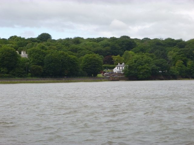
Ferry Inn at Fidlers Ferry

Boatyard at Fidlers Ferry

Fidlers Ferry lock - near HW.
Photo of Marlin outbound passing Fidlers Ferry Sailing Club (from FFSC):

Fidlers Ferry Power station astern; MARLIN at speed:

Gateway Bridge (passed at 12:43 doing 11 knots over the ground):

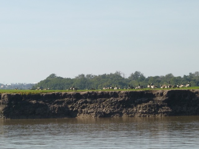
Canada Geese (which breed successfully on the bank between the
Manchester Ship Canal and the Mersey):

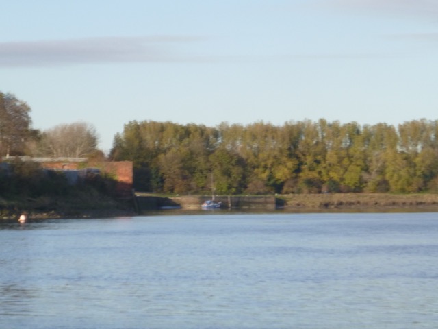
Abandoned lock into Manchester Ship Canal.

Spike Island (West Bank Boat Club) at Widnes

Runcorn Bridges:

After passing through Runcorn gap (at 12:50), I was approaching an area of strongly falling tide (at Hale Head HW is 30 minutes after Liverpool: so circa 11:40). I kept up the revs to get through this area before the tide fell further. By 1:06, I was passing Hale Head [local HW+85'].
Hale Lighthouse (abandoned)

I was able to use my surveys to cross Hale Sands and get around to the Garston Channel. I was off Liverpool by 2:00. So 2 hours from my point of turning.
Liverpool Pier Head:

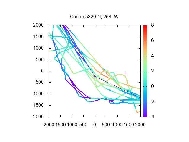
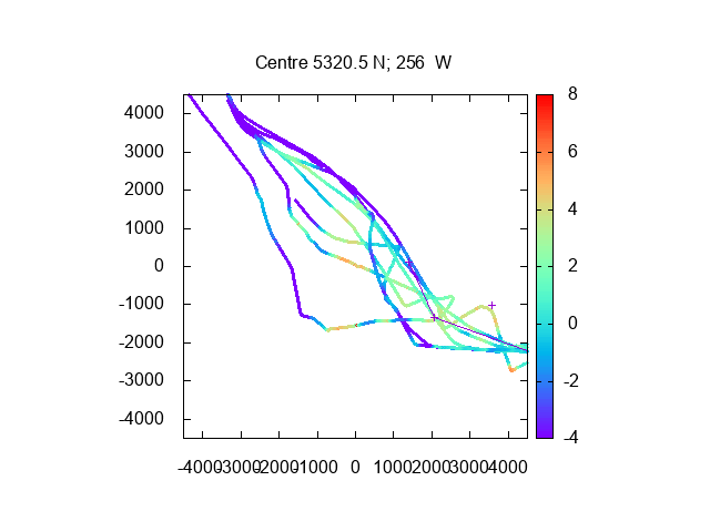
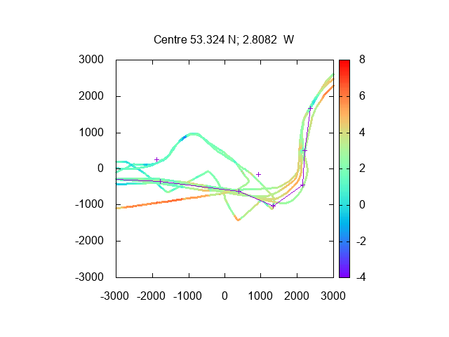
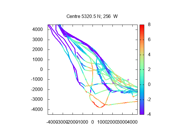
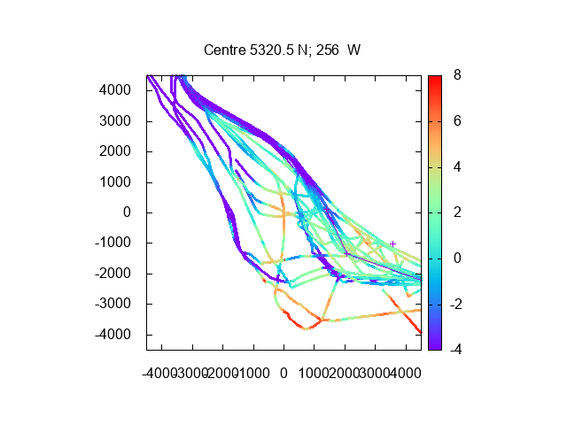
Plot of depth under my keel in upper river [Hempstones Point to
Warrington](depths and distances in metres):
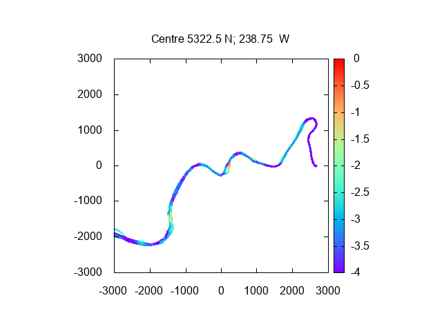
Passing Hempstones Point (at left) round to Fidlers Ferry (at right)
(with tide corrected using Gladstone tide gauge depth 60 minutes
earlier); 2019 trips; depths over CD and distances in metres:
Same information on HO charts (darker is shallower):
Passing South of Garston: Plot of depth over CD (using Gladstone
tidegauge depth 15 minutes earlier) (+ for waypoints MER0, MER01 and
airport gantry; 2018-9 trips; depths and distances in metres):
Distance run 39 nm (so 19.5 miles up and back to marina). Average speed 9.3 knots over the ground.
I was too late to lock into the marina, as I expected, so I took the opportunity to do some low tide exploration of the Rock Channel, wrecks on Hoylake beach and the Training Wall.
First, to complete the cruise of the Mersey from head of navigation
to mouth: I made for New Brighton, where the Rock Lighthouse (disused)
marks the mouth:

I then passed through the Rock Channel and headed along the north
Wirral coast towards Hoylake to take a look at a wreck on the beach. At
3:23, I was within 0.22nm of it (due north) and could see that the sand
around the wreck was just awash. This, with tide gauge data, helped to
determine the height of the wreck above CD - which may help in deciding
what vessel the wreck actually is.
As it was approaching low water with a predicted
height of only 0.6m above CD at 6:13pm, I then returned east, to go through the Rock Channel - to check my waypoints -
and then explore the Training Wall
- to see how much they actually dried at low water; since I have never, in
30 years of sailing in and out of Liverpool, actually seen any part of
these walls. I also planned to anchor in Lagoon to take a break, out of
the current, while waiting for enough water for the marina lock to open
(around 9:30).
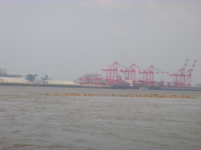
Some images of the training wall near LW (with MSC Messina loading
containers; Stena Mersey incoming near C23 buoy):
After exploring the Rock Channel and Murphy's Gut, I decided to
anchor in Lagoon. This is the local name of an inlet on the east side of
Brazil Bank. At low water, it is protected on 3 sides by Brazil Bank
and by the Training Wall on the remaining side. It thus has rather little
current and is fairly calm. I anchored at 53°27.11N 3°3.305W at
5:10 (before LW). From here, I could see the Brazil bank, Training Wall
and Murphy's Gut and note at what tidal depth they covered/uncovered.
My conclusion, for Brazil Bank itself, is that it is in two parts:
the southerly part dries about 3.6m; the northerly part dried 4.0m while the
joining part (west side of Lagoon) dries only 1.3m. Note that these results
may change as tides, storms etc push the sand around. Note that the chart
of this Bank shows data from MDHB surveys from 1988-1997.
As I was at anchor in Lagoon at low water, I was surprised to see a
boat coming in through Murphys Gut. It was a small local fishing vessel
(registered as LL506; 5.8m long). So I am not the only person who goes
through Murphys Gut. It was very peaceful anchored in Lagoon - except
for a low rumbling noise from the big ship engines (generators?) coming
from the docks on the Liverpool side.
Lock in to Liverpool Marina at 9:30. There was a 4 knot current off
the marina at that time - convenient for me since Marlin has a least
speed, in gear at tickover, of 4 knots: so I can easily keep stationary in the
river off the lock.
Exploration to Hoylake and back from the marina added 24 nm to my
distance run: so 63nm in total.
For my results for the Rock Channel and Murphys Gut, updated by this
trip, see Rock Channel.
Thursday 5 June (Liverpool HW 13.14 9.2m). Wind S 3-4; mostly overcast.
Enter river from marina at 11:45. Main reason for trip was to test
AutoPilot with new electric hydraulic pump installed. Because wind was
from S, decide to hug the Wirral coast for more shelter. So head over to
Cammell Lairds shipyard and then proceed up river towards Eastham:
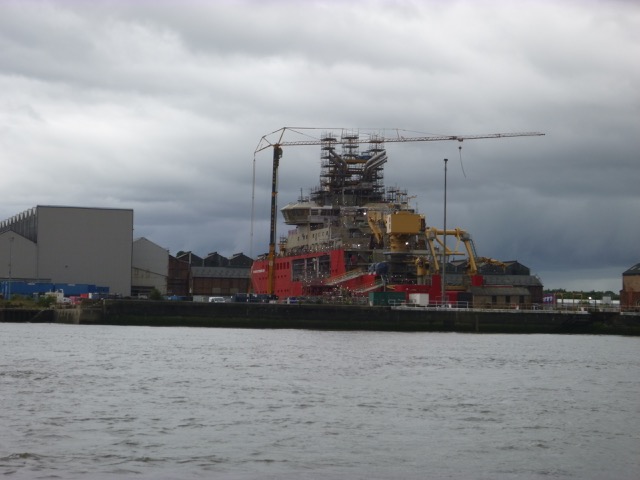
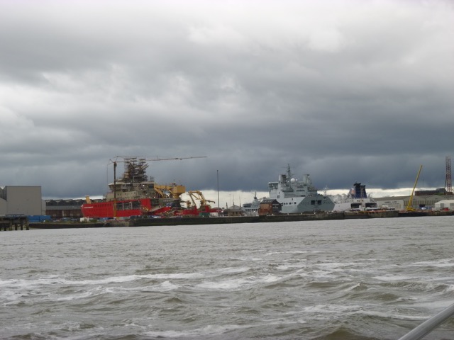
Cammell Lairds: Polar Research Vessel under construction
(aka Boaty-Mac-Boaty-Face);
Vessels under repair in Cammell Laird's Dock - RFA Tidespring (grey)
at centre; P & O European Highlander (Cairnryan - Larne Ro-Ro Ferry,
163x23m) at right in dry dock.
Pontoons used by windfarm boats
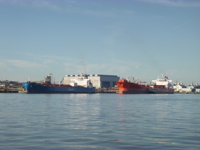
Floating crane-barge (Lara1, ex-Mersey Mammoth, 60x24m); Tanker Parthenon (250x44x12.5m) on Tranmere oil stage
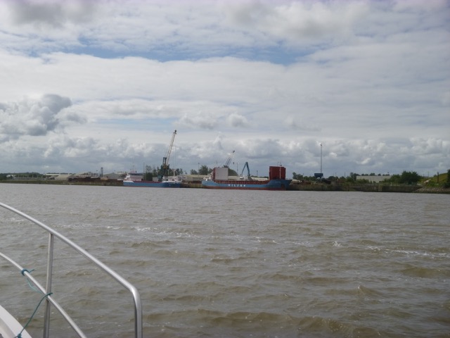
Bromborough Wharf (here called Mersey Wharf) - no vessels alongside;
McTay Marine built many vessels from 1971 to 2015 when they closed.
Their premisies and slip were taken over by Carmet who continue to
repair and build.
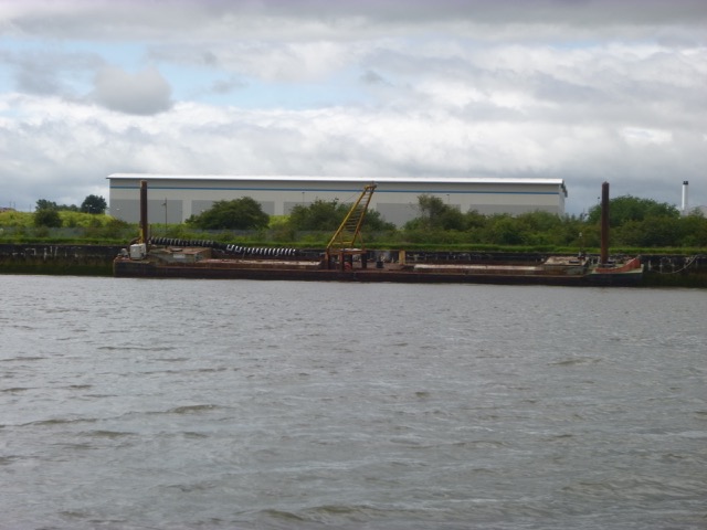
Spud-leg barge (Haven Seafield?) alongside near McTay's shipyard (now
Carmet).
The slip at McTay's (now Carmet) with ferry (Royal Daffodil) being
restored and overall view including jack-up rig:
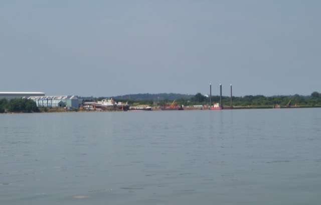
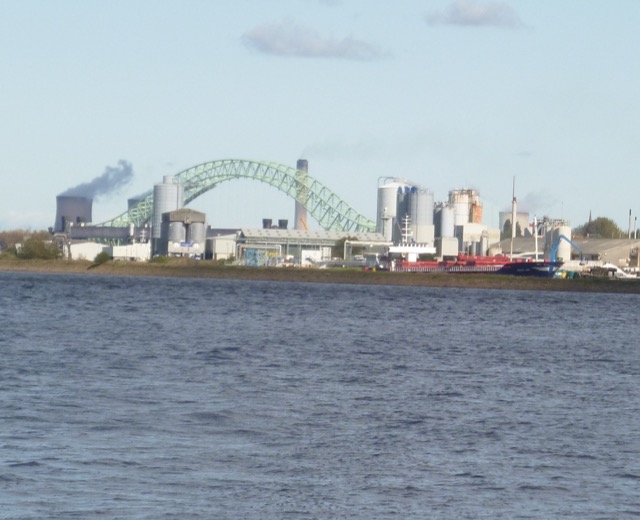
Eastham:
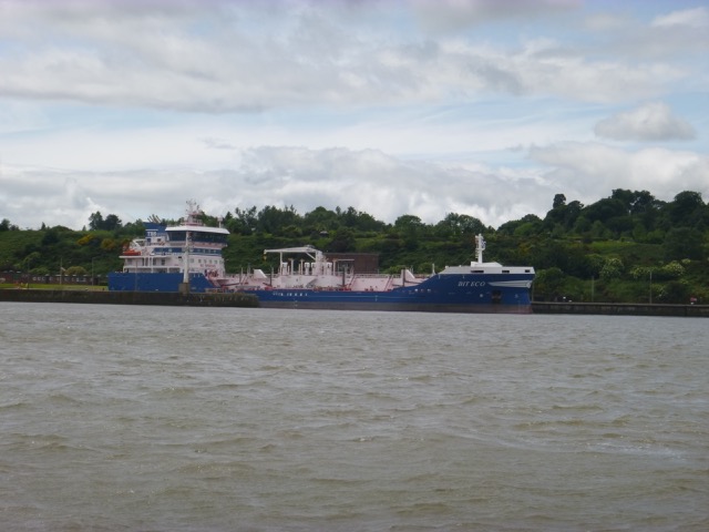
Bit Eco (120x20x7m, described as asphalt/bitumen tanker) passing
Eastham after leaving ship canal lock:
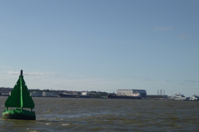
Survey vessel (Peel Port's Royal Charter 11x4m):
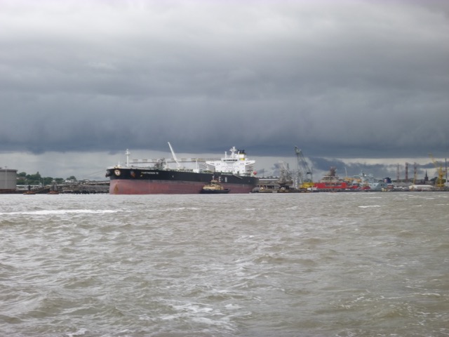
Oil Tanker Stella Theresa (126x21m) inbound to lock at Eastham, with tug:
I reached Eastham by 12:45 and remained close by, since it was
sheltered, to eat lunch. Then cross over towards the airport - with
increasingly choppy seas. I explored some of the routes I had taken
previously to get data on the current depth.
Depths (from 2019 trips, corrected to CD using Liverpool tide-gauge data, taken 15
minutes earlier), distances in metres, showing estuary from Eastham to
off Airport.
Lock back into marina at 2:00. 12.1nm run.
Tuesday 2 July (Liverpool HW 11.30 9.0m). Wind SW 3-4; mostly overcast.
Enter river from marina at 10:26. With wind SW, Wirral shore was
more sheltered. So head over to
Cammell Lairds shipyard and then proceed up river towards Eastham:
Cammell Lairds: Polar Research Vessel under construction
(aka Boaty-Mac-Boaty-Face);
Slow moving container ship (RMS Veritas which takes containers from
Liverpool up the Manchester Ship Canal to Irlam).
Bromborough Wharf with coasters Fluvius Teign and Wilson Tees alongside.
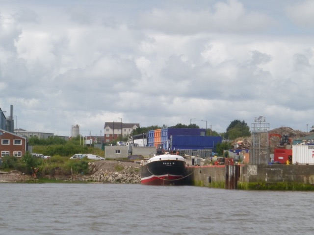
Vessel Britain alongside at Carmet (ex-McTay) yard [Built Dublin
1910 as Lightship Penguin, 100ft long, for the Daunt Rock station, on
the western approach to Cork near where the PS Killarney was
wrecked, then converted in 1966 to a sea training vessel Halloween,
then converted in 1980 to a 3 masted schooner Arctic Penguin, then
alongside at Inveraray as a Maritime Museum until 2015 when it was
bought to be restored to a 3 masted motor yacht, to be based at Barrow].
Reach Eastham by 11:07 and head east along shore from there (not
charted). Part of this area is called Poole Hall bay/rocks/sands. The
tudor Poole Hall (at Netherpool) was demolished in 1938/9 to make way for
industrial development (Paper Mill). The area of ground on the seaward
side of the Manchester Ship Canal is raised (man-made from the
MSC construction and called Mount Manisty) and should be quite wild
since access is not easy. Another feature of interest is that the stream
that used to discharge into the Mersey near here is now carried in a tunnel
(Poole Hall syphon) under the MSC and then reaches the sea.
Eventually decide to head across to Hale Point - since the channel
there was well known to me.
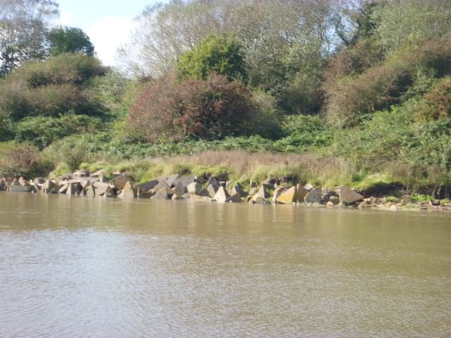
Head around the shore close in - past reed beds, tank traps and
the abandoned quay.
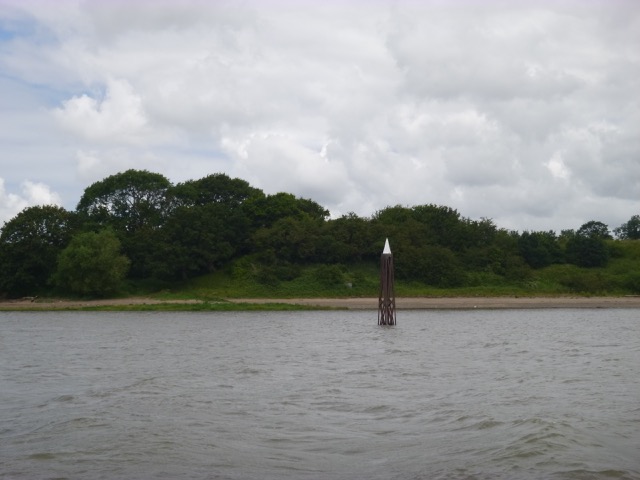
Lattice Perch off Dungeon Point
Pass Dungeon head at 12:13; Garston at 12:45 and lock in to
Liverpool marina at 13:10.
Birders on board reported seeing the following during this trip:
Cormorants, shelducks, oystercatcher, lapwing, grey herons,
lesser black backed gull, herring gull, black headed gull.
Depths (from 2019 trips, corrected to CD using Liverpool tide-gauge data, taken 15
minutes earlier), distances in metres, showing estuary from Eastham to
off Airport.
Depths (from 2019 trips, corrected to CD using Liverpool tide-gauge data, taken 30
minutes earlier), distances in metres, showing estuary between Dungeon
Point and Hale Head.
19.8 nm run, mostly at 7 knots through the water.
Friday 2 August (Liverpool HW 12.51 9.6m). Wind SW 0-2; sunny.
Enter river from marina at 11:37. Plan to fill in some gaps from my
previous surveys. Aim to locate the sandbanks - since, with a big tide,
there was no chance of running aground.
Cammell Lairds: Royal Fleet Auxilliaries under repair/refit [two in
Cammell Lairds Dock and RFA Tiderace arriving],:
(also the red vessel is the new Antarctic Survey Vessel, aka Boaty-Mac-Boaty-Face);
The recent heavy rain has washed a lot of logs down - some were
quite big:
I headed for the MSC [Manchester Ship Canal] entrance at Eastham and
then followed the MSC route (it follows the shore line) to the SE. This
is an image of the outer wall which impounds the MSC, with a gap where a
stream can cross under it.
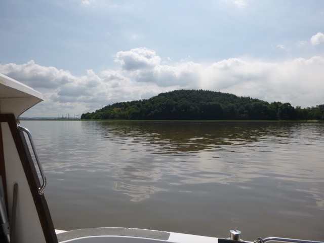
I planned to get as close as feasible to Mount Manisty: this is an
artificial hill on the offshore side of the MSC - so inaccessible except
by boat. It reportedly has a fair sample of wild life.
It seems to have grass/reed on the shore at spring HW. View of Mount
Manisty with Stanlow Oil Refinery to left:
Shelduck (fuzzy image):
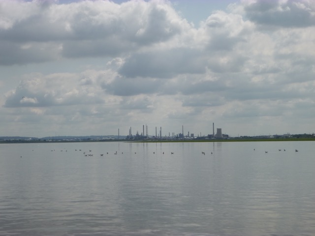
The wind had dropped completely - so it was very calm. View of
Stanlow Oil Refinery:
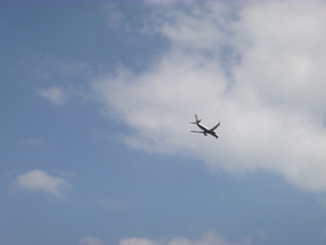
Incoming jet, approaching Liverpool Airport over me:
After zig-zagging around, I headed back towards Liverpool Marina
following the Eastham Channel (though keeping offshore of the buoyed
route).
Carmet's shipyard with vessels under repair:
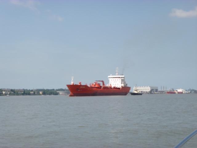
Oil Tanker fest: Sten Idun (144x23m) inbound to Eastham and
Eagle Torrance (246x42m) on Tranmere Stage (both with tugs)
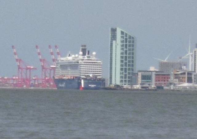
Cruise Ship Mein Schiff 5 (295x36m) on the Liverpool Cruise
Terminal:
General cargo vessel Pex (91x16m) passing Cammell Lairds inbound to
Eastham with several RFA vessels (Tiderace, Tidespring, Fort Victoria) under
repair/refit.
Depths (from 2018-2019 trips, corrected to CD using Liverpool tide-gauge data, taken 15
minutes earlier), distances in metres, showing estuary from Eastham to
off Airport. [Mount Manisty is at bottom right of centre]
From my trips, Google Earth and other sources: it seems that the
southern area of the Mersey Estuary is mainly shallow and dries to mud
at low water. Several streams and rivers flow into it and they leave
meandering channels which are deeper: working west to east
Lock back in to Marina at 1:35
15 nm run, mostly at 6 knots through the water.
Thursday 19 September (Liverpool HW 14.43 8.6m). Wind 0; sunny.
Enter river from marina at 12:57 along with a survey cat Valkyrie.
Very calm and sunny day forecast - so aim to check out the upper Mersey again.
Fleet auxilliary vessels at Cammell Lairds:
Two large tankers on the Tranmere berth: Sti Pimlico(184x27m) and
Signal Alpha (258x44m):
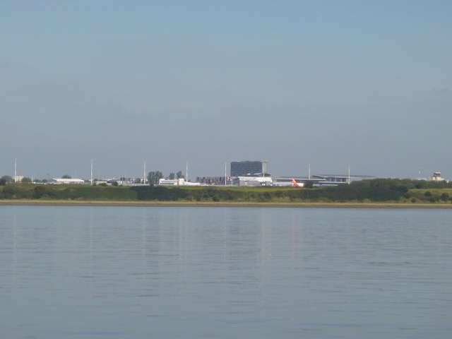
Liverpool Airport from the Mersey:
Once or twice I was worried by a sudden noise that sounded like my
engine was malfunctioning. A quick look outside - and a jet landing or
taking off from the airport was the culprit.
The river Weaver flows into the Manchester Ship Canal and then
empties through a controllable sluice into the tidal Mersey. This
causes a flow which scours a channel from the sluice out to sea. I
decided to seek out this channel. It is charted as running close to the
southern edge of the estuary initially (also on Google Earth). As it
was still 60 minutes before local HW, I could explore without prior
evidence. My
efforts to get to it were thwarted - I ran gently aground and had to
back out and head away. A view of the sluice
from the Ship Canal.
Weaver Sluice from the estuary: where water from the River Weaver runs out from the
Manchester Ship Canal, near Runcorn:
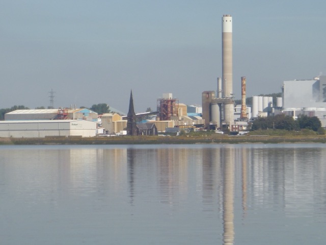
Another iconic building is the abandoned church at Runcorn Docks.
It was built in 1841 mainly for employees of the Weaver Navigation. With
the construction of the Manchester Ship Canal and the Runcorn and Weston
Canal, it was left on an uninhabited island - only accessible by
crossing the lock gates if closed. It was deconsecrated in 1995 and is
now in an
abandoned state.
Another view.
The old Docks church (Christ Church) at Runcorn - overshadowed by industrial buildings:
The abandoned lock gate from the MSC (just south of the church) to the tidal Mersey (just
visible with old wooden lock gates behind).
For some views
of the abandoned locks etc on the outer wall of the Manchester Ship
Canal.
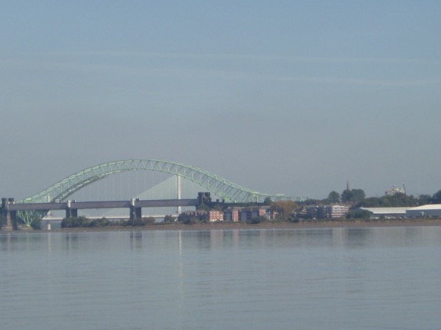
Three Runcorn-Widnes bridges seen from downstream:
I decided to head on up to Pickerings
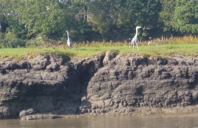
Pasture - a nature reserve on the NW bank of the tidal Mersey.
Two grey herons on the river bank at Pickerings Pasture.
Canada Geese on the river bank at Pickerings Pasture.
I turned around at 2:35 (local HW-40 minutes) with current still
running up river at about 2 knots. Once I had passed Hale Head, the
current slackened and then turned favourable.
The obligatory photo of Hale Head Lighthouse:
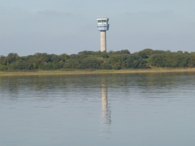
Liverpool airport control tower (in very calm conditions):
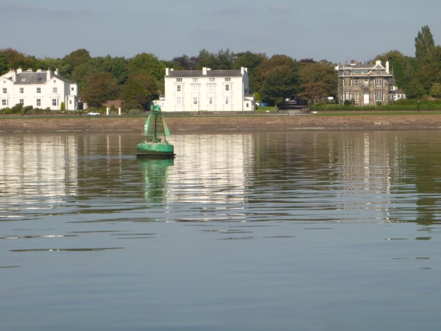
One of the Garston Channel buoys (G11) with houses at Grassendale behind.
During this trip. I saw no other boat in the upper Mersey - there
were no yachts moored off LSC either.
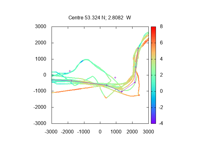
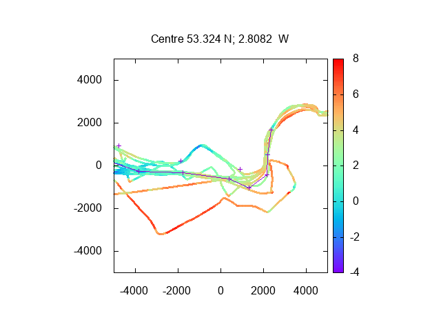
My tracks (with depths in metres above CD) from this trip and others
from 2018-9. From Dungeon Point to Hale Head. Attempt to reach the
Weaver Sluice is at bottom right. Pickerings Pasture is at upper right
(to left of tracks).
Lock back into Liverpool Marina at 4:15.
22.3 nm run.
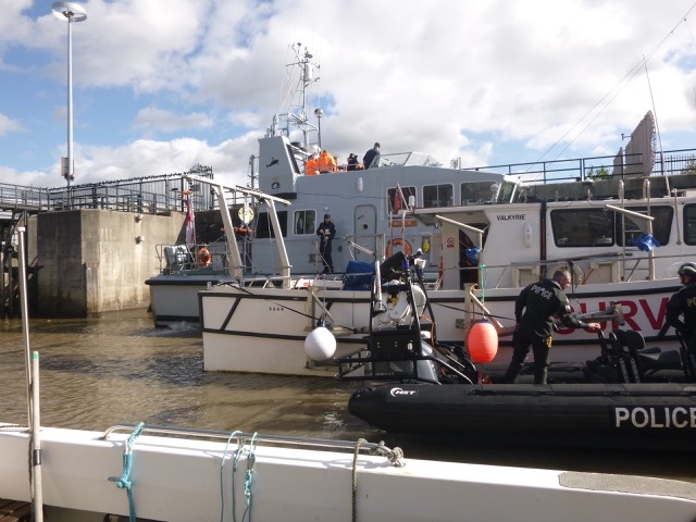
Wednesday 2 October (Liverpool HW 14.18 9.6m). Wind NW 2-4; sunny periods.
Since the HW level was a metre more than my previous (September) trip, I could explore anywhere that was
covered on that trip. So ideal for continuing my survey of the southern
(Cheshire) side of the Upper Mersey Estuary.
Enter river from marina at 12:28. The lock was quite full - with
"powerful" boats: Navy Reserve HMS Biter and a Police RIB. Also a survey cat,
Valkyrie, and two yachts.
Marina Lock with HMS Biter beyond Valkyrie and a Police RIB:
Head up river, towards "Stanlow
Island". This is a triangular piece of land between the Manchester
Ship Canal (MSC) and the tidal Mersey, close to where the River Gowy
emerges from a syphon under the MSC. It has the remains of a monastery
and some abandoned buildings of much later date. It also has "laybys"
where tankers berth to load refined products from the Stanlow Refinery.
It is reached by using a ferry service across the MSC, provided by the
Stanlow Refinery.
See also the section off Runcorn in 2015:
There were some large logs floating - presumably washed down by the
recent heavy rain. After crossing some very shallow banks, at 1:07 pm
reach the deeper channel of the River Gowy, off Stanlow Island.
Stanlow Island (tops of Tankers just visible). River Gowy emerges at
left side.
I then headed for the channel of the River Weaver (using Goggle
Earth 2018 images for guidance). Again some very shallow banks (but a
making tide still, so no worries). By 1:30 I had reached the somewhat
deeper channel and then headed in close to the southern shore.
Sheep grazing on the land between the MSC and the tidal Mersey.
The River Weaver enters the MSC and then the water is released (in a
controlled way) by the Weaver Sluice (see
proposal to operate a hydro-electric power plant at Eastham Locks
which would redue the flow over the Weaver Sluice].
Weaver Sluices (closed).
I then proceed upriver, close to the MSC embankement, with a view of
the industrial buildings at Runcorn.
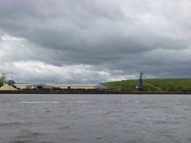
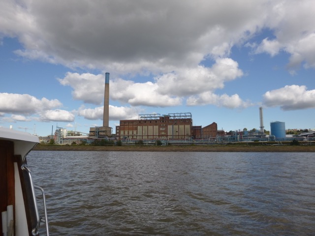
Abandoned Power Station at Weston Point (Runcorn; closed around 1998
when the gas-fired Rocksavage plant was built).
More info.
Lots of Canada Geese on the embankment:
The (abandoned) lock gate from the tidal Mersey to
the MSC (Christ Church spire just visible) with abandoned wooden lock gates:
At 2:05, I then headed across the Mersey Estuary towards the shore near Hale
Head, with current still incoming quite strongly.
View of a vessel (Frisian Lady 104x15m, which subsequently left for a
port in Finland) at the cement berth in the MSC at Runcorn seen from the tidal Mersey, with the
Runcorn road bridge and Fidler's Ferry Power Station beyond:
Head back (west), against the current, around Hale Head and the keep
close inshore around the bay between Hale Head and Dungeon Point. This
has a deep water channel close to the shore and is a back-eddy at this
tidal state, so the current was helping me along.
In the Bay between Dungeon Point and Hale Head: abandoned tank traps
and the quay (from the salt works that were once there):
Reach Dungeon Point (Lattice Perch) by 2:41 with the current fairly
slack. Head west, close inshore, past the wooden perch and the Airport
Gantry.
Liverpool Airport Light Gantry:
Proceed past Garston with increasing waves (wind NW 3-4; wind over
tide) towards Liverpool Marina.
Two Tankers, Seamuse (180x32m) and Minerva Atlantica (250x44m) on
the Tranmere Oil Stage with Cammell Lairds beyond (Fleet Auxilliaries
under repair) seen from the Garston Channel:
Further up-river than Garston, I only saw two other vessels: a small
survey boat Osprey and a very small RIB. There were 3 yachts sailing
back and forth just upriver from the marina entrance.
Lock in to Liverpool Marina at 3:39. 22.3 nm run.
My tracks (using depth over CD using Liverpool tide gauge 30 minutes
earlier). The southernmost track is from this trip:
Depths (over CD) of my tracks shown on HO chart - darker is shallower. Also
waypoints shown. First plot shows the south shore of the upper Mersey;
second plot is the Hale Head - Runcorn area,
Soon afterwards the CG helicopter was hovering over the river near
the marina and several CG vehicles were about, fashing lights going. A
subsequent report indicated that a body had been possibly sighted and it
was searched for by several lifeboats and the helicopter, with the
Hoylake Lifeboat eventually recovering a body.
Monday 18 November (Liverpool HW 14.36 8.4m). Wind N 1-2; sunny; calm.
Leave marina lock at 12:50 and head for Eastham (MSC entry lock).
Pass Cammell Laird shipyard with Royal Navy Fleet Auxilliaries (Fort
Victoria, Tidespring and Tiderace) under repair:
Then pass Tranmere oil stage with two tankers (Nord Vantage
(182x32m) and Ingrid Knutsen(257x43m)) moored
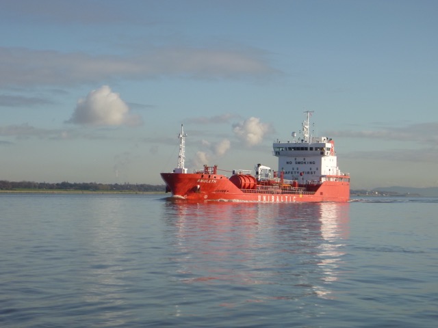
As I proceeded up the Eastham Channel the oil products tanker Amuleth (102x15m)
passed me outbound.
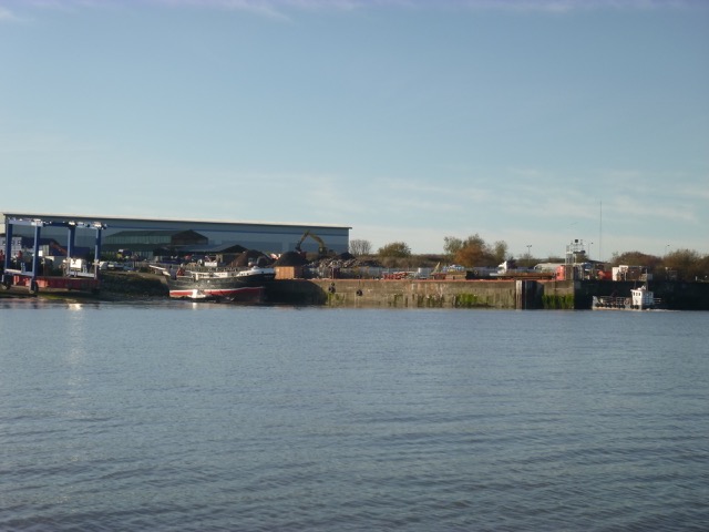
Further along I passed the Carmet shipyard with various vessels
under repair:
I reached the MSC entrance lock at 13:20 and then headed across the
estuary to near the airport - to survey the channels. I then continued
along the northern side of the Mersey - passing Dungeon Point, Hale
Head, Pickering Pasture, and approaching the bridges.
Hale Head with Fidlers Ferry Power Station chimney behind.
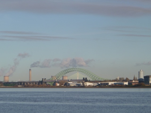
Three bridges: Rail; Road(Suspension) and Gateway(cable stayed) with
Fidlers Ferry Power Station beyond.
I passed under the Runcorn-Widnes bridges at 2:30 and could see
repair work (with a cherry-picker) high up on the road bridge:
I turned around near the entrance to the St. Helens Canal at Spike
Island (Widnes) used by the West Bank Sailing Club -
with a yacht moored alongside.
From here you get a fine view of the new Gateway Bridge:
In order to get back to Liverpool Marina in good time, I upped the
revs to give me 9 knots through the water since I had adverse current
from when I turned around at 2:35 until I was off Hale Head at about
3:03. Again, because of recent heavy rain, there were several
large logs floating in the river - one, that was almost underwater,
created quite a thud when hit.
I was off the marina lock by 3:52 and locked in soon afterwards.
Two other boats (one small fishing boat and one sailing boat) had also
been out enjoying the sunny and calm weather.
Chart of depths (from this trip plus all other trips in the previous
year) over CD showing the Eastham Channel at left, Garston Channel at
right and airport (gantry marked +) at lower right.
25.3 nautical miles run.
A record of the depth and track of my voyages are available from
teamSurv
If higher resolution versions of the above images are wanted, please
contact me. All information given in good faith, but please do not
rely on it. Back to index here

MARLIN trip up Mersey to Eastham June 2019
MARLIN trip up Mersey to Eastham, Hale July 2019
The depth was quite shallow even a significant distance
offshore.
MARLIN trip up Mersey to Eastham, Mount Manisty August 2019
Depths (over CD) shown on HO chart - darker is shallower:
(i) Just west of Mount Manisty is a stream (Pool Hall Brook) that issues from a
syphon under the MSC. This syphon was designed to allow fresh water to
pass out, but has a tidal flap to stop seawater coming through at high tide.
(ii) Just east of "Stanlow Island" where the tankers berth, the
river Gowy issues from a syphon under the MSC.
(iii) The Holpool Gutter emerges further east.
(iv) To far east, near Runcorn, the river Weaver flows into the
MSC and then, if the level is too high, pours over the "Weaver Sluice" to enter the Mersey Estuary.
MARLIN trip up Mersey to Hale and Runcorn September 2019
MARLIN trip up Mersey to Stanlow and Runcorn October 2019
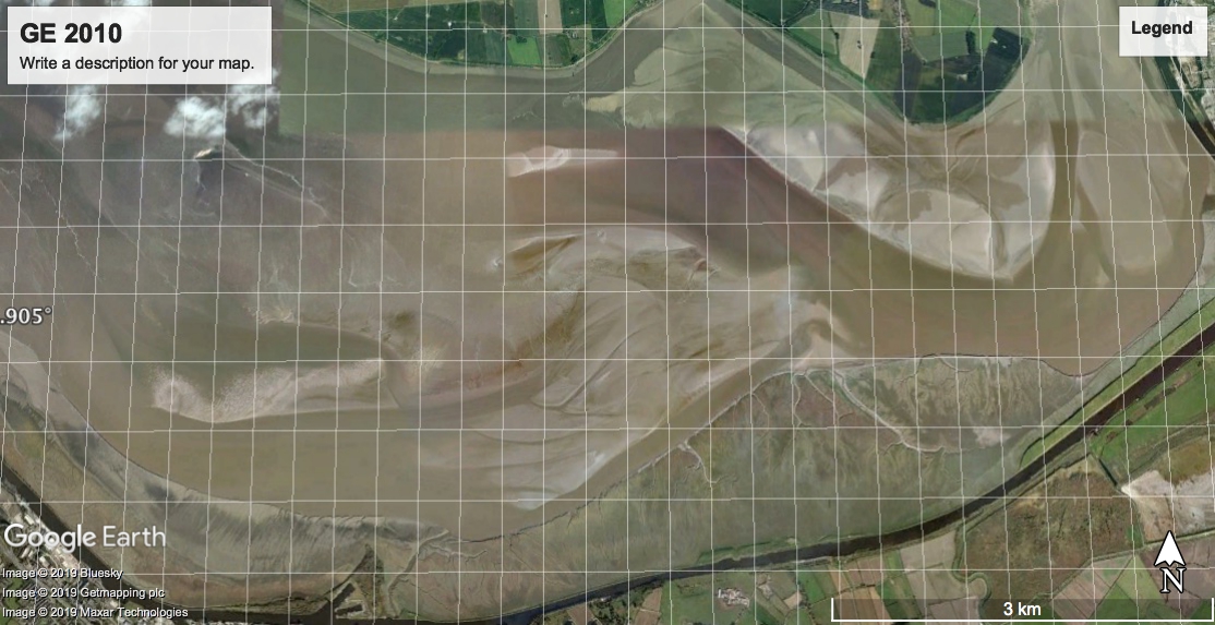
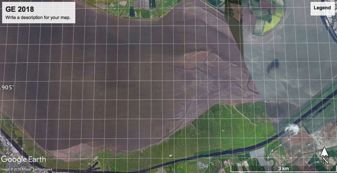
Since the River Gowy scours a channel, there is likely to be
sufficient depth at HW, if you can find that channel. Google Earth from
2010 shows a deepish channel along the southern shore of the Estuary
from Runcorn to Eastham, including Stanlow. By 2018, this channel
appears to have disappeared - except for a small section west of the
Weaver Sluice (more on this later).
Images:
Later reports suggest that it may be that of a woman who went missing near
Warrington on 25 September.
MARLIN trip up Mersey to Eastham and Widnes November 2019