Tuesday 20 Aug (Liverpool HW 11.15am, 9.2m)
Enter river from marina at 9.40 and head up Garston Channel.
Calm weather. Leave Garston channel at G11 (SHM) and head for
waypoints MER0,...MER6. (see here
for navigation info, some history and more photos).
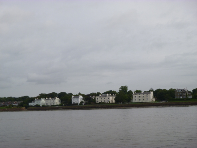
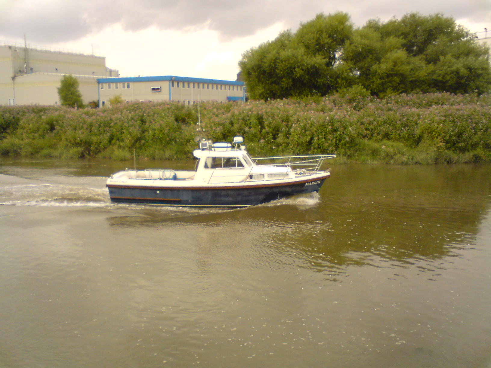
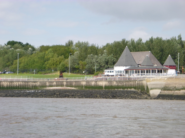
View of houses at Cressington, buoy marking Garston Rocks (with Garston Docks behind) and two boats moored off Liverpool Sailing Club (club house at right of centre).
| |
|
|
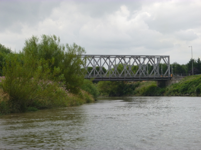
Cross south of Hale Head at 10.40 and proceed along north bank up to the Runcorn bridges. Go through centre arch (of three) of the railway bridge. Above the bridges, the HO chart shows a channel on the south side whereas FFSC advice is to follow the channel that runs along the north shore. The bank between these channels was dry (at Liv HW). I had previously used the southern channel, so I followed that. It was rather tricky to squeeze through but I found deeper water again past Hempstones Point.
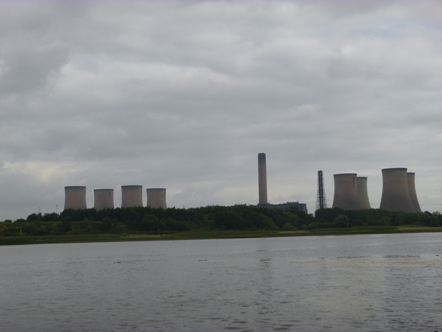
View of Runcorn Bridges (from above), Fiddlers Ferry Power Station, Fidler's Ferry lock entrance.
 |
 |
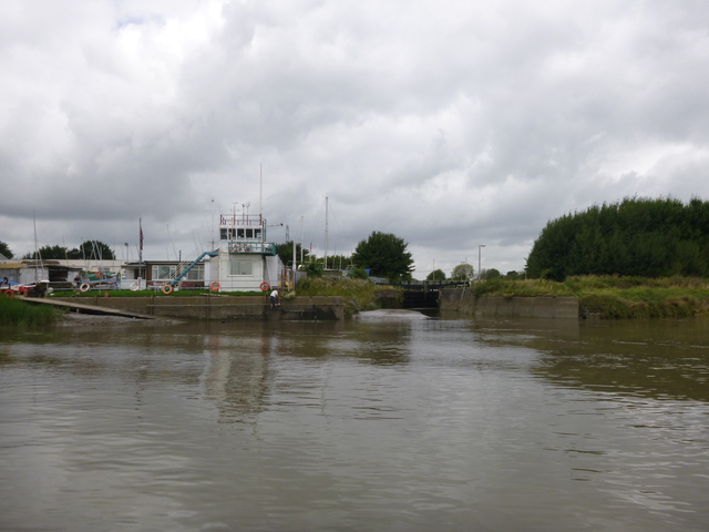 |
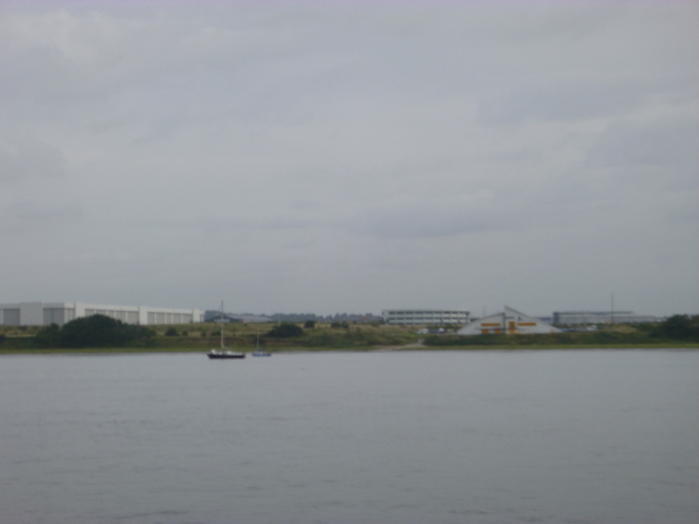
Pass Fidler's Ferry lock entrance at 11.32 (Liv HW+15 minutes) with
current strongly up river. Carrying on up river, there are buoys laid
by Fidler's Ferry SC for dinghy sailing (numbered 1 to 10). See their
Map. The
sandbank island (in Penketh Reach) after number 6 was partly dry and
looked as if the south side had deeper water -- wrong. I had to back
out on the rising tide and take the deeper water on the north side.
Above this the river is narrow and seems to be fairly deep right across.
I did not know the air draft of the bridges that now cross the
Mersey in the Warrington region. The head of navigation for masted
boats is the bridge carrying Forrest Way (used to access the waste tip).
I have a air draught of 4 metres (and can lower radio aerials to reduce
that). I passed under Forrest Way bridge (which amusingly has red
cylinder and green cone shapes on the two supports - to mark the
navigation channel between them) easily.
This bridge is listed as having a design air draught of 10 metres at HAT.
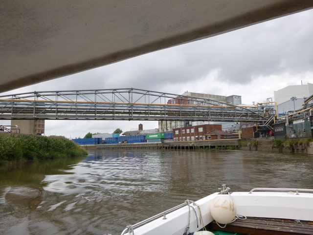
I then looked out for the next
charted bridge. This turned out to be a pipe bridge at Bank Quay with
again enough air draught for me (a video from Fidlers Ferry Sailing Club
shows a Liverpool Bay Falcon just failing to get under this with her
mast up). Just past that the derelict
Transporter Bridge looms. This has plenty of air draught (that was
why it was built like that). The bridge joins two parts of what was
Crosfields (now PQ Silicas) Chemical Works. Beyond the Transporter is a
box girder road bridge also belonging to PQ Silicas and I did not want
to risk getting trapped under that, so turned at 12.05 (Liv HW+50
minutes). The current was running up river at 2-3 knots, so I chose to
keep to mid-river to avoid the strongest of the current which sweeps to
the outside edge on corners.
Head of navigation (for masted boats): Forrest Way Bridge; pipe bridge further up (shown looking downstream), MARLIN near transporter bridge.
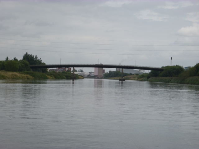 |
 |
 |
Transporter bridge (also showing the suspended platform that would have crossed the river). Box girder road bridge (private) further up again.
| |
|
 |
Proceed down river, making use of my up-river track to locate adequate depth. I passed Fidlers Ferry SC at 12.40 (Liv HW +85 minutes) where I met slack water. More care was now needed since the tide was falling. There were also some big logs floating. I passed two dinghies sailing near Fidler's Ferry.
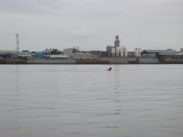
Floating log; light(?) marking base of pylon holding power line crossing Mersey (below Fiddler's Ferry).
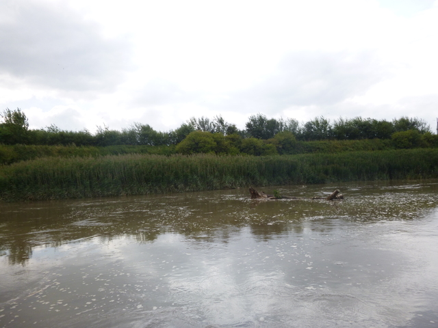 |
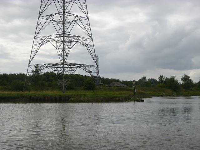 |
I then retraced my route through the Runcorn bridges, along the north shore and around Hale Head (using my waypoints). Off Hale Head (at 13.30 Liv HW+135 minutes) I had only a few feet under my keel at times. Once past Dungeon Point, the depth was more. I rejoined the Garston Channel at 2pm. I was too late to lock into Liverpool Marina, so I planned to take the opportunity to dry out and clean up my hull.
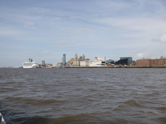
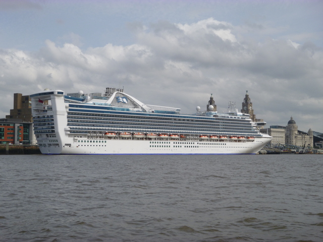
Britannia pub showing rough seabed at bottom of seawall; view of Liverpool City centre; cruise liner Caribbean Princess (3200 passengers).
 |
 |
 |
I drifted with the current and motored slowly, arriving off New Brighton about 4pm (Liv LW-2 hrs). Drove up the beach to stay aground until shortly before 8pm. A chance to remove weed and slime from the hull plus some barnacles. Also time to refresh at the Ship Hotel nearby. As ever, a succession of people came to talk to me while the boat was aground. Refloat gently and lock in to Liverpool Marina at 9.25.
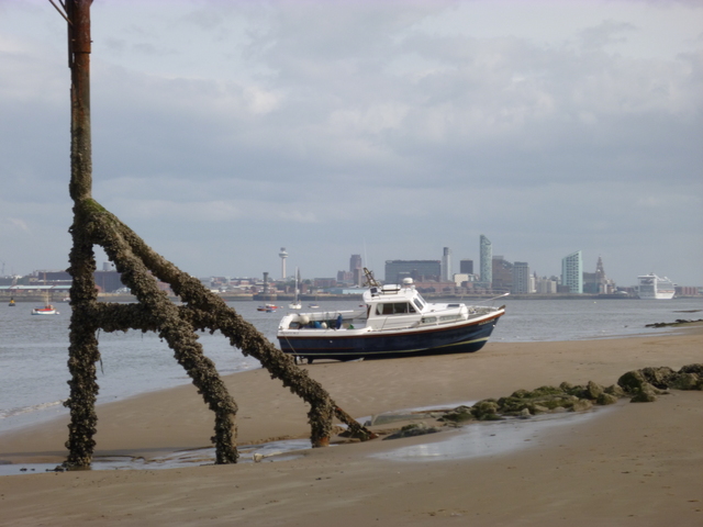
MARLIN aground at New Brighton (near LW) with the Liverpool City Centre (and cruise liner) in the distance.
 |
The Mersey from head of navigation to its mouth. On a bigger spring tide (I had 9.2 metres which is near the average of 9.3 metres for a spring tide, the biggest can be over 10 metres) there would be more depth in the upper reaches, but more current too.
If higher resolution versions of the above images are wanted, please contact me. All information given in good faith, but please do not rely on it.
Back to index here