Inland of Liverpool, the Mersey Estuary widens out to cover a large area at high water. It gets narrower again at the Runcorn-Widnes gap and is more like a river above that. The (historical) head of navigation is at Warrington which had the first bridge across the Mersey.
There are now two buoyed channels above Liverpool: leading to Garston Docks on the North bank and the Manchester Ship Canal entrance (and to a dock) at Eastham on the South side. See sketch map.
Historically, there was a considerable shipping trade in the upper Mersey: to Runcorn (docks and to the Weaver Navigation, the Mersey and Irwell Canal, the Bridgewater Canal), Widnes (docks and to the Sankey Canal) and Bank Quay just below Warrington. This was mostly carried in the ubiquitous Mersey Flat: a barge-shaped wooden sailing vessel of about 60-70 ft length and width of 14-17 ft. The canals and navigations were mostly wide enough to allow these flats to enter - so they could reach St Helens, Warrington, Northwich,..
Shipping in the upper Mersey was unable to compete with the Manchester Ship Canal and with railways. In 1973, the Upper Mersey Conservancy, which was responsible for navigation and buoyage, was wound up - and there has been no buoyage after that date.
So anyone who ventures into the upper Mersey is "on their own". Here I describe what I know from trips I have made myself from 1990 on, as well as from other sources. The main complication is that the deepest channel changes significantly with time.
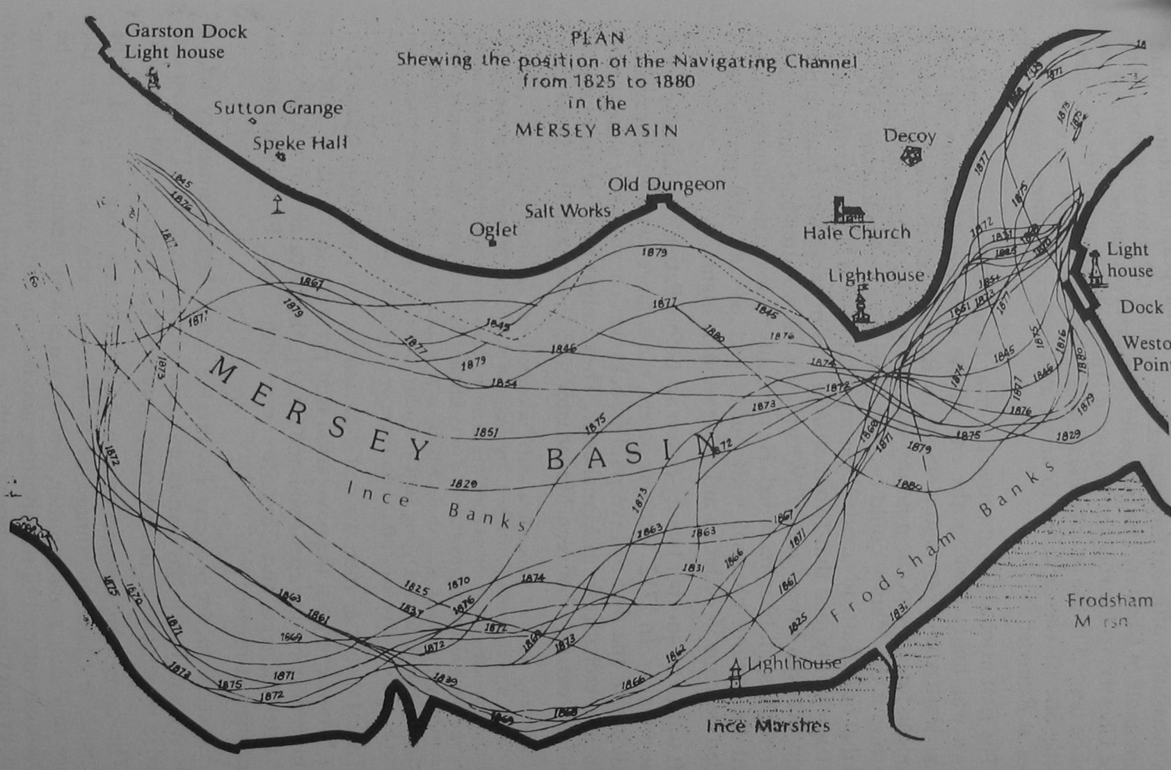
Years ago, when the channel was buoyed professionally, it sometimes
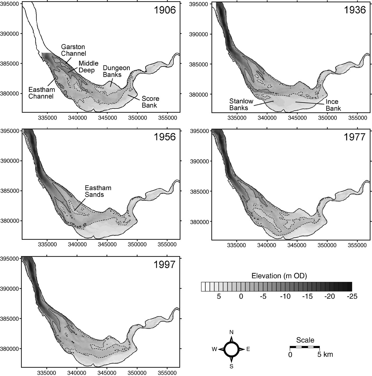
changed almost completely from one year to the next. See Illustration. More recent changes based on MDHB
surveys (given as depth relative to mean tide level) are here . Also see the changing channel
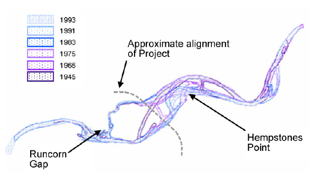
above Runcorn here.
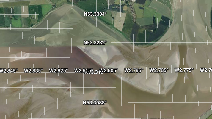
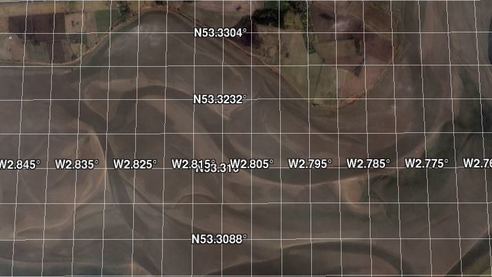
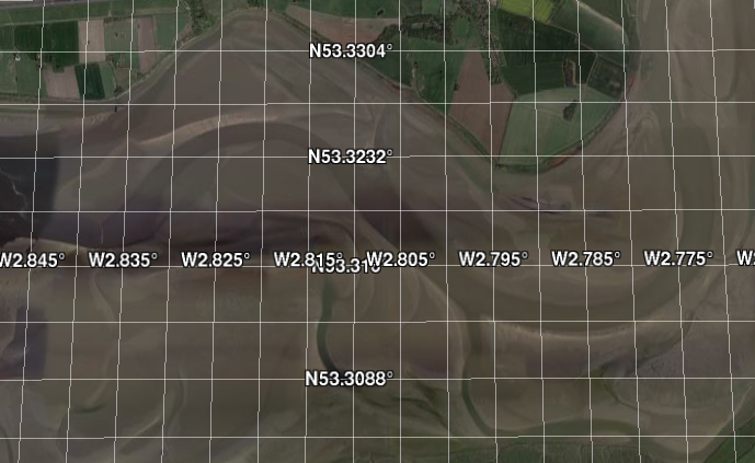
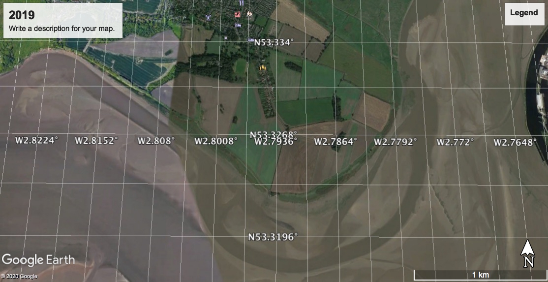
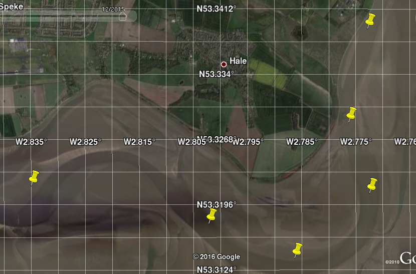
Also see a sequence of Google Earth images of the area
south of Hale Head showing the changing channel:
Dec 2010,
Apr 2013,
Apr 2015,
Sep 2019.
My general advice to anyone venturing up the Mersey, is to go up on a
large (spring) tide while it is still making (before HW). Since HW in the
upper Mersey is progressively later than at Liverpool, one has over 3 hours
to get from Liverpool Marina (leaving at HW(liv)-2 hours) to above Runcorn (HW
at HW(liv)+1 hour) on a making tide. The current will be mostly 2-3 knots to
speed you along so the 12 miles [to Widnes] will be accomplished easily in this time by
most boats. If one runs aground, the tide will float you off. Note your track and
depth to help plan the return.
The trickier bit is the return: if you start at a time
close to (HW(liv)+1 hour) when the current is slack and then, as you head out,
the tidal level will be falling. Hence, after one hour, at HW(liv) + 2 hours,
the depth will be less (for example: near Hale Head at local HW+1.5 hours) and running
aground means a wait until next high water. It will also be difficult to reach
Liverpool Marina in time to lock in (before HW(liv)+2 hours).
My boat can cruise economically at 7 knots, and I can comfortably get up to Widnes (West Bank) [12 miles] and back to Liverpool marina on a spring tide (recent trips: April and October 2018; Jan 2022). I can also get to Fidlers Ferry(and here 2021) [16 miles] and back over HW, if I run at 10 knots for a part of the trip. When I have ventured further up (to Warrington in August 2013, April 2019 and Sept 2022) [20 miles], I have been able to return without running aground, but too late to lock in to Liverpool Marina. In a faster boat (RIB etc) such a trip will be much easier. In all my trips, I have only ever run aground briefly (going up to Warrington - see here and to Fidler's Ferry - see here and here) and I got off easily on a making tide on each occasion.
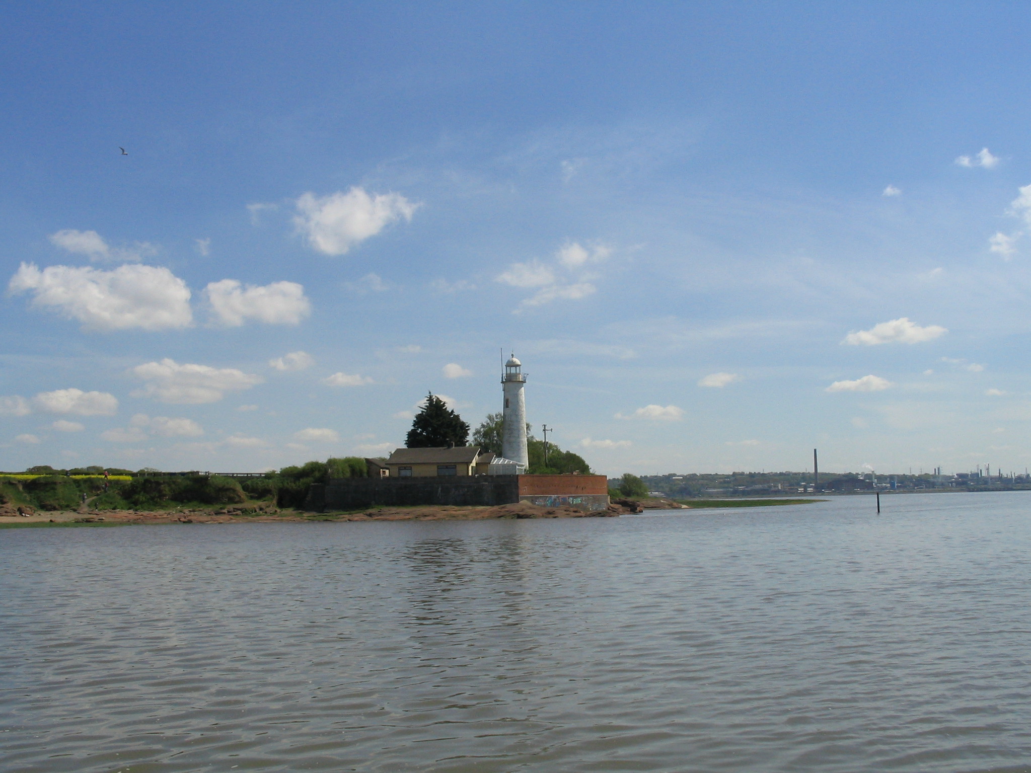
If you don't fancy risking a trip to Runcorn, then Hale Head is less far so easier to reach and return over HW. The abandoned lighthouse at Hale Head is quite a pretty sight.
Why go?
There are leisure boat facilities at Widnes (West Bank Boat Club)
and at Fidlers Ferry. If you are heading to one of these, ask the locals for
their advice. There is also a slip belonging to Liverpool Sailing Club just
above Garston, a slip at Widnes close to the rail bridge and a slip at
Fidler's Ferry.
Otherwise - enjoy the views: there are very industrial parts
(Stanlow Oil Refinery, the Runcorn Chemical Works and Liverpool Airport), but
mostly it is quite peaceful and has plenty of wildlife. My favourite is the
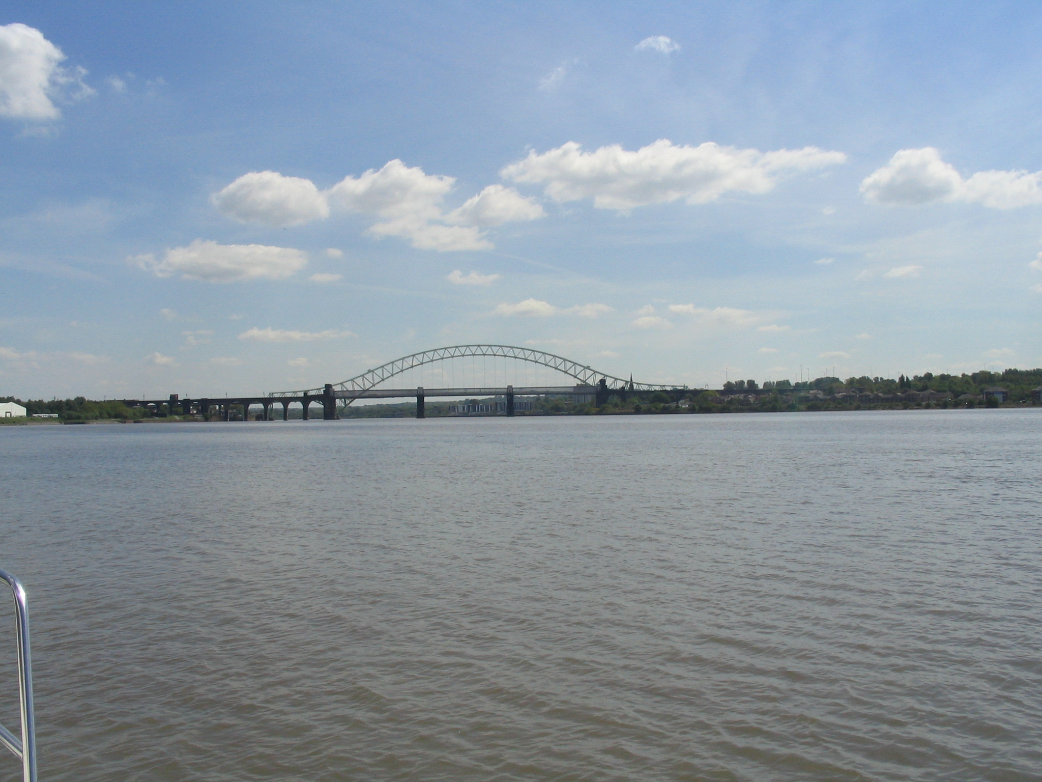
transporter bridge at Warrington - which is best viewed from the river. There
is also the pleasure of retracing historic shipping routes.
The other reason is that there is nowhere much else to go, with the tide,
around HW from Liverpool marina.
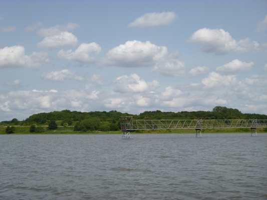
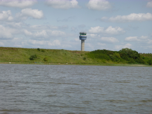
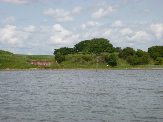
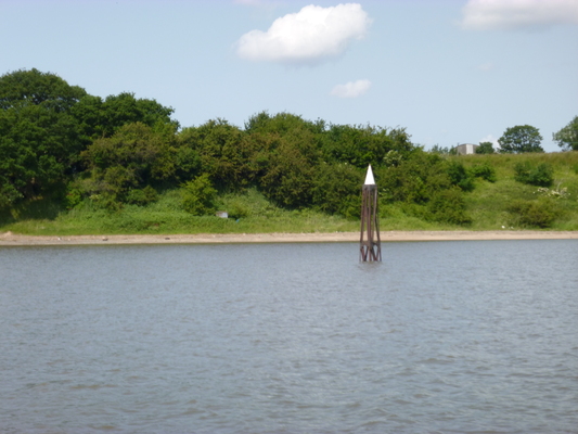
Images of the gantry holding the Airport landing lights, the airport control tower, the wooden perch further east, the Lattice perch marking Dungeon Point, Hale Lighthouse and Runcorn Bridges from downstream.
Details of channel and navigation:
The Chart of this area (hydrographic number 3478 and (for western part) 3490) cannot be relied on since the survey east of 2° 52' dates from 1970) and the chart information west of that (outside of the buoyed Garston channel - surveyed 2017) has not been updated since 2001. See here for online access to chart survey dates. The Ordnance Survey maps show mean low water but no longer give a date of the survey (I note that my old OS map quotes LW survey from 1963-1970 but is identical to most of the LW information shown on my 2008 Explorer OS map no. 275 and on web OS maps.) (see also for web OS maps (click option OS)).
Tides
The Mersey sometimes has a bore
on a big tide (10 metres plus at Liverpool).
See video also.
It may be seen in the lower estuary opposite Hale Point
about 2hr 25 min before HW Liverpool; Pickerings Pasture at HW
Liv - 2hr 15; from the park at Widnes West Bank, it may be seen passing under
the Runcorn road and rail bridges about 1 hr 50 min before HW Liverpool;
at Fidlers Ferry at HW Liv - 60 min; at Forrest Way Bridge at HW Liv -25
min. Its speed is around 5 knots but that depends a lot on water depth
upstream of the bore.
Under good conditions the bore may be seen as far as Warrington passing
under the rail bridge south of Bank Quay station about 20 min before HW
Liverpool. It passes rapidly through the town centre (at 5 min before
HW Liv) and arrives at Howley Weir just before HW Liverpool. A
Liverpool tide greater than about 9.45 metres will overtop Howley weir
and reach Westy over an hour after HW Liv.
[for example, on 13-11-2023, Liv HW (by tide-gauge) was 9.99m at 10:30, and the Westy tide
gauge showed a rise starting at 11:30 and peaking at 0.3m at 12:15]
Tidal information in the Mersey (from Reeds and HO charts) but expressed as
height in metres above/below OD datum-basically just below mean tide level
(CD+4.93m at Liverpool).
| Location | MHWS | MHWN | MLWN | MLWS |
| Liverpool | 4.47 | 2.57 | -1.73 | -3.83 |
| Eastham | 4.67 | 2.57 | -2.13 | -4.33 |
| Garston | 4.77 | 2.67 | -1.73 | -3.63 |
| Hale Head | 4.9 | 2.90 | ||
| Widnes | 5.1 | 3.00 | 0.5 | 0.5 |
| Fidlers Ferry | 5.4 | 3.2 | 2.5 | 2.5 |
| Warrington | 5.6 | 2.9? | 2.9? |
The above table shows that, at springs, the HW level is actually
significantly higher as one goes further inland: so using the height at
Liverpool as an estimate will be an under-estimate.
Data from the Centre Park Link Bridge design quotes a mean
water level (LW stand) of 3.7m above OD at that location in Warrington.
Times of HW (springs) are, from Reeds, in minutes compared to Liverpool(Gladstone):
Eastham +14; Garston +26; Hale +35; Widnes +45; Fidlers Ferry +65[at
springs; +90 at neaps].
The HO chart also quotes Warrington +85 (only tidal at springs).
Easy Tide (simplified model) gives HW (springs) Eastham +23; Garston +28; Hale
+33; Widnes +46; Fidlers Ferry +70.
Fidlers Ferry Boat Yard quotes +75 minutes. While AB Ports quotes HW Garston as +4
minutes.
Note that LW in the upper river lasts until the times quoted
above for the bore [for large spring tides, and until even later for smaller
tides] and the duration of the flood (until HW) is of shorter duration as
one goes up the river, being about 120 minutes at Fidlers Ferry and 105
minutes at Warrington at springs.
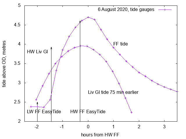
For a real time record of river height at Fidler's Ferry see
here (heights given above datum 0.05m below OD) ; and
here at Warrington (above the weir).
See here for a
comparison of Fidlers Ferry tidegauge results with the assumption of
using Liverpool (Gladstone) 75 minutes earlier [from here].
I have compiled a more detailed investigation into upper Mersey
tide heights and times - see here. This
compilation shows clearly that the time of HW is later for small tides
than for spring tides - another motivation to explore the upper Mersey
on a spring tide.
Navigation
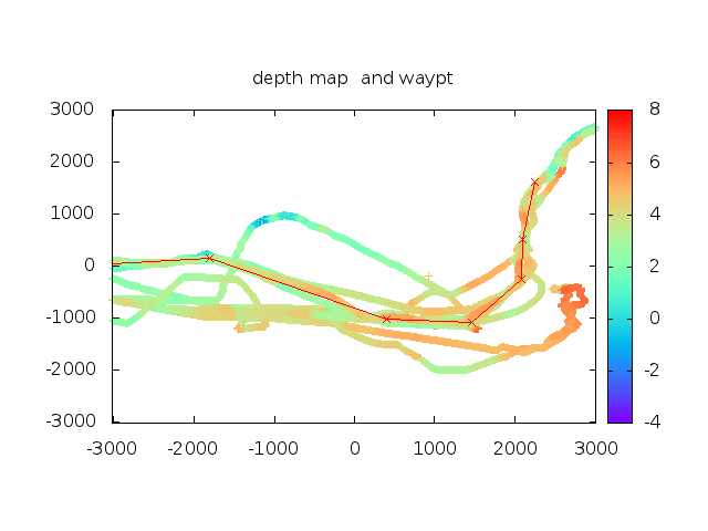
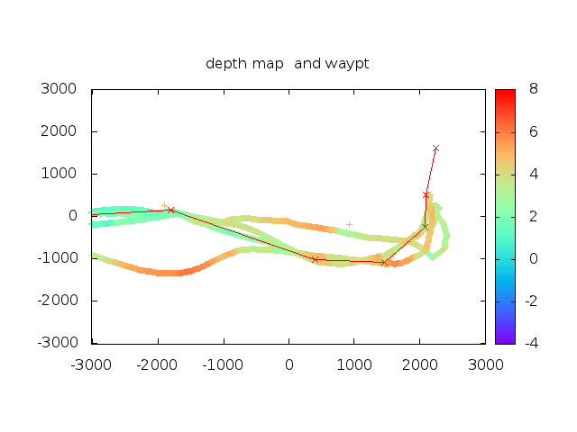
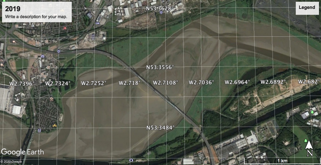
The best source of images of the channel are from Google Earth
(which allows a choice of dates of imagery). Since 2013, I have recorded the
depth, position and time from my many (23 plus) trips into the upper Mersey. I use these two
sources to construct waypoints which can guide my later trips. I present my
depth values by using the tide-gauge results (for Liverpool Gladstone Dock) at
the time appropriate for the location (eg 30 minutes later for Hale Head). This
then gives depths over CD (which is the Lowest Astronomical Tide at Liverpool
- 4.93 m below OD - where OD is essentially mean tide level). Note that the
Hydrographic Office Charts (if they exist) use a CD (chart datum) which changes as
one goes up a river - very confusing - so not how I present my results.
Note also that my data are available from Team Surv [defunct] - though they currently only
present depths above CD up to Fidlers Ferry.
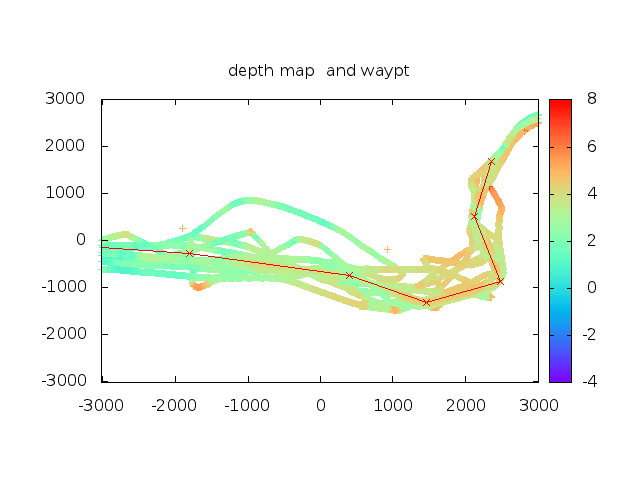
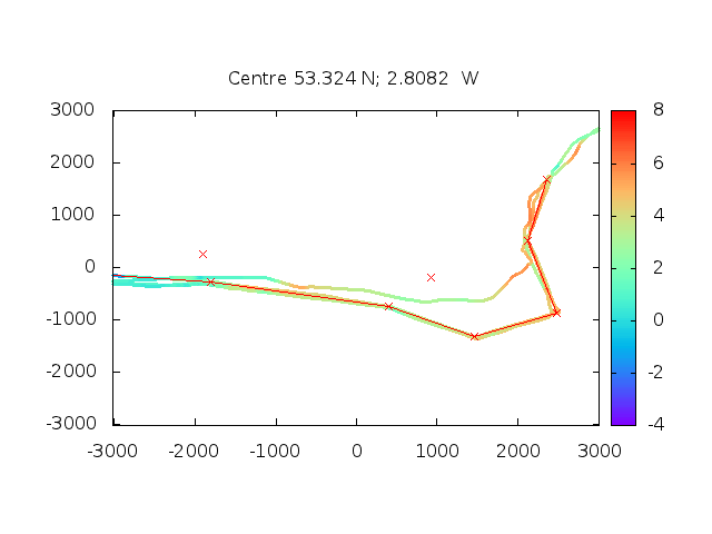
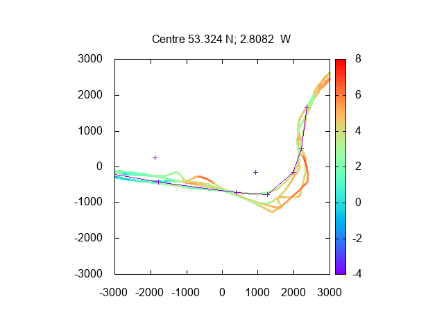
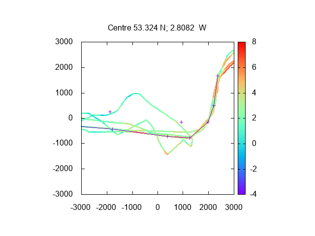
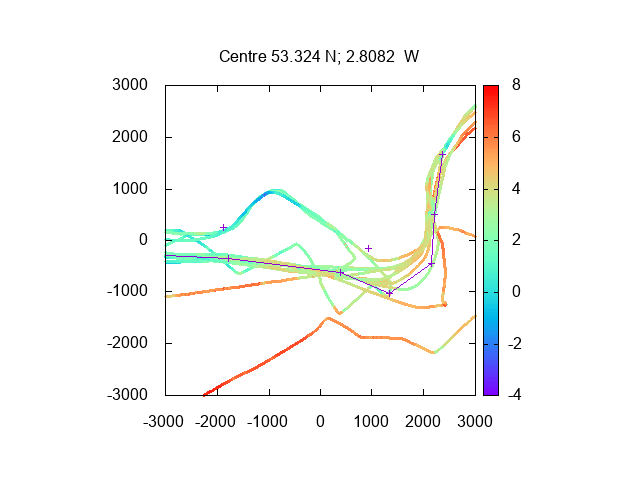
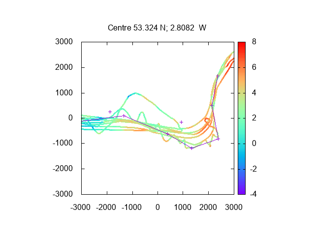
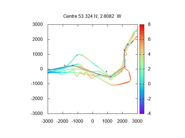
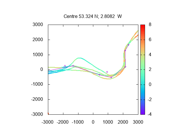
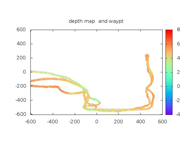
Since 2013, I have regularly combined my depth readings from several trips and
compared with my waypoints, but the resulting "chart" is still incomplete: see
2013 here(with 2013 waypoints),
2014 here(with 2013 waypoints),
2015 here(with 2015 waypoints),
2016 here(with 2015 waypoints),
2017 here(with 2017 waypoints),
2018 here(with 2017 waypoints),
2019 here(with 2019 waypoints),
2020 here(with 2020 waypoints),
2021 here(with 2021 waypoints),
2022 here(with 2021 waypoints).
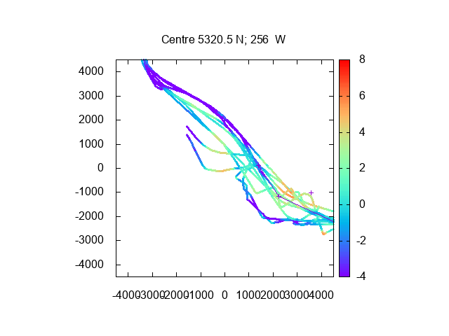
These plots are from Dungeon Point
past Hale Head (lines join waypoints Mersey2,..Mersey7
below) with scales in metres.
Crosses mark the
position of Dungeon Point and Hale Head. Note that the channel crossing
Hale Bank (also called Score Bank) seems to have moved further North for
some years (though in 2019 it moved a bit south again).
A Google Earth image from April 2015 is compared to some of my 2015 waypoints here . This shows rather good agreement - and I had set up the waypoints several years before the GE image was made available.
See also Google Earth April 2021 images here.
Another way to check out the channel is from the top of Runcorn Hill (Hale Head to Garston) and the top of the Catalyst Museum from Widnes for up river. Also - look out of the window if landing/taking off from Liverpool airport.
Here I summarise some of the issues in picking the best channel (be
aware that the location of the deepest channel changes frequently):
- After following the (buoyed) Garston Channel to G11, one has
to pass sufficiently south of Garston to avoid shallows. One also has
to pass south of the airport gantry. A compilation of my recent tracks here shows the Garston channel (blue at top)
then the need to move off-shore to pass the shallows off Garston (with
waypoints as below).
- Further east, one can either head fairly straight to cross
the Bank off Hale Head, or follow the deep channel (as shown on the
Ordnance Survey map) close to the north shore in the bay between Dungeon
Point and Hale Head. This does exist (2011, 2013, 2015, 2019, 2021 and 2022) (and is a back eddy on a
making tide). To continue up river, one still has to cross Hale Bank in
the appropriate place.
- The crossing of Score Bank (off Hale Head) has got easier in recent
years. See images above comparing this area from 2013-21.
- Then one needs to rejoin the deeper channel that runs fairly close
inshore from Hale Head all the way round to the Bridges.
- The Rail bridge has three large arches. The South and North arches
have had more depth. See here for depths under the rail
bridge (passages under all three arches shown just west of origin). If
proceeding further up river, I used to find it more convenient to use the southern
arch and then keep close to the Runcorn shore (Manchester Ship Canal).
Although in July 2020 I explored the northern option.
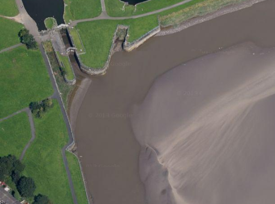
- To reach the Spike Island lock (Widnes West Bank) which is
12.5 nm from Liverpool Marina, one can continue along the south side
until the (abandoned) lock into the Ship Canal is passed then head
across (north) to the lock (see
here). See satellite
view or LW near Spike Island[circa 2019].
- On the south shore, soon after passing the abandoned lock, there is
an obstruction mid-channel: this is an
abandoned wharf (image at low water 2018, now charted 2022) which has its SW end at position
53°20.715 N, 2°43.087 W as shown by Google Earth (2009 and 2015).
- Proceeding further up river was not possible (without prior
booking) for a few years because of the trestle bridge built as a
temporary measure during the construction of the Gateway Bridge. I went
that way in 2013 before the bridge - see here - and more recently in
2019 here and 2020 here. Until 2020, I had always
followed the south shore here, but a route close
to the north shore was also considered viable; and in July 2020, I
explored this northern option. A
Google Earth image from 2019 shows this
more northern route. It has moved a little by 2021 - see
here.
- Further up river - basically keep to outside of bends. See
account of my trips in August
2013, April 2019 and September 2022. See also Map near
Fidler's Ferry (16 nm from Liverpool Marina). This shows the river
Mersey up to the first bridge at Warrington (Forrest Way Bridge - design
specification was air draught of 10 m at HAT) which is shown on the
latest HO chart. See also Google Earth
image from 2019 of bend near overhead pylons.
- The head of navigation for small boats (ribs, kayaks) is Howley Weir
at Warrington. Some spring tides can even overtop this weir. There are
now many bridges below this at Warrington. Forrest Way Bridge is the
first encountered (see above) and is the limit for high-masted boats
although most power boats should be able to pass under it. The next two
bridges (pipe bridge and transporter bridge) have sizeable air-draft and
the one after that, the box-girder road bridge joining two parts of the
PQ Silicas site, is likely to be the next constraint. It has a
clearance estimated roughly as a little over 4 metres at HW spring tide (7 metres at
LW). It is approximately 3.5 nm above Fidlers Ferry.
For more information on the bridges see 2013 and
2019.
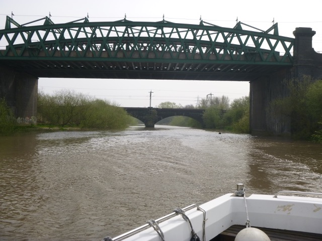
Some images of bridges:
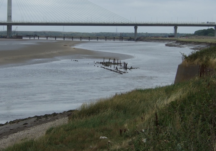
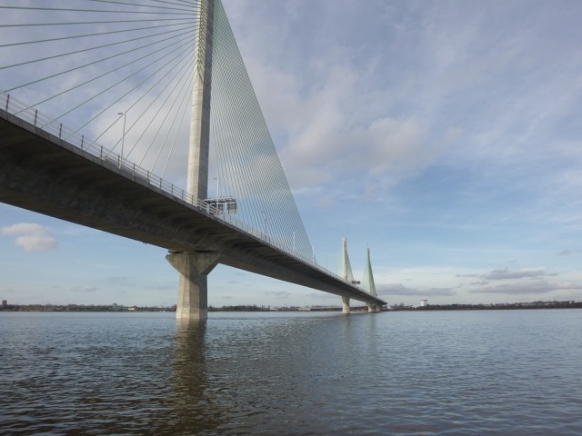
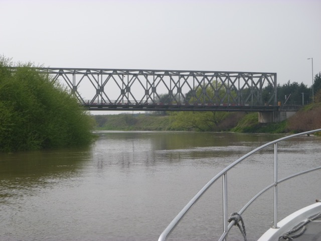
Road and Rail Bridge at Runcorn,
Gateway Road Bridge,
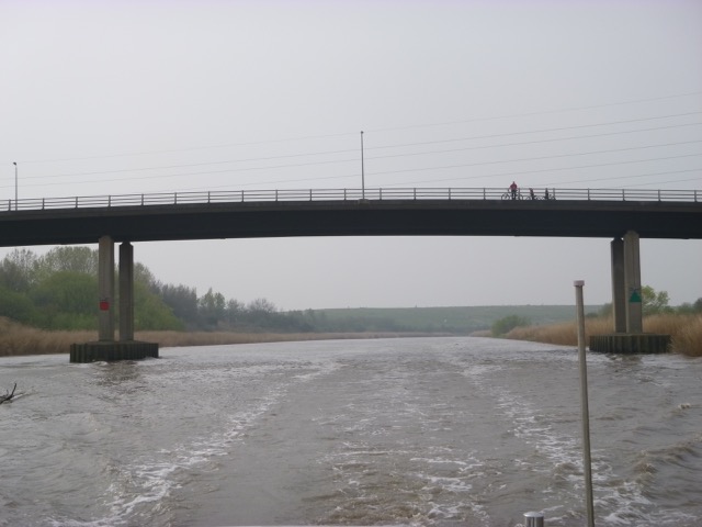
Forrest Way Road Bridge,
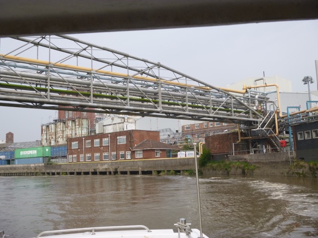
Pipe Bridge,
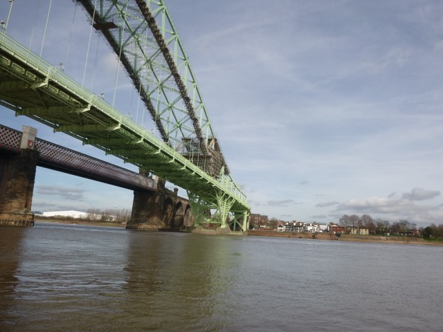
Transporter Bridge,
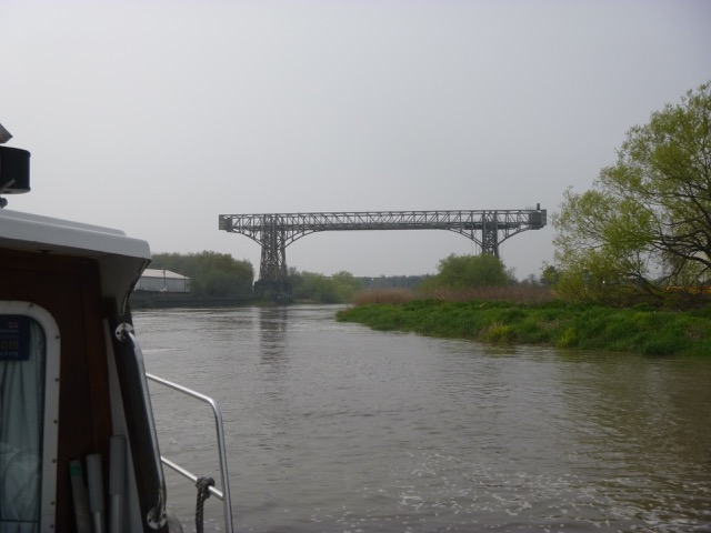
Box Girder Road Bridge,
Walton 12 Arch and Girder Rail Bridges.
Note that a new
Centre Park Link Bridge road crossing is under construction in 2020. It is 460 m
up-river
from Walton 12 Arch bridge and has a clearance height of 8.65m above OD [giving
air draft of approx 4.65m at LW and 2.36m at spring HW].
Note also that a Warrington Western Road Link is planned -
possibly starting 2023, which includes a further bridge close to the
Forrest Way Bridge - hopefully with similar or larger air draught.
My 2021 waypoints
[do not rely on these - the channel can change at short notice]
Note my 2021 trips suggest
big changes to previous years
If, instead of heading up beyond Runcorn, you want to stay in the wider expanses of the Estuary: be aware that the southern shore (from Eastham to Runcorn) is mostly rather shallow with narrow channels where rivers (Gowy, Weaver, etc) flow. I explored this a bit in 2019, especially in October. There is a lot of wild-life here, but it is hard to get close because of the shallow water.
Information from other sources:
Some info (2010 on) from Liverpool Yacht club on the passage up river here
For some other input (from Fidler's Ferry sailors in 2010 which follows closely the north bank) see here [link dead].
Yacht Clubs: West Bank Boat Club in the Sankey Canal at Widnes; Fidler's Ferry Boat Yard; Fidlers Ferry Sailing Club.
Note that the Sankey Brook (which heads northeast from the Mersey just less than a mile above Fidler's Ferry) is tidal and can be navigated for a mile or so at spring high water (by a rib or kayak). The first Sankey Navigation made use of this brook to reach Sankey Bridges - where a new canal navigation was built to lead further inland (to St Helens). The low bridges in the Sankey Bridges area now limit boat navigation further up the Sankey Brook. The Sankey Brook was difficult for Mersey Flats to navigate, so the Sankey Navigation was extended to Fidlers Ferry with a lock (still in use) directly to the Mersey. See here for tidal levels in the Sankey Brook at Liverpool Road. See also Fidlers Ferry Sailing Club for a video of a rib trip up the Sankey Brook.
Some info (2010) from Liverpool Sailing Club here[link broken: see here]. Their club house is on the north bank of the Mersey near the airport.
A kayak trip in 2020 from New Brighton to Warrington and back.
A 2019 canoe trip from Widnes to Warrington here
History The 1948 West of England Pilot (Admiralty) states
that vessels of draught 11.5 foot (and carrying 150 tons) can reach
Warrington Bank Quay at springs, but local knowledge is essential.
Nothing that big goes anywhere near these days.
Note that in 1853, a shipyard at Warrington Bank Quay launched the
large iron clipper TAYLEUR of 230 ft length and 40 ft beam. It was towed by 3
tugs to Liverpool to be fitted out. It sank on its maiden voyage.
Some upper
Mersey history.
1870 Sailing Pilot.