
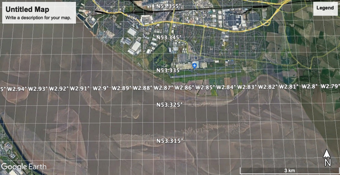
Jump to: May(to Hale Head and Dungeon)
Jump to: July(to Hale Head and Pickering
Pasture)
Jump to: July(to Runcorn Bridges)
Jump to: August(to Fidlers Ferry)
Jump to: October(to Eastham)
Jump to: December(to Eastham, Garston)
Thursday 27 May (Liverpool HW 12.24 9.7m). Sunny, warm, calm.
Canal and River Trust have finally got the sea-lock working - and I have got Marlin sea-worthy too: so promising weather and a good time to explore up river.
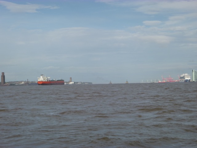
Enter river from marina at 10:25am with 4 other boats. Head up the Garston Channel (buoyed) then follow my waypoints - which proved to be inappropriate this year, since the location of the sand banks has changed.
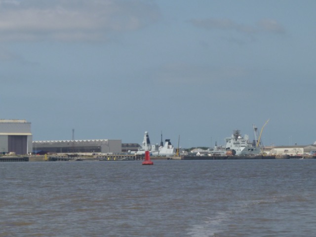
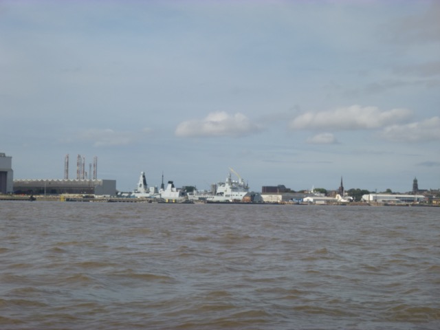
Oil tanker unloading crude oil at the Tranmere Oil Berth with
Cammell Lairds beyond.
RFA vessels being refurbished at Cammell Lairds.

Easy Jet planes parked up at Liverpool Airport.

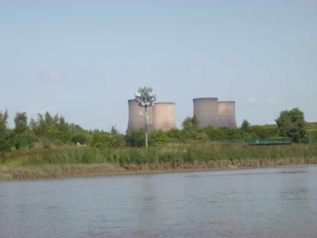
I reached Score Bank (south of Hale Head) at about 11.45, with strong up-river current. My waypoints from previous years seem to be no longer useful here. I followed the surface disturbance and found a deeper route that now runs quite close to the shore at Hale Head.
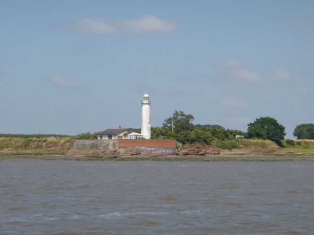
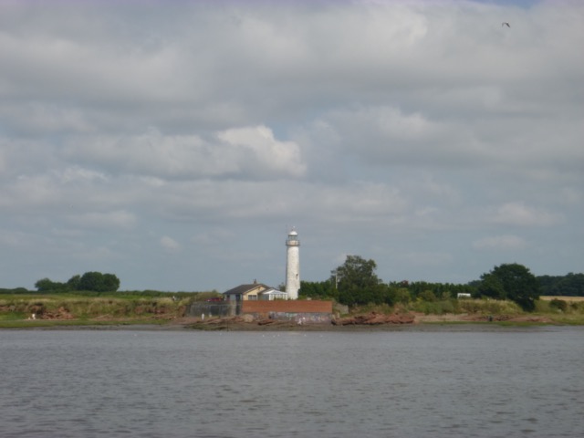
Hale Lighthouse (disused)

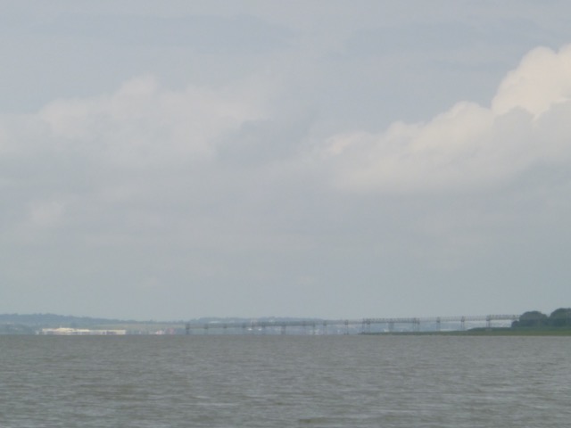
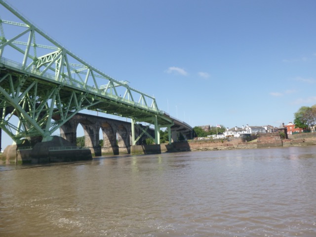
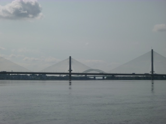
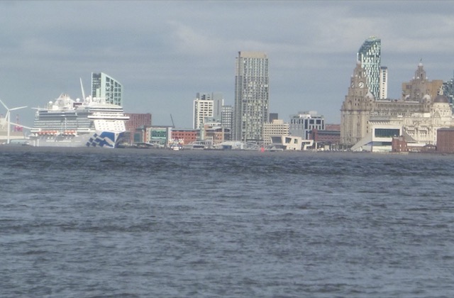
View of the Runcorn Bridges in the distance:

Since I had back-tracked to find the deeper channel, and the current was still strongly up-river; I decided to visit the Dungeon. This is the name of the bay on the north bank, just west of Hale Head. There is a deep channel close inshore here, and the current is a back-eddy, so it would be running favourably for me. I drifted slowly with this current between 12:00 and 12:25. It was very calm and there were few people - just one or two cyclists on shore.
Heron

Abandoned "tank traps" on shore

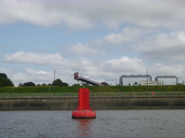
Leaving the bay, at Dungeon Point, I passed the lattice perch - almost the only
navigational mark still present.

Then I continued, fairly close to the north shore, passing the
Airport Gantry (landing lights)

And the Liverpool Sailing Club Building and moorings

A little later, I was surprised to see another boat out - a fishing vessel, Little Jess, coming from Spike Island (Widnes) to the Marina.
The marina lock is operating once an hour midweek, so I raised the revs to reach the lock by 1:15. This is good for the engine - which had done no more than tick-over since last November.
In the lock were 4 vessels again - one being a rib maked AFM Maritime
Squadron - Malta's Navy - I believe.

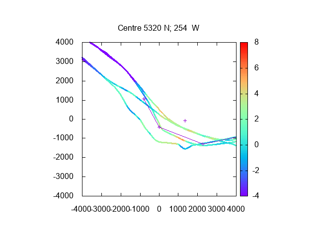
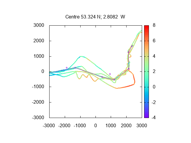
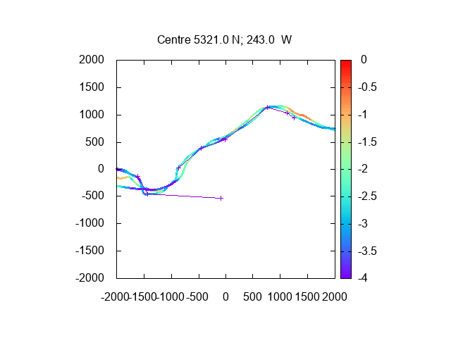
Survey depths (reduced to chart datum using Gladstone Dock tidegauge 30 minutes earlier) from my tracks (with 2020 waypoints, joined by lines), units metres:
Area of Garston Channel and south of Garston: + mark is end
of airport gantry.

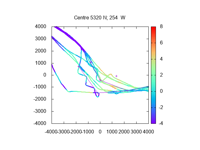
Area of Hale Head (lighthouse marked +) and Dungeon Point
(lattice perch marked +)

The previous day (wed) there had been an incident at the lock gate - a yacht with 3 people aboard had got caught on the sill and tipped over as the tide ebbed. See RNLI report. It was refloated that evening.
Total distance run 20.15nm
Thursday 8 July (Liverpool HW 11.03 8.2m). Overcast, warm, calm.
Leave lock at 9:23 with one other boat. Head up Mersey to check for best channel and to reset my waypoints.
Proceed up buoyed Garston Channel then head off shore of airport
gantry
I zig-zagged around to find the deepest channel, reaching Hale Head
by 10:35.
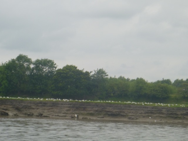
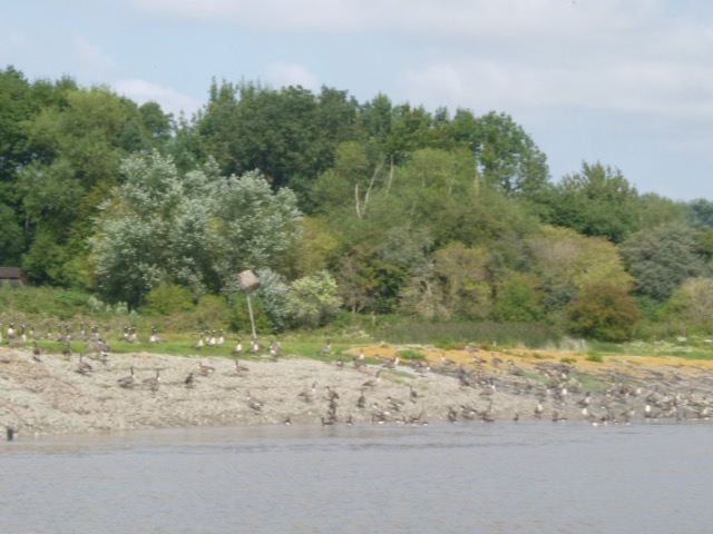
I continued on to Pickering Pasture - with flocks of birds
along the shore:
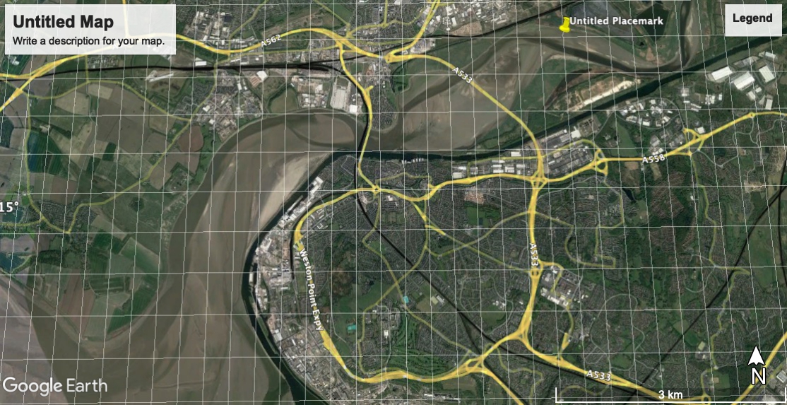
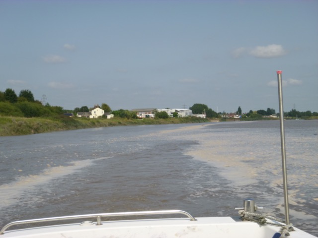
From here one can see the 3 Runcorn-Widnes Bridges lined up in the distance:
I turned around about 11:05 and retraced my steps - with some adverse current intially - to fill in my survey. I locked in at 12:40 with one other boat.
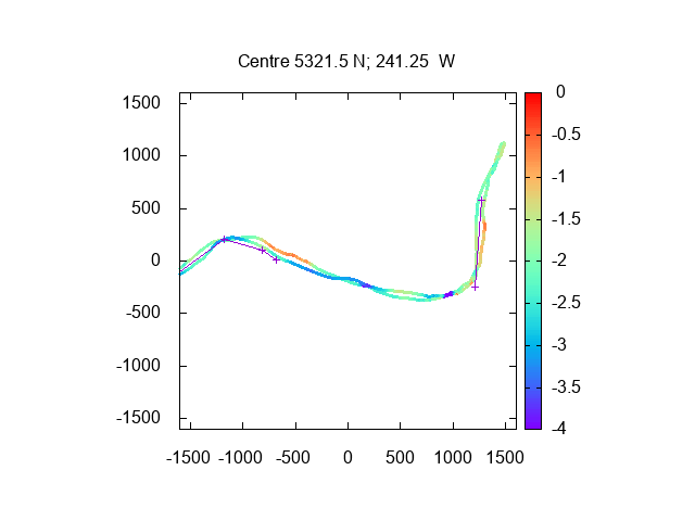
Depth on my tracks from my 2021 trips [as height over CD, using
Gladstone Dock tide gauge values from 30 minutes earlier].
Also region off Garston and Airport Gantry (tide corrected by 15 minutes):
From these surveys, I revised my waypoints - the new 2021 ones are shown on the above plots. For values see here.
Thursday 15 July (Liverpool HW 15.35 8.5m). Overcast then sunny, warm, NW 3.
Leave lock at 13:42 with three other boats. Head up Mersey to check my new waypoints and to reach further up than the previous week. It is usually advised to venture into the upper Mersey on a spring tide - but I can reach Widnes on an average tide.
Proceed up buoyed Garston Channel to G11 then follow my waypoints past airport gantry, Dungeon Point and Hale Head.
I reached Hale Head by 2:53 with still strong up-river current.
I continued round the North shore, passing Pickering Pasture and then
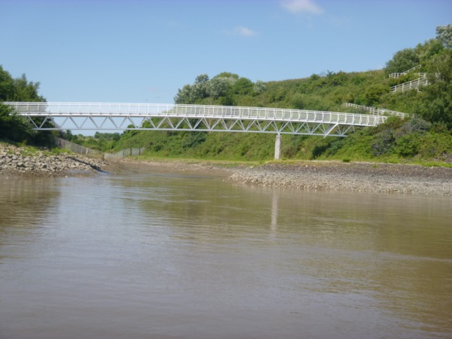
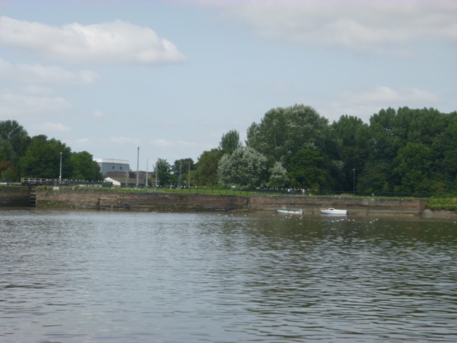
passing the pretty foot-bridge near Tescos.
The sandbank in mid-river
off Runcorn Docks was just uncovered.

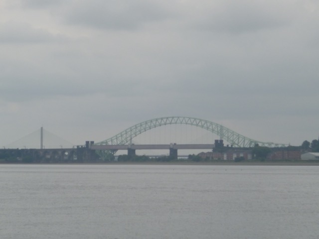
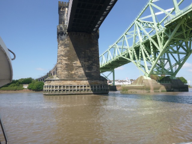
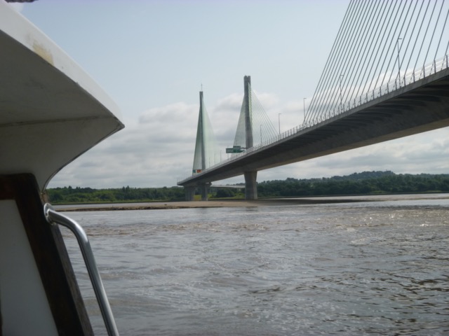
I decided to pass under the Road and Rail Bridges - choosing the North arch of the Rail Bridge - at 3:14. The current was still strongly up-river (around 3-4 knots), but the depth was getting less (about 1.3 metres under my keel), so I decided to turn around and head back out. This was very slow over the ground (3-4 knots adverse current) , until I upped the revs to counter the current.
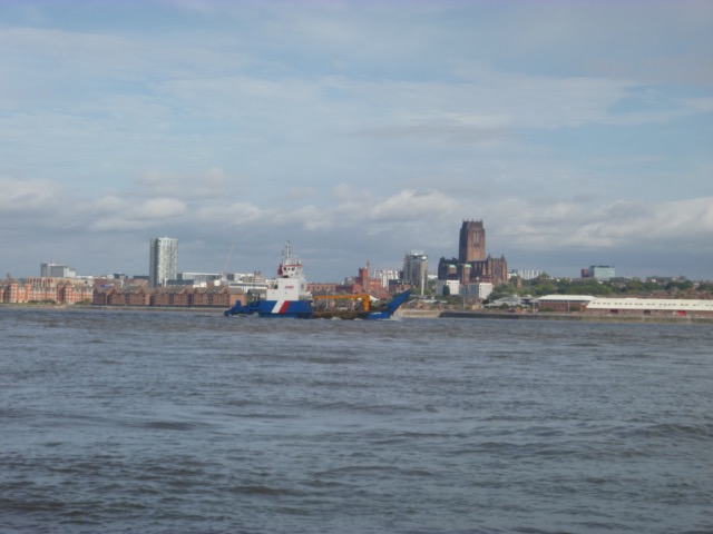
Passing under the Rail and Road Bridges
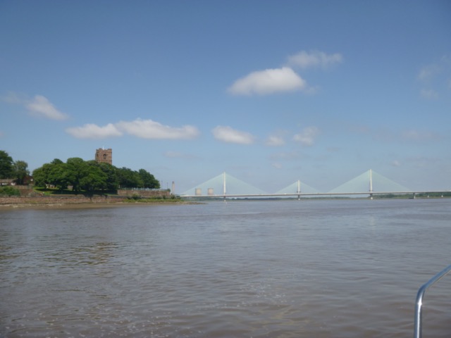
Widnes church on headland and Gateway Bridge in distance
Pass Dungeon Point (with lattice perch) at 4:00, with still some
current up river (this is supposed to be the time of local high-water -
but I find that HW is later on a small tide than a spring tide):
From around 4:30 the current had picked up enough to help me along - so I could drop the revs down to a very economical rate. I zig-zagged a bit to explore the deepest channel.
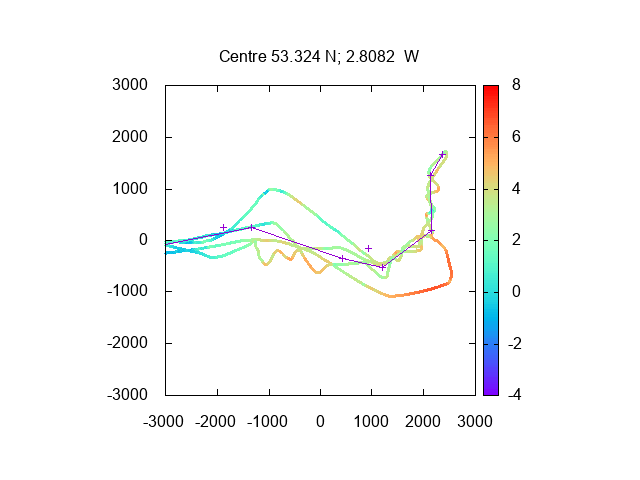
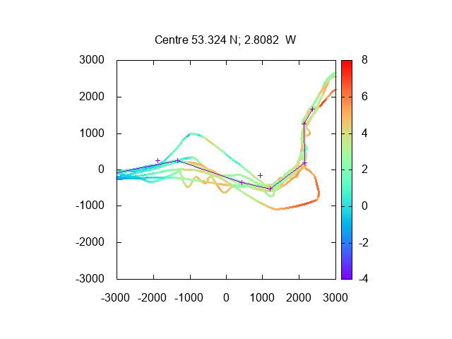
Depth on my tracks from all my 2021 trips [as height over CD, using
Gladstone Dock tide gauge values from 30 minutes earlier], from Dungeon
Point(+) to Hale Head(+), with 2021 waypoints.
Also region off Garston and Airport Gantry (marked +) (tide corrected by 15
minutes) with 2021 waypoints:
Lock into Liverpool Marina at 5:20 (only boat).
Total distance run 24.55nm
Wednesday 25 August (Liverpool HW 13.56 9.0m). Calm, sunny periods.
Having gone successively further up the Mersey each time in 2021, it was time, tide and weather to go as far as I can reach on a single tide - to Fidlers Ferry.
I had also come across a Google Earth set of images of the Mersey
dated April 2021 which show the deepest water channel quite well. I used
these to tweak my previous waypoints a little. They show the deeper
channel quite a bit south of Garston - which I had found in previous trips.
Leave lock at 12:05 (no other boats). Proceed up buoyed Garston Channel to G11 then follow my waypoints past airport gantry, Dungeon Point and Hale Head.
RFA vessels being refurbished at Cammell Lairds.
A fairground near Otterspool Promenade
I reached Hale Head by 1:13 with still strong up-river current.
Lots of geese at Pickerings Pasture.
I continued round the North shore, passing Pickering Pasture and then
passing the pretty foot-bridge near Tescos. I passed through the
central arch of the Rail Bridge at 1:34. There was a RIB alongside at
the slip on the Widnes bank near the bridges. I then headed past the
Widnes church around towards Spike Island (2 boats moored off it).
A wreck is now (since May 2019) charted off Spike Island - at 53°21.14N, 2°43.75W. It is the remains of a 6m long metal cruiser. In 2019 it was marked by an unlit orange buoy - but I did not see any buoy on this trip.
I followed the deep channel around the northern shore - passing under
the Gateway Bridge at 1:42. The central sandbank was still very
prominent and current was strongly up river.
Then I turned near the "art installation" on shore (with Fidlers Ferry
Power Station behind):
I headed towards Hempstones Point and then followed the channel past
the pylon crossing into Fidlers Ferry Reach (at 2:00) with current about
3 knots upstream.
According to the Fidlers ferry tide gauge - the low water stand ended
at 1:45 (so just before I arrived) and high water was 2.6m higher at
around 3:15. Current at that location would only be outgoing from after 3:30
- leaving no prospect of reaching Liverpool Marina by 4:00.
See discussion of upper
Mersey tides.
In order to get back to Liverpool Marina by last lock (4:00), I decided to turn here and head back. This was very slow over the ground (3-4 knots adverse current), until I upped the revs to counter the current. Also I tried to keep out of the deepest part of the channnel, in order to have less adverse current. Even then I made slow progress until in the wider part after Hempstones Point.
View of 3 bridges lined up from up-river.
Back under the Gateway Bridge at 2:28, the Runcorn bridges at 2:35 and then approaching Hale Head (passed at 3:00), the adverse current turned favourable and I could run at a more efficient speed (circa 7 knots through the water) from 2:40 on.
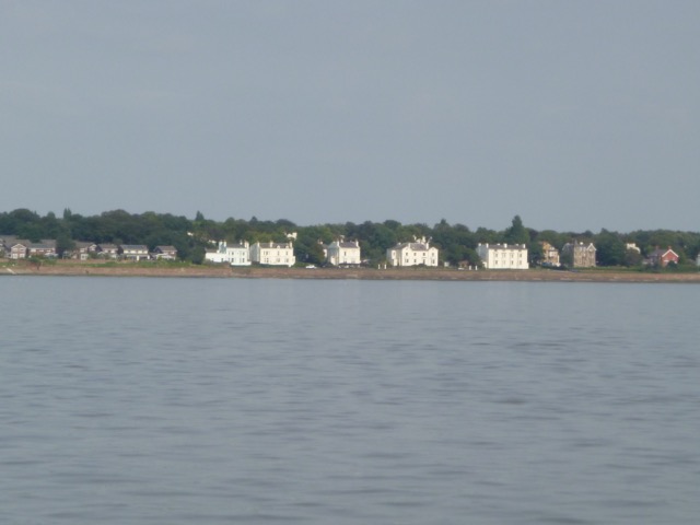
View of the houses on the waterfront at Grassendale.
I headed for the marina, arriving at 3:55.
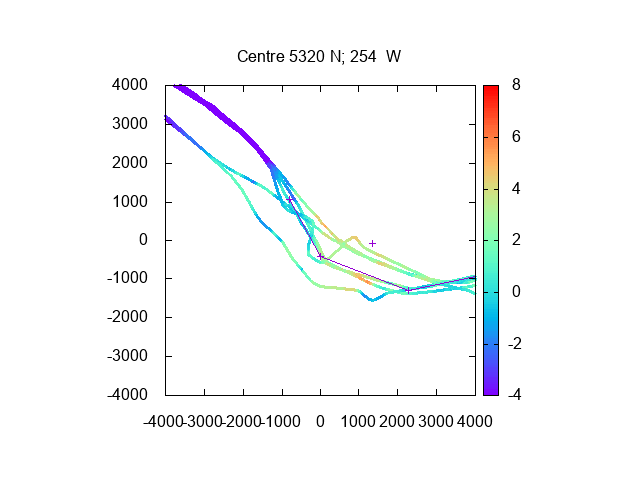
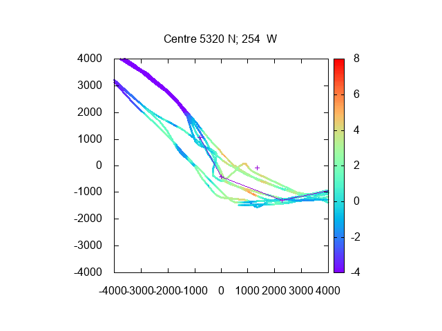
Depth on my tracks from all my 2021 trips At no stage, on this trip, was I close to running
aground - I always had at least a metre under my keel.
From Widnes to Hempstones Point and then from Hempstones up to
Fiddlers Ferry. In this area the tidal predictions are very tricky -
see discussion of upper Mersey
tides. So I plot the depth under my keel - add 0.7m for water depth.
Note depth was much more on return than on way up - since nearer to
local HW.
From Dungeon Point(+) to Hale Head(+), [as height over CD, using
Gladstone Dock tide gauge values from 30 minutes earlier], with 2021
waypoints.
Also region off Garston and Airport Gantry (marked +) (height over CD
with Gladstone tide corrected by 15 minutes) with 2021 waypoints:
Lock into Liverpool Marina at 4:00 (only boat).
Total distance run circa 31 nm
Friday 8 October (Liverpool HW 13.03 9.8m). Wind S 2-3, sunny periods.
A brief period of warmer, drier weather - so an opportunity to check out the boat. I only planned a brief trip and, to keep in calmest water, I headed over to the Wirral side. Lock out at 11:50 with 3 yachts.
Oil tanker Eagle Hamilton [114022 dwt, 250 x 44m] leaving and cruise
ship Sky Princess[3660 passengers, 145285gt, 330 x 38m] on Cruise Terninal
[this vessel is on a Southampton-Southampton 10 day cruise around
British Isles, but has arrived in Liverpool on 8th not 13th as
advertised).
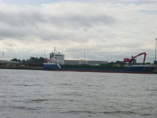
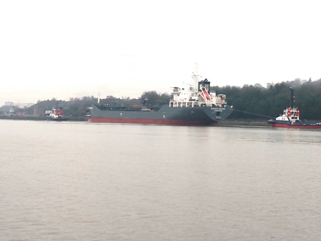
Coaster Celtic Freedom alongside at Bromborough
When I reached Carmet's shipyard at 12:18, I turned round to retrace my route -
with current against me now.
Buoy tender Cameron heading up to Garston
I passed the Tranmere moorings, Oil Tanker Berth then Cammell Lairds where I crossed to the marina.
RFA vessels being refurbished at Cammell Lairds
Sky Princess again.
Lock into Liverpool Marina at 12:50 (only boat).
Total distance run 5.6nm
Thursday 16 December (Liverpool HW 9.21 8.3m). Wind light, overcast.
A brief period of high pressure - so an opportunity to check out the boat [after some recent repair work] and survey the depths. Lock out at 8:55 with 1 other motor boat - Welsh spoken.
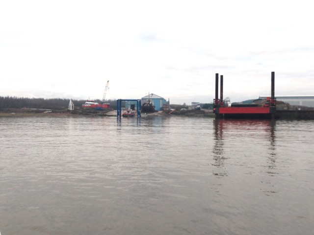
Carmet shipyard with vessels under repair.
Head up Eastham Channel to MSC entrance. Tanker Elisalex Schulte
(128m long) was being eased into the MSC lock by two tugs.
Then cross to my waypoint MERSEY0X (shown at lower middle) for the (optional) deeper channel further south - to explore depths in that area and then head towards Garston.
Lock back in at 10.55 - only boat.
Depths from all 2021 trips - here airport at middle right, Eastham at
bottom left:
12nm run - mainly at tick-over.
If higher resolution versions of the above images are wanted, please contact me. All information given in good faith, but please do not rely on it.
Back to index here