Jump to: April
Jump to: October
Jump to: November exploration.
Jump to: January (2019) exploration.
Thursday 19 April (Liverpool HW 14.11 9.5m). Wind nil then W 2-3;
sunny.
Enter river from marina at 12.15.
Calm weather. After testing a magnetometer on the wreck of the Nelson,
head up Garston Channel. Leave Garston channel at G11 (SHM) and head
for waypoints MER0,...MER7. (see
here for navigation info, some history and more photos).
I also use evidence from the surface ripples to try to find the
deepest part of the channel but it was so calm this was little help.
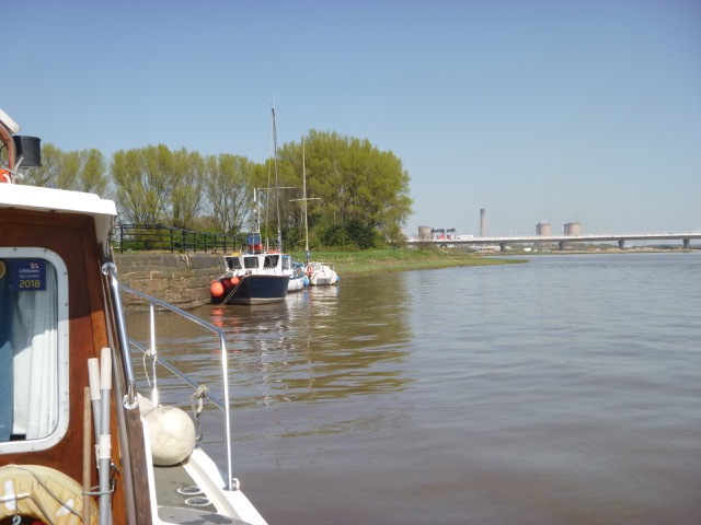
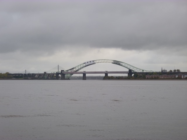
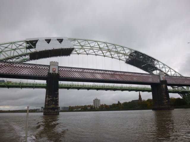
Cross south of Hale Head at 1.20pm and proceed along north bank up to the Runcorn bridges. Go through south arch (of three) of the railway bridge at 1.48. I was a bit perturbed by a nasty rumbling sound - fearing an engine malfunction - until I looked up and saw a train crossing the rail bridge. The road bridge is currently being repaired and has workmen on the arch. Follow south bank until just past (abandoned) lock into Ship Canal, then head north towards church (with tower) on Widnes bank and then follow shore towards Spike Island, waiting for some shore anglers to reel in. There are three "openings" here: western is filled in lock, middle is active lock and eastern is entrance to abandoned dock. Rather than tie up in (active) lock entrance, I went alongside the wall to the east - where there was a ladder - at 2.00. There are some shallower parts quite close by. Also the current was a bit "swirly".
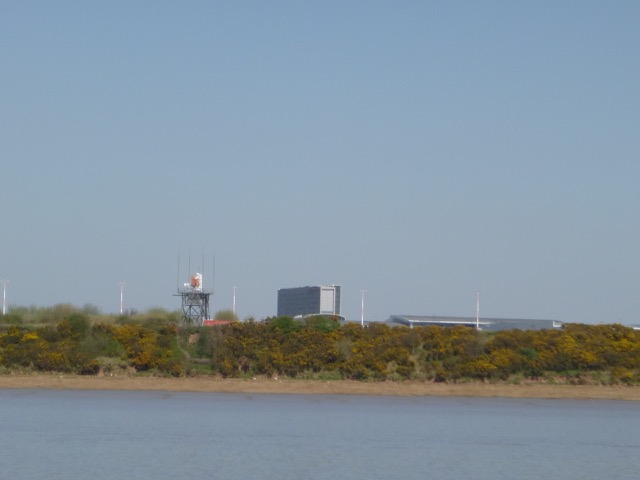
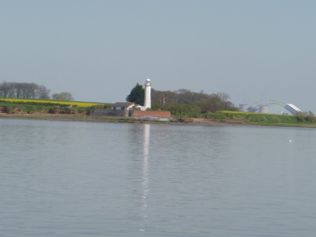
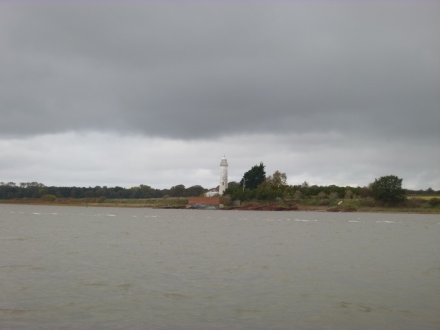
Liverpool airport radar; Hale lighthouse.
| |
|
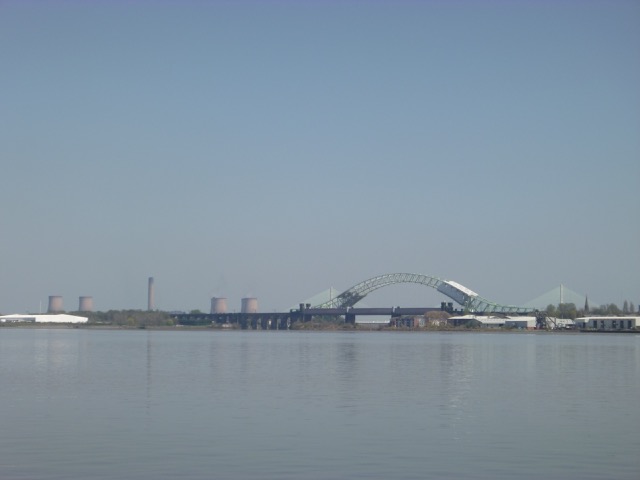
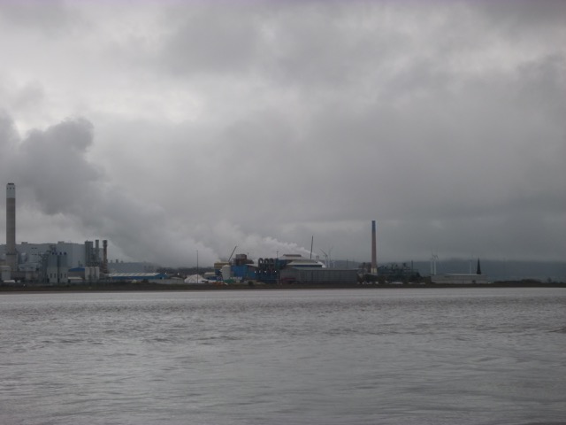
Runcorn Gap from downriver (showing work activity on right hand side of suspension arch); Chemical works at Runcorn.
 |
 |
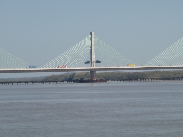
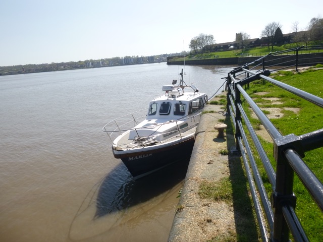
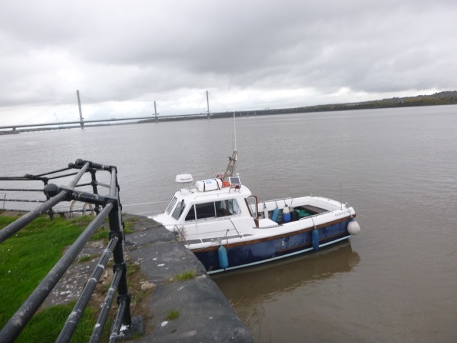
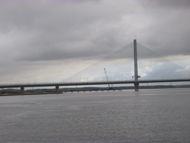
The Gateway Bridge (showing temporary trestle bridge below); Marlin at Spike Island.
 |
 |
Ashore 2.00 to 2.20, waiting for the current to slacken. Near Spike
Island there is a back eddy with less current. Proceeding above Widnes
is currently tricky since the construction of the new bridge involves a
trestle bridge with limited air draught. This is scheduled to be
removed in 2018.
The cafe at Spike Island is now closed - and the premises
are now the West Bank Boat Club - and their lease does not allow them
to serve food or drink.
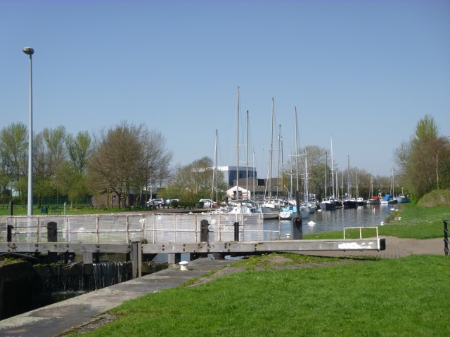
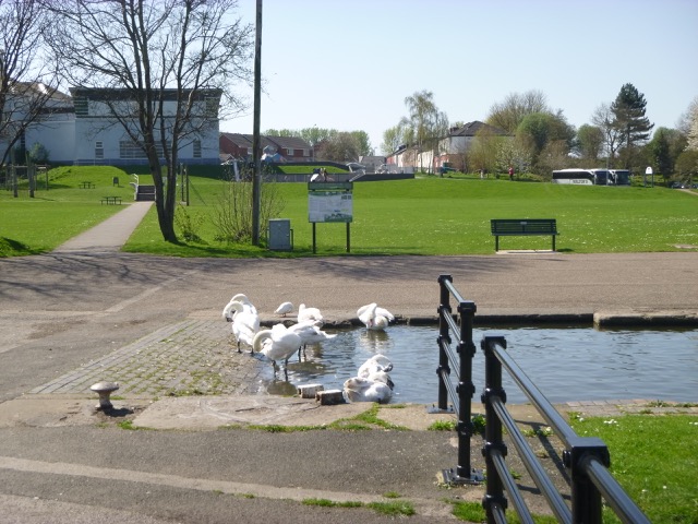
Spike Island with boats in Sankey Canal; swans; boats alongside in Mersey.
 |
 |
 |
Distance run (over ground) 25.5 nm, all at my displacement speed (7 knots through the water or less).
On this trip I found that the channel has shifted near MER0, MER01
and MER1 and I have revised these waypoints.
See details here.
Thursday 25 October (Liverpool HW 12.15 9.4m). Wind NW 3;
overcast with some drizzle.
Depth around waypoint MER0 seems shallower than previously - to be
explored on return trip.
Cross south of Hale Head at 11.25am and proceed along north bank up
to the Runcorn bridges. Go through south arch (of three) of the railway
bridge at 11.45. The road bridge is currently being repaired
and has workmen on the arch. Follow south bank until just past (abandoned)
lock into Ship Canal, then head north towards church (with tower) on
Widnes bank and then follow shore towards Spike Island, waiting for some
shore anglers to reel in. There are three "openings" here: western is
filled in lock, middle is active lock and eastern is entrance to
abandoned dock. Rather than tie up in (active) lock entrance, I went
alongside the wall to the east - where there was a ladder - at 12.00.
There are some shallower parts quite close by. Also the current was a
bit "swirly".
Two locals were working on their boats nearby (as they
emphasized, one, a 26 foot bilge keeler, was for sale) - and offered me
useful advice about the "trestle bridge" among other things. Two large
cranes were evident - removing the trestle bridge at each side. The
middle has gone but the deep channel is quite close to the shore - so
not yet accessible because of the low air-draught of the trestle bridge.
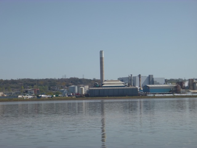
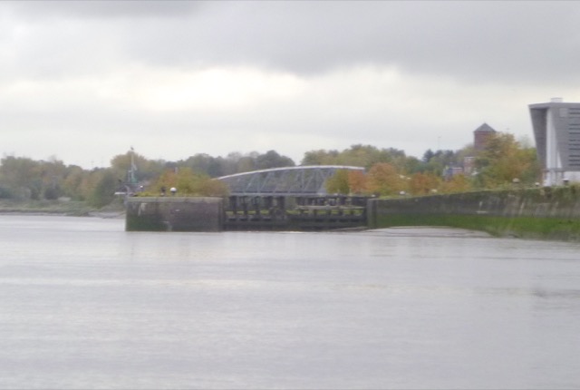
Runcorn chemical works (looking satanic); Lock (abandoned) into
Machester Ship Canal.
The waypoints do not represent the best route - just a sufficiently
deep route for my purposes. Do not rely on them. The channel changes
frequently.
MARLIN trip up Mersey to Widnes October 2018
Enter river from marina at 10.23. Sea state Calm.
Head up Garston Channel. Leave Garston channel at G11 (SHM) and head
for waypoints MER0,...MER7. (see
here for navigation info, some history and more photos).
 |
 |
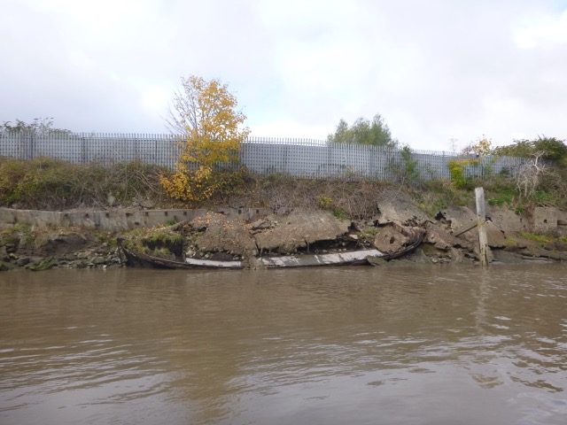
Runcorn Gap from downriver; Barge (flat?) wrecked on shoreline at Widnes.
 |
 |
Repairs to the Runcorn Road Bridge. Marlin at Spike Island.
 |
 |
Ashore 12.00 to 12.20, waiting for the current to slacken. Near Spike Island there is a back eddy with less current. Leave against the current (still incoming).
Crane removing trestle bridge (northern sector); Hale Head Lighthouse
 |
 |
Distance run (over ground) 25.5 nm, all at my displacement speed (7 knots through the water or less).
On this trip I found that the channel has shifted near MER0
and I have revised that waypoint.
See details here.
Sunday 25 November (Liverpool HW 12:09 9.6m). Wind NE 2.
Explore region off Garston and Airport - to clarify issues about
channel near my waypoints MER0, MER01. I was able to check the
depths and locate a deeper channel that runs further south
that my usual route.
Plane landing at the airport (easterly wind so landing near the
in-river gantry):
My tracks (and from earlier 2018 trips) showing Garston Channel at
top, airport gantry marked +, and waypoints:
Sunday 6 January (Liverpool HW 11:16 9.1m). Wind SW 2.
Explore region off Garston, Airport and to Hale Head - to clarify issues about
channel near my waypoints MER0,..MER5. I was able to check the
depths and confirm a deeper channel that runs further south
that my usual route.
Enter Mersey at 9:52 and return 12:20. Calm, mostly overcast.
Airport light gantry:
Hale Lighthouse:
I also explored the deepwater channel that runs close to the Oglet
Shore: this has remains of a Salt Refinery (with Quay) and dumped WW2
tank traps. This is a very peaceful area - apparently enjoyed by Paul
McCartney and George Harrison when children.
Industrial remains on Oglet Shore (quay of salt refinery):
Industrial remains on Oglet Shore (tank traps):
My tracks (and from earlier 2018 trips) showing Garston Channel at
top, airport gantry marked +, and waypoints:
My tracks (and from earlier 2018 trips) showing Oglet Shore at
upper left of centre, Dungeon Point Perch marked + and Hale Lighthouse marked +, and waypoints:
Total distance run: 20.2 nm.
If higher resolution versions of the above images are wanted, please
contact me. All information given in good faith, but please do not
rely on it. Back to index here
The waypoints do not represent the best route - just a sufficiently
deep route for my purposes. Do not rely on them. The channel changes
frequently.
MARLIN trip exploring upper Mersey November 2018


Depths in metres above CD; distances in metres
MARLIN trip exploring upper Mersey January 2019


Depths in metres above CD; distances in metres

Depths in metres above CD; distances in metres
A record of the depth and track of my voyages are available from
teamSurv