Jump to: Upper Mersey, Rock Channel, Meols, Alt, Going North.
I kept a workboat in Liverpool Marina 1989-2024, and made frequent trips, as well as drying out sometimes at low water.
Here I collect what I know about the Mersey area especially as relevant to boat cruising. I should be grateful to receive any relevant information from anyone who can correct, add to, or improve anything contained in this guide. (email: cmi@liv.ac.uk)
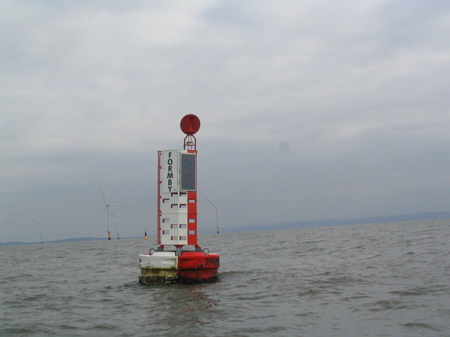
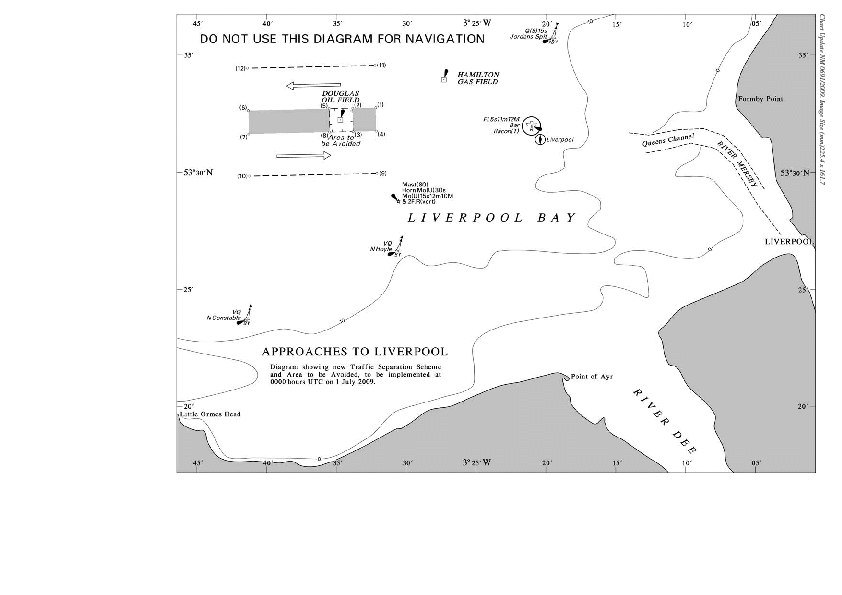
The main shipping channel is well buoyed and starts at the Bar (offshore mark, racon) with the channel proper starting at Formby buoy (mid-channel marker). It is a deep channel, running between training walls and dredged, navigable at all states of the tide. West of the Bar, there is a traffic separation zone either side of the Douglas rig. Also see map.
The Rock Channel provides a short cut for boats coming/going west but is not buoyed and it dries at spring low water. Coming/going north, it is possible to join/leave the main shipping channel around the ALPHA buoy under certain circumstances.
Further in than Liverpool, two channels are buoyed, one going to Garston Docks and the other to Eastham (Manchester Ship Canal entrance and Queen Elizabeth Dock).
The upper Mersey is not buoyed and navigation relies on local
knowledge -- Upper Mersey navigation details here.
Widnes
(Spike Island: Sankey Canal) (West Bank Boat Club
-link dead); and Fidler's Ferry Boatyard have leisure boat
facilities. See also
Fidlers Ferry Sailing Club.
Note that large commercial vessels come into the Mersey and they turn in the river to enter/leave locks or to come alongside the in-river stages. Some visiting ships also anchor/moor in mid river. Mersey VTS (VHF 12) monitors and reports shipping movements. It is strongly recommended to monitor channel 12 when in the Mersey and approaches. It is also recommended to inform Mersey VTS (on Channel 12) when transiting the Mersey.
In the Mersey the main shipping channels should not be obstructed.
Those wishing to anchor should avoid them: this means either using the
area west of Egg-Tower-Brazil buoys (while avoiding the moorings which
may have chains on the seabed - and also avoiding the charted foul area
just south of Tower), or using the area east of Dukes-Puckington Bank-G2
buoys or the area between the Eastham and Garston Channels.
Note that there are charted no-anchoring zones to the north east of
Dingle buoy (near a pipeline) and a strip right across the Mersey
further in (roughly between G6 and G7 on one side and E5 and E7 on the
other).
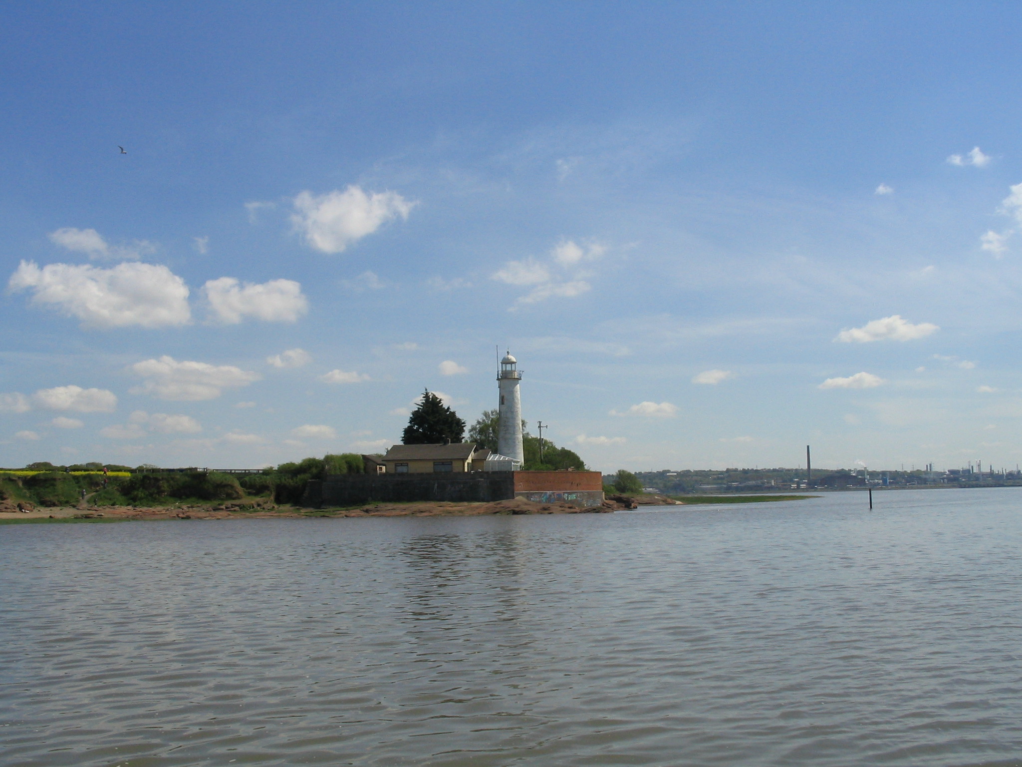
Lighthouses at Leasowe, Bidston, Perch Rock, Hoylake(Upper) and Hale are all disused now. The first two are open to visits at set times, the others are privately owned.
Tidal currents in the Mersey can be strong. The diamonds on the Hydrographic Office Charts show maximum currents (for mean spring tides: 9.3m HW) of 5.2 knots ingoing at HW-2 hours near Puckington Bank buoy and 5.3 knots outgoing at HW+2 hours in mid-channel near Egg buoy. Wind effects plus above average spring tides can both increase these rates.
At Liverpool, the tidal range is 9.3-1.3m at springs; 7.3-3.2m at neaps with a highest astronomical tide range of 10.4-0.0m. Note that on 5 Dec 2013, the Liverpool tide gauge recorded a height of 11.14m (compared to a predicted height of 9.9m) so a storm surge added 1.24m. Also on 23 Feb 2017 (storm Doris) the gauge read 9.4m (1.5m above the predicted 7.9m). Another exceptional high tide was on 10 February 1997 when 10.82m was recorded. Also storm Eowyn (24-2-2025) had a 1.43m surge.
Liverpool tides;
Hilbre Island
tides (close to Liverpool).
For more detail on tidal models for Liverpool see here.
High water is 17 minutes later at Eastham, 30 minutes later at Hale Head, 45 minutes later at Widnes and 75 minutes later at Fidler's Ferry, compared to Liverpool.
Extracts from the 1870 Pilot here . (Of historical interest).
RNLI lifeboats are at New Brighton (Atlantic 85) and at Hoylake (beach tractor launched Shannon and Hovercraft). Within the Mersey Marine Fire 1 is on station.
Notices to Mariners: Peel Ports ; Searchable HO info.
For an up-to-date (zoomable and shiftable) chart (not for navigation)
see Navionics. Or see
here for already centred on Liverpool Bay.
Note that C-Map has a similar online chart
offering. This has the extra useful feature that clicking (selecting -
right-click) gives the lat and long.
New Brighton moorings
Seacombe Mersey Ferry stage.
Birkenhead: Alfred Lock
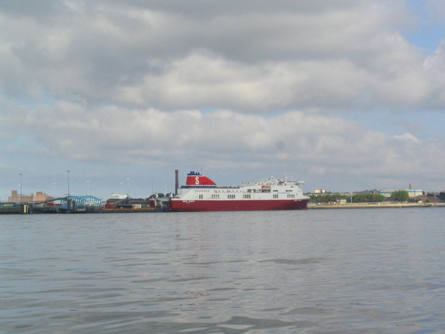
Birkenhead: Belfast and Dublin Ferry stages.
Birkenhead: Woodside Mersey Ferry stage.
Birkenhead: Priory Wharf, road route to it
Birkenhead: Cammell Lairds
Tranmere: Oil Tanker stage.
Tranmere: Royal Mersey Yacht Club moorings.
Bromborough Wharf.
Eastham/Ellesmere Port: QE Dock and Manchester Ship Canal (
Requirements for MSC ).
Also provides access to Weaver Navigation from MSC (see
pix).
See also
Small boats transiting Mersey
Alt.
Gladstone and Langton Locks
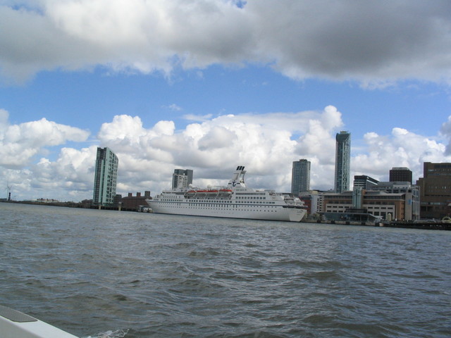
Pier Head: Cruise Liner stage; Isle of Man Ferry stage; Mersey Ferry stage.
Canning Lock to Albert Dock (access HW-2 to HW by prior arrangement: British Waterways 0151 709 6558)
Brunswick Lock to Liverpool Marina. Also Liverpool Yacht Club info. Take care of the sill.
Widnes Spike Island, (Sankey Canal Lock), West Bank Boat Club [features a photo of Marlin alongside]