MARLIN trip into Dee estuary 15 July 2019
Monday 15 July. High pressure. Leave Liverpool Marina at 12:11 (HW 11:00 8.5m; LW 17:46 2.0m; HW 23:20 8.8m). Calm and sunny. Proceed past New Brighton (at 12:40) and through Rock Channel.
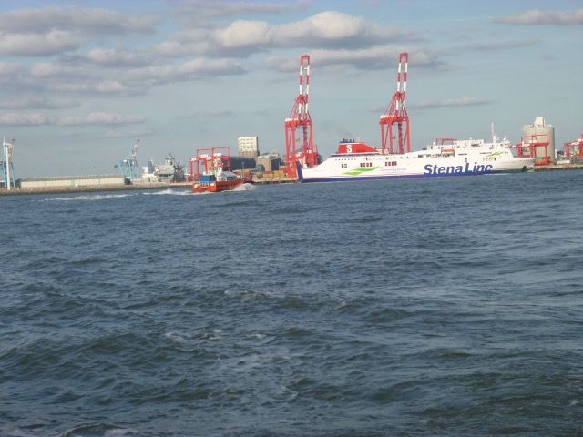
Shipping seen in Mersey:
Stena Forecaster alongside at Birkenhead

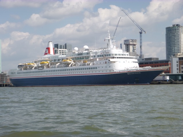
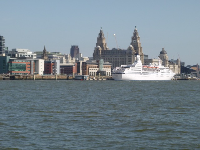
Fred.Olsen cruise ship Black Watch on cruise terminal berth:
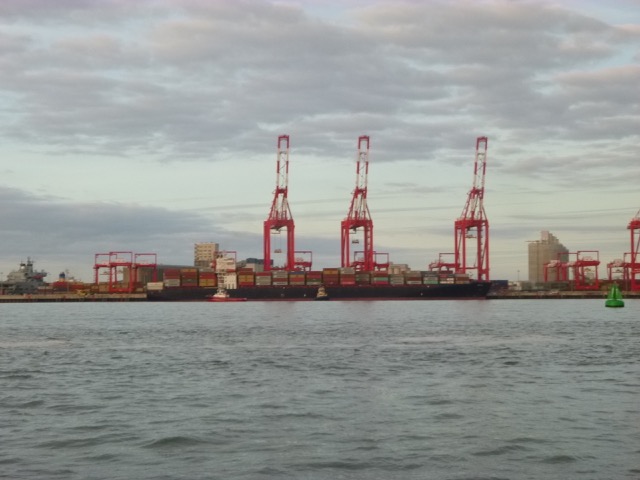
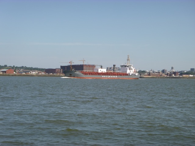
Container vessel Vancouver (SM Line) (278m x 40m) on in-river
container berth:

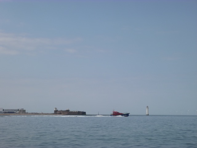
Out-bound Pilot Vessel Kittiwake with New Brighton beyond:
After passing through the Rock Channel (round white buoy "chip" was
in place), I decided to survey a few wreck sites (Ulloa, Resolute). These are
locations where the wreck was reported to have been covered by sand -
but, as the sand banks move, they may reappear. No significant
underwater sonar signal was found.
I also
visited the "Hoylake Beach
Wreck" to check the depth of the seabed around it. It was marked by
two plastic cans - presumably one at each end. The seabed I found, using
tidegauge data for Liverpool, to be close to 3m above CD. There is a prominent
scour also.
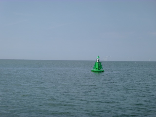
Hilbre Swash buoy HE3:
Hilbre:
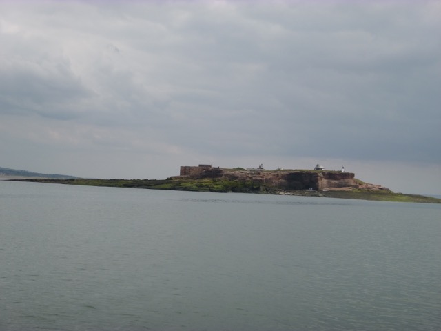
I rounded the end of Hilbre Island at 2:35 with adverse current. The
seals were lying on the SE tip of the Hoyle Bank - which was only just
dry at that time.
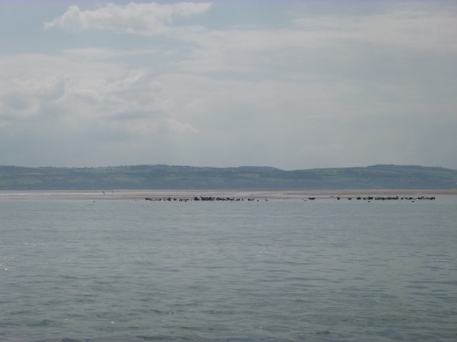
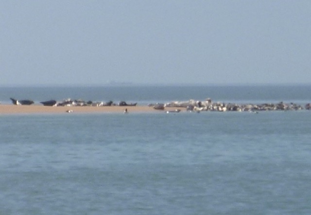
Seals on the Hoyle bank:
I wanted to be able to get back to Liverpool Marina by first lock
(tidal height 6.5m), so surveyed the area just south of the SE point of the
Hoyle bank - looking for a suitable spot. There was a flat area and I
anchored at 3:03 with 0.8m depth under my keel. I was eventually
aground at position 53°22.112N, 3°14.199W by 3:55 and I went
overboard to check my anode, stern gear and hull.
At this location the seabed depth was about 2m above CD, using
Liverpool tidegauge data. So just above LW level on that day.
I also took a walk around - taking care not to disturb the seals.
There was a drainage channel right next to the Hoyle Bank - which was
knee deep to cross. The weather was sunny with slight wind.
Also taking advantage of the fine weather, a group of about 10 small motorboats had gathered further south of my position (on Salisbury Middle Bank) and stayed there over low water - possibly collecting cockles, since the season usually starts in early July.
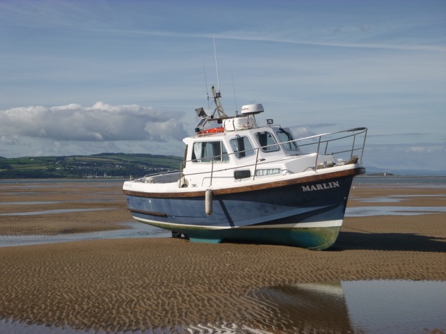
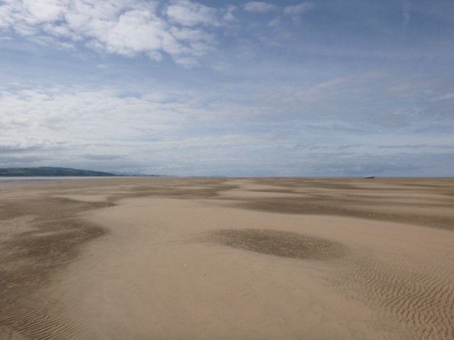
Marlin aground (Middle Eye beyond, drainage channel in foreground):
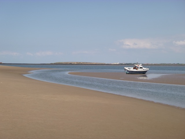
View of the channel running SW, towards Wales, alongside the Hoyle Bank:
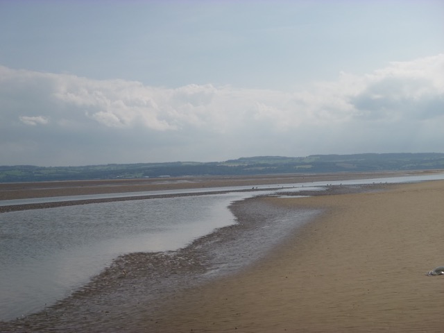
View from Hoyle bank of Marlin aground at LW, looking up Dee Estuary:
I was afloat by 7:05 and returned via Hilbre, He3, my waypoint for crossing the East Hoyle Spit, my waypoint Corner, the Rock Channel, into the Mersey. Crossing the East Hoyle Spit had least depth 3.5m, whereas the direct route from there to Corner crossed the North Bank at 8:16pm with least depth of 1.8m under my keel.
In the Mersey, I passed the Hopper Dredger Amazone (76x14m) doing
something or other (most probably unloading "arisings" from Royal Seaforth
Dock) while almost stationary near the Tower Buoy.

Reach Liverpool Marina by 9:05. There were about 7 boats waiting to enter, including two small fishing boats.
Trip out 17.0nm, back 14.4nm.
Liverpool HW 16:36 7.7m; LW 23:26 3.1m
Friday 23 August: After some boat chores on my berth at Liverpool
Marina, leave through lock into Mersey at 5:12pm. Sunny and calm.
Mersey Endurance (bunker vessel) alongside at Pier Head.
Stena Lagan Ferry passing Seaforth Container Terminal with windfarm boat also:
Pass New Brighton at 5:53 and head through Rock Channel, over North
Bank, over East Hoyle Spit, towards Hilbre.
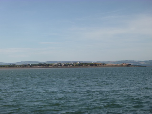
View of Snowdonia:
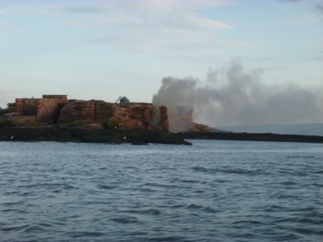
Nearing Hilbre, great clouls of smoke were rising - as if part of
Hilbre Island was on fire. As I turned Hilbre Point, I could see that it
was coming from a fire at the base of the cliff - possibly from burning rubbish.
Wind was light but from the north and as I continued up the Dee, I
passed through the smoke which had a plasticky smell.
As the wind was forecast to strengthen from the SE overnight, I
decided to anchor in more shelter off Thurstaston. I arrived off
Thurstaston at 7:45 (HW+3 hours). The offshore bank (that runs NW-SE) was
uncovered - although the other banks in that area were still covered.
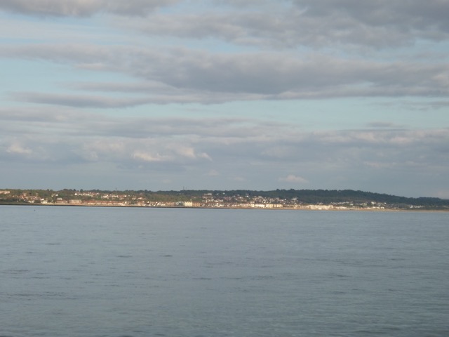
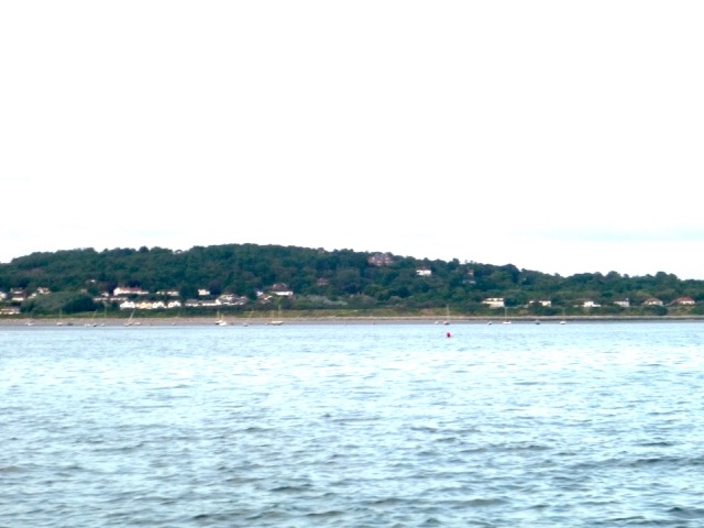
West Kirby moorings seen from the deep channel, with Cubbin's Green behind.
Bank (dry at 7:45, charted from 1987 survey as drying 4.4m, but now
drying more than 5.4m) off West Kirby with buoys also dry.
I nosed into the channel into Thurstaston (as used by me in 2015) and found that it was
considerably less deep than hitherto. I anchored off in deeper water
(4.6m under my keel) at 53°20.468N, 3°11.693W at 8pm. There is
some current at this location, but my anchor held firm all night.
Impressive cloud formation over North Wales:
16nm run.
Saturday 24 August (Liverpool HW 5:07 7.7m, LW 11:55 3.1m, HW 17:41
7.3m).
I planned to set off around HW (assuming enough light) to explore
several areas of the Dee Estuary. I set off at 5:55 with SE force 3
wind and clear skies (sun rise at 6:20 behind the Wirral shore). I
headed into the Thurstaston moorings following my previous tracks. I was
surprised to find much less depth in the outer section. Since I live
overlooking this area, I had not expected this significant change.
Taking advantage of my daily walk along the cliffs overlooking this
sea area, it looks like the deepest channel into the Thurstaston
moorings now runs to the NE of the prominent bank (running NW-SE)
described above. This was also confirmed by the Wesy Kirby Sailing Club
boatman - who says the channel runs 50 metres or so from the "ark".
Sunrise over the Wirral shore.
After reaching the deeper channel further in and near to the
Thurstaston moorings, I turned around to
explore the West Kirby moorings. I cut across, via the "ark" to these
moorings. At this time (6:20, HW+80mins) the outer vessels on the West
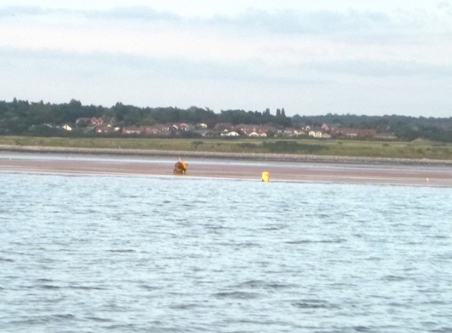
Kirby moorings were still afloat. I left the moorings heading SW to
regain the deep channel, passing a yellow buoy SHELL (marking this route?).
Vessels moored at West Kirby:
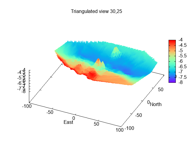
My tracks and depths (depth in metres above CD using Liverpool tide
gauge, distances in metres). West Kirby moorings at centre top,
Thurstaston moorings at far right. This trip into Thurstaston
was shallower (orange track) in entry. Crossing waypoint DeeX (+) is just SE of
waypoint (+) marking Dee1 buoy.
I then crossed the next bank (covered at that time) near my waypoint DeeX and rejoined the main
channel up the Dee (which passes buoys Dee1, Dee2, Dee3, etc). I had
attempted to find the direct channel from near Dee3 to Mostyn on a previous trip and had set up a
waypoint marking this. I now attempted to check out this short-cut. At
6:54 (HW+110mins) I was near this waypoint when the depth ran out on me.
Not wanting to go aground on a falling tide, I turned around and
retraced my route via Dee2 and then passed Dee1 and West Bar. By 7:30,
I had reached the MF buoy (fairway to the new Salisbury Channel into
Mostyn).
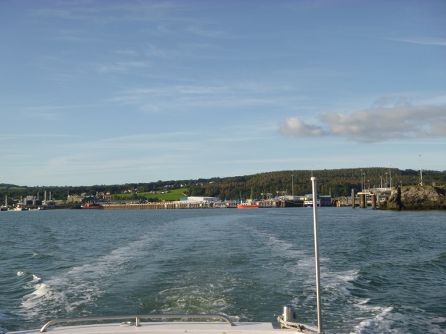
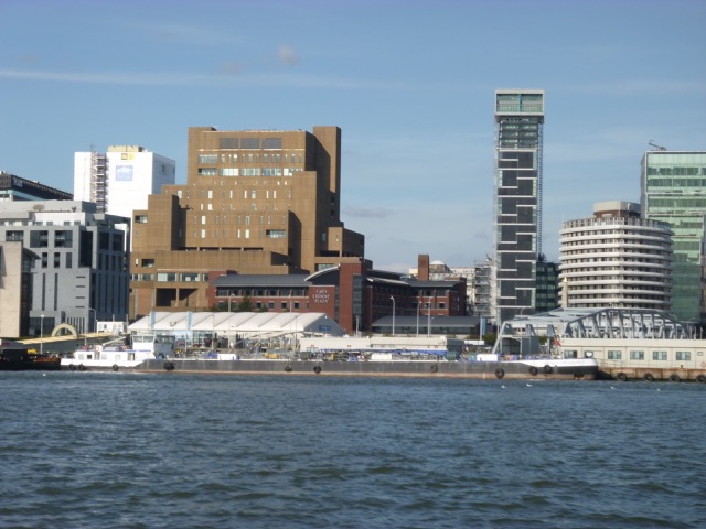
Mostyn Docks:
I then headed out via the mid-Hoyle channel (buoys Salisbury Middle,
Dee, East Hoyle Spit, Mid Hoyle, Hoyle, NW Hoyle). I planned to survey
the area around the wreck of the Ceylon, since some new
information has been reported by a 2019
survey of a nearby "new feature" about 65m N of the Ceylon (now
both sites are charted) - this does seem to be present:
Sonar survey of Ceylon wreck:
The wind was SSE force 3-4 hence the Dee Estuary had waves building up -
so ruling out some of my usual places to dry out at LW. I decided
instead to seek the shelter of the shore by anchoring close inshore NE
of Hilbre island. There are some obstructions here (the Thomas which I reported to the Hydrographic Office)
to be avoided. I crossed the Hoyle Bank and arrived at my anchorage
(53°23.512N, 3°13.015W) at 10:30 (LW-90mins). Siesta and lunch
time.
Wildlife seen: a seal watched me for a while and the wind (offshore)
blew a dark butterfly/moth aboard for a while. Because it tried to hide
under things - I guess it was a moth: Cinnabar or Burnet. It was quite
large (Peacock Butterfly size). It was last seen being blown further
offshore - next dry land being a wind-turbine or the Isle of Man.
Hilbre Island from my anchorage:
I set off again at 2:05pm and headed across the East Hoyle Spit (via
my waypoint) and then crossed the
North Bank near my waypoint "corner" at 3:05. I headed through the
Rock channel and locked in to Liverpool Marina at 4:15.
Cement Carrier CEMGULF outbound from Runcorn:
Cruise ship ASTOR (CMV vessel mainly taking German passengers) on
Liverpool cruise Terminal. 41nm run.
Liverpool HW 18:25 7.6m; LW 01:17 3.1m
Saturday 7 September.
Leave through lock into Mersey at 7:00pm. Sunny, wind N 2 and small swell
Mersey Endurance (bunker vessel) alongside at Pier Head.
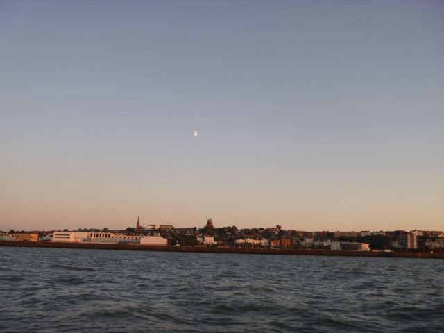
Moon (half-moon) over New Brighhton.
Pass New Brighton at 7:38 and head through Rock Channel (buoy "chip"
not evident), over North Bank, passing close to the Hoylake Beach Wreck, over East
Hoyle Spit, towards Hilbre. Sunset was at 7:50 but one could still see
from the reflected sunlight in the sky, and, later, from the moon.
As the wind was forecast to drop overnight, I
decided to anchor off West Kirby - in the fairly deep channel. At 9:05
I was anchored at 53°21.144N 3°12.553W in about 8m.
It was fairly calm and quiet overnight.
14nm run.
Sunday 8 September (Liverpool HW 7:11 7.3m, LW 14:03 3.4m, HW 19:50
7.5m).
I planned to set off before HW to explore several areas of the Dee
Estuary, even though it was a very small (neap) tide. I set off at 6:30
with N force 1-2 wind and clear skies (sun rise at 6:45 behind the
Wirral shore). I headed into the area of the West Kirby and Thurstaston
moorings and explored the locations of the various locally-laid buoys
(by doing a 360° turn around them). Large cylindrical yellow buoys
are racing marks (SHELL, SWC, A) as is the smaller OSM buoy near West Kirby SC
"ark".
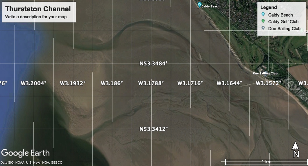
Later [2023] Google earth image of access to Thurstaton:
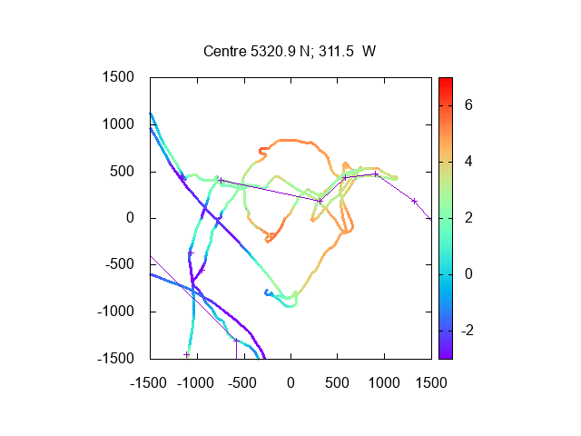
My tracks (from this trip and that of the previous month) are shown
(with depths in metres above CD using the Liverpool tide-gauge data 10
minutes later) and distances in metres.
West Kirby moorings at centre top,
Thurstaston moorings at far right. Top of offshore bank is just SW of
centre.
The two outer waypoints (at 53°21.00N, 3°11.22W and at
53°21.12N, 3°12.17W) are near locally-laid buoys.
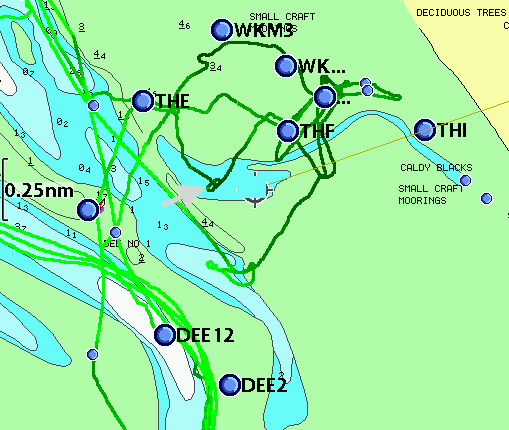
My 2018-9 tracks on HO chart. Darker is shallower. The arrow points to
the buoy marking the offshore bank - which is not correctly represented by the
HO chart (the bank has moved inshore and got higher).
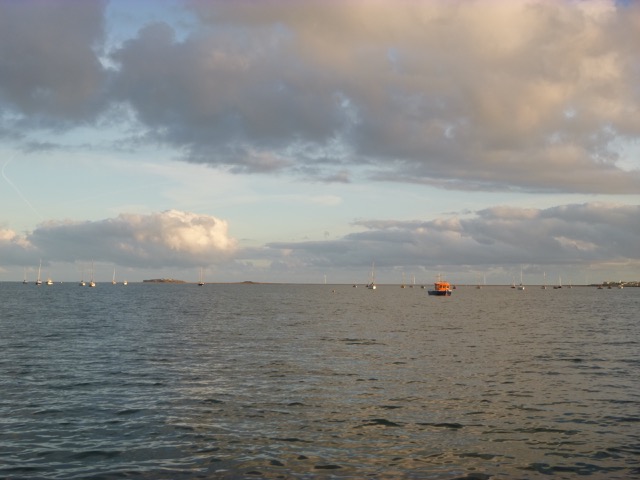
Vessels moored at West Kirby (with "ark" nearest and Hilbre in the background).:
I then crossed the next bank (covered at that time) near my waypoint DeeX and rejoined the main
channel up the Dee (which passes buoys Dee1, Dee2, Dee3, etc). I had
attempted to find the direct channel from near Dee3 to Mostyn on a previous trip and had set up a
waypoint marking this. I now attempted again to check out this
short-cut. At 7:55 (HW+44mins) I was near this waypoint, and unlike in
August, the depth was sufficient - though only 0.8m
under my keel. I was able to carry on, passing Llanerch y Mor (disused
"fun-ship") and Mostyn Docks.
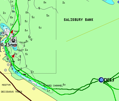
My 2018 and 2019 tracks on HO chart. Darker is shallower. Mostyn at left, Llanerch
y Mor at bottom.
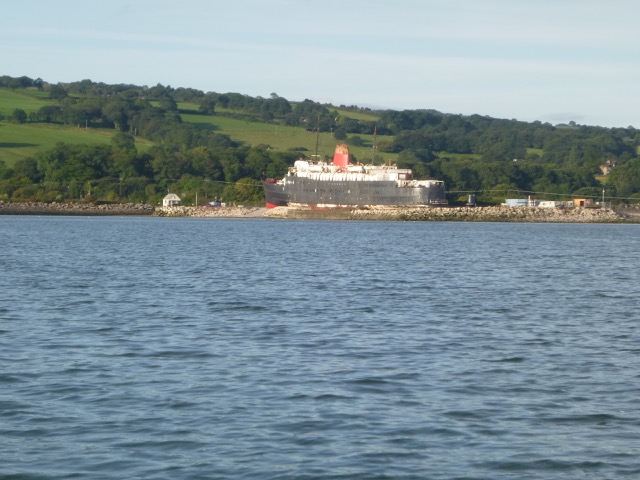
Abandoned vessel Duke of Lancaster
at Llanerch y Mor:
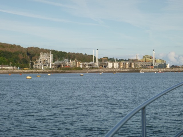
Mostyn Docks (moorings to SE):
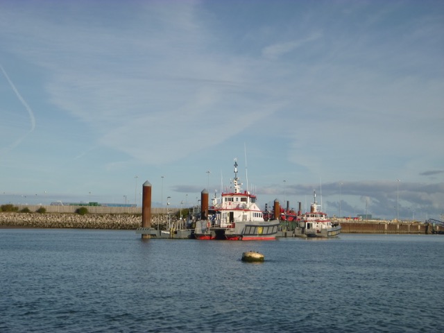
Mostyn Docks (pontoons for wind-farm boats):
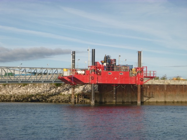
Mostyn Docks (jack-up rig alongside quay):
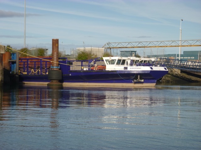
Mostyn Docks (Afon Dyfrdwy, which brings Airbus wings from Broughton):
Mostyn Docks (view leaving):
I then headed out via the Salisbury channel (buoys S4,..S1 etc), to
the main channel up the Dee. I continued out past buoys MF and SalMid
to the Dee buoy. My plan was to explore "Welshman's Gut". Many years
ago, this was a buoyed route along the inshore side of the Hoyle Bank -
there was a buoy (SE Hoyle) marking it. Indeed it was used as the
preferred route by the steamers linking Liverpool
and Rhyl before the railway was built. It is now only viable near
HW and the HO chart has depths recorded from a survey dated 1994. The
HO chart seems to suggest heading east from buoy Dee towards the part of
the Gut I know, which is just south of HE4 buoy. Wrong! This is too far
north since the Hoyle Bank has moved substantially south since the HO
survey. I ended up on the north side of the highest part of the bank.
No problem since the sea state was calm - but another example of my rant
Not for Navigation.
At 9:05, I was aground and the seabed was dry around my position
(53° 22.144N, 3°15.559W) at 9:45. At low water, I walked around
the Hoyle Bank - the highest point was quite close to the ESE of my
position: it seems to dry more than 6.8m. I could see that the southern
edge of the Bank was some way away (at a position estimated as near
53°22.00N, 3°15.31W).
I took advantage of my longer-than-planned stay to remove fishing
line from my propellor (another rant: shoreside anglers near the marina
lock entrance don't pull their lines in sufficiently) and to tidy up
generally - in warm and sunny weather. I must have had a square mile of
clean firm sand to myself at low water. There were some yachts anchored
near the SE corner of the Hoyle Bank (my usual location too). Note that
my position is not recommended: as the tide comes in, you are not
sheltered from waves unless it is very calm offshore. Although I had
the Hoyle Bank to myself, there was a lot of action above me: as well as
birds, there were frequent small private planes on jaunts.
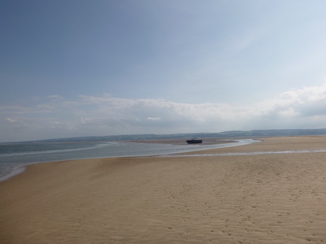
Marlin aground on the Hoyle Bank, with Point of Ayr Light-house
in the distance.
Sand, glorious sand: Marlin in the distance.
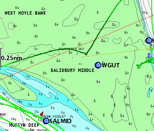
My track across Hoyle Bank with darker being shallower. The kink is
my dried-out position. The waypoint
WGUT is my estimate of the southern edge of the bank - by direct
observation on foot.
I was afloat again at 6:02pm and headed directly in very calm seas
around the north Wirral shore and into the Mersey.
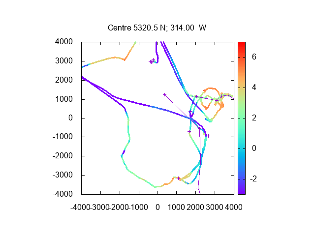
Overview of my tracks (and depths) from 2019 trips into the Dee
(Mostyn at lower left, Thurstaston at middle right, Hoyle Bank at top).
West Kirby from the Hoyle Bank.
ORCA 1 (294x32m) alongside the Seaforth Container berth.
The Mersey was unusually busy near the Pier Head. Isle of Man
High Speed Ferry Mannanan had just left, Tanker Yellowstone had just swung off Tranmere,
Inbound tanker Jutlandia Swan had just passed heading to Eastham,..
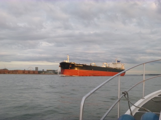
Tanker Seaways Yellowstone (250x44m) heading out past me after leaving the Tranmere
tanker berth, with 2 tugs accompanying.
After a speedy passage, lock in to Liverpool marina at 7:25.
28nm run; 41.9 in total for both days.
A record of the depth and track of my voyages are available from
teamSurv
If higher resolution versions of the above images are wanted, please
contact me. All information given in good faith, but please do not
rely on it. Back to index here MARLIN trip into Dee estuary 23-24 August 2019


MARLIN trip into Dee estuary 7-8 September 2019
Since my trip in August, I had realised
that the previous deepest
water route into the Thurstaston moorings has moved and now lies to the
NE of the prominent offshore bank. This bank
has a large orange spherical buoy marking it (with a yellow racing mark
nearby in summer) - and, since I only had 1.1m under my keel there at
6:50, I estimated that it dries 5.6m above CD (chart datum) near the
buoy and dries even more nearby (top at approximately 6.5m from
observations from the shore) where I did not survey. Note that this
bank is higher and inshore of that charted as drying 4.4m by the HO.
This route into the Thurstaston moorings seems to have a least
depth of about 3m above CD - so at half-tide, one has 2m depth.