Introduction
Experts from the University’s Department of Geography and Planning are working alongside two small companies to revolutionize the way in which safe navigation is monitored. The research is exploring how data from satellites, radar monitoring stations and numerical models can be combined to detect changes in water depth close to the coast, and thus minimize the risk of ships running aground.
Led by Dr Jonny Higham, a lecturer in contemporary processes and dynamics, the project also involves two UK maritime SMEs; Marlan Maritime Technologies Ltd and Satellite Oceanographic Consultants Ltd (SatOC).
The project applies novel data analysis methods (machine learning and modal decomposition) to monitor changes in the pattern of waves on the sea surface. From these patterns, the research aims to isolate the effect of changes in sub- and intertidal bathymetry due to siltation or moving sandbanks. Project outputs will alert port operators to significant reductions in the depth of access channels and the position of dynamic sedimentary features, therefore effectively target dredging operations to address emerging navigation hazards.
The project is one of eleven projects funded by Maritime Research and Innovation UK (MarRI-UK), a Government and industry backed initiative to boost collaborative innovation and jointly tackle key technology challenges in UK Maritime. The MarRI-UK initiative is supported by the UK Department for Transport (DfT) and aids the development of technological innovation to improve the services and operations of UK Maritime.
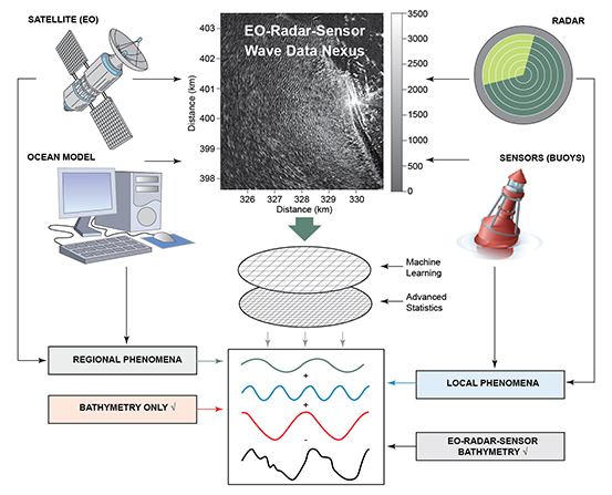
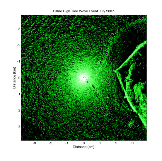
The development of a commercial service for ports is being led by Marlan Maritime Technologies Ltd., a Liverpool-based maritime company and has collaborated with the University’s environmental scientists on a number of projects since 2012 including PhD projects and a Knowledge Transfer Partnership. Marlan operate a network of land-based radars around Liverpool Bay which monitor wave conditions and changes at the coast. The radar monitoring feeds a bank of data, known as the data nexus - along with numerical model output, satellite imagery and instrumental observations – which is then analysed to reveal the patterns of erosion and deposition on the sea bed.
SatOC is a UK-based SME specialising in the applications and exploitation of satellite oceanography. SatOC supply satellite and model data to the data nexus which provide essential wider regional data on wave conditions.