Sediment Sampling and Topography Survey
The Quaternary Environmental Change Laboratories at Liverpool have extensive capability for field survey terrestrial/aquatic geomorphic-systems and the sampling of soils and sediments from marine, coastal, lacustrine, fluvial, wetland and aeolian sedimentary sequences. This has included the development of bespoke systems for sampling the sediment-water interface in lakes and a large-volume general purpose for sampling waters through the water column of lakes.
Topographical survey is facilitated using our differential RTK GPS (Topcon and Trimble R6), a scanning total station (Trimble VX), and pool of terrestrial laser scanners (Riegl LPM-321 and Focus3D X 330). These equipment and expertise are available for high resolution site investigations and topographical survey.
We undertake shallow geophysical survey of sediment sequences including ground penetrating radar survey, resistivity and shallow seismic methods. We have capability for recovering shallow boreholes to ground truth stratigraphy and for sediment sampling using a shallow (<10m depth) un-cased Eijkelkamp petrol powered vibrocore powered by percussion hammer (Cobra TT).
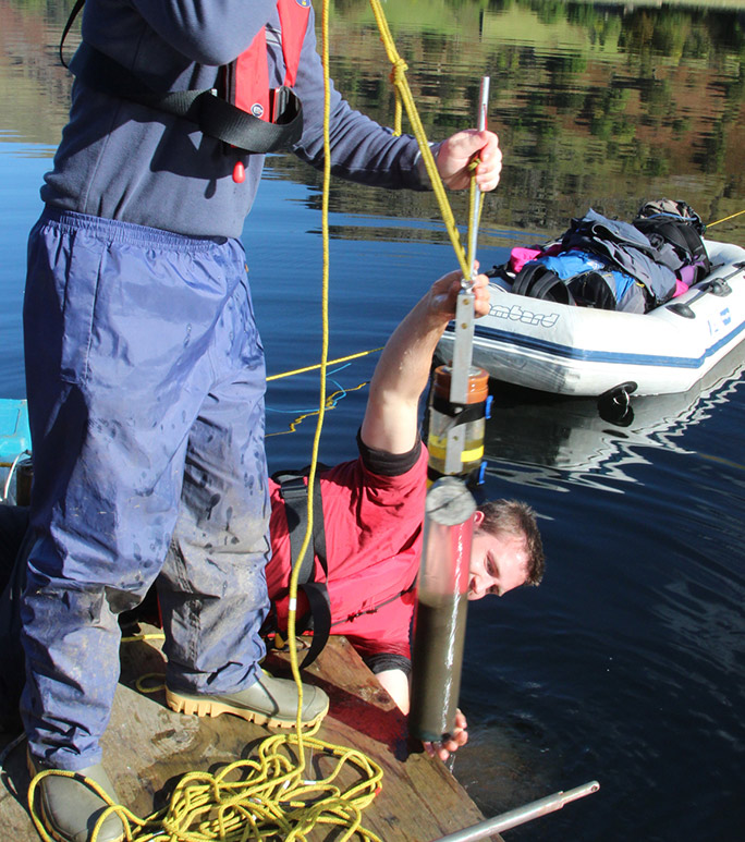
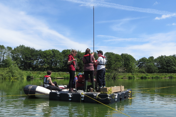
For soft sediment sampling, coring and stratigraphy, we have Open water platforms and five inflatable boats for lake research with a GPS echo-sounder for bathymetric survey, YSI and Aquaprobe Multisensor sondes for water quality measurement, rod Russian style sediment coring to ~25m depths, sediment water interface sampling (Boyle corer), Eijkelkamp shallow water Beeker piston (5m) and freeze coring. Rod-based coring for soft sediments (peat, lake, estuarine) includes other Russian-style, Livingston Piston, Wardenaar peat sediment samplers.