I have previously attemped to visit Morecambe: first in 2012 when I failed to get near; and then in 2017 when I got as far as Morecambe and moored, but did not go ashore since the current and waves were too much for my tender. Then in 2018 when I found a reasonably deep route in, but failed to pick up a mooring, so left.
Using the route of my previous trips, I planned to approach in good weather and then have the option to go ashore.
Monday 8 July: leave Liverpool Marina 6:04 (Liv HW 3:53 9.1m; LW 10:54 2.0m; HW 16:26 8.7m), Calm and overcast with SE 2-3 wind.
There were quite a few vessels in the Mersey:
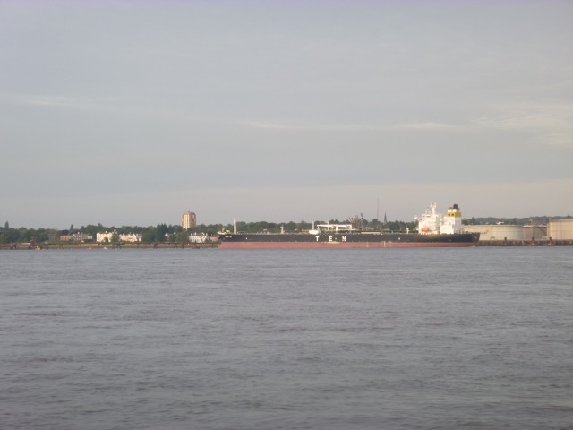
Tanker Sola TS (250x44m) on Tranmere oil stage unloading crude. She
had been involved in a curious accident (on 8 Nov 2018) as she was
leaving the oil terminal near Bergen when she was hit by a Norwegian
Navy frigate Helge Ingstad which was disabled by the collision, went
aground, and sank.
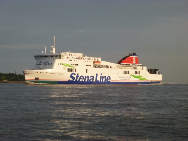
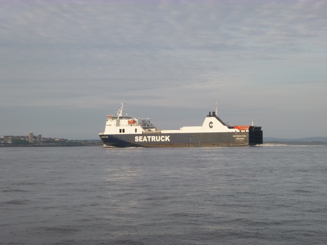
Ferries Stena Lagan and Seatruck Pace:
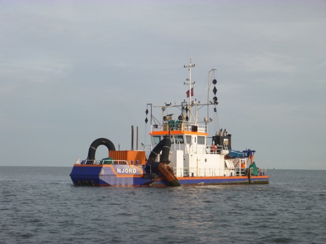
Dredger Njord water-jetting the seabed near Crosby buoy. Beware
vessels with so many shapes strung up - here "carrying out underwater
operations"; "safe side to pass" - both sides.
Out via the shipping channel until ALPHA buoy when I took my shortcut going north at 7:16. Head past Lennox Rig with views of Blackpool. Current somewhat adverse after heading north.
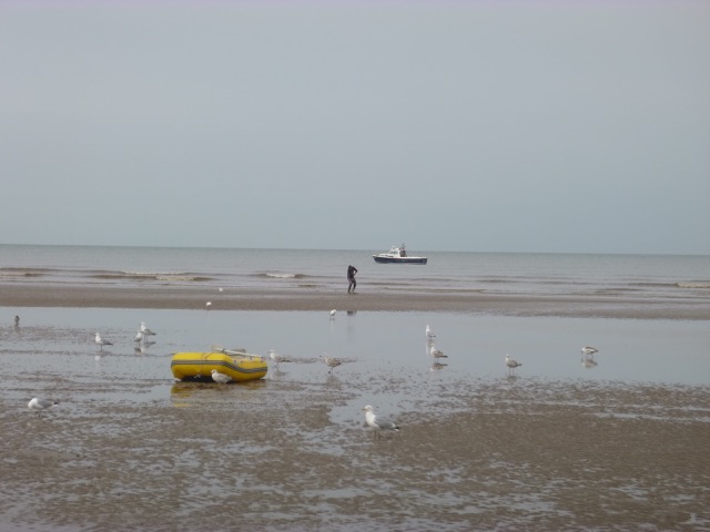
As the wind was offshore (SE), it was calm and I decided to take the
opportunity to go ashore at Blackpool. LW was at 10:54, so I could row
ashore before LW, leave my tender at the waters edge, then retrieve it a
similar time after LW.
I anchored between the North and Central
Piers (opposite Blackpool Tower) in 1m depth under my keel at
53°48.855N, 3°4.008W. I rowed ashore and pulled the tender up a
bit. It was a bit muddy on the sand in places. At LW, I noticed
obstructions seaward of the Central Pier - presumably some remains of
a longer pier [it was reduced in length by 300 ft in the 1970s]..
As I walked up the
beach, the lifeguard came in his buggy to see me. He was a bit
perplexed: apparently inflatables are banned on the beach - to avoid
people being swept out to sea, I suppose. I assured him that my tender
was a "boat" not an "inflatable" - and he agreed, especially since I was
wearing a lifejacket.
I found a coffee shop nearby and had a bacon roll to go with it. As
I returned, I saw the donkeys lined up, waiting for trade.
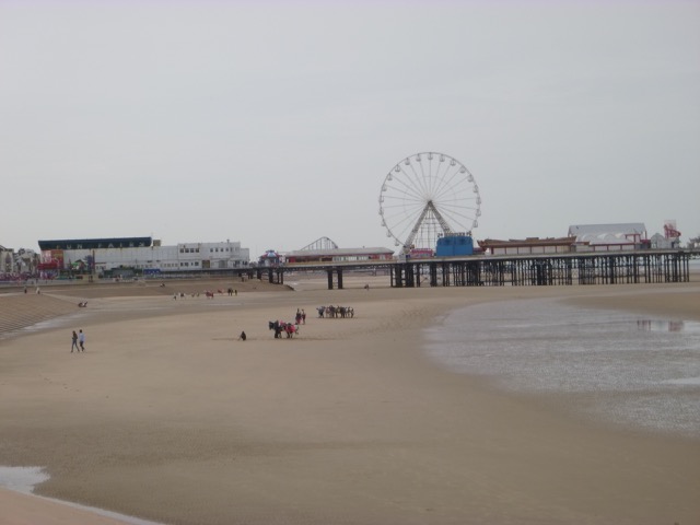
As I retrieved my tender, I talked to a man getting worms for bait with a clever tube device. I was back aboard at 11:08 and set off at 11:30. There were some small fishing boats around.
Views of Blackpool: Tower with North Pier; Big One at South Beach.
I headed north quite close inshore. I passed Rossall Point (with
the curious leaning building housing the National Coastwatch Institution
lookout) at 12:30. There is a pipeline marked by 3 beacons in line. I
have crossed it previously - and this time I passed outside the
innermost beacon at 12:30 with quite a surface disturbance from the
flood tide over the pipeline: I found least depth under my keel of 2m
with 4m in the surrounding area.
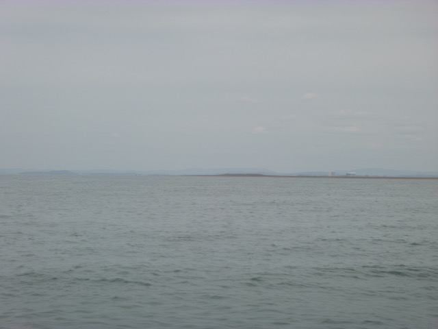
I rounded the North Bank to head into Morecambe bay. The NW corner
of this bank is called King Scar on the chart. Some wrecks are marked
nearby - though with no name assigned by the HO. The Faroese fishing
schooner Stella Marie was
lost hereabouts in 1941.
See here
for location of wreckage.
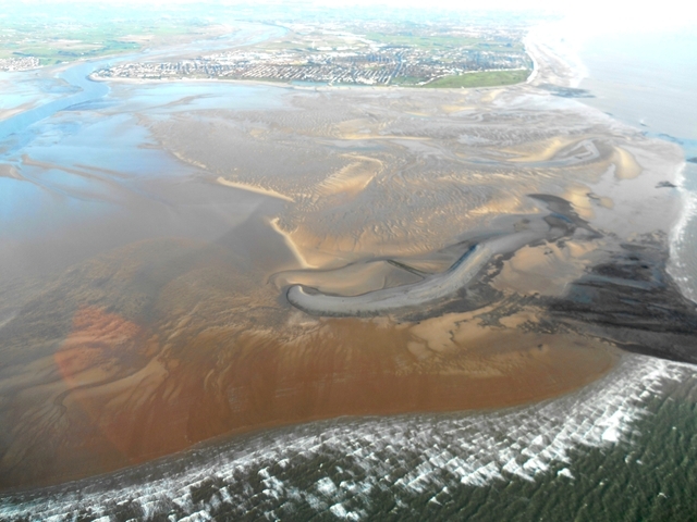
Aerial photo
of King Scar and the shingle "island":
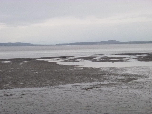
The view from the sea is less clear - though the "island" is
prominent.
Cutting the corner, as ever, to head into the Lune Deep, I found one
quite shallow spit with surface disturbance and small boats fishing
nearby. I then headed across the charted channel (which leads into
Heysham) and then towards my waypoints MCB1, MCB2 and
MCB3.
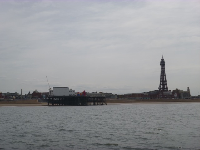
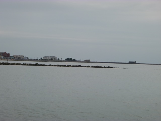
Stone Pier, commercial moorings and Midland Hotel.
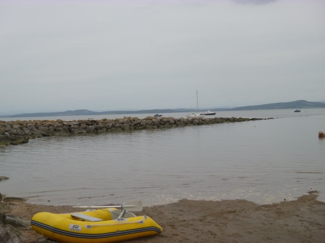
Row ashore at 4:05 with calm sea and almost no current. The depth
was about 2.9m under my keel at that time. A man
working on his boat confirmed that the seabed near where I was moored
was firm sand but with an ankle-deep covering of mud. I then walked
along the promenade to the centre - the clock tower marking this. I
found a suitable chippy and afterwards had a quick drink at the Pier
Hotel (which had live music). It started to drizzle, so I returned
aboard by 5:30.
Marlin moored at the leisure moorings near HW:
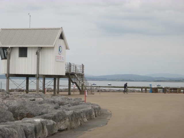
Morecambe Sailing Club "hut on stilts" with Marlin moored in the distance.
By 8:00 I was aground and using the "weed box" [ Propellor
Clearance Box] to reach my stern
gear from inside the boat and using my tender as a platform to keep the
mud at bay, I was able to sort out the rope around my prop and moor
properly to the chain. I also managed to retrieve my anchor easily
(apart from it getting rather muddy).
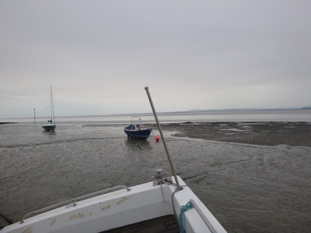
The leisure moorings near LW (from my moored position) (some nasty
looking obstructions appeared further offshore of the moorings).
It was calm overnight, though one squall came over - which surprised
me by the change in sound.
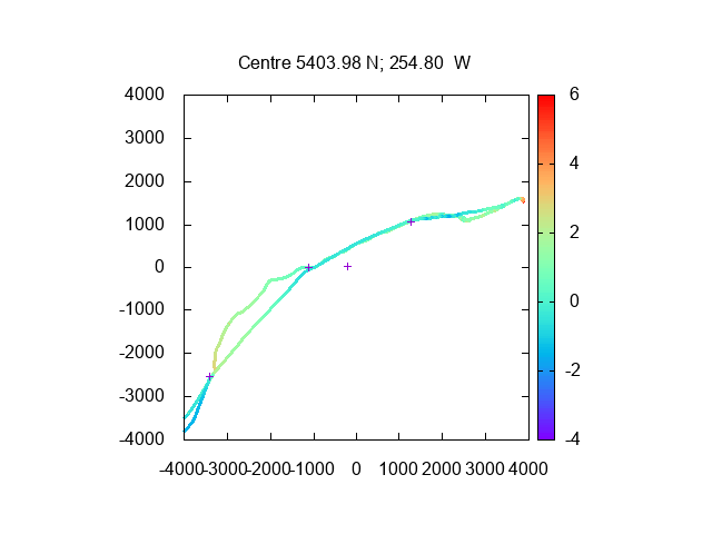
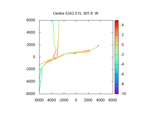
My track into and out of Morecambe (mooring at far right; waypoints
MCB1, MCB2 and MCB3; also an extra waypoint for going to Heysham).
Depths over CD in metres using tidegauge for Liverpool 13 minutes
earlier. Distance in metres.
Tuesday 9 July Liv HW 4:48 8.3m, LW 11:48 1.9m, HW 17:24
8.4m.
I got up around 4:30 with rain falling but quite calm. I managed to
get most of the mud off the tender and set off after breakfast at 5:00.
It was now a falling tide, but I retraced my route from the day before
and, of course, the current was favourable. Visibility in the rain
showers was only a mile or so, but it improved in between. By 6:30, I
was off King Scar and then I headed over the pipeline (depth jump from
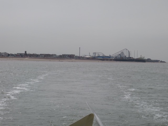
8m to 7m when crossing). I passed Blackpool Tower at 7:50 and the South
Pier at 8:05. It was half tide at around 8:20, so I decided to head up
the Ribble to anchor over LW. See
Ribble Pilot Guide from 2010. Unlike a previous trip made at neap
tide, I found it difficult to locate sufficient depth when approaching
the waypoint RIBE [Waypoint E, now also called Bravo in the Ribble Pilot
Guide] marking the start of the channel proper. With a falling tide, I
did not want to get stuck, so decided to anchor off the Ribble Estuary
mouth - just south of it and east of the Gut buoy in 6m. It was fairly
calm with wind from the west at force 1-2 and occasional rain. I stayed
there from 9:30 until 12:12 to wait for a favourable tide to get into
Liverpool.
My tracks in the outer Ribble Estuary from this trip
and earlier ones (waypoint RIBE at left; Lytham mooring at right).
Depths over CD in metres using tidegauge for Liverpool 10 minutes
later. Distance in metres.
I then set off to buoy Alpha in the shipping Channel (reached at 1:54) and
then carried on into Liverpool in the Channel.
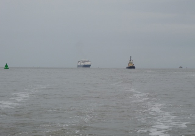
Shipping seen included the
inbound container vessel Atlantic Star (296x38m)(with 2 tugs to shepherd her into
Gladstone lock):
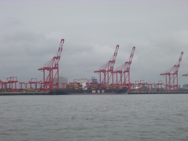
Container ship MSC Pilar (294x32m) on the in-river berth:
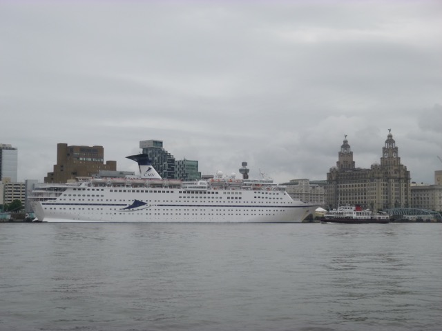
CMV cruise ship Magellan on the cruise terminal berth:
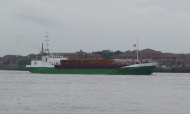
Irish coaster Ayress (sound like heiress)(78x13m) carrying timber logs
from Campbeltown to Birkenhead (waiting off Alfred Lock):
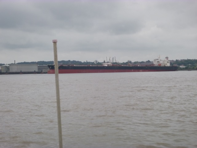
Tanker Aspen Spirit (274x48m) on the Tranmere oil stage (previous
port was in USA):
I locked into Liverpool Marina at 3:33 with a wind-farm boat
and a fishing charter boat.
Trip mainly at my displacement speed of 7 knots through the water.
Total distance 100nm.
A record of the depth and track of my voyage is available from
teamSurv
Clicking on an image should give a higher resolution picture. If
even higher resolution versions of the above images are wanted, please
contact me. All information given in good faith, but please do not rely
on it. Back to index here
The banks, inshore of King Scar itself, have risen in height
in recent years. There is a long strip that is dry at even the highest
tides. It has moved inshore a bit in recent years. The Coastwatch
quote [1.9nm seems a bit too far from their Tower];
KingScar Shale banking: 330° from
Rossall Point Tower 1.9nm. Approx 1/2 nm in length running
240/060°, 50 to 75 yards in width. Numerous sandbanks and gullys
leading out to King Scar can result in the unwary becoming trapped by
incoming tides which have up to 10 metre range.
Note that the Hydrographic Office Chart of Morecambe Bay is
mostly out of date (circa 1966 or earlier) except for some parts of the
channel into Heysham (2015) and a small section from Yeoman Wharf to Grange
Channel (also 2015). The Kent Channel (between Clark Wharf and Clark Wharf
Spit) is partly from a 1964 survey. As described in my earlier visits, I rely more on Google
Earth images. As I followed my waypoints, I noticed a sandbank north
west of MCB1 that was still dry (at HW(Liv)-3 hours).
I arrived at the Stone Pier at Morecambe at 2:10 (HW
Morecambe -2:20) and inspected the area with commercial moorings for a
possible location. A fishing vessel, that was leaving, advised me that
there were chains everywhere, so anchoring was not advisable.
Since I was planning to go ashore, I proceeded on to the
leisure moorings which are beyond a Y-shaped groyne. There was just
sufficient depth around the outer moorings and I spotted a free one. As
I attempted to moor to it, some rope got around my stern gear. I decided
to wait until low water to fix that and stayed attached, also putting
out an anchor for extra security. The depth was about 0.8m under my keel
at 2:40 (HW-2 hours). I decided to wait until near HW, in order to be able to leave
my tender near the HW mark - which would be less muddy.