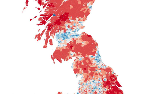
Introducing AHAH – the index of ‘access to healthy assets and hazards’ (2016)
The Geographic Data Science Lab are proud to announce the full release of their new data resource containing a whole suite of health indicators including the index of ‘Access to Health Assets and Hazards’ (AHAH).
AHAH is a new multi-dimensional index for Great Britain measuring how ‘healthy’ neighbourhoods are derived from data on:
- Access to retail outlets (fast food outlets, pubs, off-licences, tobacconists, gambling outlets)
- Access to health services (GPs, hospitals, pharmacies, dentists, leisure services)
- Quality of the physical environment (green space, air pollution).
It allows researchers and policy makers to understand which areas have poor environments for health and helps to move away from treating features of the environment in isolation to provide a comprehensive measure of neighbourhood quality.
AHAH is produced for Lower Super Output Areas for England and Wales, and Data Zones for Scotland. Estimates are produced for 2016 and we will update the measure annually.
All of the individual inputs have also been made freely available in the data resource as well in a push for opening up small area health data. It provides one of the most comprehensive free data resource available for such data.
Data can be freely accessed at http://maps.cdrc.ac.uk/. AHAH and the individual input variables are are located under the ‘indicators’ tab. Data can be downloaded from http://data.cdrc.ac.uk.