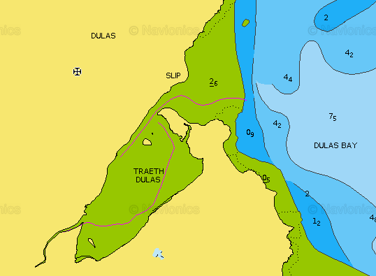
Dulas Bay is on the NE corner of Anglesey. It has an offlying island (Ynys Dulas) and several rocky reefs. There is also a large sheltered area (Traeth Dulas) which is mostly very shallow.
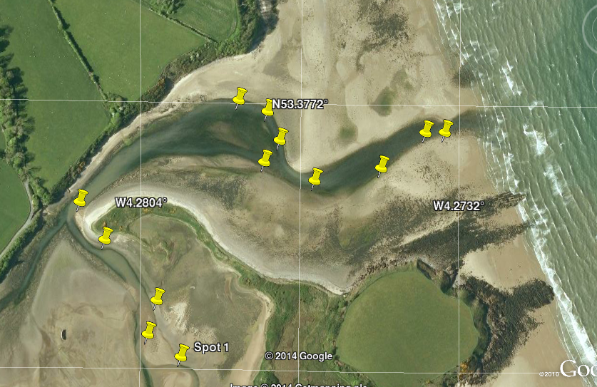
Dulas Bay from the 2015 Hydrographic Office sea-chart; Traeth Dulas entrance from Google Earth (2009) with waypoints marking shore side of LW channel (measured by CM in 2014) of Afon Goch.
| |
|
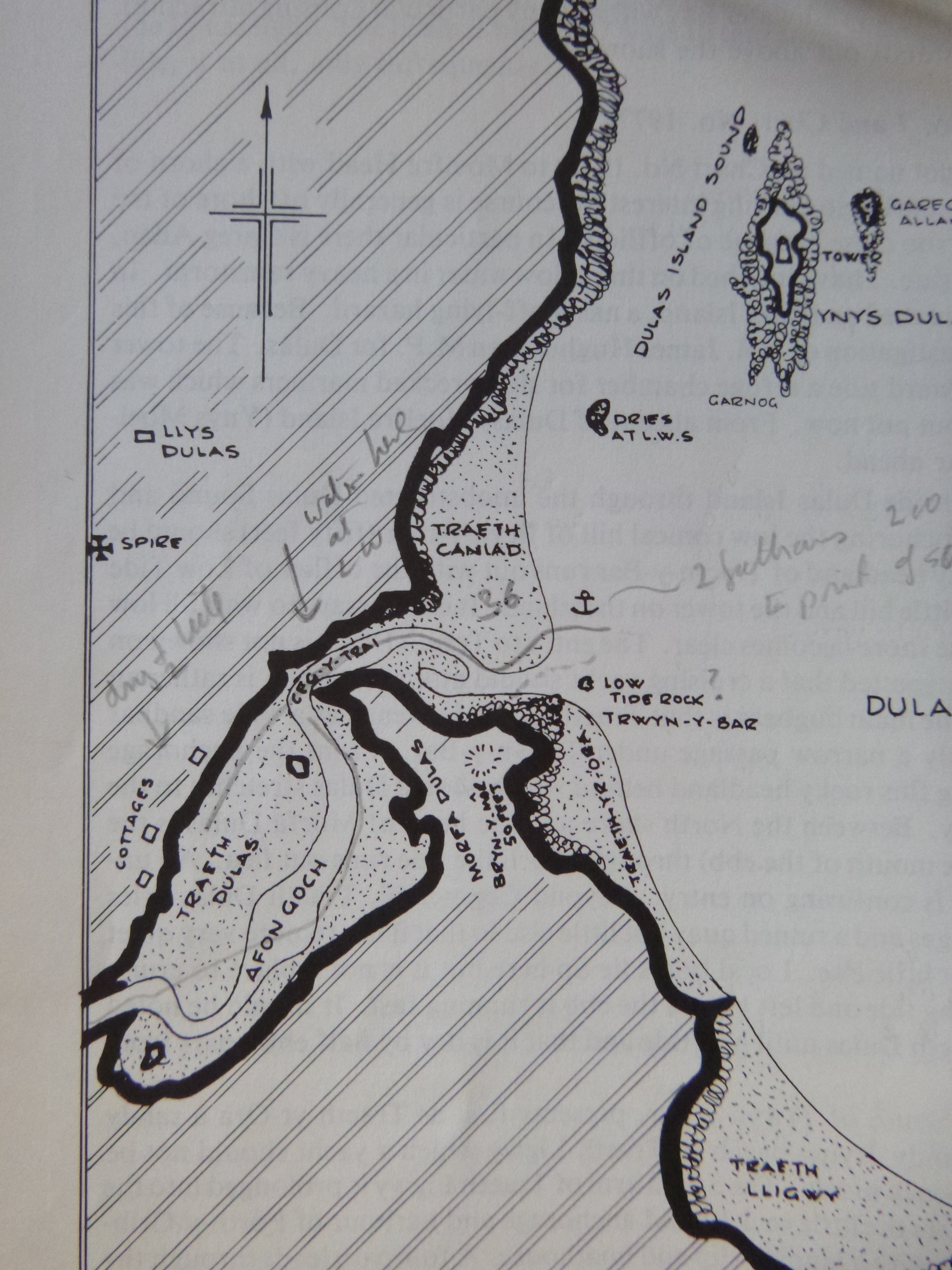
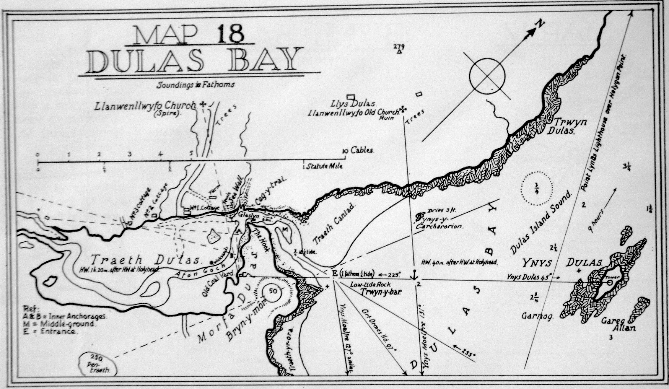
Sketch map from Glazebrook's 1961 Pilot [large file; depths in fathoms at LWS]: click here . This shows 4.5 ft depth in the access channel at half tide. It also warns that the ebb current at Ceg y Trai can be up to 6 knots so this is not a suitable place to anchor.
Sketch map from 1977 Guide to Anglesey:
 |
The Cruising Guide to Anglesey and the Menai Straits 1977:
The approach to Traeth Dulas involves passing (on your starboard
side) the outer spit, Treath Caniad, which covers at half tide. The
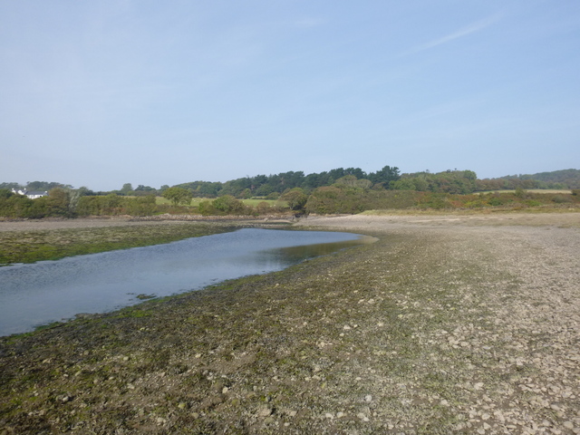
narrow mouth (Ceg y Trai) to Traeth Dulas has fast tide current. The
flood reaches Traeth Dulas at half tide. It is dry at half ebb apart
from the trickle of Afon Goch. This guide reports that Traeth Dulas has
a ruined quay.
There are two wooden wrecks in Traeth Dulas. At one time the area was more active with ship building taking place.
I have explored this area by sea: surveying depths in the entrance
August 2014 ,
August 2015 and (earlier). I have also walked the area at
LW, locating the edge of the channel (of the river Afon Goch) by GPS
(using my phone).
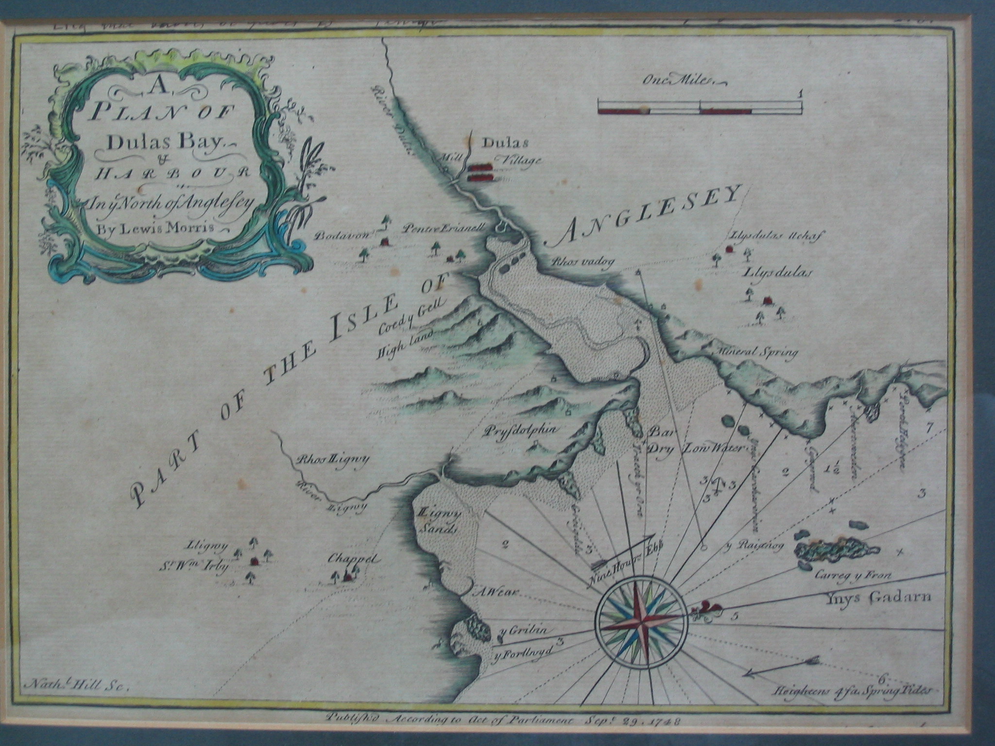
One reason for my interest is that the Lewis Morris set of charts of
1748 includes a chartlet of
Dulas Bay.
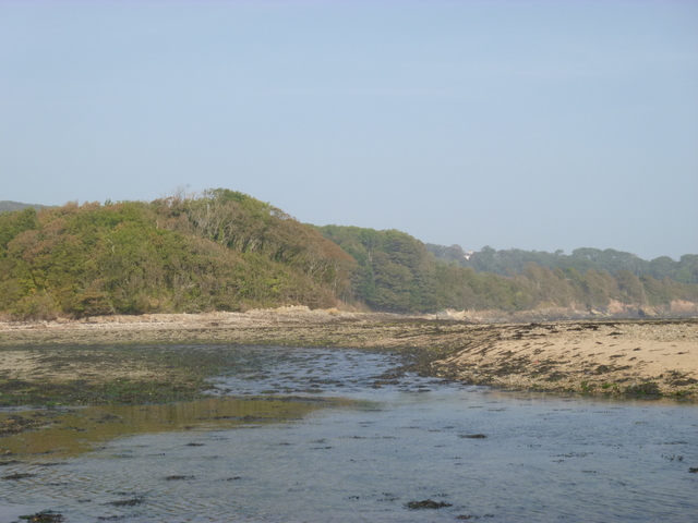
Images from visit at LW in 2014: corner of outer spit (which is covered at half tide); fork in channel behind outer spit (take right fork) ; narrows looking outwards.
 |
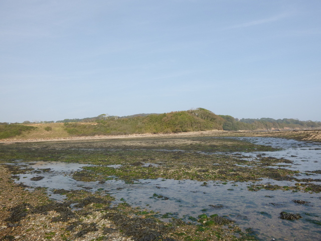 |
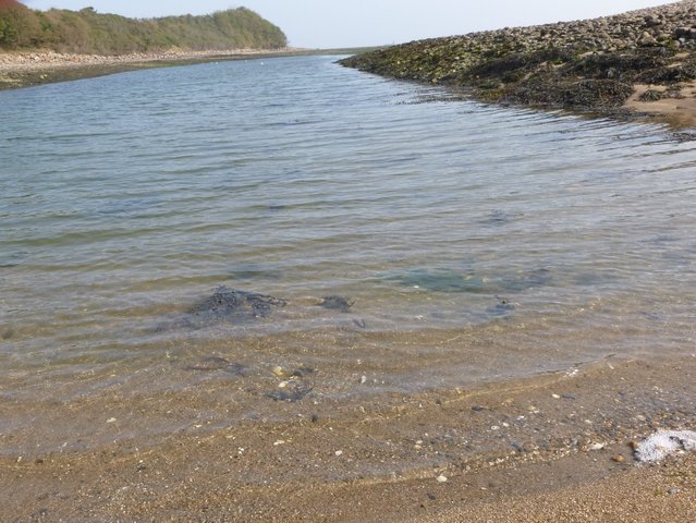 |
Fork after Narrows with Afon Goch to left; Afon Goch channel behind inner spit (looking towards Narrows).
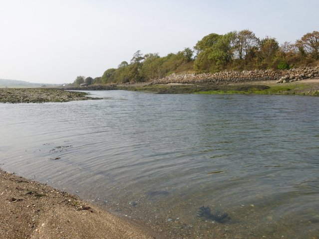 |
 |
The results from my boat surveys have been reduced using the Llandudno tide gauge depths (from the actual time of survey). Llandudno has a mean tide level of 4.1m and MHWS of 7.5m.
Depth surveys (distances in metres and depths in metres above Chart Datum):
Entrance to Traeth Dulas (my waypoints are shown also).
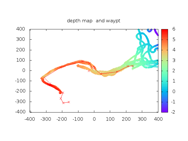 |
The entrance to Traeth Dulas has water at half tide (4.1m depth above CD) up to the narrows. Sufficient depth depends on boat draft. On a big tide (spring or above), there is plenty of time to get into the narrows and beyond around HW.
Ynys y Carcharorion (centred on 53 22.97 N, 4 16.23 W)
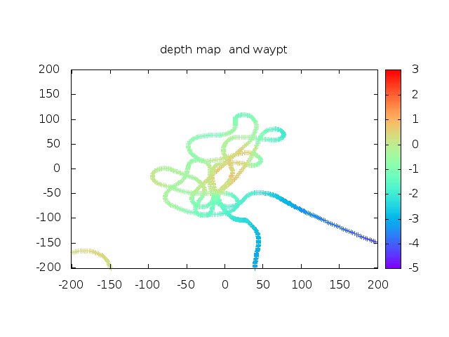 |
This survey shows that Ynys y Carcharorion is 75m north of charted
position (shown as green blob in dark blue area north of entrance to
Traeth Dulas) and that it will be awash at LW springs.
The name means Prisoners' Island and tradition is that prisoners
were left there at low water to drown.
All information given in good faith, but please do not rely on it.
Back to index here