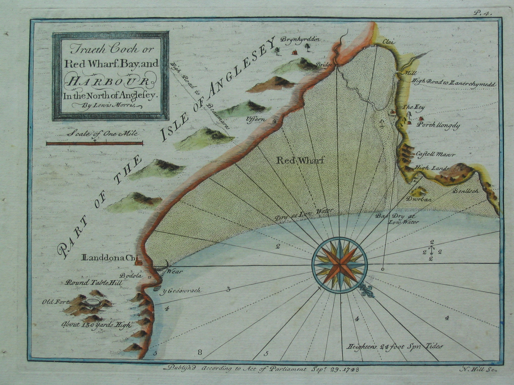
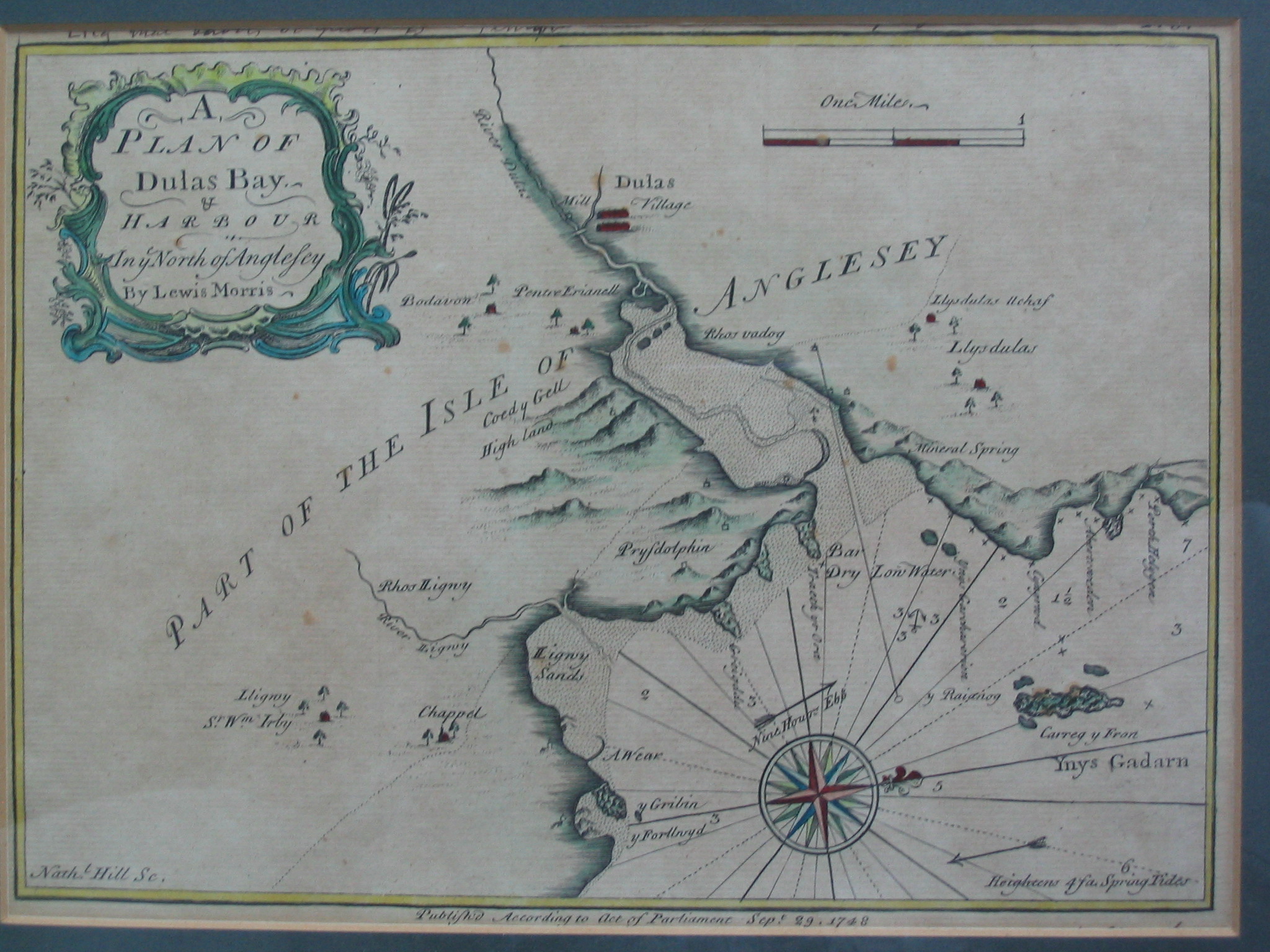
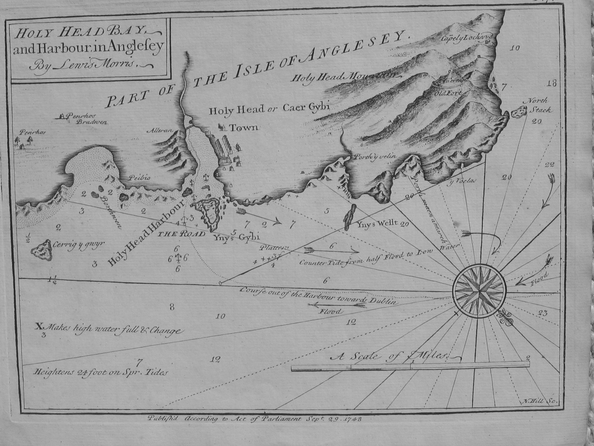
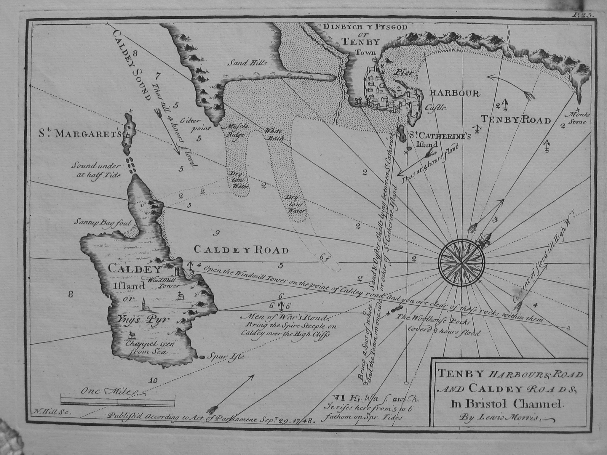
Plates (from Lewis Morris original or from later William Morris reprint):
These are each quite large files: about 1 Mbyte
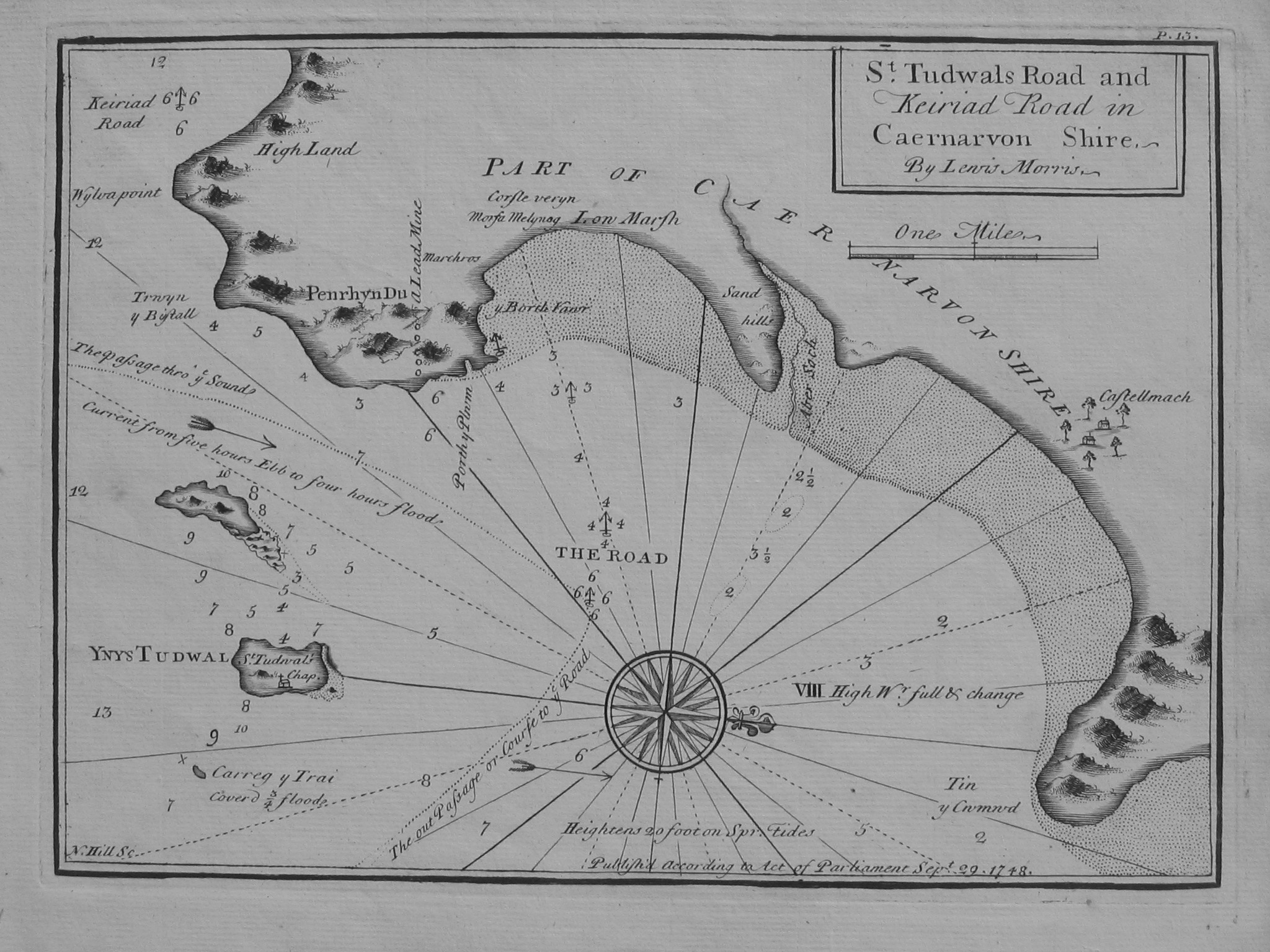
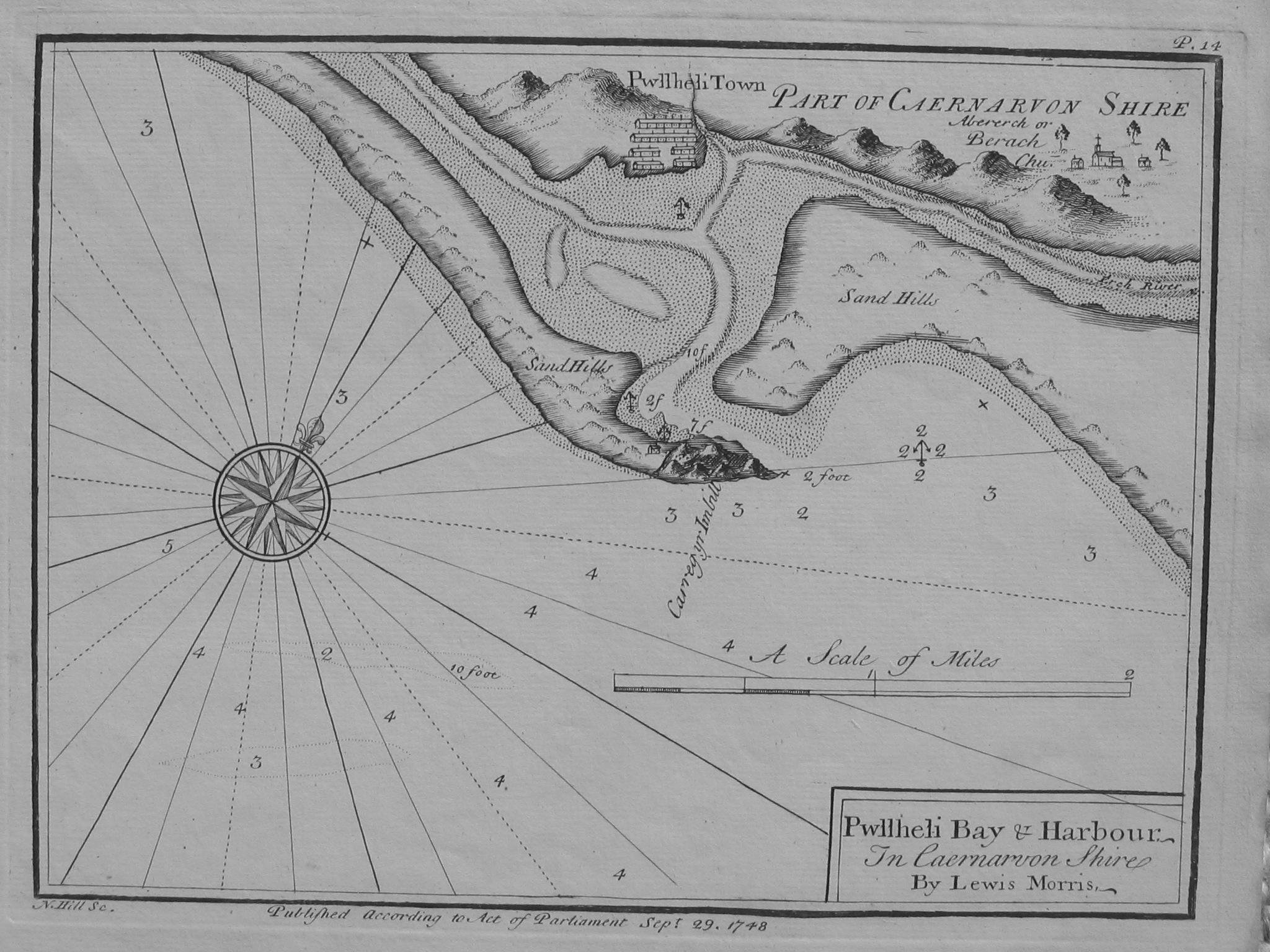
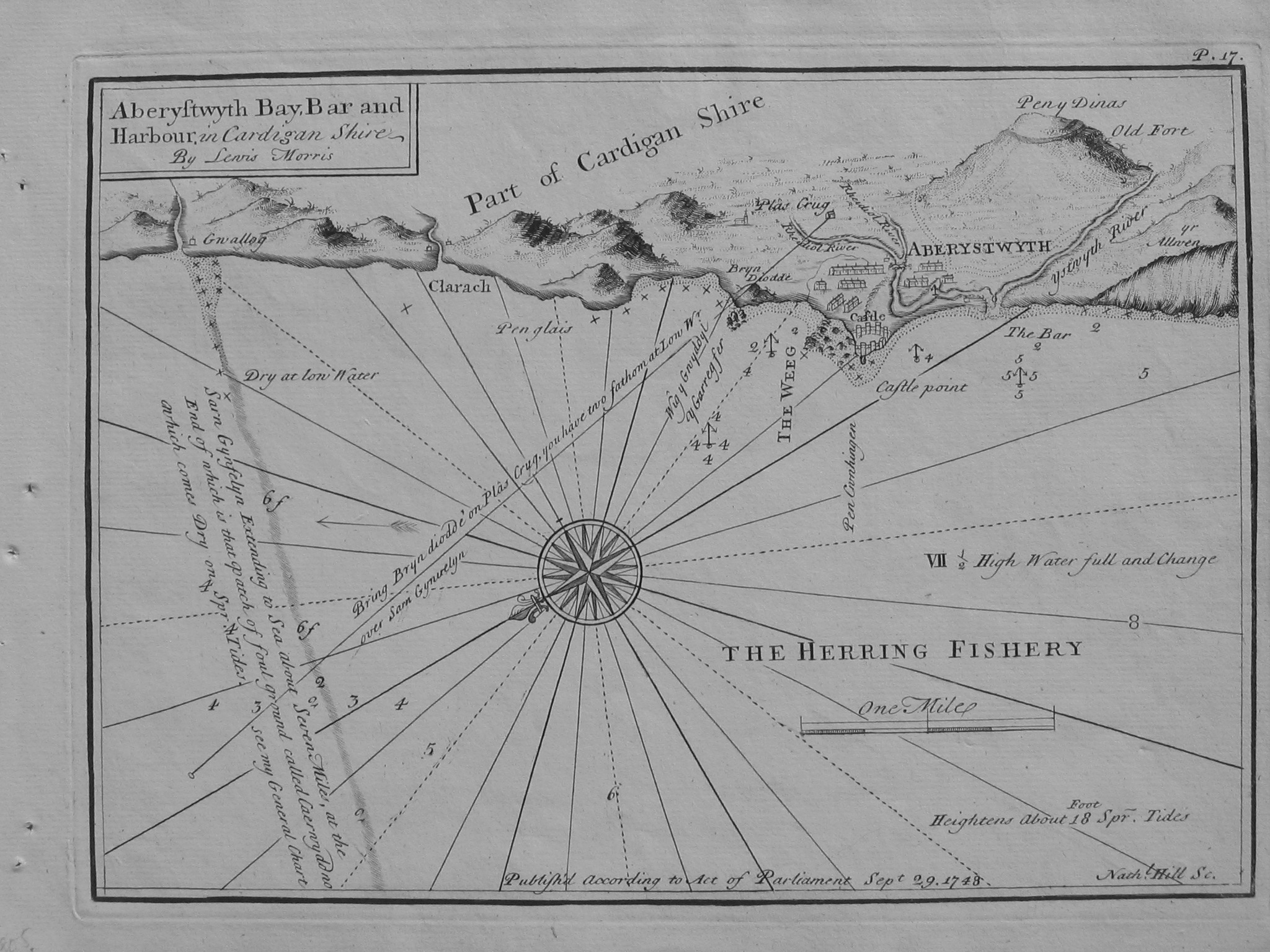
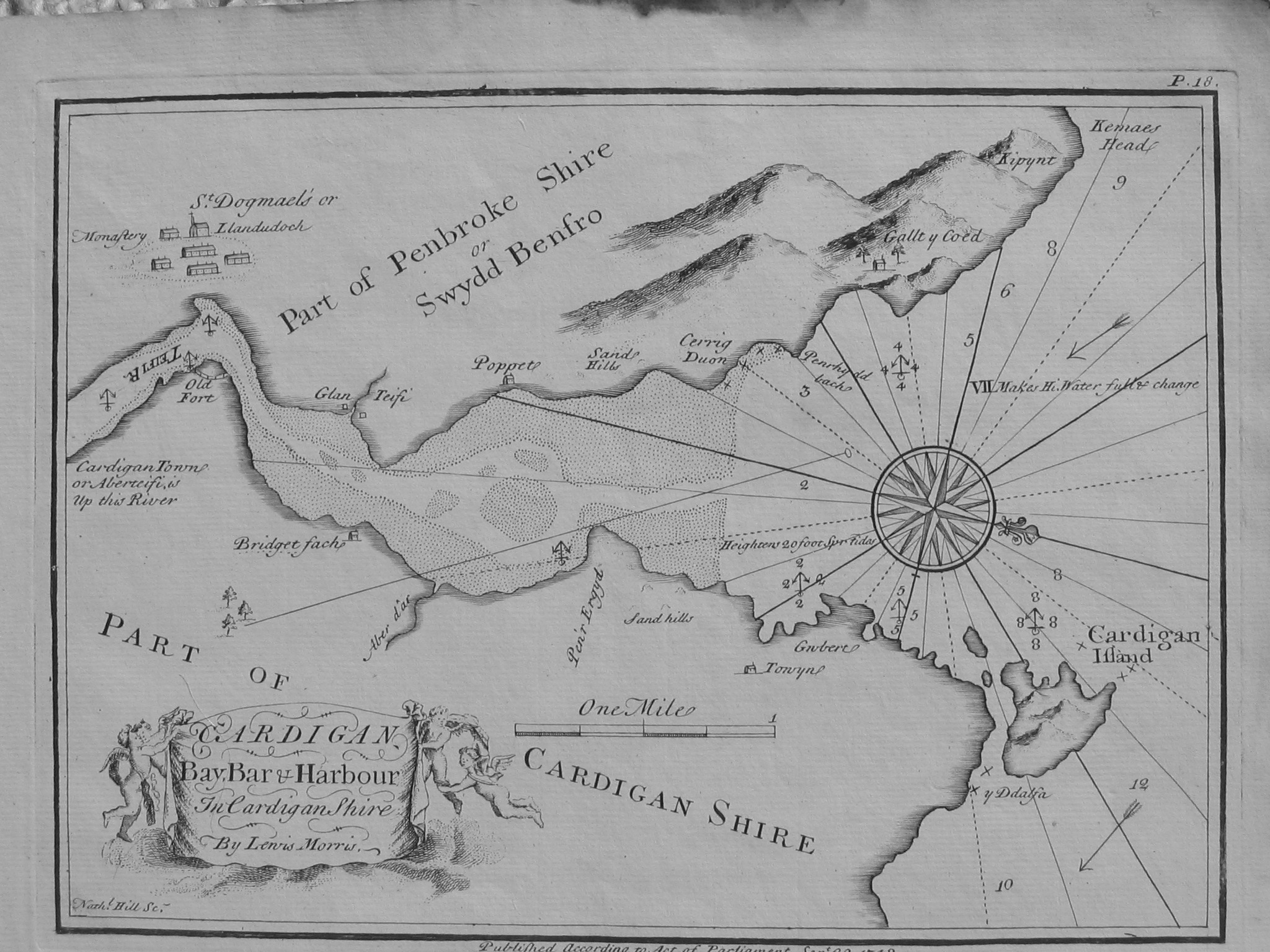
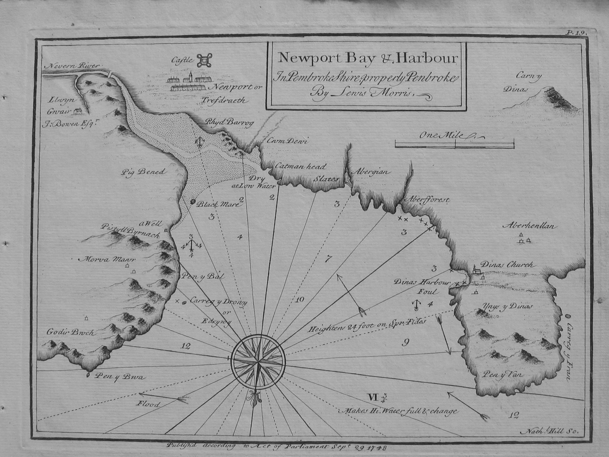
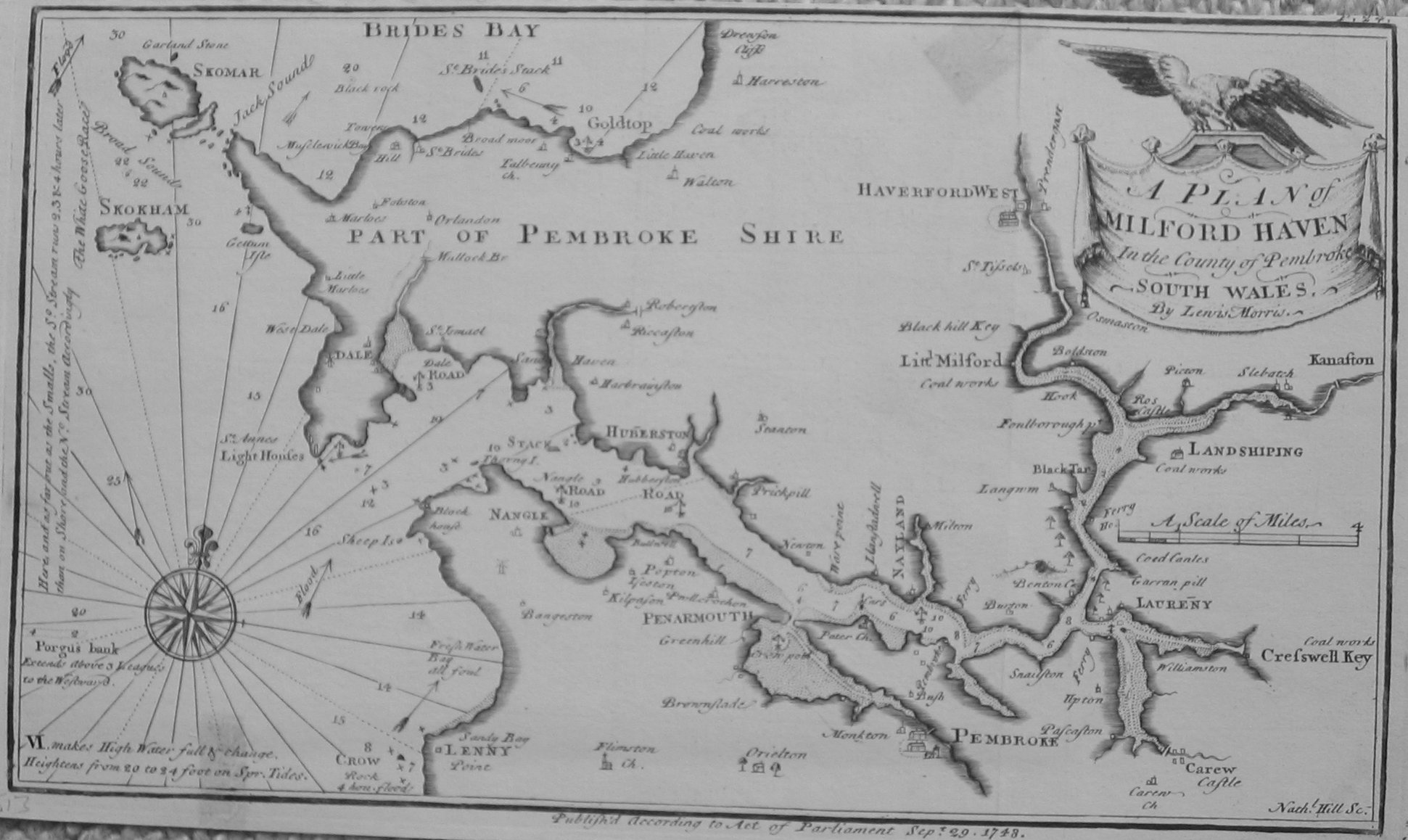
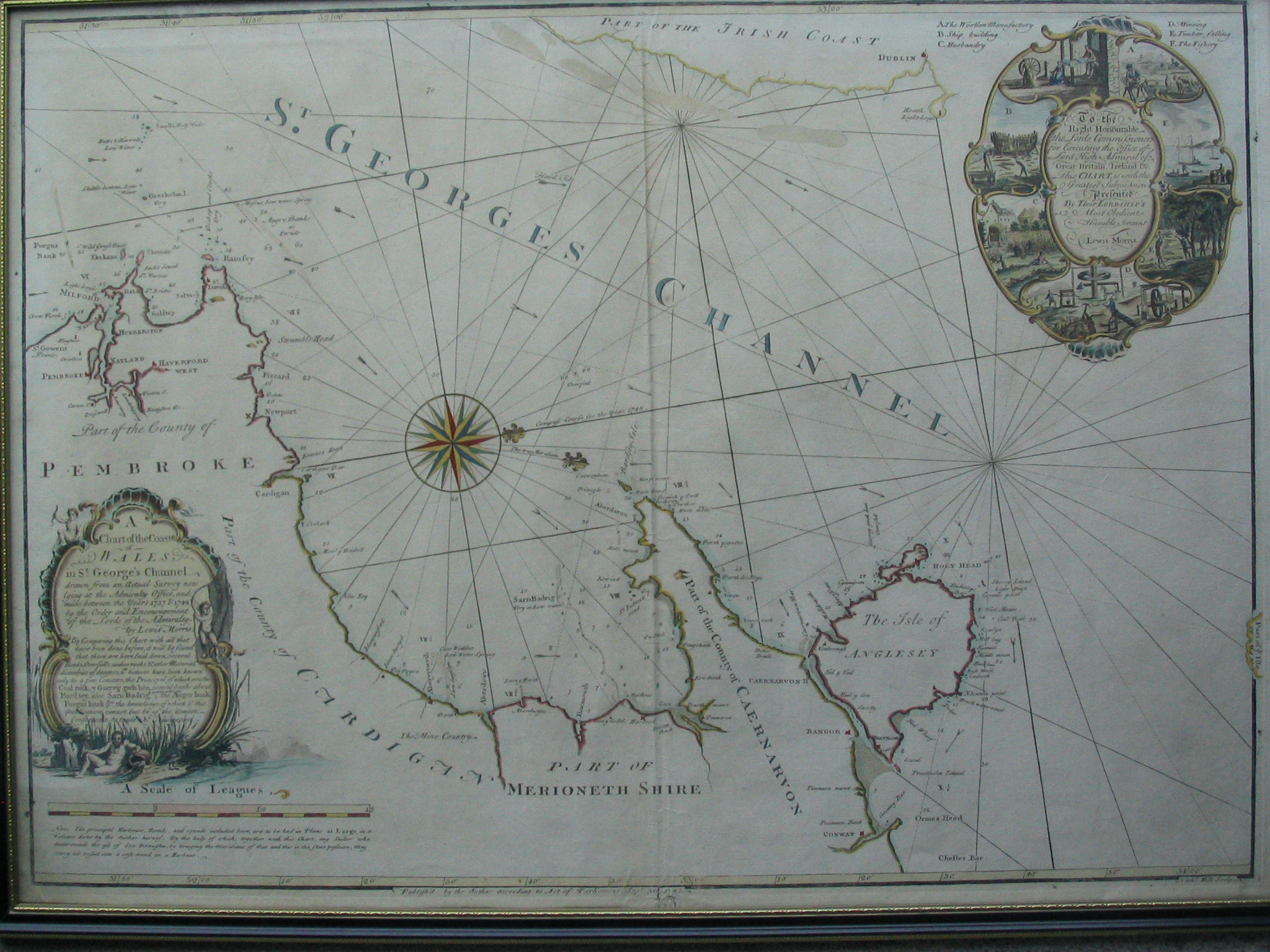
Published separately: Chart of the coast of Wales in St. George's Channel. This chart was the first to describe the causeways in Cardigan Bay (Sarn Badrig, etc) unlike previous charts.
Text of Cartouche of this large chart here
For some biographical information about Lewis Morris see Welsh National Library ; Antique map dealer information and article by A.H.W. Robinson (Lewis Morris an Early Welsh Hydrographer. Journal of Navigation, 11, pp 344-355 (1958))
%%%%%%%%%%%%%%%%%%%%%%%%%%%%%%%%%%%%%
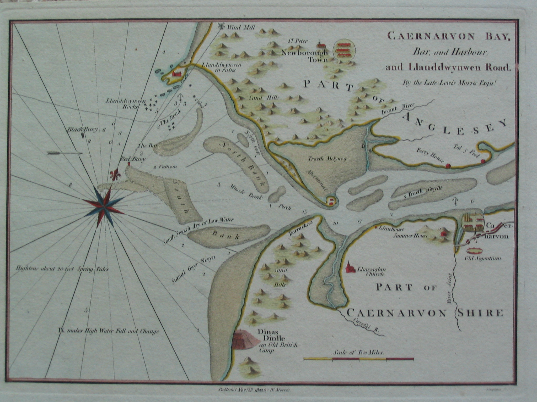
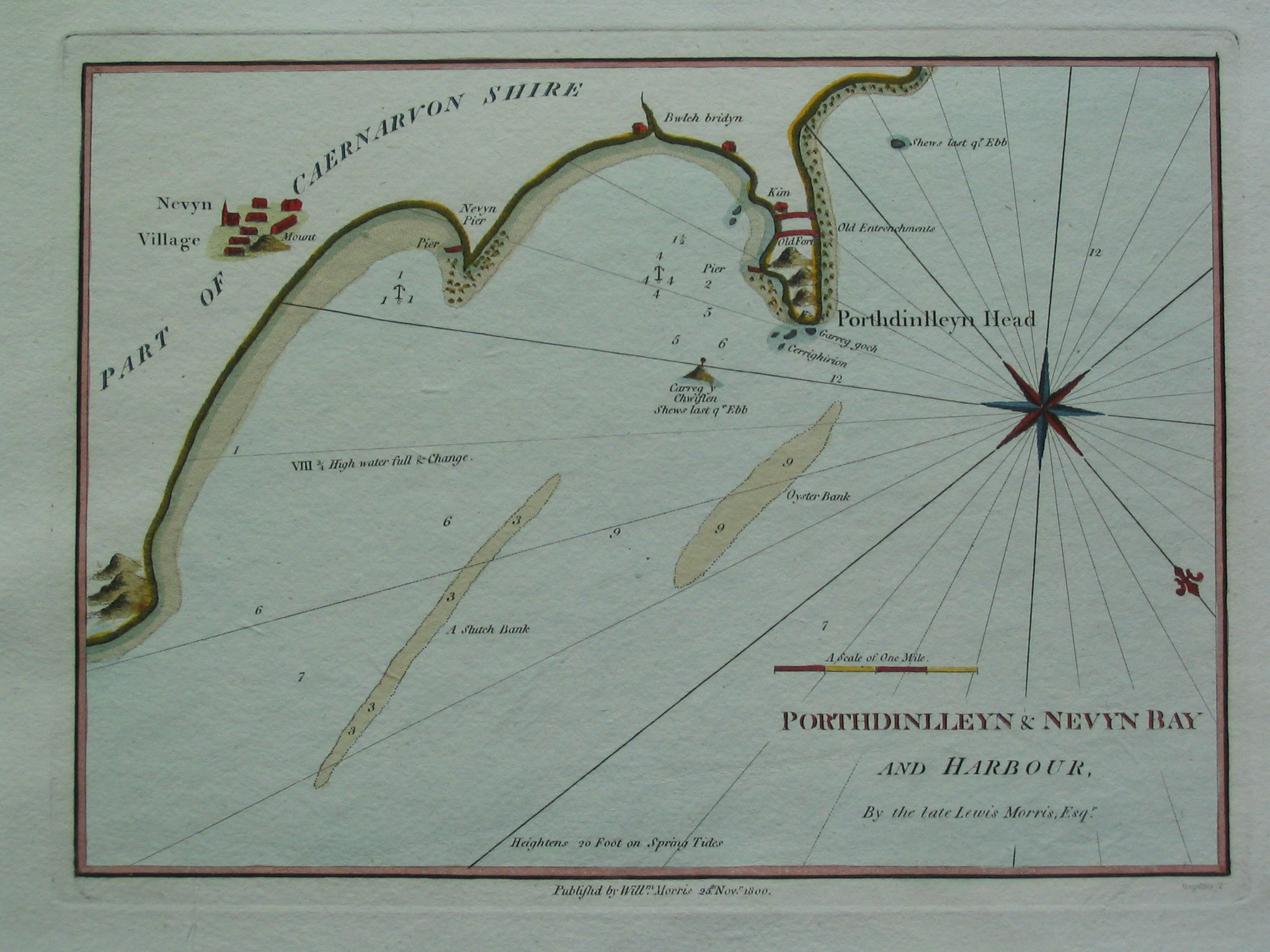
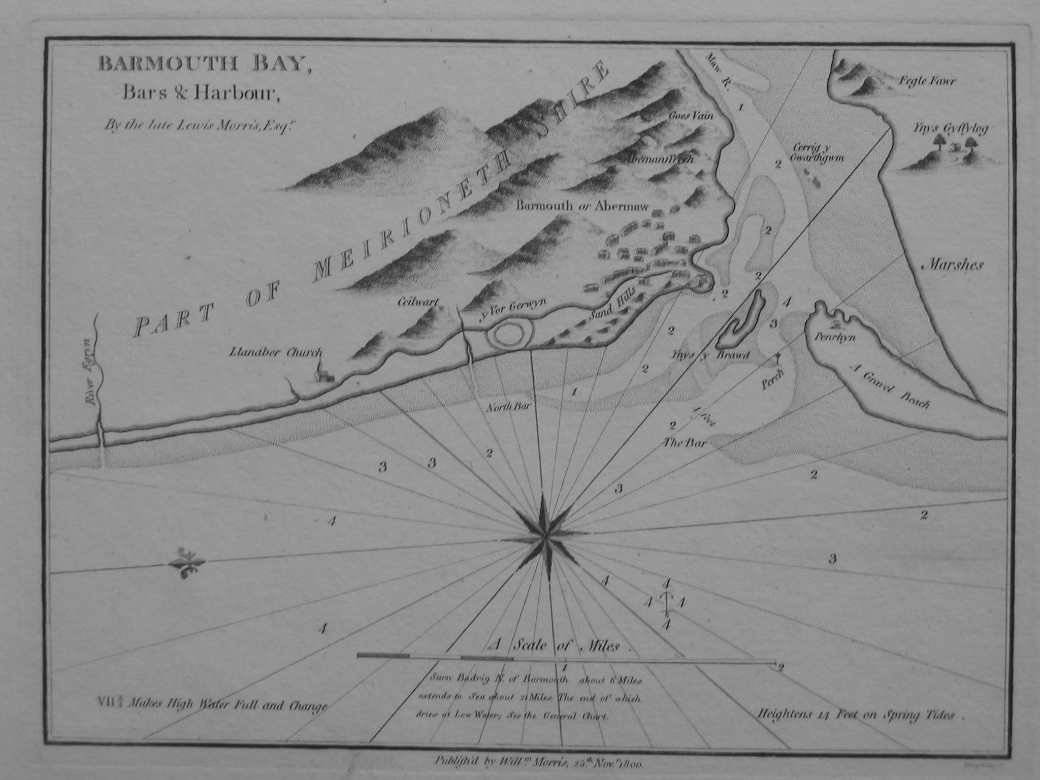
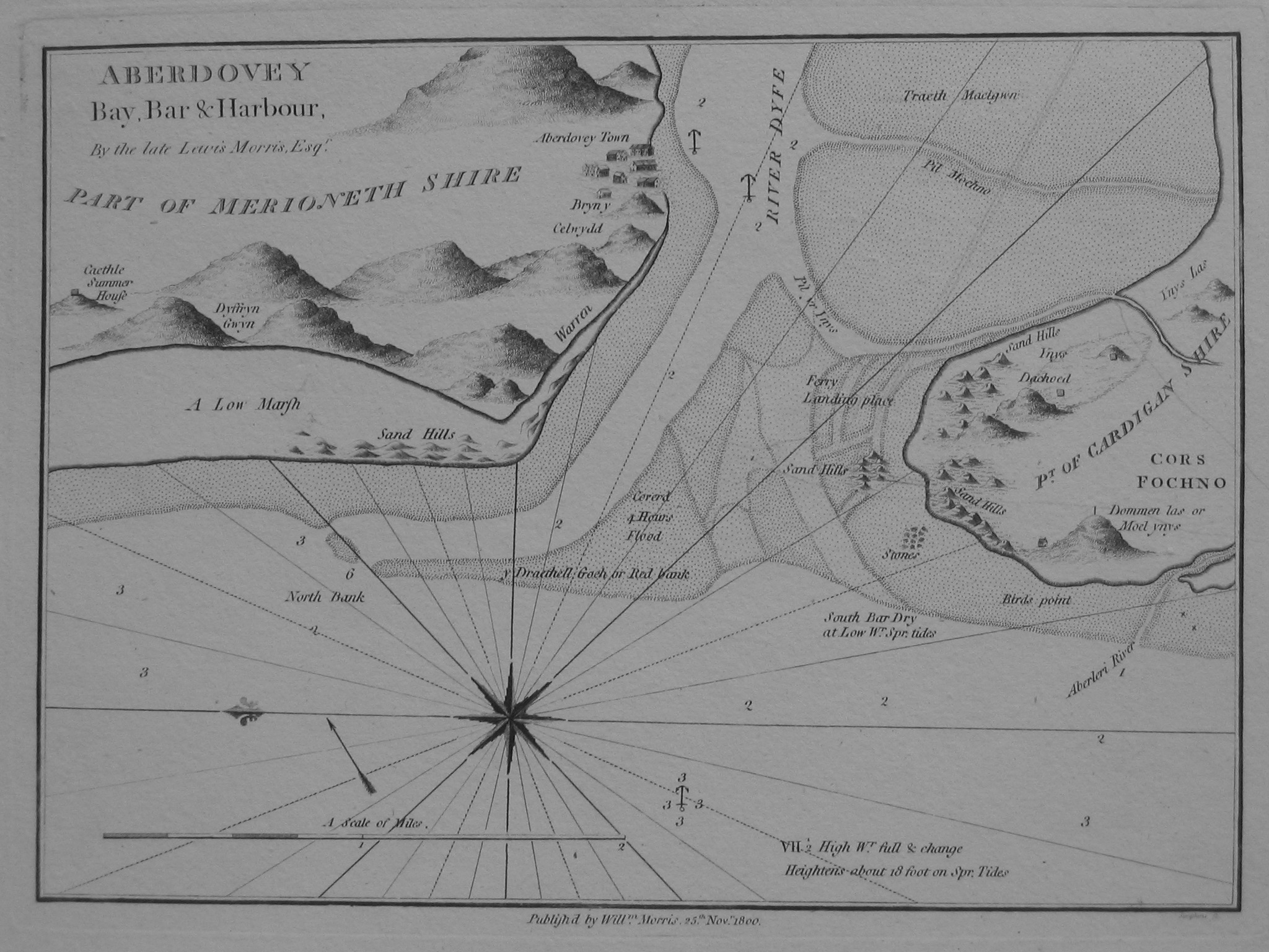
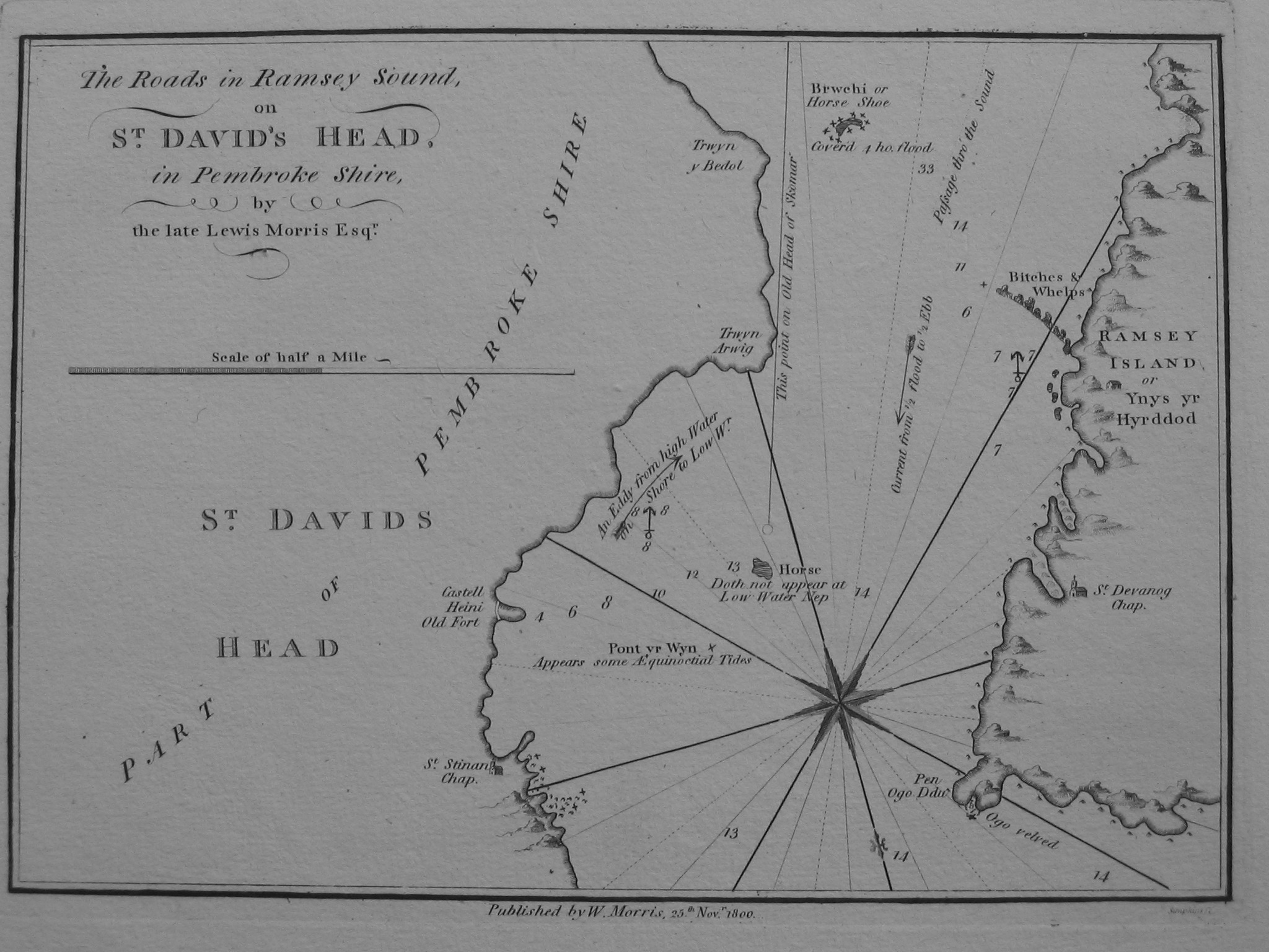
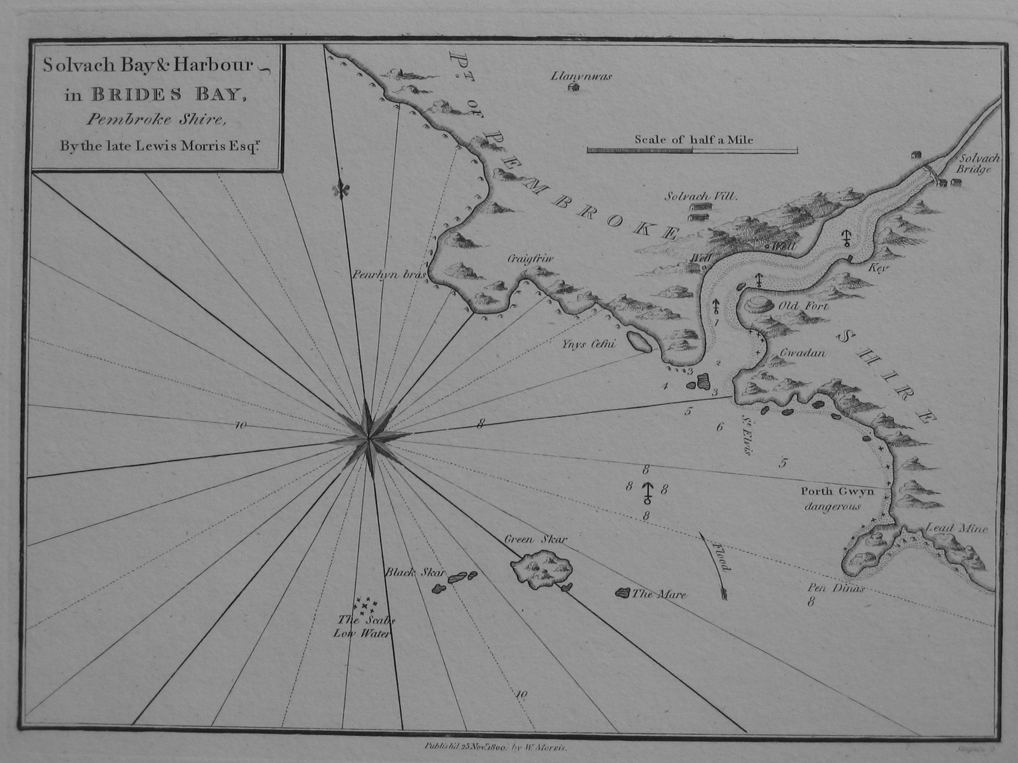
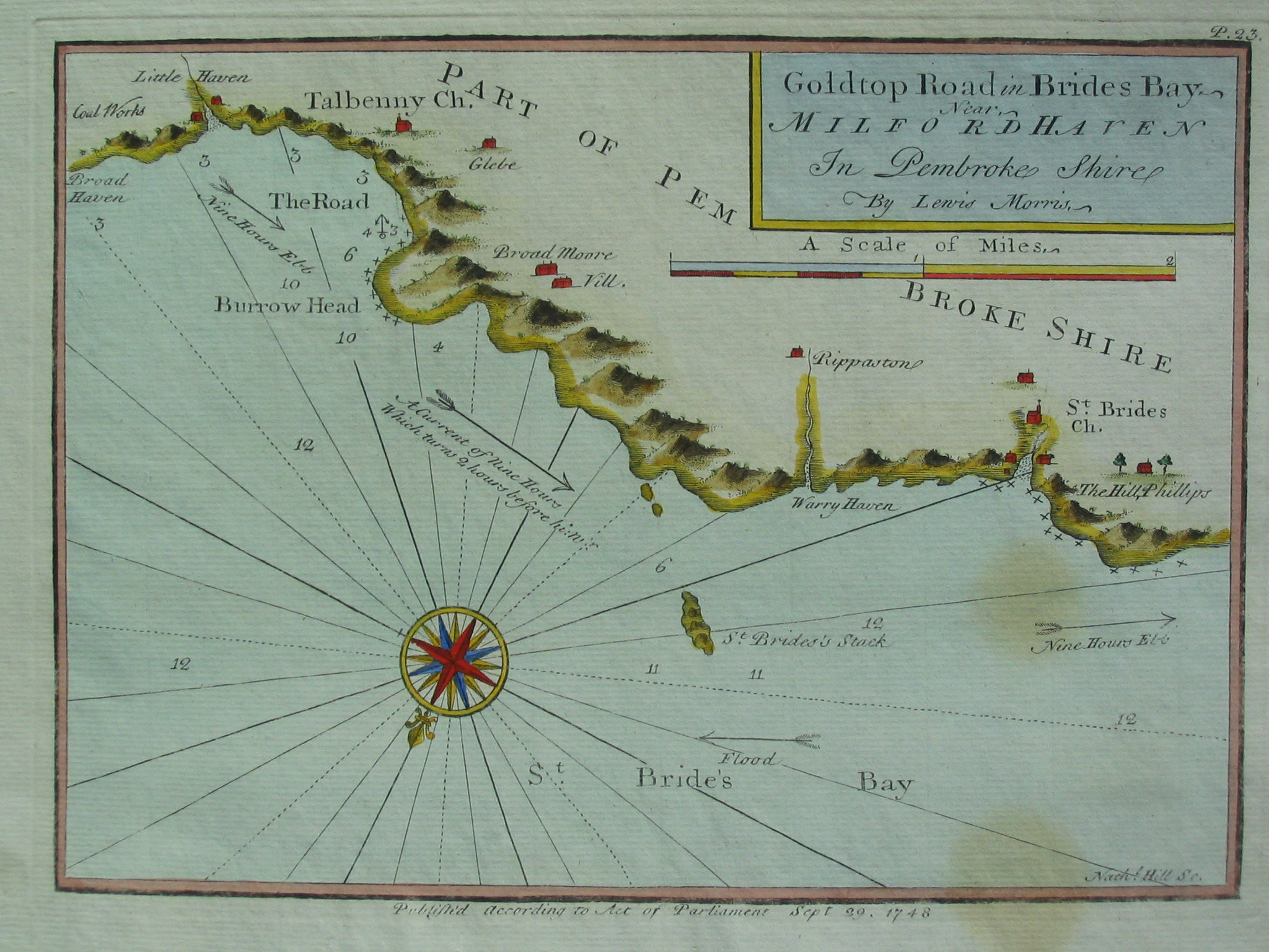
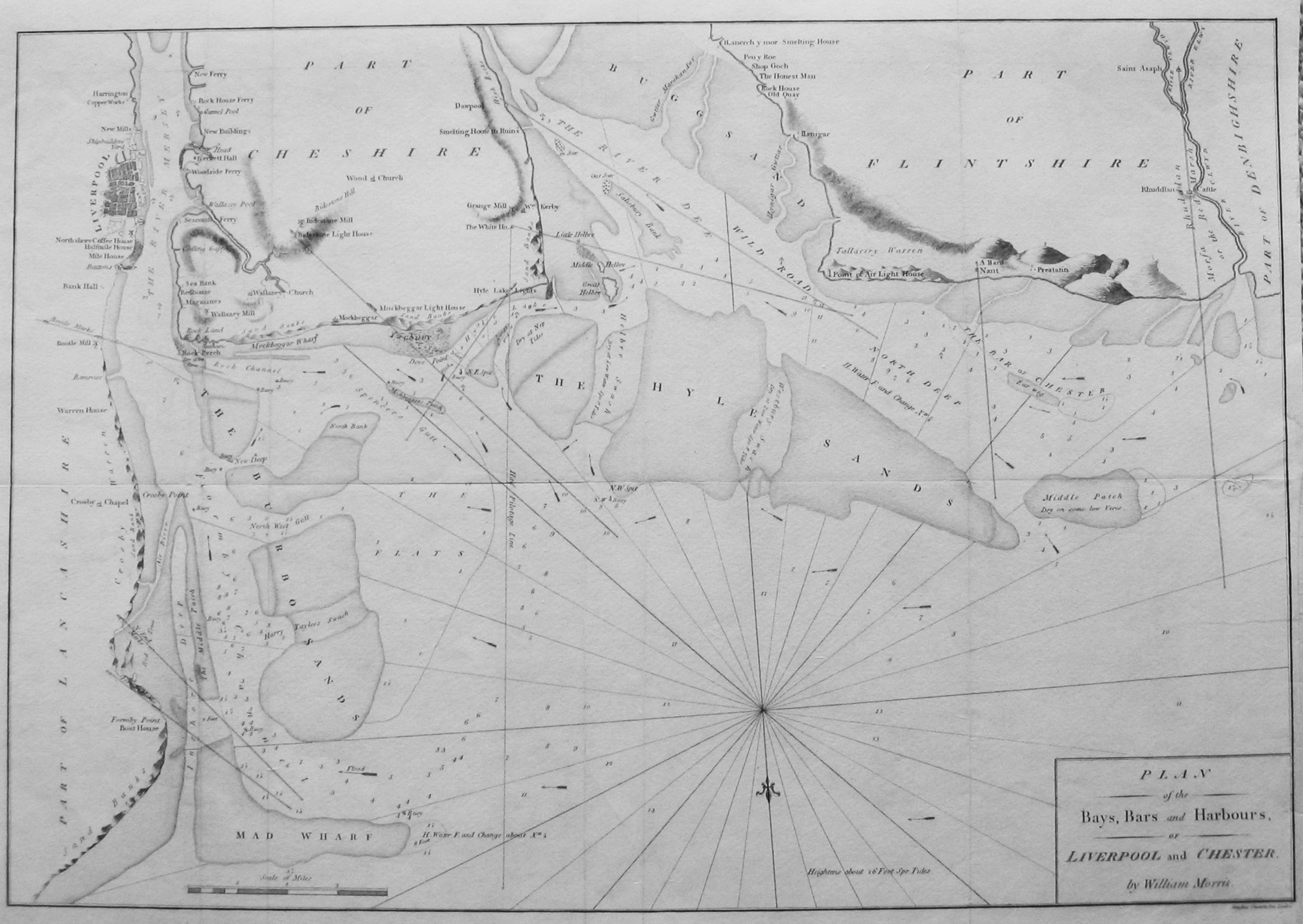
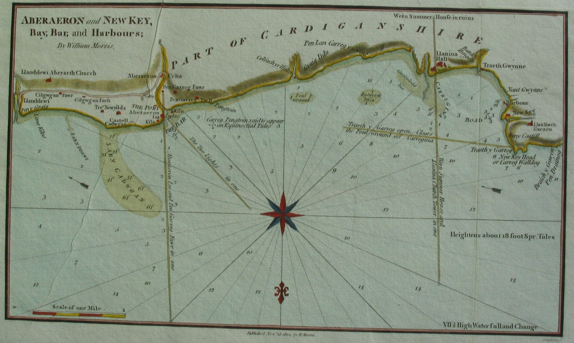
In 1800 William Morris (son of Lewis) republished the above (largely unchanged but with some soundings and leading lines modified) plus some additional charts [see also here]:
Also the overall chart "now extended by an actual survey"
The above images are copyright Chris Michael. They may be copied for non-commercial use.