I mainly use tides favourably (this helps a lot) and motor at my displacement speed (5 to 7 knots).
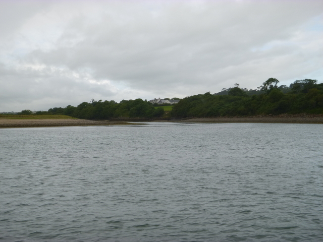
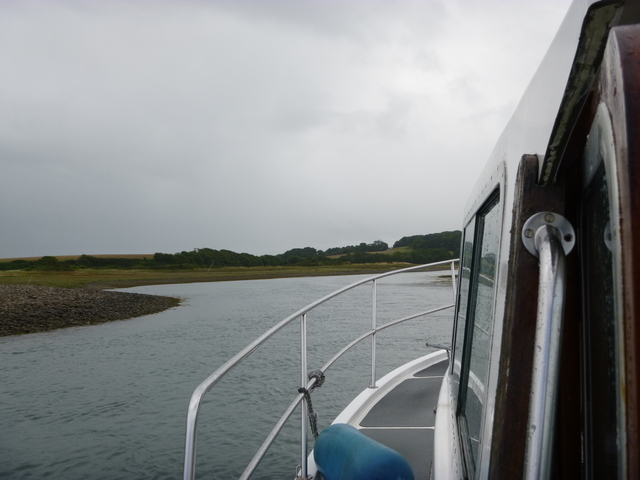
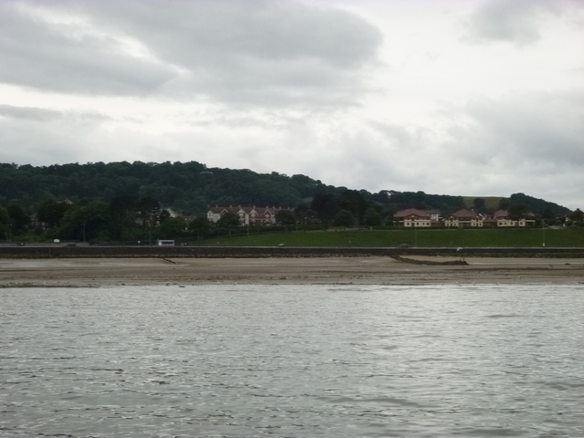
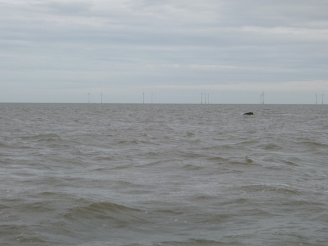
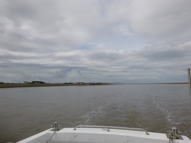
Friday 31 July: Leave Liverpool Marina near HW [11.48 9.1m] at 13.15. Leave via Rock Channel, then past wind farms and Great Orme. Waves mainly not too big since SW 4-5 wind had little fetch. Off Great Orme (circa 6pm) the wind was funnelled around the headland and whipped up bigger, steeper waves. A few times MARLIN dipped her bow into the oncoming waves and "took it green". Head for Moelfre as the anchorage would be sheltered in the SW wind. Anchor (at second attempt) at 8.30pm. Two other boats were anchored and one was tied to the big mooring buoy (marked Liverpool Pilots). I decided not to ventutre ashore in my tender because of the wind. The wind howled for a while and then eased to SW 3 overnight. I set a drift alarm (GPS) when anchored which gives peace of mind.
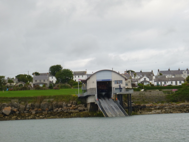
Moelfre Lifeboat station; Snowdonia from my anchorage.
| |
|
Saturday 1 August.
Leave Moelfre at 9.10 and head for Dulas Bay. My first task was to
survey Ynys y Carcharorion at around 9.45. This means "Prisoners Island"
and it is a reef awash at low water which is reputed to get its name
from the practice of putting prisoners there for them to drown as the
tide rose. A less grisly option is that there is a ruined fish trap
nearby and maybe the prisoners were fish? See
here for more info.
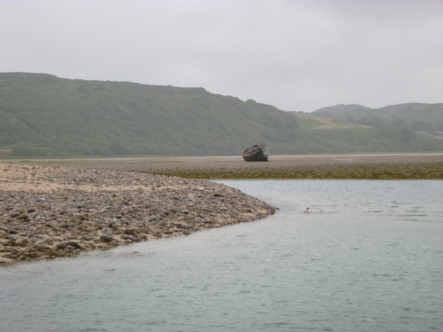
I found the reef to be about 75m north of the charted position and
to be awash at spring LW.
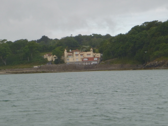
House (Portobello) on the shore overlooking Dulas Bay; entrance to Treath Dulas (at right hand end of shingle spit)
 |
 |
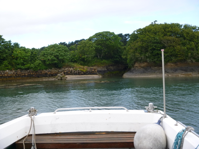
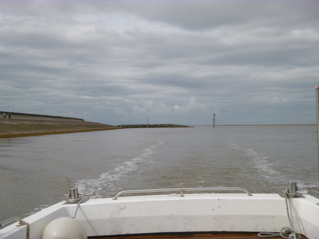
At 10.07am [HW Liverpool 12.31 9.5m] I started to enter Traeth Dulas itself: a large expanse of sheltered sand and grass which is only covered near HW. This has a sinuous entry channel between two overlapping spits. The innermost spit is dry (stony) and at its NW tip is the narrow passage into the wide and mostly shallow Traeth Dulas. I had surveyed it previously on foot at LW, so was able to find my way in by 10.20 [local HW -2h approx]. The current in was quite strong, so as I tried to turn in the Narrows, I was swept up the channel of the Afon Goch to the SE. The river bed was stony and it took a while for the anchor to hold. The river channel is quite narrow, then with the rising tide, I had enough width to swing around to face out. I waited until the current had slackened (at 11.45) to retrieve my anchor and head out. There was still quite an incoming current in places. See here for more info.
Traeth Dulas: Channel in to Narrows after passing outer spit, Afon Goch to left from Narrows; NW side of Narrows.
 |
 |
 |
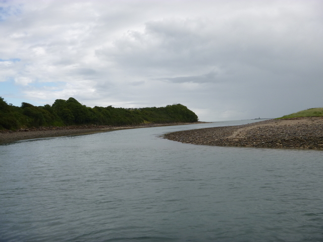
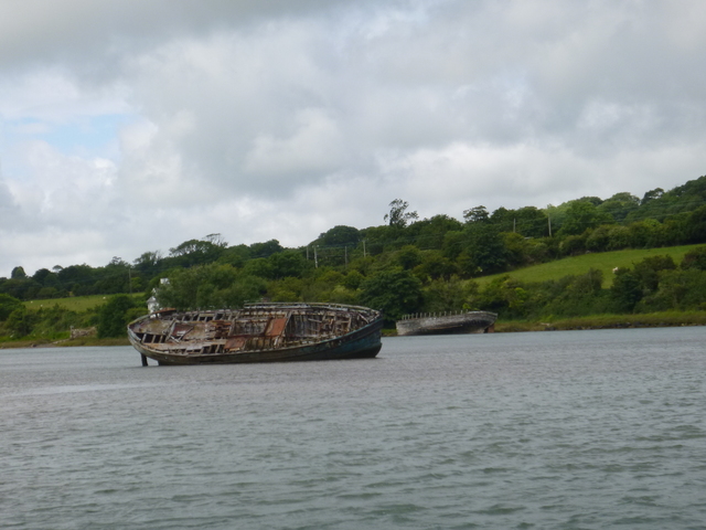
Traeth Dulas: Narrows looking out; Afon Goch channel further in; Wrecks at high tide (tide higher than Mean Springs so whole of Traeth Dulas covered).
 |
 |
 |
After some boat chores off Traeth y Ora (a lovely unspoilt beach), I headed towards Conwy along the shore SE past Moelfre and Red Wharf Bay and Puffin Island. I planned to explore the North Deep channel into Conwy which had been recently buoyed (3 small green buoys: see Conwy Yacht Club or NWCC or CMBHA for positions). I planned to approach from seaward and then turn around if it was too shallow. At 2.50pm, I entered the North Deep channel and buoy-hopped. The innermost buoy was off-station (it is supposed to be in line with the breakwater off Tremlyd Point at about 600m 345° from C11). I had least depth of 1.2m under my keel [so circa 2m depth surface to seabed], reaching the main channel near the perch by 3.00 [HW Conwy + 2h 50; half tide Conwy at 3.39]. I then retraced my steps back through the same channel, leaving the channel at 3.15 and heading for Great Ormes Head.
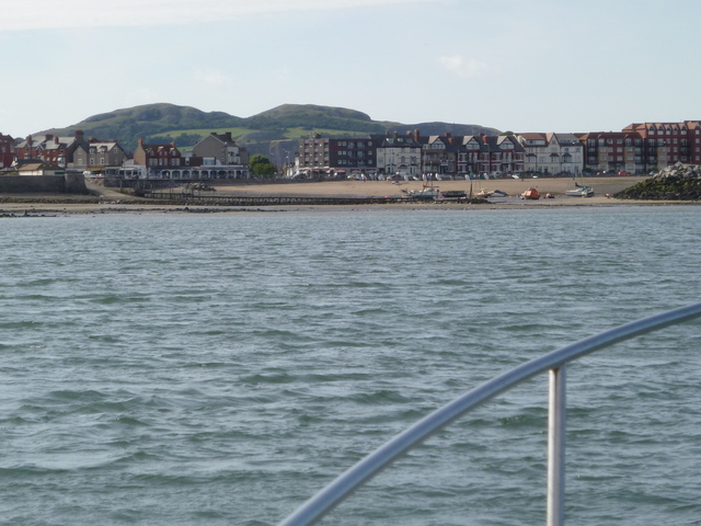
I passed Llandudno Bay before entering Colwyn Bay towards Rhos. Since the wind was SW and was forecast to veer to S, this was a sheltered spot. I anchored at 4.45 just outside the LW mark on the chart. I did consider beaching MARLIN to allow me to get off for a pub visit over LW (Liv LW 19.27 0.9m). The beach getting explosed near LW seemed to have quite a lot of stones -- so I decided to stay afloat. The wind was quite gusty overnight but was offshore. It calmed down a bit by the morning.
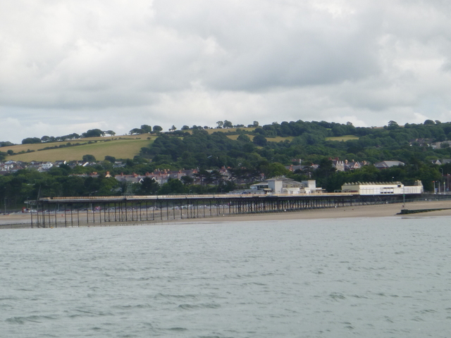
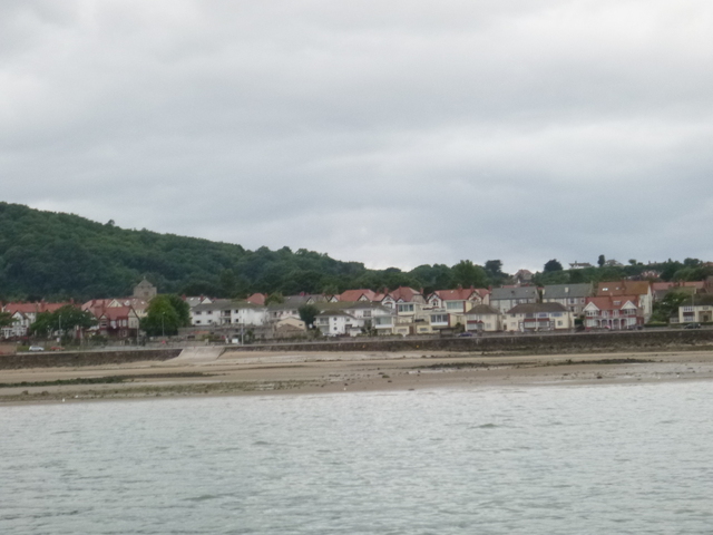
Colwyn Bay pier, Rhos Harbour
 |
 |
Two views of Rhos beach at LW (Liverpool LW 0.6m) and a view of the wreck of the Nestos (awash)
 |
 |
 |
Sunday 2 August. Up anchor at 7.15 am at Rhos and head for the Rock Channel into Liverpool with favourable current. This route takes you close to the wreck of the NESTOS on the Hoyle Bank. This is a mussel covered mass of steel and can seriously damage your hull. For more details of this wreck see here .
At 10.45 I was off the entrance to the channel into
the moorings at Meols. It was Liverpool HW at 13.16 (9.6m). So with a
making tide, and knowledge from previous trips, I headed in. By 10.55 I
had reached the sea-wall which I then followed westerly, passing the
"folly" (3 poles marking the sewer outfall) to gain access to the
moorings at 11.05.
I then turned around and headed out against the current (about 2
knots). I was back out by 11.30. There are buoys marking the channel
(mainly can-shaped black with letters T,J,C,L [Turning, Jubilee, Castle,
Leasowe] in order on way out). I
presume they are to be passed on the shore side, although only the first
two (to be passed on shore side) seem to correspond closely with the
deepest channel I found. There are also a clutch of large yellow buoys
-- which mark the lifeguard-patrolled Moreton beach area.
For more about the Meols approach see here
Meols: view from start of moorings of Folly; inner moorings. View on way out of channel looking back to Folly.
 |
 |
 |
I then headed around the coast, through the Rock Channel and up the Mersey to Liverpool Marina by 12.15.
All information given in good faith, but please do not rely on it.
Back to index here