Jump to Port St Mary, Castletown, Douglas, Laxey, Ramsey, Peel, Port Erin
I mainly use tides favourably (this helps a lot) and motor at my displacement speed (5 to 7 knots).
Only parts of some of the isle of Man harbours are accessible at all tides (outer wall of Port St Mary, Douglas and Peel). The others are drying but accessible above half tide.
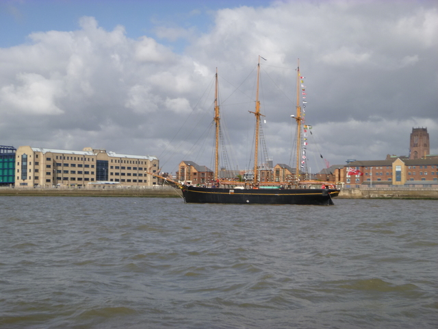
Monday 1 Sept: leave Liverpool Marina at 3.35pm, pass Cruise ship Celebrity Infinity and go through Rock Channel to Puffin Island. Waves from NW so boat rolling a bit at times. Anchor off SE side at 9.25pm. One other vessel at anchor there.
Liverpool: 3 masted vessel; Celebrity Infinity on Cruise Terminal.
| |
|
Tuesday 2 Sept: up anchor at 6.25am and proceed through Trwyn Du
(survey sandbanks) to head north to Isle of Man. Less waves and
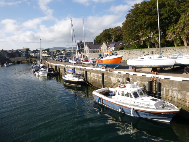
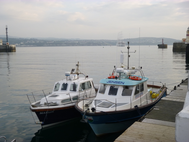
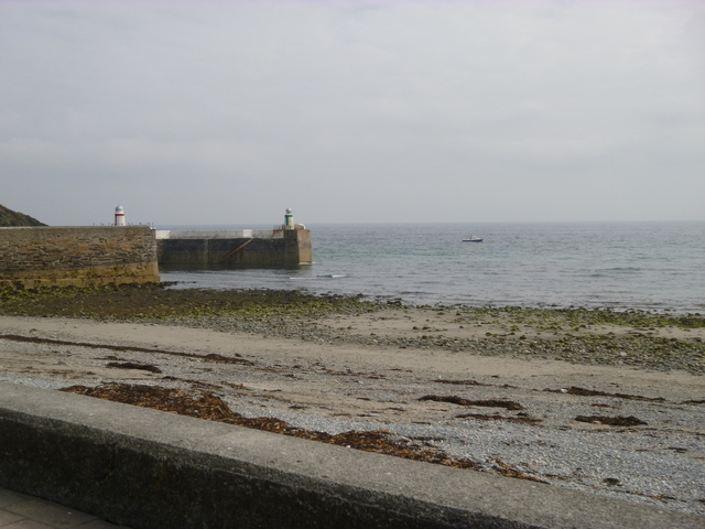
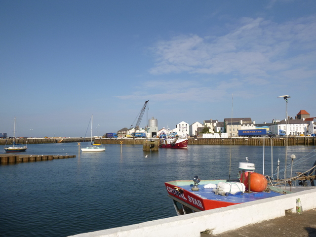
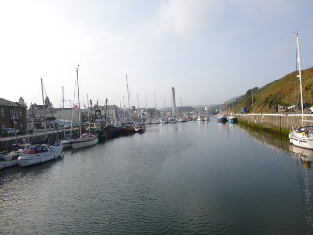
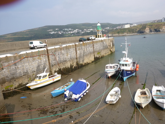
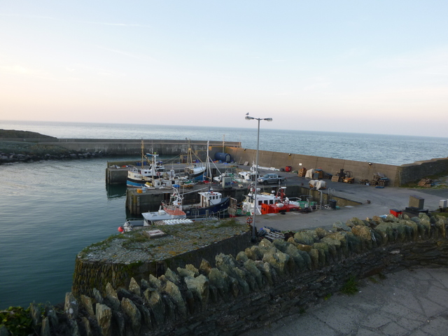
overcast. Arrive at Port St Mary outer pier at 1.52pm. I tied up
alongside a fishing boat (advice from a skipper of a nearby boat was
that it was the "eternal flame" -- "it never went out"). Advice was to
eat at the Pavilion - part of the Golf Club that welcomes non-members.
This was indeed a good place to take on food and coffee.
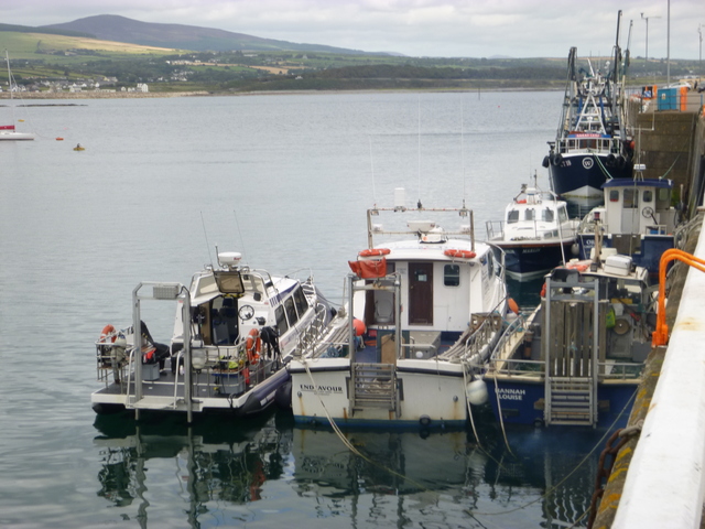
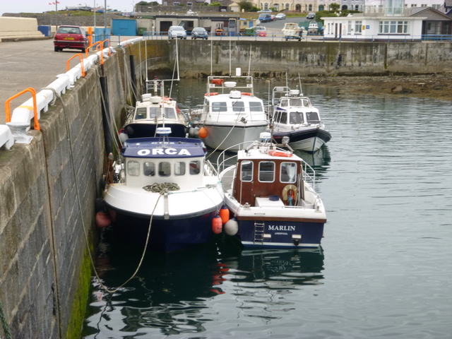
Port St. Mary Pier: Marlin, Orca and 3 dive boats alongside.
 |
 |
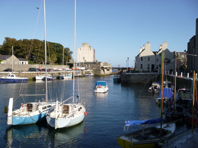
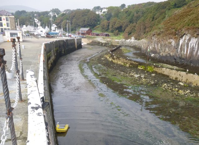
Since Castletown is accessible near HW, I set off at 3pm against the
current, mooring at the visitor's buoy off Castletown at 3.30. Here I
tilted my highest aerial to get my air-draught down to 4metres. I
entered the harbour, passing under the swing-bridge (not much to spare)
and asked a local working on his boat (thanks Trevor) who advised that
the visitor's berth was in the SE corner next to the swing-bridge and
that it dried level.
I had 2.4m under my keel near HW [close to Liv HW 4.45pm 7.9m]
decreasing to 1m by 7pm and was aground at 8.45.
Advice from locals was that there was limited choice of eateries:
I went to the Tap Room (pub nearby; beer "Castle Rushden" was brewed in
Yorkshire I learned) which was OK.
The Castletown swing-bridge is hand operated and blocks the entrance to the "middle harbour". It can be opened by the harbour-master -- although he can not always be contacted [indeed Castletown had no habour master in post at that date]. There is a height gauge attached to the west support of the bridge. It gives the air draught (1m at top; 4m at bottom). If the tide level is below the bottom of the gauge, as it was when I entered, then you have more than 4m air-draught. At spring HW, air-draught would be less than 4m, but when the sea level had fallen sufficiently (before or after HW) it would be possible for a 4m air-draught vessel to enter/leave.
Castletown Harbour: middle harbour (2 views) and air draught gauge beneath swing bridge.
 |
 |
 |
Wednesday 3 Sept: I left Castletown at 5.50am, with enough daylight
to spot fishing markers. Heading for Douglas, the current was adverse
(up to 3-4 knots around Langness) so I looped into bays to minimise it.
I tied up on the Battery Pier, outside Jensen at 7.55am. (Jensen is a
Rhyl boat whose skipper, Tony Parry, I know).
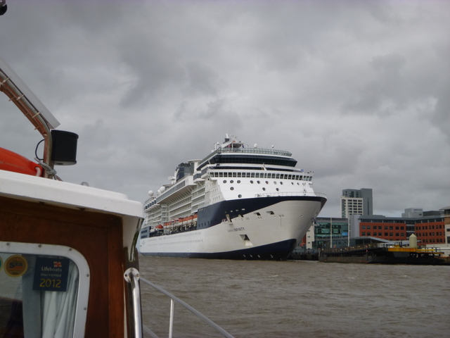
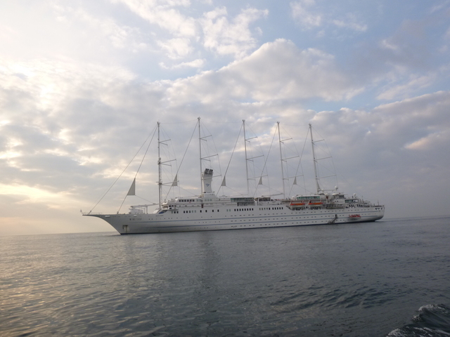
In Douglas Bay the 5-masted sailing cruise ship
Wind Surf was
anchored and passengers were being ferried ashore by her motor boats.
Port Soderick(abandoned resort); Douglas: Cruise vessel Wind Surf; Marlin on pontoon.
 |
 |
 |
The current would be favourable after LW (11am) so I left at 11.40,
proceeding NE to Laxey. In Laxey Bay there were 3 visitor's mooring
buoys off Garwick and one off Laxey Harbour. Pick up the mooring buoy off
Laxey at 1pm. There was enough water in the harbour to allow a tender to
enter the outer part and so disembark in some shelter (there was a SE
sea running). Row in at 1.30 and tie up at base of outermost ladder
on west pier. Ashore for a walk and icecream. Return soon. Marlin was
rolling in the SE swell at the mooring so making it less easy to
transfer from the tender.
By 2pm the tide had reached the base of the west harbour pier half
way up from the mouth.
Laxey: views along harbour wall; view from beach (Marlin at mooring in distance)
 |
 |
 |
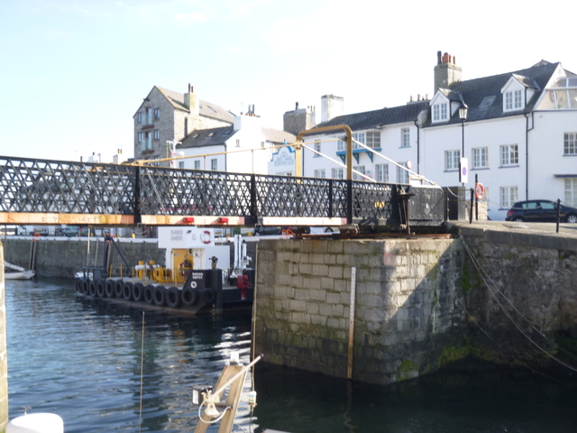
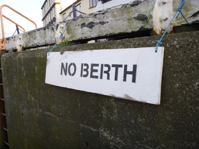
Proceed NE past Maughold Head to Ramsey. There were 3 visitor's
moorings near the (abandoned) pier off Ramsey, but I arrived at a time
(3.45 pm) suitable to enter [local HW 20' after Liv HW 17.58 7.7m]. Ask
a local working on his boat for advice: he directed me to a visitor's
berth. This was above the swing bridge (which has low air-draught but
was fixed open for repair work). This visitor's berth had a sign "No
berth" on it - but, after seeking confirmation from locals, I was
reassured that this was to keep it free for visitors. I had 1.3m under
my keel at the berth at 4.20, rising to 2.3m at 6.10 and then falling to
1.3m at 8.20. Mid-channel off the berth was about 1m deeper.
Local shallow-draught boats returned as late as 8.30.
The Town Quay (where I had berthed on previous visits) was
monopolised by fishing boats: 2 were moored there when I came in and
another 10 came in later.
The swing bridge has a clearance level which is about that of the
quay-side. This would be too low for Marlin. A vessel with 3m air-draught
might squeeze under at a time with just enough depth in the channel.
Ashore for sustenance: the Harbour Bistro is very close to where the scallop boats unload and I chose a dish with queenies: a very generous portion of fresh scallops. There was a pub facing the town quay which provided local beer. Marlin took the ground gently.
Maughold Head; Ramsey: entrance and Marlin on visitor's berth with (open) swing bridge beyond.
 |
 |
 |
Ramsey: Town Quay; "No berth"; don't buy a plastic owl to scare off seagulls.
 |
 |
 |
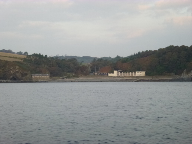
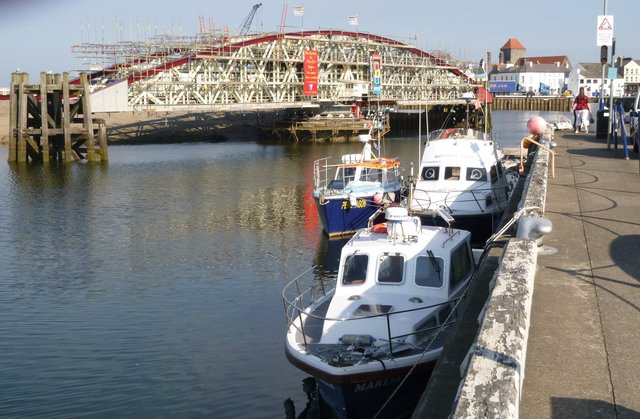
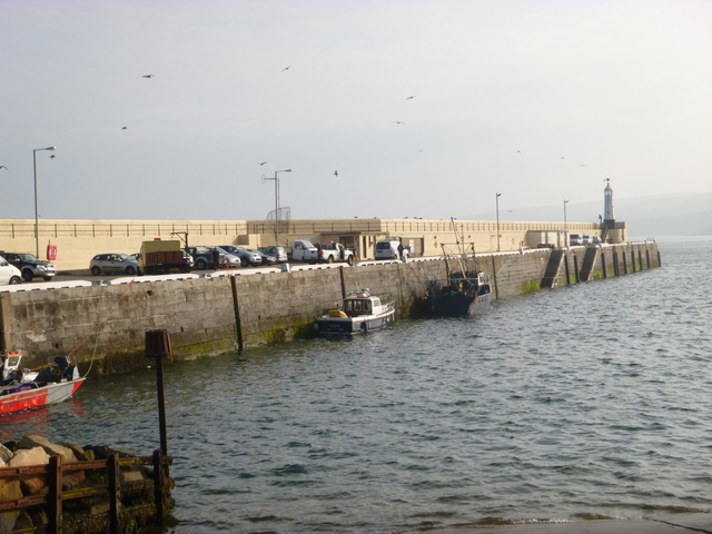
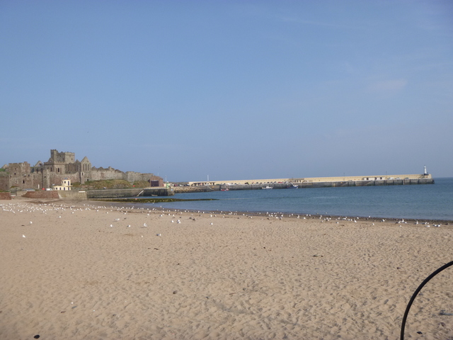
Thursday 4 Sept: set off at 5.50am (2m under my keel on berth) with enough light to see obstructions. A coaster, Silver River, was waiting to enter. With SE wind, I decided to go round to the NW coast of the Isle of Man. Proceed to Point of Ayr at 6.43. Though this was near HW [Liv HW 6.37 7.5m] the current was not slack but 2-3 knots in a favourable direction in places. Proceed down the sheltered NW coast with the current, arriving at Peel at 9.00am. Tie up along outer harbour wall. Ashore for a walk around Peel Harbour and to get some coffee and a bacon sandwich.
Peel: Marlin on outer wall; inner harbour; view from beach.
 |
 |
 |
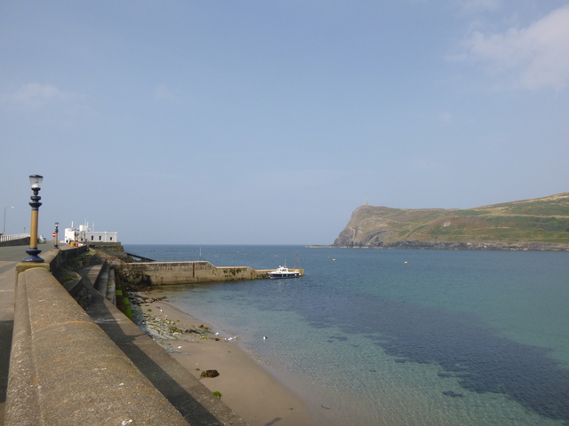
Leave Peel 10.15 and proceed SW past Contrary Head (where tide
direction changes) to Port Erin, arriving 12.00. Decide to go alongside
concrete landing jetty (which covers at HW) for brief visit and a
take-away beer. The wind was SE and gusty which made tying up a bit
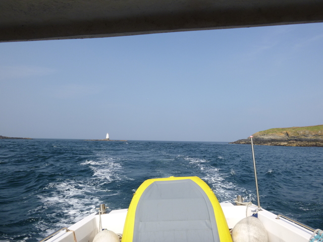
tricky. Leave 12.30 and head for Calf Sound, passing through at 1.0pm
with favourable current: a bit lumpy from wind-over-tide at S end.
Port Erin: Marlin on jetty; with Port Erin beyond; with Bradda Head
beyond; Inner harbour
 |
 |
 |
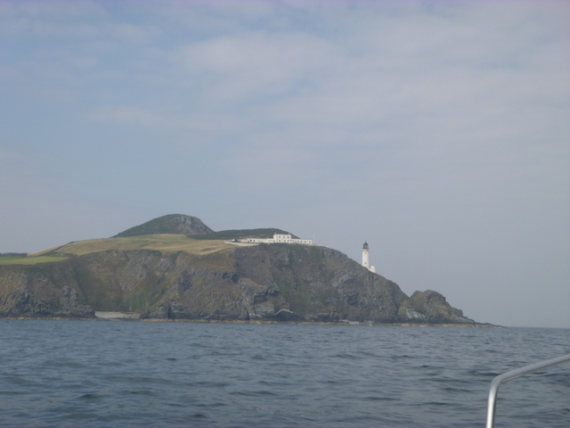
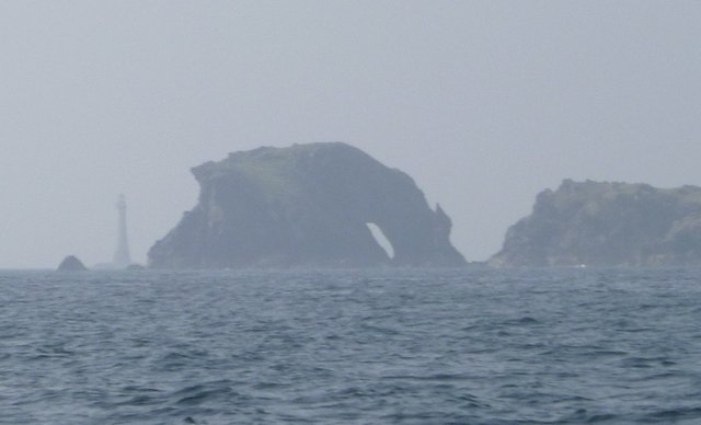
Calf Sound astern; Burroo (Rock with opening off Calf of Man) with Chicken Rock lighthouse to left.
 |
 |
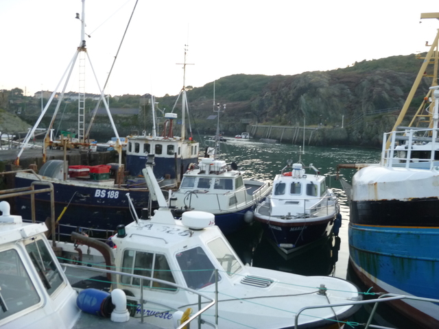
Proceed to Anglesey, making for Amlwch which has all-tide access to an alongside berth (fishing vessels permitting). Arrive 7pm. The outer pen had room for me and a local was encouraging. Some boats were scheduled to leave at 6am the next morning -- which suited me. I was surprised to see two 4-person sea-rowing boats practising in the harbour.
Following local advice, walk into Amlwch port to get "pysgod a chipiau" at the chip shop and a beer at the Vaults next door.
Amlwch harbour is quite full of boats, some in not very good condition. The "pens" have Liverpool Pilot boats in one and a variety of commercial boats (fishing, diving, survey, passenger) in both. The pens are sheltered and have all-tide access. I was near a whelk boat -- which had a strong smell from the rotting fish used as bait.
Amlwch: Marlin in the "pen"; general view of "pens"
 |
 |
Friday 5 Sept: leave Amlwch at 6.15am in calm weather. Pass Point
Lynas and enter Dulas Bay. Survey the entrance to Traeth
Dulas around 7am [HW Liv 8.08am 7.3m], finding that near HWN I could not
get very far in while keeping at least 1m under my keel.
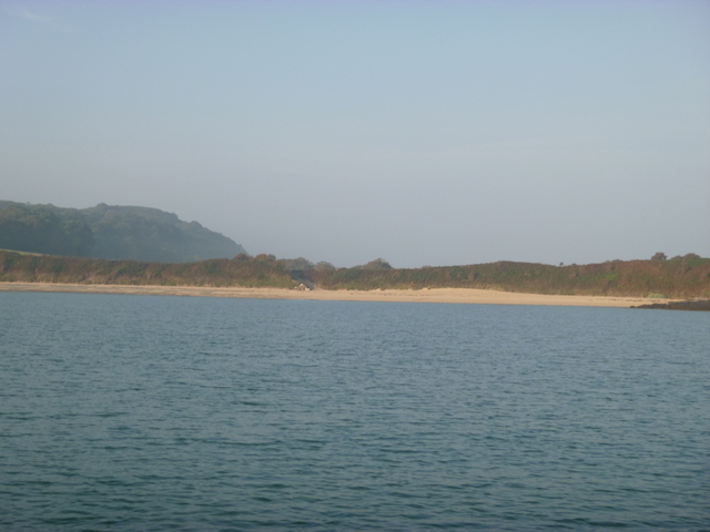
I then anchored off Treath y Ora in mirror-calm seas with nobody in
sight on the beach; calm except for some shooting ashore (hunting
birds?). Rest and boat chores. At 11.05am proceed to Moelfre. Take up
a mooring in very calm conditions and row ashore, landing on the beach.
To Ann's Pantry at midday
(when they start serving the lunch menu) for food.
Traeth y Ora beach; Moelfre beach
 |
 |
Back aboard at 12.55 and head for Liverpool, stopping to survey a
wrecksite (Mermaid) on the way. Thread my way through/around the wind
farms (with safety vessel Isadale FD177 defending Gwynt y Mor wind farm
construction actively) and enter Rock Channel.
The Trailing Suction Hopper Dredger
HAM 316 (9769 grt) was tied up at the Cruise terminal at Liverpool:
she is engaged in deepening the shipping channel from July 2014 for a year.
Enter Liverpool Marina lock at 7.30pm.
If higher resolution versions of the above images are wanted, please contact me. All information given in good faith, but please do not rely on it.
Back to index here