How close are unhealthy features of environments?
The newly updated AHAH (Access to Healthy Assets and Hazards) data resource released today allows us to examine health-related features of environments, and how they may impact populations.
Our data reveal important insights about the concentration of certain amenities that may be damaging or promote health. For example, on average, individuals in Great Britain are just as close to a pub or bar, as they are to their nearest GP (1.1 km).”
42% of people in Great Britain live within 1 km (or a few minutes’ drive time) of their nearest gambling outlet. A similar percentage (44%) are within the same distance to their nearest fast food outlet.
60% of the population were located within 1 km of their nearest pharmacy. Median distance to the nearest dentist was 1.14 km suggesting that health services have good overall accessibility.
Access, however, was not evenly spread across Great Britain – rural areas have poorer access to many health services, and those services which are seen as damaging to health are often concentrated in poorer areas.
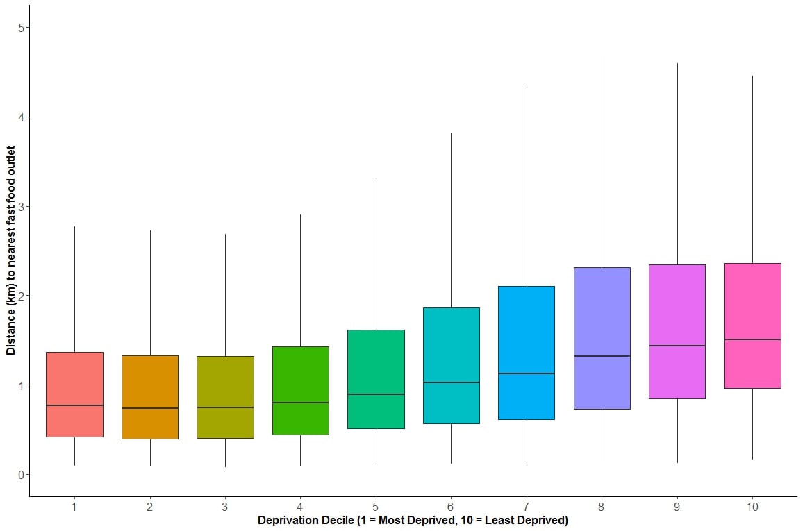
For example, 62% of people who live in the 10% most deprived areas are within 1 km of a fast food outlet compared to 24% in the 10% least deprived areas (see image for distance to nearest fast foot outlet by deprivation level).
Compare that though to accessibility to pubs, bars and nightclubs and you see little difference by deprivation level (e.g. distance to nearest was 1.02 km in the most deprived areas vs 1.11 km in the least deprived areas).
Different features of green space were more or less common by deprivation as well. Access to green spaces which are used for physical activity were more common in the least deprived areas, whereas the passive benefits of green space and access to blue spaces were more common in deprived areas.
The full suite of indicators can be viewed for free at http://maps.cdrc.ac.ukand downloaded at http://data.cdrc.ac.uk. We hope that the tool will be used both by citizens, policy officials and researchers interested in understanding how their local neighbourhoods may shape their health.