New Paper on Dynamic Exploration of Urban Area of Interest
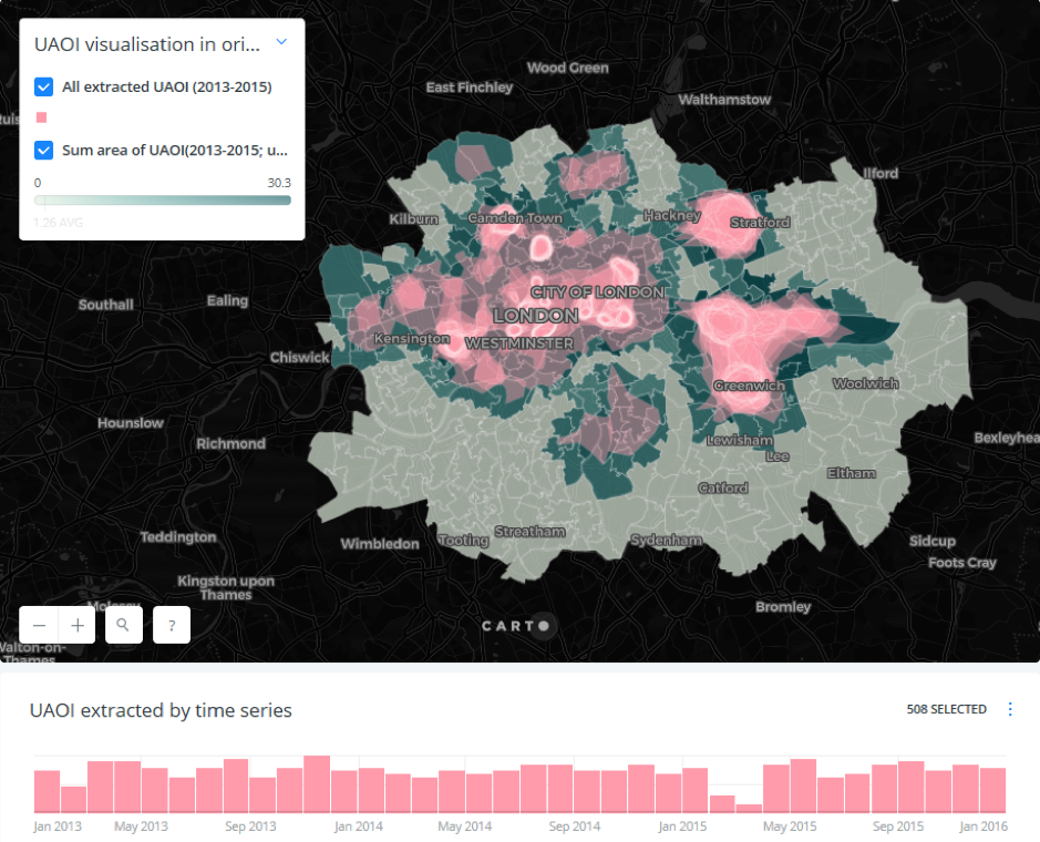
Obtaining insights about the dynamics of urban structure is crucial to the framing of the context within the smart city. Where and which urban areas need to be paid more attention for stakeholders at certain specific time? The answers can be found in a recently published paper in the Journal of Geographical Systems co-authored by GDSL’s Meixu Chen, Dani Arribas-Bel and Alex Singleton. It presents a method to extract urban areas of interest (UAOI) and quantifies their dynamics through geo-temporal analysis.
UAOI, refers to parts of the urban built environment that can be delineated in their extent through the clustering of human activity. It is a concept that provides functional definitions of a city’s spatial structure. Identifying and understanding UAOI would be informative to several domains. For example, it can help urban planners to develop better strategies related to tourism planning. If certain tourist attractions showed a seasonal pattern, urban planners could allocate resources for tourism more efficiently.
Traditional sources of social data can rarely capture these aspects at scale while spatial information on the city alone does not capture how the population values different parts of the city and in different ways. Hence, we leverage volunteered geographic information (VGI), geotagged Flickr data in this context, to overcome some of the limits of traditional sources in providing urban structural and functional insights. To do this, we propose a methodological strategy that combines hierarchical density-based spatial clustering for applications with noise and the ‘α-shape’ algorithm to quantify the dynamics of UAOIs in Inner London for a period 2013–2015 and develop an innovative visualisation of UAOI profiles from which UAOI dynamics can be explored.
The results on the spatial dimension of our analysis suggest that the urban environment influences human activity, shaping the attention of people and attracting them to areas where many unique buildings and important landmarks are located. Conversely, the temporal aspect of our results reflects how human activity evolves and shapes the use of the urban environment. Putting these two together, our spatiotemporal profiles visualise how the popularity of certain regions is influenced by factors such as time of the year and season, and also make visually explicit how popularity levels differ across areas. Our results expand and improve upon the previous literature on this topic and provide a useful reference for urban practitioners who might wish to include more timely information when making decisions.
This paper is open access and can be found here. The code and data used for the study are also released as open source and available in an online repositoryat Github. An interactive map showing all UAOI extracted and their area change at various time span is also available by this link.