Trajectories of Neighbourhood Change in Britain
A team of GDSL researchers have been investigating the spatial manifestations of socio-economic inequality in Britain over the last five decades. Supervised by Dr. Francisco Rowe and Dr. Dani Arribas-Bel, Nikos Patias is currently working on his PhD project on assessing the extent, sequence, pace and spatial pattern of neighbourhood change in Britain over a 40-year period from 1971 to 2011. The project is funded by the Economic and Social Research Council (ESRC) and the Ordnance Survey (OS) through the Data Analytics and Society Centre for Doctoral Training.
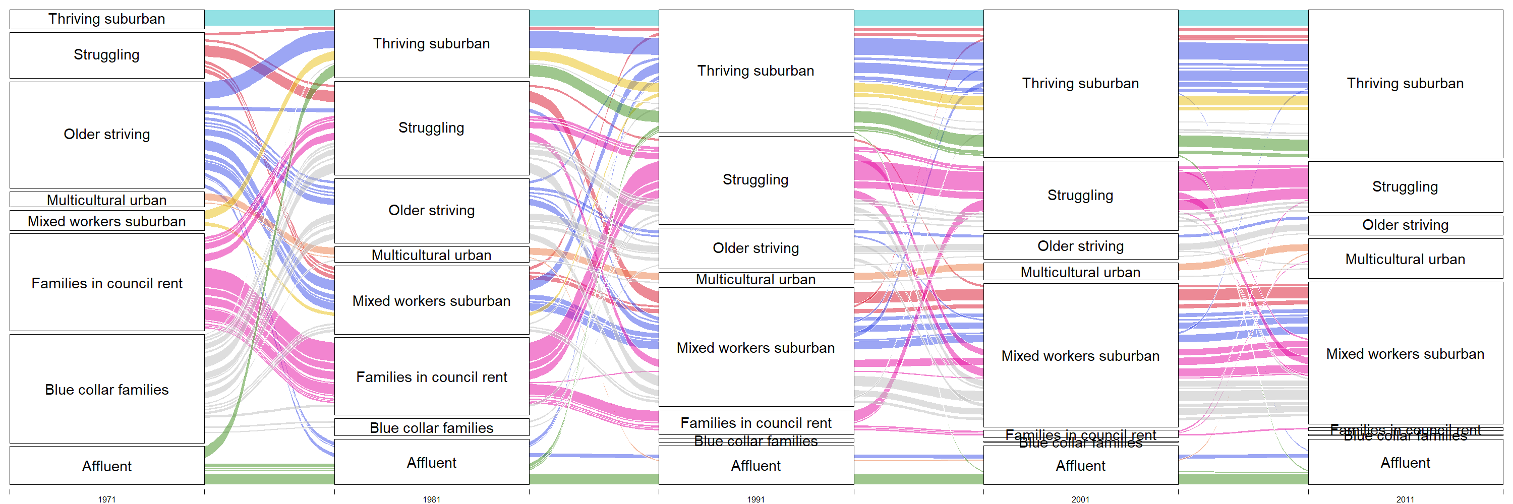
The team have recently published a policy brief and developed two interactive maps (links below) for the UK2070 Commission on regional inequalities. The work reveals the geographical structure and temporal change of neighbourhoods resulting from persistent socio-economic inequality in Britain between 1971 and 2011. The first map presents a geo-demographic classification and displays a typology of eight representative neighbourhoods for Britain. The second map displays a classification of neighbourhood trajectories. It captures the sequence of transitions of each neighbourhood (1km grid) between neighbourhood type at each census year. Neighbourhoods are represented by temporally- and geographically-consistent 1km grids and capture spatial variations in various demographic, socioeconomic and housing attributes, from the Censuses of Britain conducted in 1971, 1981, 1991, 2001 and 2011.