Geography & Computers: Past, Present, and Future
Reposted from original article
I’m really pleased to share a piece that Dani Arribas-Bel and I recently co-authored in Geography Compass on the sometimes fraught relationship between (human) geography and computers, and advocating for the creation of a Geographic Data Science. For those of a ‘TL; DR’ nature (or without the privilege of an institutional subscription!), we wanted to share some of our key ideas in a more accessible format.
PART 1: A (VERY) BRIEF HISTORY
Looking back at the history of quantitative geography it becomes clear that changes in computer hardware and software are bound up in changes in the how we practice geography. For convenience, we divide this history into three overlapping phases:
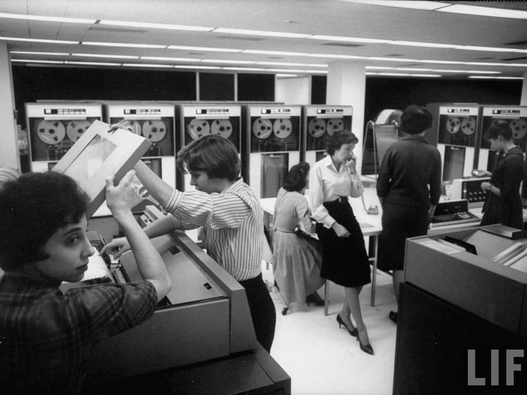
- A computer in every institution: in which room-sized computers are substitutes for slide rules and human computers with a focus on testing theories with data.
- A computer in every office: in which computers become personal and can therefore be used as exploratory tools that promote computational thinking.
- A computer in every thing: in which the embedded-ness of computers in everyday items makes possible entirely new ways of collecting and analysing data about society.
We’re obviously not saying that computers determined these shifts in geographical practice, but that they enabled us to develop new ways to “do geography with computers” (Harris et al. 2017).
WHY GIS IS NOT GEOCOMPUTATION
Along the way we had to wrestle with what (if anything) distinguishes the different terminologies that we–as teachers and researchers–use to describe what we do: why is GIS not Geocomputation??? Looking back, we were able to distinguish two distinct relationships: in one strand, computers are (in a sense) simply faster and more accurate statisticians and cartographers; in the other, computers help us to think differently about our field (through processes like recursion, iteration, and variation). As Couclelis (1998, p.19) put it: GIS can be seen as ‘a technological advance that… allows applied geographers and others to do faster, more comfortably, and better what they had always done’, while geocomputation is more properly seen as the interface between between geography and computer science. What do computers make possible, not what do they make easier (see Gahegan, 1999)!
WHY A GEOGRAPHIC DATA SCIENCE?
“I think statisticians are part of it, but it’s just a part. You also want to be able to visualise the data, communicate the data, and utilise it effectively. But I do think those skills–of being able to a access, understand, and communicate the insights you get from data analysis–are going to be extremely important.”
Hal Varian (2009)
To understand why we’re proposing a Geographic Data Science, it’s helpful to understand why Data Science is the hot job of the day. Data Science as a discipline can be seen to emerge largely from the work done by Google, Yahoo!, and others so there isn’t much in the way of a ‘theory’ of data science. But Donoho (2017) traces a distinct branch of thinking about data back to Tukey’s The Future of Data Analysis (1962) and points to six points of difference: an interest in data gathering, preparation, and exploration; questions of data representation and transformation; computing with data, visualising and presenting data; modelling with data; and a degree of reflexivity (a ‘science of data science’).
These are all topics with which geographers have been wrestling ever since the first critical responses to the rise of quantitative geography. And data science, emerging from a mix of computer science and statistics, is largely new to such debates: even though most ‘big data’ is also spatial data there isn’t much awareness of the role that geography plays in pattern and process. So we see the need for an interface between our domain and Data Science, and for pragmatic reasons would call this ‘Geographic Data Science’ since it seeks to engage with modern approaches to data capture, transformation, processing, and analysis while remaining true to the critically aware traditions of Geography.
Next steps…
And that, in a nutshell, is the message of our paper. Unlike your ‘typical’ publication we don’t see this as the end of the story, but as the (‘official’) beginning of a new one. We hope our paper helps kickstart a broader discussion and set of actions that make Geographic Data Science happen.
If you don’t have access to the article on Geography Compass, drop us a line and we can send you a read-only link via the Wiley author services.
Jon & Dani