Ravenglass is a village at the side of a sheltered estuary formed by the rivers Mite, Esk and Irt. It is accessible around HW and has drying moorings but no alongside berths. It has restaurants, a shop and pubs. It has two railway stations: the narrow-gauge one being a tourist attraction.
Here I collect information about access to Ravenglass by boat from offshore. I also present my own survey results (from 4 trips in and out of Ravenglass).
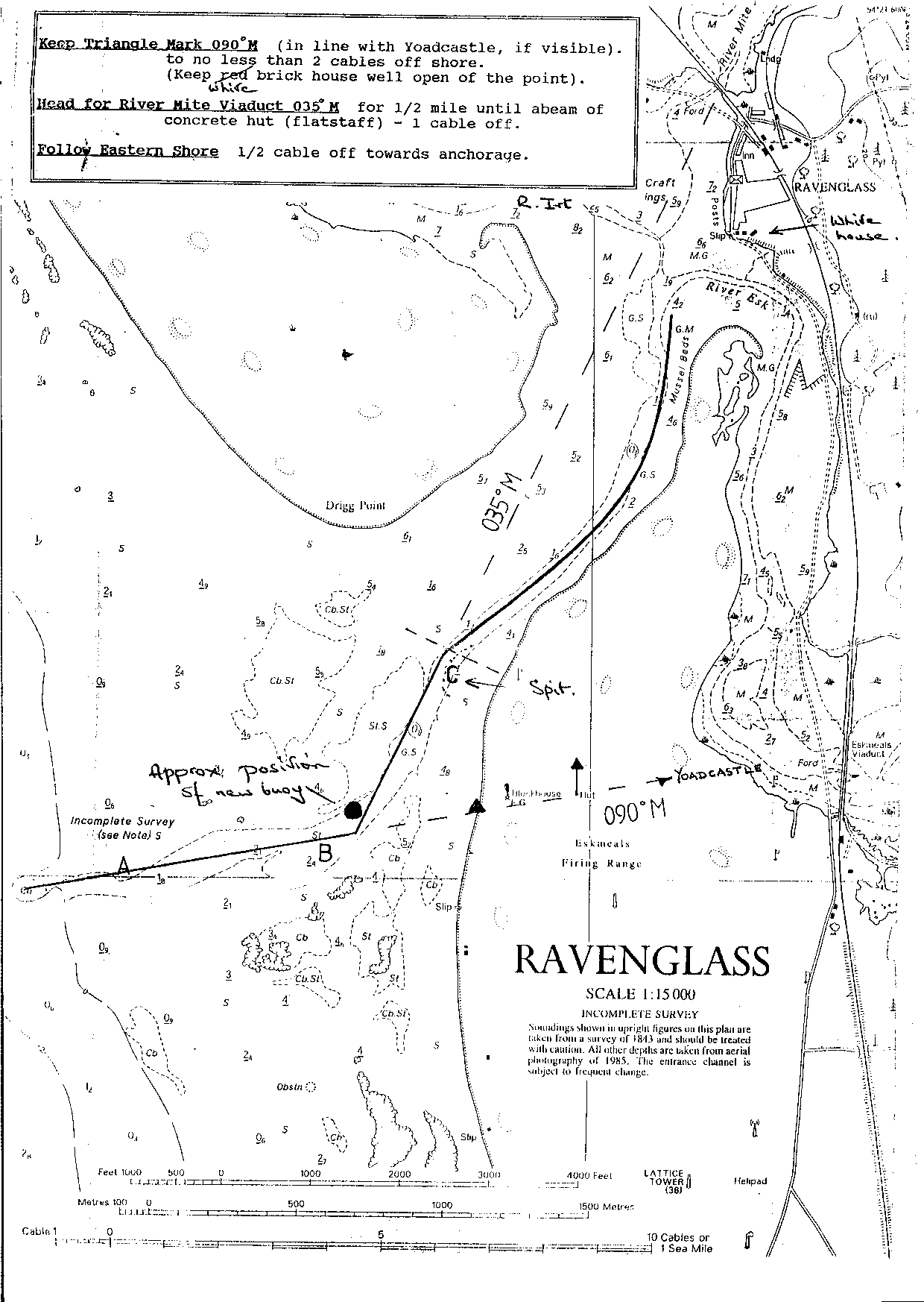
The Hydrographic Office Chart shown here (zoom in) has spot depths from 1843 and the channels marked are from a 1985 aerial survey. Or see here for already centred view.
Ravenglass Boating Association issued some guidelines in 1995: these are here . Alternative: sketch map from RBA.
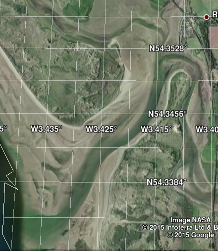
Google Earth shows the estuary at fairly low tide in 2004. See here
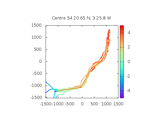
I visited Ravenglass in 2011 , 2013 and twice in 2015, 2015 and overnight in 2016 . I recorded my depth and position from 2013 on and used the Workington tide gauge data (real time) to convert the depth readings to Chart Datum (see below).
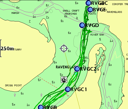
This image above (distances and depths in metres) shows also some
waypoints that are guided by my depth results and by the Google Earth
images. The conclusion is that the estuary dries by about 3m up to the
confluence of the three rivers. Further progress will depend on which
mooring one goes to: some dry much more than others.
The mean tide level at Ravenglass is 4.5m, so access with 1m draft
is just possible at half tide. Reaching most moorings would be feasible
at HW+/-2. Note that there can be quite strong currents in the estuary.
I found that the River Esk channel contributed a lot of current at times
away from HW.
From my overnight trip in 2016, I observed the low water
channels and they do seem to agree with those marked on the chart.
See images here .
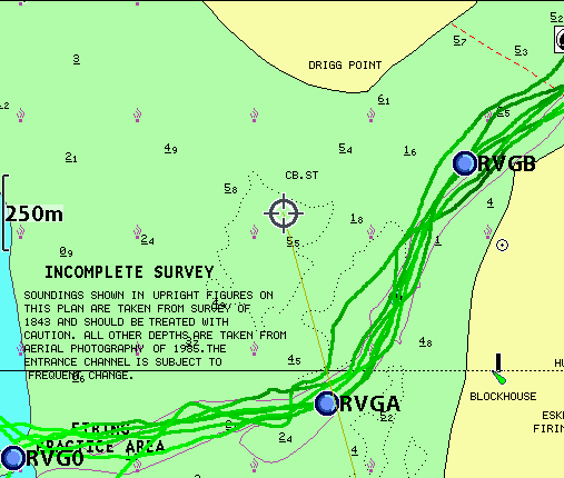
Images of my tracks below (shown with darker colour being shallower)
overlaid on HO chart and with waypoints: Outer then inner region.
Notice that charted "channel" is not deep near RVGB waypoint.
Tides: Ravenglass tides are based on values given for Tarn
Point (nearby):
duration 5.45; HW Liv + 10';
MHWS 8.3; MHWN 6.4; MLWN 2.5; MLWS 0.9.
By comparison Workington has:
duration 5.45; HW Liv + 29'/27'; ML 4.5;
MHWS 8.3; MHWN 6.4; MLWN 2.7; MLWS 1.0.
Thus Ravenglass tides can be estimated from Workington tides at a time 18 minutes later.
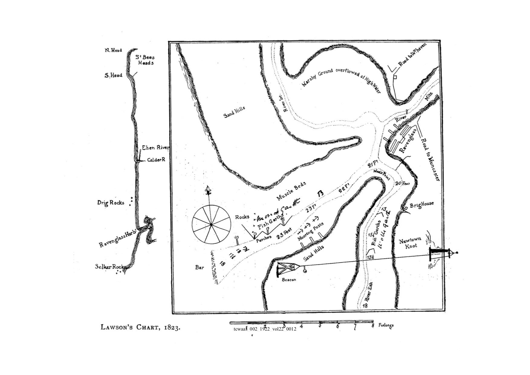
Historic information: 1823 Chart of Ravenglass.
All information given in good faith, but please do not rely on it.
Back to index here