Wednesday 15 March (Liverpool HW 12.48 9.3m). Wind S 2;
sunny.
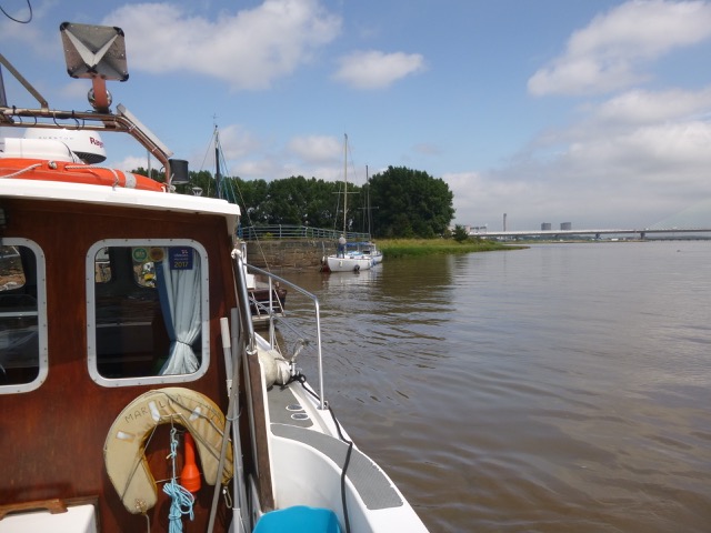
Enter river from marina at 10.58 and head up Garston Channel.
Calm weather. Leave Garston channel at G11 (SHM) and head for
waypoints MER0,...MER7. (see
here for navigation info, some history and more photos).
I also used evidence from the surface ripples to try to find the
deepest part of the channel.
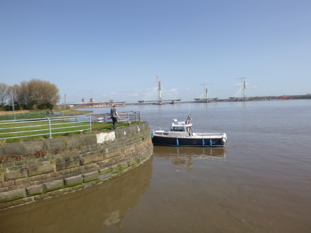
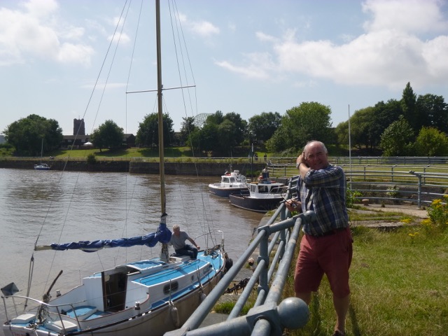
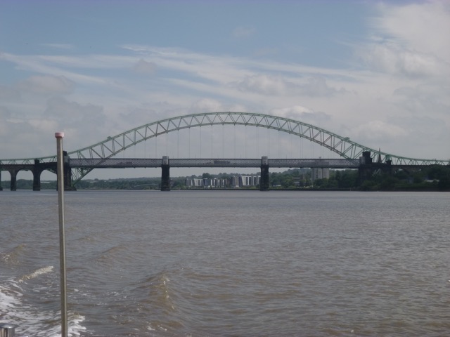
Cross south of Hale Head at 11.52 and proceed along north bank up to the Runcorn bridges. Go through south arch (of three) of the railway bridge at 12.24. Follow south bank until just past (abandoned) lock into Ship Canal, then head north towards church (with tower) on Widnes bank and then follow shore towards Spike Island. There are three "openings" here: western is filled in lock, middle is active lock and eastern is entrance to abandoned dock. Rather than tie up in (active) lock entrance, I went alongside the wall to the east -- where there was a ladder at 12.45. There are some shallower parts quite close by. Also the current was a bit "swirly".
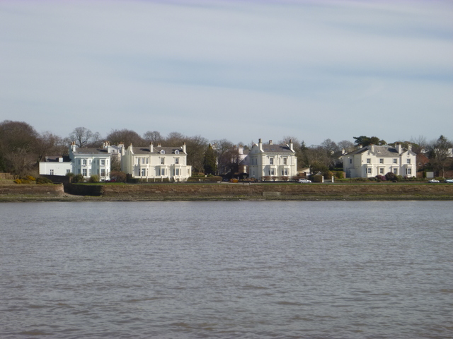
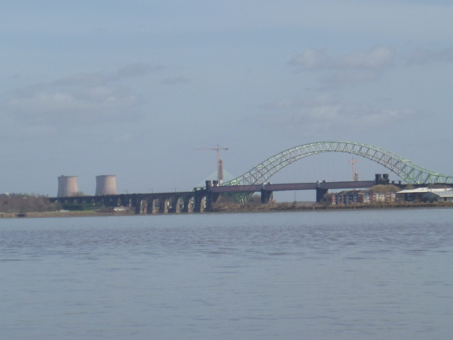
The waterfront at Cressington, the bridges from downstream; the Edwardian "pier" building at West Bank, Widnes (near the old transporter bridge terminus).
| |
|
|
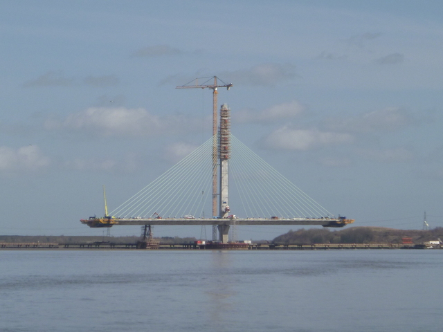
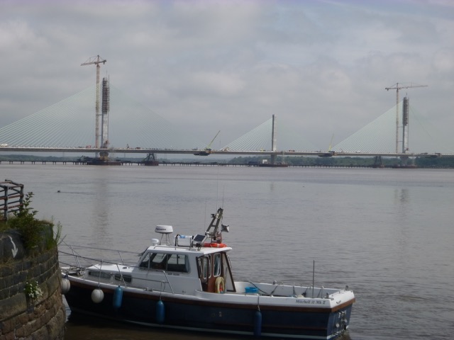
The New Bridge under construction; Marlin at Spike Island; Marlin with new bridge construction in distance.
 |
 |
 |
Ashore 12.45 to 12.58, waiting for the current to slacken. Near
Spike Island there is a back eddy with less current. Proceeding above
Widnes is currently tricky since the construction of the new bridge has
limited air draught. This will be improved when construction is
finished.
Then return with initially some adverse current (pass through N
arch of bridge). To make best progress against the current, I avoided
the deepest part of the channel to have less adverse current. A rib
with a roof passed me coming up to the bridges. By 13.25, close to my
waypoint MER7, the current was almost slack.
Soon the current began to pick up helping me along. I arrived off the
Marina lock at 14.35. I locked in with 3 "snarly" ribs being tested
by MST.
Distance run (over ground) 26 nm, all at my displacement speed (7
knots through the water or less).
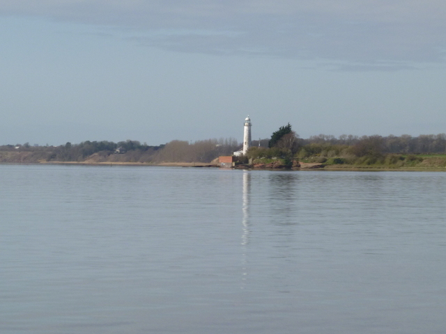
Hale head lighthouse; their radar is bigger than mine.
 |
 |
On this trip I had a least depth of 2.0m under my keel (so 2.7m
water depth) but I have revised my waypoints MER4 and MER5 to be in
deeper water.
The waypoints do not represent the best route - just a sufficiently
deep route for my purposes. Do not rely on them. The channel changes
frequently.
Wednesday 25 July (Liverpool HW 13.22 9.6m). Wind W 2;
sunny.
Cross south of Hale Head at 12.35 and proceed along north bank up to
the Runcorn bridges. Go through south arch (of three) of the railway
bridge at 12.55. Follow south bank until just past (abandoned) lock
into Ship Canal, then head north towards church (with tower) on Widnes
bank and then follow shore towards Spike Island. There are
three "openings" here: western is filled in lock, middle is active lock
and eastern is entrance to abandoned dock. Rather than tie up in
(active) lock entrance, I went alongside the wall to the east -- where
there was a ladder at 13.00. There are some shallower parts quite close
by.
Several other boats were tied alongside - some being worked on.
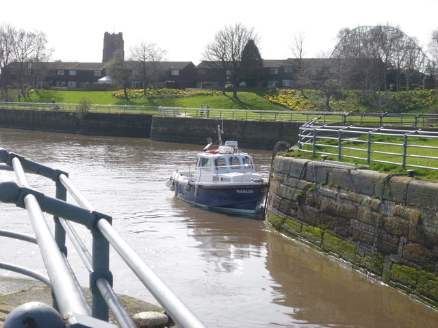
Views of Marlin at Widnes: with new bridge construction beyond.
MARLIN trip up Mersey to Widnes July 2017
Enter river from marina at 11.34 and head up Garston Channel.
Quite weak current in Garston Channel.
Calm weather. Leave Garston channel at G11
(SHM) and head for waypoints MER0,...MER7. (see here for navigation info, some
history and more photos).
 |
 |
Widnes; Bridges viewed from downstream.
 |
 |
Ashore 13.05 to 13.25, waiting for the current to slacken. Near
Spike Island there is a back eddy with less current. Proceeding above
Widnes is currently tricky since the construction of the new bridge has
limited air draught. This will be improved when construction is
finished.
Then return with initially some adverse current (pass through N
arch of bridge with 3 knots plus adverse current). To make best
progress against the current, I avoided the deepest part of the channel
to have less adverse current.
By 14.00, passing Hale Head, the current was
almost slack. Here, close to local HW, I just took the shortest route -
disregarding waypoints.
Soon the current began to pick up helping me along. I arrived off the
Marina lock at 15.05.
Although weather was fine, there was little boat traffic around: one
rib and a survey motor vessel had ventured into the upper Mersey and a small
sailing boat was off Hale Head.
Distance run (over ground) 26 nm (13.4nm up; 12.5nm back, all at my
displacement speed (7 knots through the water or less).
On this trip I had a least depth of 1.7m under my keel (so 2.4m water depth). The waypoints do not represent the best route - just a sufficiently deep route for my purposes. Do not rely on them. The channel changes frequently.
A record of the depth and track of my voyage is available from teamSurv
If higher resolution versions of the above images are wanted, please contact me. All information given in good faith, but please do not rely on it.
Back to index here