
I headed north to the Barrow Channel entrance - with little shipping and nothing much to see. I reached the Barrow Channel at 5:42 (pm), having cut across the outer edge of Mort Bank (least depth 2.2 m under my keel). I passed the Piel Island moorings at 6:00, with no yachts moored and no sign of activity on the Island.
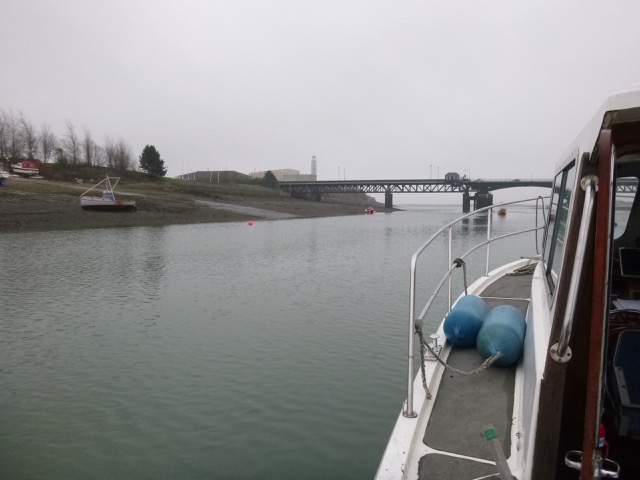
Accompanied by a lot of windfarm catamarans, I headed on past Barrow Docks (they have in-river moorings and an in-river fuel berth there) to pass up the channel between moorings buoys at either side. I went under the Jubilee (lifting) Bridge at 6:40, and was not alarmed (unlike last time) by the clunking noise of the traffic crossing above.
The chart gives some non-drying areas north of the bridge, and the tidal prediction was for a least depth of 1.9m. Most mooring buoys were unoccupied and I found a promising one. It had an attachment rope with lots of seaweed on it - but it looked quite substantial. As I was securing to the buoy, a local fishing boat (BW28) came past and suggested that another (yellow) buoy would be a better choice. So I re-moored, feeling more confident that the mooring was considered sound.
I was planning to stay on board anyway and I set an anchor (or drift) alarm so I am alerted if I have moved further than the specified distance. It turned out that this buoy gave me 1.1m under my keel at the next LW (1.9m tidal depth).
BW28 moored nearby and the skipper rowed past me - giving me the chance to check my local knowledge. He warned me that the current on the mooring would be strong so going ashore could be tricky. I asked about proceeding north through the Walney Channel - he said he intended to do this in his boat the next morning since a 8.8m (Liv) tide would be sufficient and that his boat drew 1.4metres. He confirmed that there was no specific channel through the meetings (the shallowest part) and that he planned to go through before HW, so he could get off if he touched bottom.
I stayed on board overnight - it was very calm with some distant rumbling from traffic crossing the bridge and some noise of fans(?) from the nearby huge BAE shed (that is part of the facility that builds/repairs nuclear submarines)
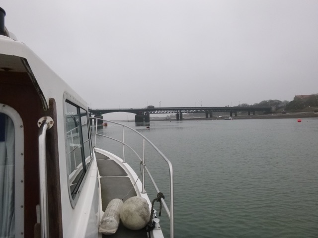
Views from my mooring (towards Jubilee Bridge):
Liverpool to Barrow 47.3 nm.
Saturday 14 April: HW (Liv) 11:03 (8.8m); 23:26 (8.9m). Weather mostly sunny with very slight wind.
Views from my mooring (moored FV BW28; BAE shed with fishermens' stores in foreground
and part of Barrow Sailing Club to right):


Current submerging buoy near my mooring:

My researches suggested that departure north 1-1.5 hours before HW Barrow would be suitable. HW Barrow is 18-20 minutes later than Liverpool (so 11:21). I decided to go early, since it would be a making tide and the current might show the deepest water: so at 9:45 I set off with still a strong north-bound current. I followed the channel (as shown by LW photographs and Google Earth) and was alongside the gap in the slag cliffs by 10:00 in 3.6m depth under my keel. The current was less here. The "meetings" starts from there and stretches to North Haws Point. I headed slowly across, with a least depth of 1.2m under my keel (so sea depth 2.0m). I passed close to a yellow buoy - so circled it to see what it was for - channel mark, shallow spot, ...? By 10:20, I was in the deep channel around North Haws Point - so the shallowest part was crossed. I noticed that the FV came about 10 minutes after me, and seemed to cross the meetings a bit further west than my track.
Walney Island shore (N of Jubilee Bridge):


Cliffs of "slag" on mainland shore:


North end of Walney Island (sand dunes):

The shallowest points that I found seemed to be near the yellow buoy - so maybe it marks a shallow area. Even so, the seabed in the "meetings" seems to be below 7m above CD.
North Walney Channel track (with waypoints; darker is shallower);
[note wreck near my track and marked as drying 6 metres is
SS Anastasi
driven ashore on 25 December 1946; see also
here]:

North Walney Channel (depths above chart datum using tidegauge for Heysham:
distances in metres):
I was on the north end of Walney Island by 10:30 and with still some
time to go before HW, I decided to push my way up the Duddon Estuary.
So instead of following the deeper Scarth Channel out to the west, I
headed north and then east. I had tried previously to get as far as the
port for Millom - known as Borwick Rails. This has an alongside quay
and is advertised as suitable
for coasters to use - though currently it is not in use. Until the
1990s Duddon Valley Shipbreakers operated there and several Royal Navy
Frigates were dismantled (such as HMS Aurora in
1990).
The last time I was in the Duddon Estuary, the tide was only a 7.0m
HW, almost 2 metres less, so I should be able to go anywhere that was
covered at HW last time. This encouraged me to strike across the Duddon
estuary towards Haverigg and then swing towards Askam Pier. I passed
close to the end of Askam Pier (an abandoned loading pier) at 11:00.
Just east of the root of Askam Pier is a boat harbour - drying. One of
the interesting boats moored there is Oakdale
- one of the last surviving Mersey Flats [built 1951 at Runcorn and still afloat
at high water]. She is a liveaboard located at 53°11.247N, 3°12.919W.
[Updated info: March 2020 Oakdale suffered damage during a spring HW]
Askam Pier (earth/stone embankment heading out from shore):
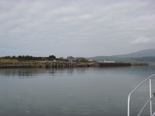
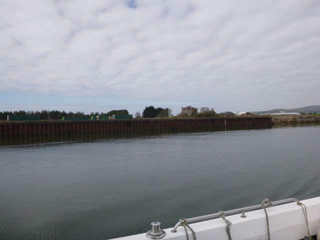
I reached Borwick Rails by 11:10 - with current still incoming at
that location. The quayside is still in good condition with ladders,
but the surrounding is fenced off. Depth about 2.7m under my keel.
Borwick Rails: abandoned quayside of Port Millom:
At 11:15, I set off back out to the open sea through the Duddon Estuary.
My depth tracks are shown here from this trip and a previous one (Borwick Rails at top right, Walney Channel at
lower right, Haverigg at top centre; depths above chart datum using tidegauge
for Heysham; distances in metres):
Tracks shown with waypoints on chart (lighter is deeper, NW-SE track
in SW corner on left image is spurious):
Haverigg with Black Combe behind.
Once out of the Duddon estuary, I headed south past the Barrow Windfarm:
With Barrow shipyard visible the other side of Walney Island:
On the SW side of Walney is the site of a wreck at Cockspec sands -
this is the Lough
Fisher which ran aground there on 28 December 1935. The wreckage
was subsequently dispersed in 1936 to a depth of 10ft, so little may be
left. It is not charted but the site was close offshore of the small
drying patch charted.
Then I continued past the Lune Estuary with IOM vessel Ben My Chree leaving:
It was sunny and calm, so I stopped off to survey a few wreck-sites on the
way. I usually cross from the North into the Liverpool Shipping Channel near
buoy Alpha. Since I was earlier than usual, the tide would be lower, to I
decided to cross further west near buoy Q10. At 7:35 (HW-3 hours 50 minutes ),
I had depth of 2.5m under my keel both crossing the sandbank and then the
training wall. As you approach the training wall, the depth gauge seabed level
shoots up and I usually slow down in case of any obstruction. Then, relief, as
the depth level shoots back down again.
I arrived off Liverpool Marina and locked in (with two other boats) at 9:20pm.
Barrow to Liverpool 67.6nm (via a circuitous route).
Trip (115 nm; 22 hours run; circa 15 galls fuel) mainly at my displacement
speed of 7 knots, or less, through the water.
A record of the depth and track of my voyage is available from
teamSurv [now defunct]
Clicking on an image should give a higher resolution picture. If
even higher resolution versions of the above images are wanted, please
contact me. All information given in good faith, but please do not rely
on it. Back to index here


The wreck charted as PA (position approximate) 1.5
miles further offshore is of the trawler Jean Marcel(FD280)
which foundered on 26-10-1968. All 3 crew were picked up by a nearby
inshore trawler (Girl Mary).
