
Lytham 14 August
Blackpool 30 August
Friday 14 August (Liverpool HW 07.35 7.2m; LW 14.21 3.6m; HW 20.18 7.3m). Mostly sunny, warm, calm.
Enter river from marina at 8:55am with no other boats. Head out of the Mersey via the main shipping lane.
Cammell Lairds: Polar Research Vessel under construction
(not the Boaty-Mac-Boaty-Face) and two Fleet auxilaries being upgraded;
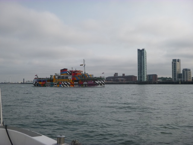
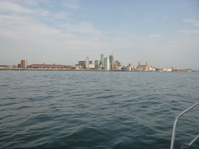
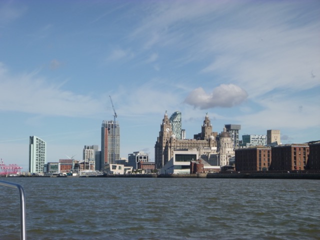
Dazzle ferry (Snowdrop) and Liverpool waterfront.
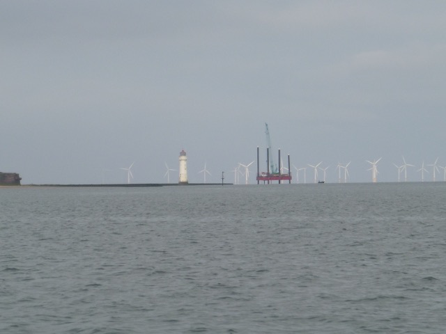
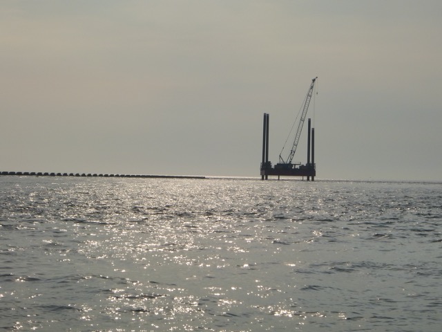
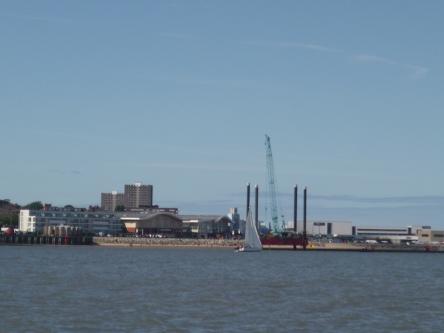
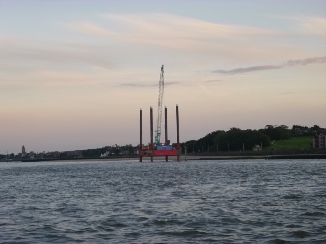
I arrived off New Brighton at 9:25. A "jack-up" rig was alongside the
groyne
by the Perch Rock Lighthouse - with a crane.
Peel Ports announced on 8
August 2020 that work on aids to navigation [perches with lights] on Lighthouse
Groyne (no 11), Fort Groyne (no. 12) and Victoria Island (no. 13) would be
carried out by jack-up barge Haven-Seariser 1, supported by barge CW-8,
workboats Vector and Vital and a safety boat. "Whilst the Haven Seariser
1 is on station off New Brighton, vessels not involved with the work
must give the jack-up barge a wide berth and pass at a suitable speed
through the water to minimize the effects of wash".
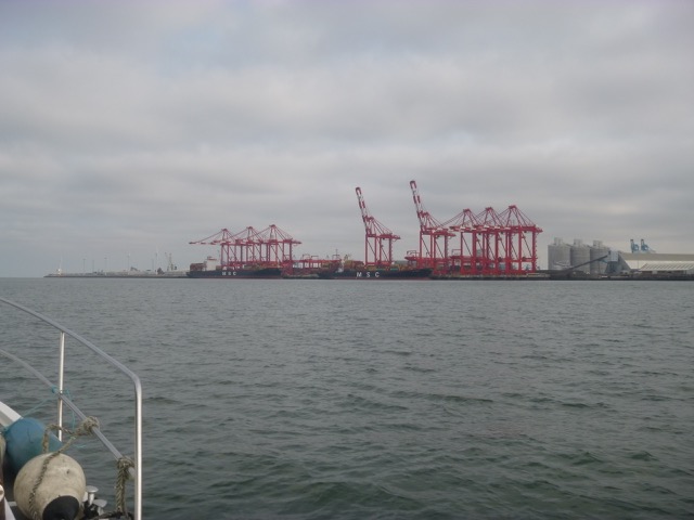
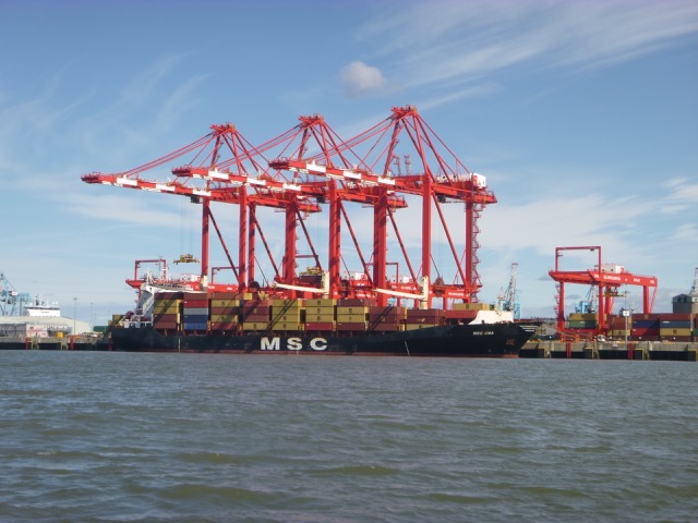
MSC vessels Bhavya (294m long) and Manya (234m long) on the Seaforth
in-river container terminal
I then entered the shipping channel.
IOM ferry Mannanan passed me coming in at 34 knots - with a bow wave that
gave Marlin a work-out.
Further along I passed the Iguaza (water injection dredger) doing her
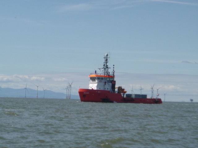
bit to muddy the waters. Also a pilot vessel (Razorbill, doing 24 knots) inbound:
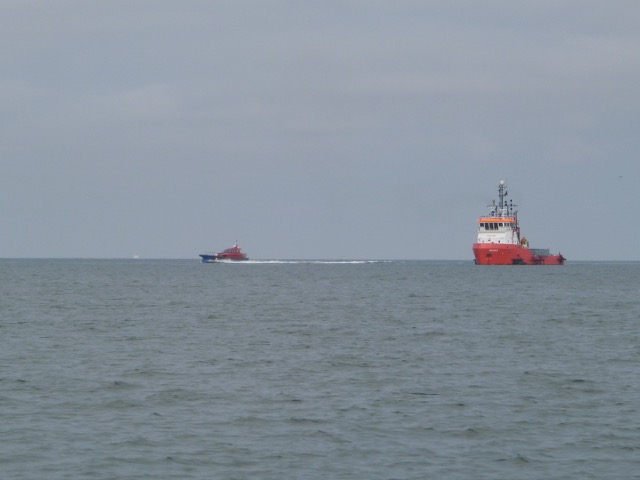
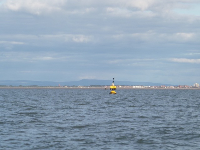
In this area, I looked for the Crosby Buoy (safe-water or mid-channel mark). Notices to mariners confirm that it was removed in late 2019 to assist in dredging - and has not yet been put back.
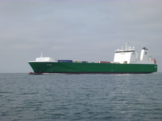
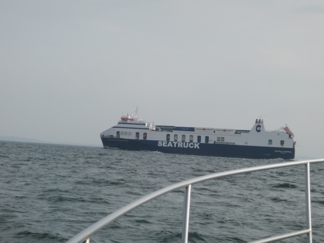
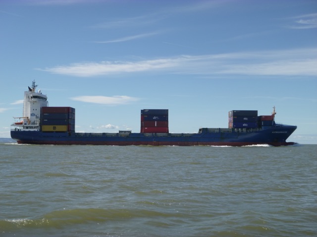
Near the "bend", I met the incoming truck ferry Misida [166 metres
long, Finnish flag but currently running Liverpool-Dublin)
Buoy Alpha marks the change from Crosby (C-buoys) to Queens (Q-buoys) Channel. I have found that, above half-tide, it is a suitable location for shallow-draught vessels to head north, saving some miles. Since pilots and regular commercial masters are not used to this manouevre, I always inform Mersey VTS (VHF channel 12) of my intention. I reached Alpha at 10.18 (so 80 minutes from the Marina lock, at my displacement speed). Then headed north watching the depth change dramatically as I crossed the training wall.
I passed inshore of the Lennox oil/gas rig, then approached the Gut Buoy - marking the entrance to the Ribble Estuary. My plan was to go up as far as Lytham, then turn around and retrace my steps. It was 12.00 as I headed in. With a very neap tide (LW of 3.6m at Liverpool), I expected to get in and out, even near LW. A very comprehensive set of pilotage notes were compiled in 2010, but the channel may have shifted somewhat since then. My last trip up to Lytham was in 2016, although I entered the outer channel to shelter over LW in 2017.
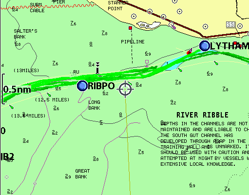
See map of Ribble from Preston Marina. This recommends leaving the Gut Buoy at Liv HW - 2 hours, if heading for Preston
I passed to the north of the charted obstruction (at 53°42.456N,
3°6.007W, charted as drying 2.3metres, remains of perch and stones)
and then entered the channel between the (ruined) training walls.
Note
that the wreck charted in 2m in the entrance channel is the SS
Hebe sunk
11-12-1911 (see also here).
Another vessel reported as lost in this vicinity is the Irene Chambers, a
9m long fishing vessel sunk 3-10-1995, charted (as position approximate:
PA) in depth of more than 5m and north of the Hebe. This PA is that of
the rescue and her wreckage is reported to have drifted inshore.
The charted obstruction (PA) further
in, drying 3m, is also now reported to be "dead". More
details here.
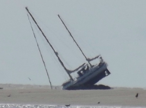
A waypoint RIBE was suggested for this approach. The shallowest part I found was outside of the entrance: presumably the training walls still serve their original purpose of causing the current to scour out a channel. There was another wreck (yacht Gean, charted until recently as drying 6.6m in the channel) - this was scary - but there is nothing now left - see details here.
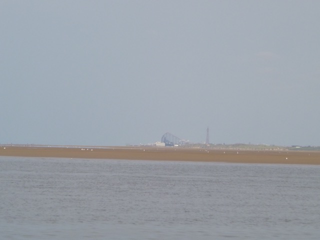
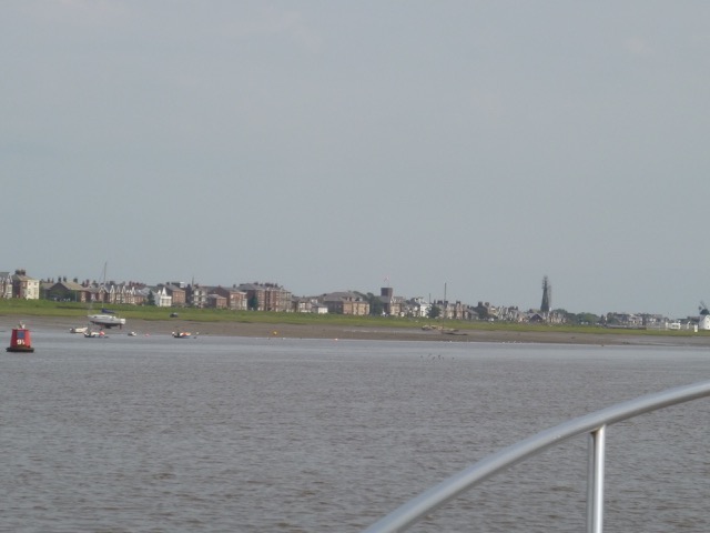
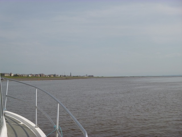
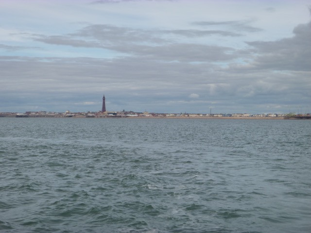
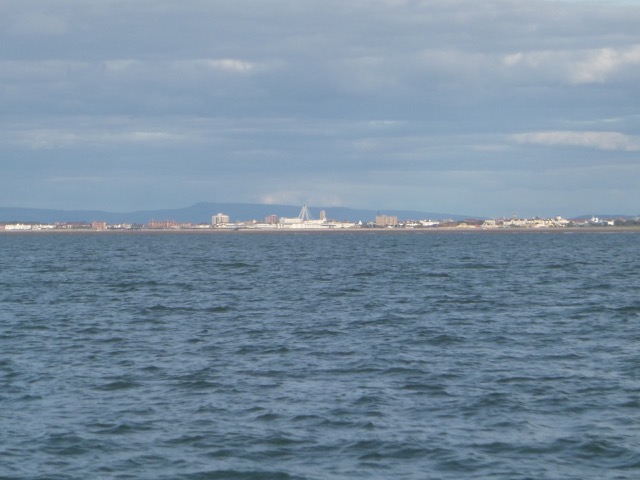
View of Blackpool from the outer Ribble:
Note that on the above sands, off St. Annes, the following evening - sadly - two boys were lost.
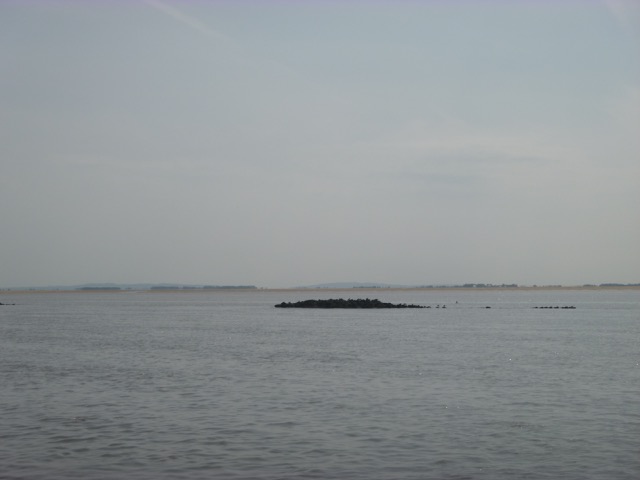
Views of the remains of the training wall:
Do avoid these training walls near Lytham,
from
RNLI Aug 2019:
By 12.40, I had reached the moorings and launching beach at Lytham
(HW liv + 5 hours).
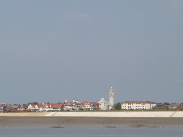
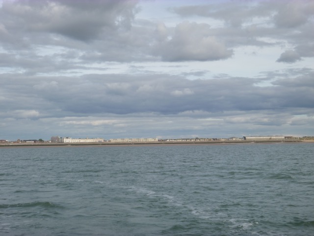
Views of Lytham (to west, then east):
I headed out with a favourable current (1 knot or less) -
retracing my incoming route. All went well until I reached the outer
area where I found a bar with only 0.5m under my keel. I may not have
found the optimum route, and it may move from time to time anyway.
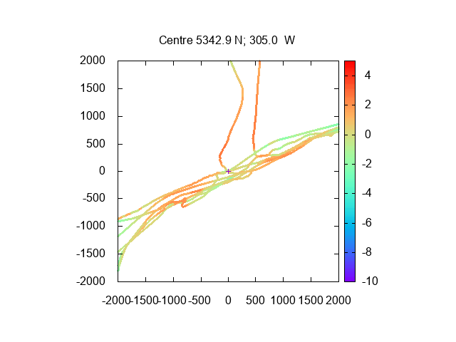
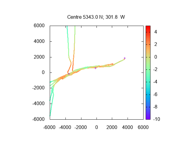
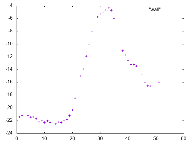
Here are
charts of my depths from this and previous visits (2016-20); depth in
metres using Liverpool tidegauge 10 minutes later, distance in metres.
Outer region, centred on waypoint RIBE (53°42.90 N, 3°5.00 W):
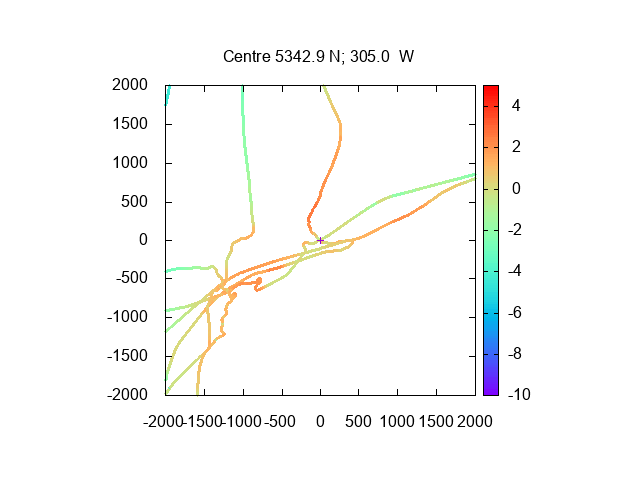
Overview of 2016-20 trips in the Ribble as far in as Lytham (showing
waypoints RIBE at left and Lytham at right):
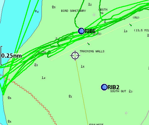
Same depth data shown on HO chart [darker is shallower]:
In the channel constrained by training walls, I followed the surface ripples to find the deepest water - with most current. This was mainly close to the northern edge, except around the region from 11 mile to 10 5/8 mile markers where the southern edge is deeper.
By 1:33, I was over the Bar and in deeper water. I stopped near the Gut Buoy for a spot of fishing. The water was fairly muddy, so I was pleasantly surprised to catch a few (rather small) mackerel. It was warm with a northerly force 2-3 wind and with sunny periods. After a siesta, I headed slowly back towards Liverpool. I reached buoy Alpha at 4:15 and followed the shipping channel in.
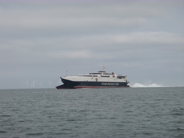
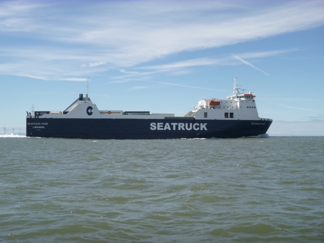
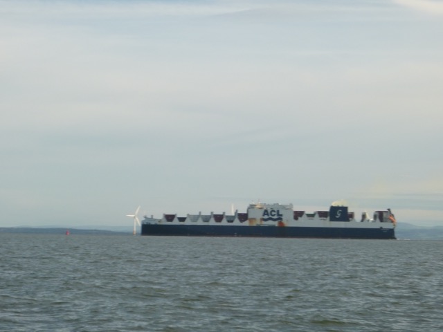
Seatruck Progress inbound
I reached New Brighton by 5:50, with the jack-up rig still in
location.
I was off the Pier Head by 6:14.
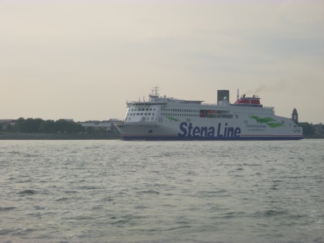
Stena Edda (built 2019, 215m long) was following me, so I offered to cut across to the east
bank, so she could berth at 12 quays.
I entered the marina lock at 7:00pm with three other motor vessels (after a delay in lock- keeper provision).
56.0 nautical miles run.
Sunday 30 August (Liverpool HW 10.12 8.1m; LW 16.53 2.4m; HW 22.30 8.6m). Sunny, cool N 2-3 breeze, fairly calm.
Enter river from marina at 11:18am with one other boat. Head out of the Mersey via the main shipping lane.
Cammell Lairds: Polar Research Vessel, Sir Richard Attenborough, under construction
(not now called Boaty-Mac-Boaty-Face) at Cammell Lairds;

Liverpool waterfront.
I arrived off New Brighton at 11:50. The "jack-up" rig was now alongside the
groyne near the launching beach - replacing the perch.
MSC vessel Uma (194 x 20m) on the Seaforth
in-river container terminal
I then entered the shipping channel. I was overtaken by Astrosprinter
(container vessel 142 x 20m):
and Seatruck Pace (142 x 23m):
I was also overtaken by a pilot vessel (Razorbill); further along I
passed the Iguazu (water injection dredger) doing her bit to muddy the
waters.
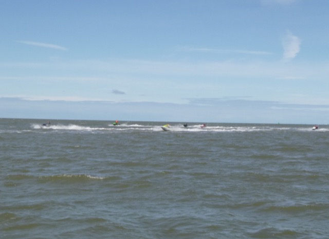
A more surprising sight was a flotilla of jet skis (about 9)
inbound:
As I approached the "bend" in the channel, I could just see a bit of the wreck of the PEGU sticking out at 12:42 (Liv HW+2:30).
Buoy Alpha marks the change from Crosby (C-buoys) to Queens
(Q-buoys) Channel. I have found that, above half-tide, it is a suitable location for shallow-draught
vessels to head north, saving some miles. Since pilots and regular
commercial masters are not used to this manouevre, I always inform
Mersey VTS (VHF channel 12) of my intention. I reached Alpha at 12.48
(so 90 minutes from the Marina lock, at my displacement speed).
Then headed north watching the depth change dramatically as I
crossed the training wall.
Depths in metres approximately every second (so horizontal distance
about 3 metres between points), heading north across wall (note CD was
at about -6m at this time, so wall here dries 2m or so at LAT):
I stopped briefly to survey again the wreck of the Nazarine.
I passed inshore of the Lennox oil/gas rig, then approached
the entrance to the Ribble Estuary. My plan was to explore the bar
(entrance) area to see if a low water channel could be found.
It was about 2:50 when I arrived: LW (liv) - 2 hours. What I found was
that it was too shallow for a full exploration - so I could add
rather little to the previous (above) trip:
I then moved offshore a bit to explore
the wreck charted in 2m in the entrance channel. This is the SS
Hebe sunk
11-12-1911 (see also here).
My depth survey is here (depths in metres below CD using tidge gauge at Liverpool):
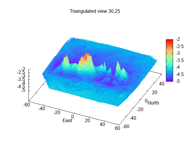
This shows a vessel lying W-E with a pronounced scour along each side, centred on 53 °42.688N, 3°7.148W. I find that the central position is about 35 metres north of the charted position. This wreck used to dry at low water and was marked by a buoy - only removed in 1975.
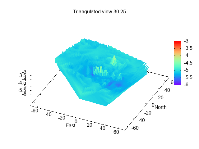
I then headed about 4 miles north to explore the wreck, charted since 2012 at 1.4m
below CD. This is about 2.4km south-west of Blackpool South Pier, at
53°46.75N, 3°5.07W.
My depth survey is here (depths in metres below CD using tidge gauge at Liverpool):
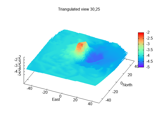
This plot agrees nicely with the survey report that "wreck is
intact, lies N-S, bow to S, 23m long, 8m wide, height 2.3m, 1m deep scour extends
50m to east".
I am interested to hear if anyone knows, or finds out, more
about the identity of this wreck. The scour suggests that the site has
current at times, and water can be quite silty, though the wreck is very
shallow at LW.
I am also interested in the scour pattern - usually
scouring occurs where there is stronger current - such as at the edges
of a wreck that lies across a current. A scour at one side only suggests
a current that flows mainly one way - to the west in this case -
scouring the upstream side. Maybe
the ebb current is much stronger than the flood, or there is a gyre
(eddy) at times.
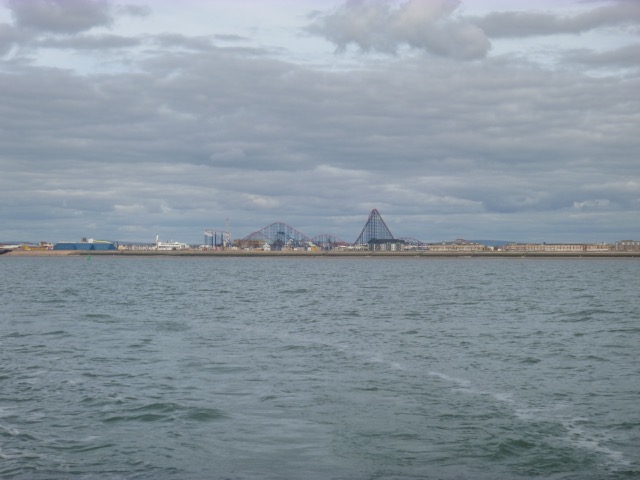
From the wreck location, views of Blackpool (Tower and S Pier; Big One):
View of St. Annes:
On my return I recrossed the Ribble Bar - to get some more depth
readings (included in plot above), then passed the buoy marking the
wreck of the Zealandia off
Southport. The wreck was breaking through the surface (visible
inshore of buoy) as I passed at 5:50. It is charted as drying 5m and
tide at Liv was then 3m, so it should have been dry by about 2m):
View of Southport (inverted V-shaped object is the Frisbee ride at
Pleasureland).
As I headed south, inside the Lennox rig, I saw spray being sent up from an area of sea. At first I though it might be a pod of porpoises, but it is more likely that it was from small fish being pursued by a shoal of mackerel. There were no seabirds diving, however.
I also saw an inshore lifeboat speeding past Southport - it was B-837 which is New Brighton LB and it had been launched at 4:01, presumably for a training run.
I reached buoy Alpha at 7:04. The large container vessel Altlantic
Sea (296 x 38m) was inbound
She was met off Seaforth by several tugs who swung her ready to enter Gladstone Lock.
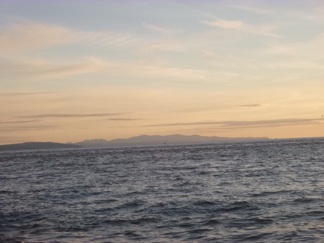
Visibility was excellent all day. The Cumbrian mountains and
Snowdonia could be seen clearly. Snowdonia:
Another view of the jack-up rig off New Brighton:
I reached the marina at 8:20 and entered the marina lock at 8:40pm with three yachts and two other motor vessels.
59.0 nautical miles run.
If higher resolution versions of the above images are wanted, please contact me. All information given in good faith, but please do not rely on it.
Back to index here