I have long had a fascination with short cuts - that can save miles if the tide is high enough. See my rant. The main (buoyed) channel into Conwy (see here) follows a route going quite far west of the river mouth - so is a long way round if coming from the Great Orme. (see also here for a chart).
For many years a North Deep Channel has been used with local knowledge. This follows the east side of the estuary and was marked by three green buoys (now removed). A dotted line on the HO chart marks this track. Note that Conwy Sands were last surveyed by air in 1991. I have used that channel (between the buoys and the shore) within 2 hours of high water. The boats taking passenger trips from Llandudno used this channel to go to and from Conwy. The shallowest part is close to where it rejoins the main channel (near the green buoy east of the perch). One way to see the current state of the channel, where it passes West Llandudno, is from the Beach Cafe web-cam .
In 2015, I learnt that there is a third channel which is available and which had become deeper than the previous North Deep. This seems to be called the New North Deep and has three green buoys (NDO, NDM, NDI) marking it. I explored this in 2015. This channel is not widely publicised - but local yacht clubs use the buoys for races around HW. Again, the shallowest part is that where it rejoins the main channel. In summer months, there are also two floating refuges located at the highest points of two of the offshore sandbanks - to provide for people trapped on the sandbanks when the tide comes in. The HO chart shows the offshore sandbanks as drying by 4.6 and 4.9m from a survey of 1991. The main channel in and out of Conwy shown on the chart was last surveyed in 1997.
This new channel was used by the historic vessel MV Balmoral when she visited the Conwy Estuary in 2017 - although she only has a 2m draught.
In 2018, I explored this new North Deep channel again.
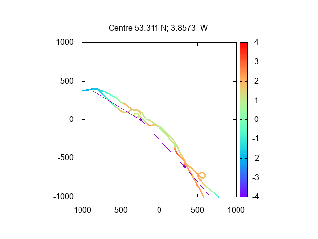
The positions of the buoys are shown as crosses on the chart (depths obtained using the
tide gauge results for Llandudno to reduce to Chart Datum).
For comparison my 2015 visit showed depths:
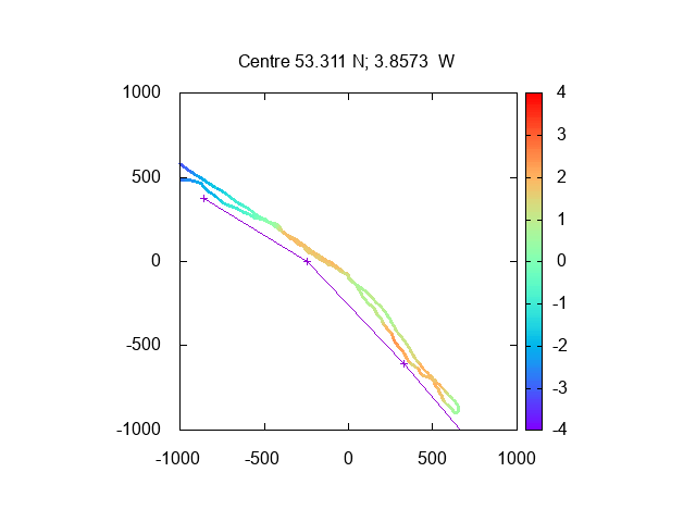
These plots indicate a least depth of 3m (or a bit less) above Chart Datum. Note that half tide at Conwy has a depth of 4.2m above Chart Datum: so the channel will have 1m depth at half tide. For comparison, the main channel has water (just) at LW neaps.