Google Earth 2014; Bing (2011-2).
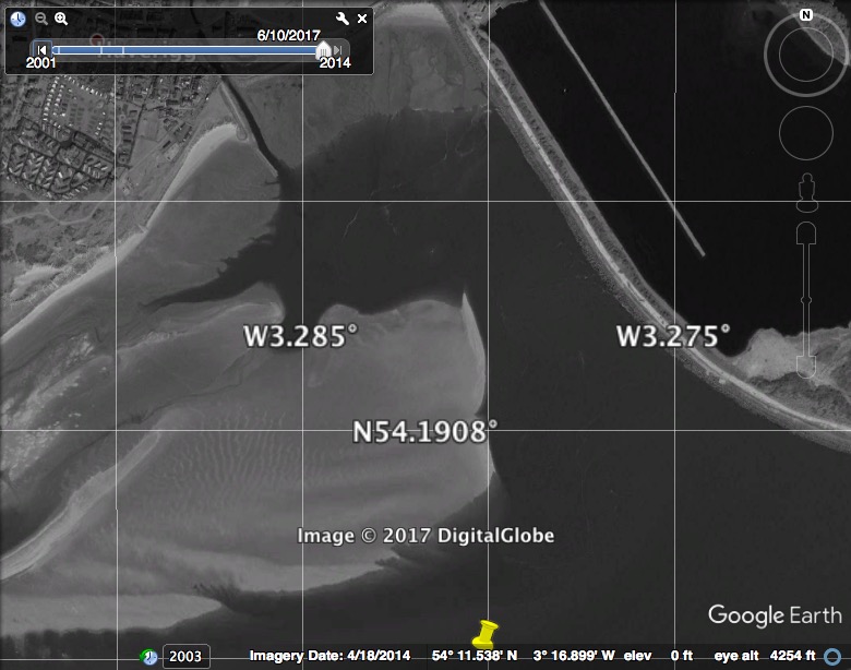
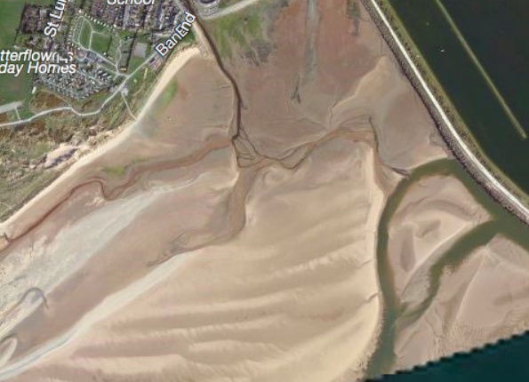
Haverigg is a sea-side resort in the Duddon estuary. It has drying moorings which are protected by a large sandbank. The river running through the moorings is the River Lazy (also known as Haverigg Pool). I decided to visit Haverigg by boat.
The current Hydrographic Office chart has no useful information (apart from some lines of unknown date - earlier than 2007 [most probably 1990 aerial information] - marking the entrance channel to the Duddon estuary). Earlier HO charts did contain some depths in the Duddon estuary - based on a survey in 1843-5!. The best source of up-to-date information is Google Earth but this does not have a recent low-water image.
I found some advice from a Glasson Sailing Club guide dated 2015.
I also discovered that Haverigg has an inshore lifeboat (independent of the RNLI) and contacted them for advice. This was most helpful - thanks Stewart.
Here is my summary based on one visit on 31 August 2017:
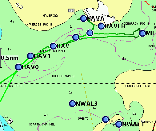
(i)Head in to the Duddon estuary following the guidelines marked on the chart and
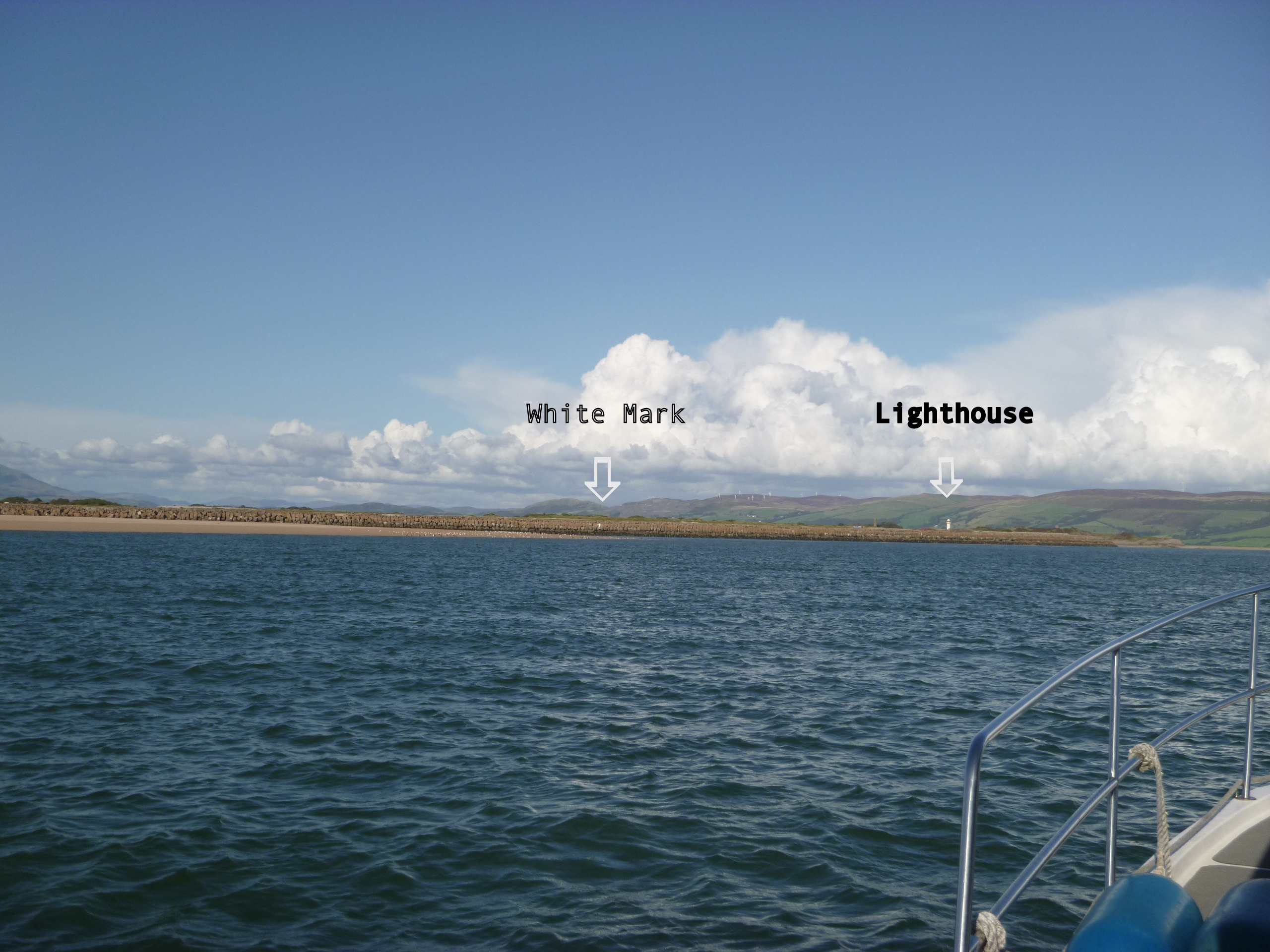
head for the lighthouse on the seawall (seawall known as "the blocks" from its construction).
(ii) A small red buoy (close to 54° 11.25 N, 3° 16.55W) marks the
corner of the sandbank and should be left to port, heading (approximately
30°) for the outermost of two white marks painted on the blocks.
(iii) When close to that mark, turn along the wall keeping 10metres or so off until abreast
the second (inner) white mark.
(iv) At the inner white mark turn to head midway between a small red buoy
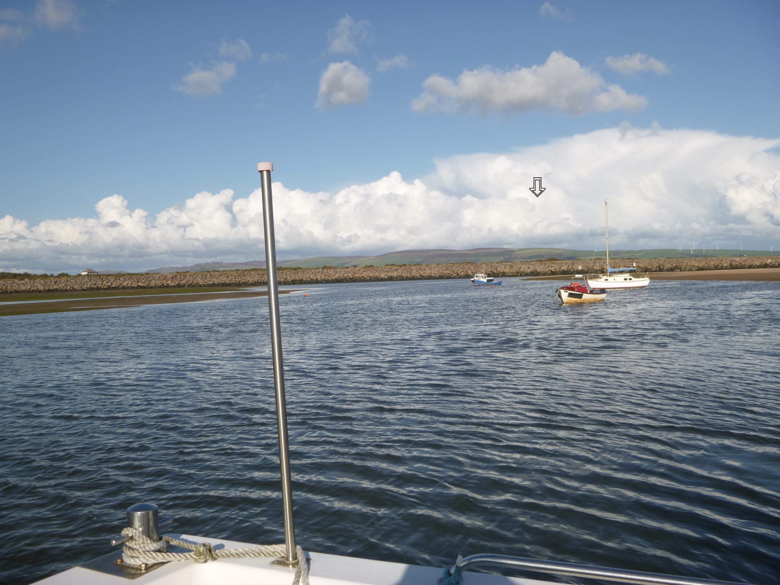
and a (rather thin) wooden post. Leave the post to starboard.
(v) After passing through this gap the moorings are visible in a line.
The moorings are in the bed of the river Lazy; they have sand to the south (with a steep bank) and muddy ground to the north (gently shelving). They are protected by the sandbank except on a very high spring tide.
I managed to get in when Liv HW was 7.2m (neap) at HW-2 hours. [I draw only 0.8metres].
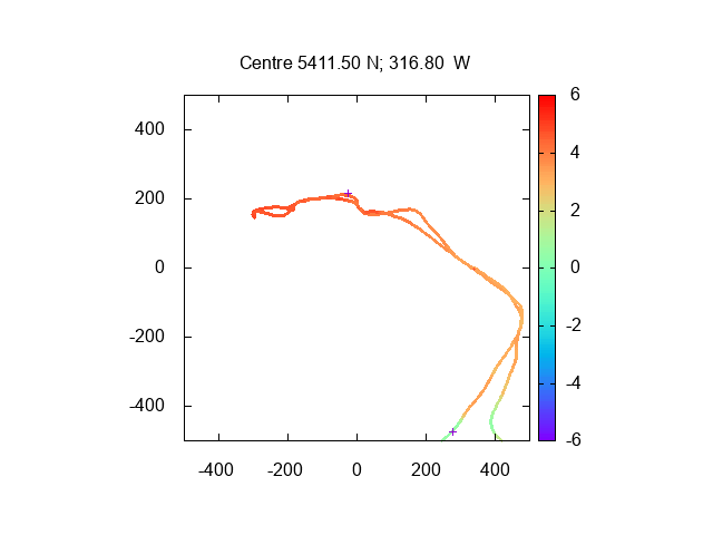
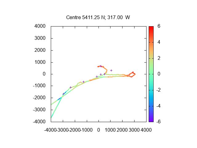
I have reduced my depth measurements using the tide-gauge results for Heysham - so half-tide
is at about 5.0metres. I also plot some waypoints (the red buoy quoted above, the lighthouse,
and some waypoints as quoted here).
Some satellite images of the moorings and access:
Google Earth 2014; Bing (2011-2).


My tracks entering and leaving Haverigg; darker track is shallower (I left
going further up the estuary towards Millom, before returning):
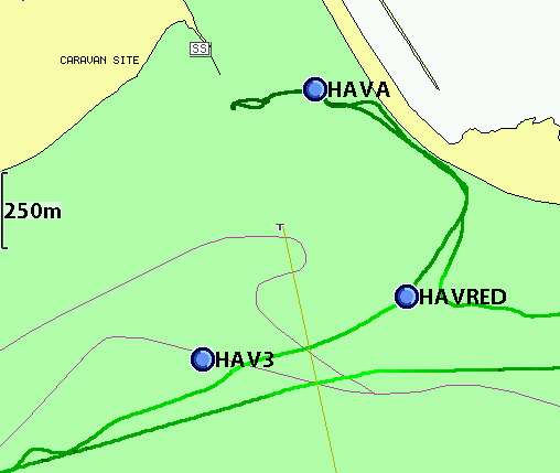
Depth of my track in metres over CD for Heysham (distances in metres and some waypoints shown):
My tracks entering and leaving the Duddon estuary.
Depth of my track in metres over CD for Heysham (distances in metres and some waypoints shown):
Some images from my trip (Aug 2017)
The Blocks with outer white mark and lighthouse approaching from seaward;
View from the moorings looking towards the Blocks and wooden pole (just visible behind
the sand spit between the moored boats)
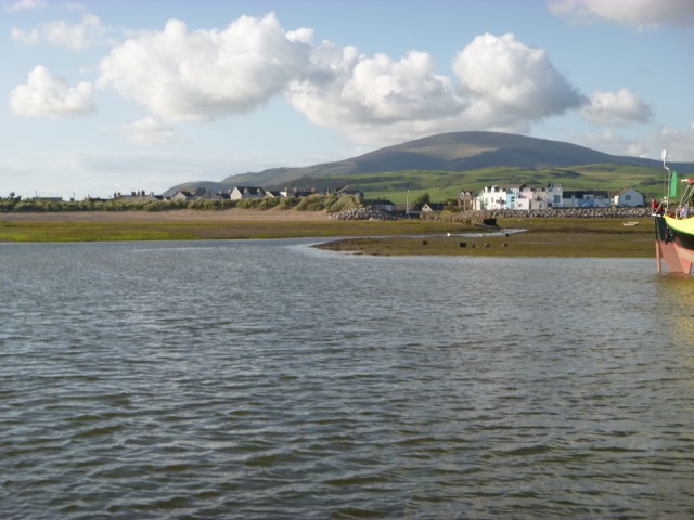
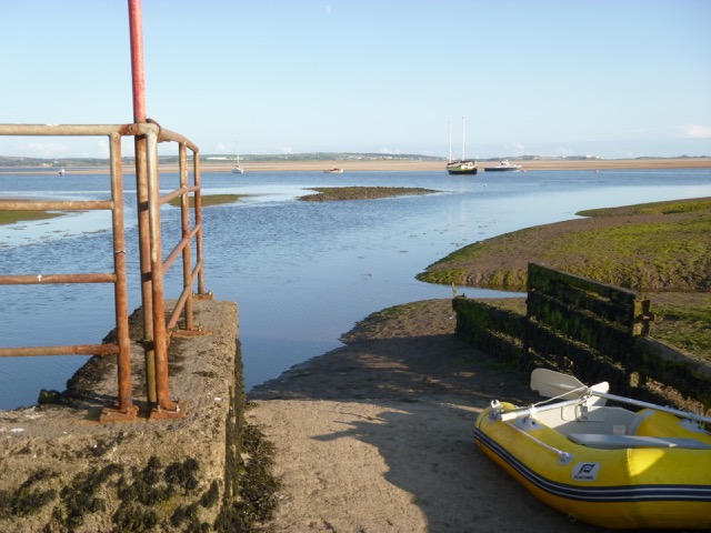
Haverigg Village from my mooring; Marlin moored from my tender landing spot.
Update 2020: I found this Google Earth image from 2018 - which shows
the sand spit coming much closer to the blocks:
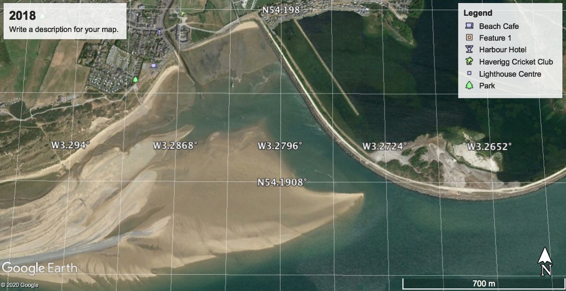
The tip of the spit is at 54°11.427N, 3°16.426W.