Triangulation - Photography Exhibition at Open Eye Gallery
Dr Les Roberts contributes to new photography exhibition on the Ordnance Survey triangulation towers.
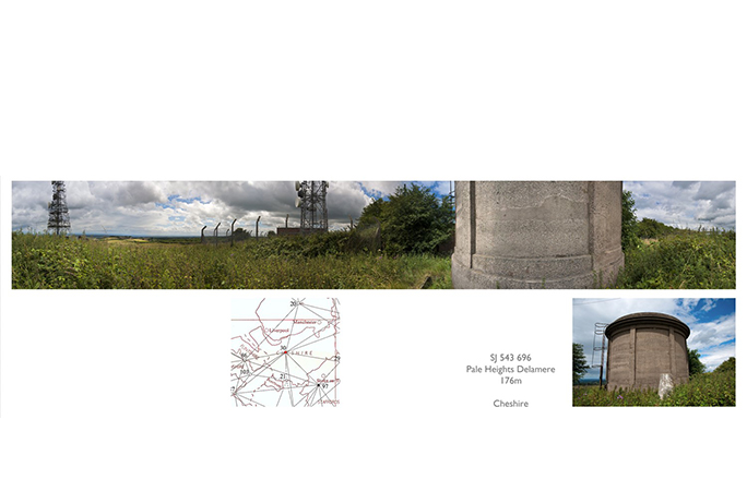
This work is from the ongoing project to visit all 310 primary triangulation points that were built and measured between 1936 and 1962 by the Ordnance Survey for the ‘Retriangulation of Great Britain’. The work will provide a comprehensive survey of the British landscape, dealing with how we represent territory and the layering of history, land use, ownership and boundaries.
Many people mistakenly think the function of the triangulation (trig) point is to mark the highest point of hills, but the trig points are placed in positions where at least two other points can be seen in order to form triangles for accurate measurement.
The panorama is produced by placing the camera and tripod on top of the trig point and taking one exposure every 30 degrees, twelve exposures to cover the full 360 degrees. The panorama seemed the most valid response to the visual experience of reaching the trig point – most people will turn to look at the view all around. The panoramas are presented alongside photos of the pillars, and the methodical approach to producing the photographs alludes to the systematic nature of survey and mapping.