Liverpool Daily Post and Liverpool Mercury: Friday 23 Sep 1910
Shipping Casualties:
THOMAS: Hilbre Island Sept 22: The flat THOMAS of Liverpool, Garston to Flint,
with sulphur ore sank about 700 yds NE from this station at two o'clock last
night. The crew of three landed on the island in their own boat.
Weather: high pressure
Tides: Thursday 22 Sep HW 1:03 21' 3" [spring; ODS add 10' to get LBD]
Comment: sulphur ore was used with seawater in the Muspratt Chemical Works at Fflint to make alkali (sodium carbonate and potassium carbonate for bleach and soap) by the Leblanc process (also needing coal and limestone). This Works occupied the site that later became Courtaulds Castle works, alongside Fflint industrial quay. The Muspratt Works at Fflint closed in 1920, although the Muspratt business became United Alkali and subsequently ICI.
BOT Wk return 1910 p85(225)
21 September 1910:
adds 68nt, built 1853 sail wood, foundered/total weck or loss.
Liverpool Wreck Records (MDHB) - copied to Hydrographic Office
THOMAS lost Sep 1916[sic], cargo:sulphur ore 60gt
not SS or MV, constructed iron or wood
53° 23' 16" N, 3° 13' 18" W [OSGB36] depth unknown
Flat Thomas built John Thomson, Northwich, 1853, 68t, owned Robert Parry, Oakenholt, Flint[Mercantile Navy List]. ON 80292.
Hydrographic Office info:
**H2003/86 24.2.87 VISUALLY DISPROVED AS LW SPRINGS ON 28.4.86. (MD & HC, HI 323) AMENDED TO DEAD. NCA.
As of 2018/9: It is charted as wreck drying 2.3 metres [from information
given by me]
Chris Michael info:
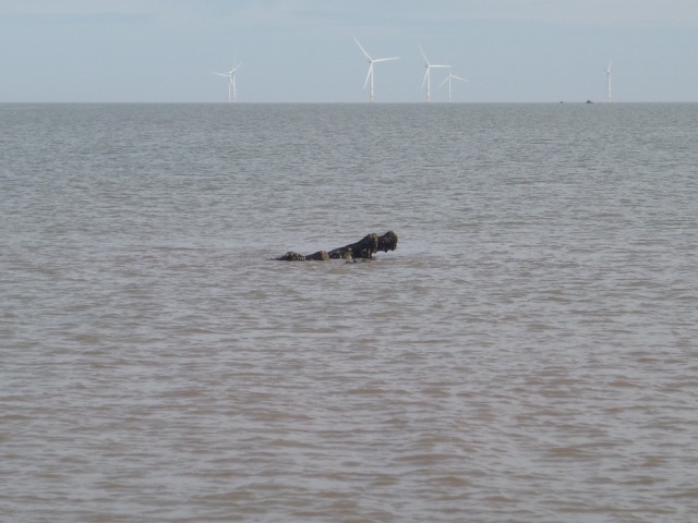
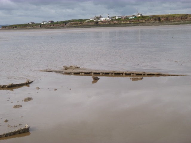
Wed 14 June 2017 LW Liv 9:20 2.0m [Hilbre 9:02 1.99m]
Photo: shows about 1 ft drying at 9:58. wooden beam.
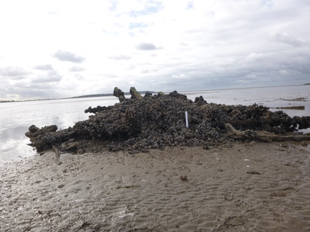
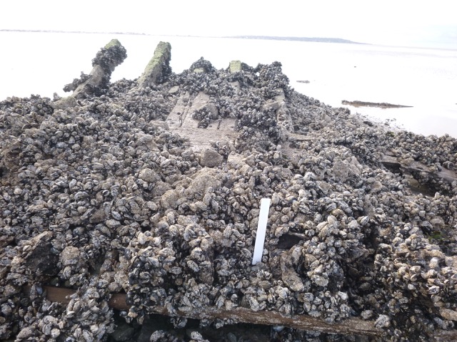
Mon 26 June 2017 LW Liv 8:15 0.6m [Hilbre 8:02 0.62m]
[Liv tide gauge 8:08 0.82m]
Photo Photo Photo : 4 ft proud of seabed at 8:12. Wooden pieces.
wreckage extends 30m SW-NE but only more than 1ft high in small area.
seabed circa 0.8m
Position 53° 23.26' N, 3° 13.47' W of highest part (WGS84).
Chart as drying 2.3m in area drying 0.8m